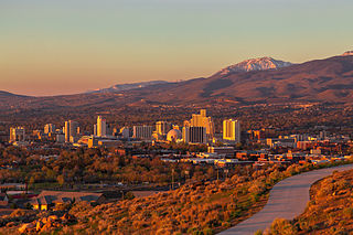
Reno is a city in the northwest section of the U.S. state of Nevada, along the Nevada-California border, about 22 miles (35 km) north from Lake Tahoe, known as "The Biggest Little City in the World". Known for its casino and tourism industry, Reno is the county seat and most populous city of Washoe County and sits in the High Eastern Sierra foothills, in the Truckee River valley, on the eastern side of the Sierra Nevada. The Reno metro area occupies a valley colloquially known as the Truckee Meadows, it is the 81st most populous city in the United States, the 3rd most populous city in Nevada, and the most populous in Nevada outside the Las Vegas Valley.

Truckee is an incorporated town in Nevada County, California, United States. As of the 2010 United States Census, the population was 16,180, reflecting an increase of 2,316 from the 13,864 counted in the 2000 Census and having the 316th highest population in California and 2114th in the United States.

Lake Tahoe is a freshwater lake in the Sierra Nevada of the Western United States, straddling the border between California and Nevada. Lying at 6,225 ft (1,897 m) above sea level, Lake Tahoe is the largest alpine lake in North America, and at 122,160,280 acre⋅ft (150.7 km3) it trails only the five Great Lakes as the largest by volume in the United States. Its depth is 1,645 ft (501 m), making it the second deepest in the United States after Crater Lake in Oregon.

The Truckee River is a river in the U.S. states of California and Nevada. The river flows northeasterly and is 121 miles (195 km) long. The Truckee is the sole outlet of Lake Tahoe and drains part of the high Sierra Nevada, emptying into Pyramid Lake in the Great Basin. Its waters are an important source of irrigation along its valley and adjacent valleys.

Alpine Meadows is an unincorporated community in Placer County, California. The community is located on Bear Creek, a tributary of the Truckee River 5 miles (8.0 km) west of Tahoe City, at an elevation of 6,480 ft (1,980 m).

Donner Lake, formerly known as Truckee Lake, is a freshwater lake in Northeast California on the eastern slope of the Sierra Nevada and about 20 miles (32 km) northwest of the much larger Lake Tahoe. A moraine serves as a natural dam for the lake. The lake is located in the town of Truckee, between Interstate 80 to the north and Schallenberger Ridge to the south. The tracks of the Union Pacific Railroad run along Schallenberger Ridge and closely follow the route of the original transcontinental railroad. The historic route of the Lincoln Highway, the first automobile road across America and US 40 follows the northern shoreline, then climbs to Donner Pass from where the entire lake may be viewed.
![<span class="mw-page-title-main">Little Truckee River</span> River in [[Nevada County, California]] and [[Sierra County, California]], United States of America](https://upload.wikimedia.org/wikipedia/commons/thumb/8/81/Upper_little_truckee_river.jpg/320px-Upper_little_truckee_river.jpg)
The Little Truckee River is a 34.3-mile-long (55.2 km) river that is a tributary to its larger counterpart, the Truckee River, north of Lake Tahoe. It drains the eastern flank of the Sierra Nevada, flowing through Sierra County and Nevada County in eastern California.
The Lake Tahoe Railway and Transportation Company was a 16-mile (26 km), 3 ft narrow gauge railroad that ran from the Central Pacific Railway at Truckee, California to the waterfront at Lake Tahoe. The railroad's width was converted to 4 ft 8+1⁄2 instandard gauge in 1926. The railroad operated its own property from 1899 until October 16, 1925, at which time it was leased to the Southern Pacific Company, which bought the property outright in May, 1933. SP abandoned the line in 1943.

The Upper Truckee River is a stream that flows northward from the western slope of Red Lake Peak in Alpine County, California to Lake Tahoe via the Truckee Marsh in South Lake Tahoe, California. The river flows northeasterly and is 23 miles (37 km) long. It is Lake Tahoe's largest tributary.

Truckee Tahoe Airport is a public airport two miles east of Truckee, California, United States. The airport is in both Nevada County and Placer County. It is owned by Truckee Tahoe Airport District, a bi-county special district. The FAA's National Plan of Integrated Airport Systems for 2009–2013 called it a general aviation airport.

Kirkwood Mountain Resort is a ski resort in Kirkwood, California, south of Lake Tahoe. The resort focuses on skiing and snowboarding in the winter and hiking and mountain-biking in the summer.

Sierra-at-Tahoe is a ski and snowboard resort in Twin Bridges, California south of Lake Tahoe. Sierra-at-Tahoe is approximately 16 miles (26 km) south of Stateline, Nevada and 12 miles south of South Lake Tahoe on U.S. Route 50 and is contained within the Eldorado National Forest. Sierra-at-Tahoe is a medium sized ski area in the Lake Tahoe region, and is well known for being a more family oriented resort and also having a high annual snowfall. Sierra-at-Tahoe's terrain is 25 percent beginner, 50 percent Intermediate, and 25 percent advanced.

Mount Lola is a mountain in the Sierra Nevada of California. Its summit, located north of Donner Pass and Interstate 80, is the highest point in Nevada County. It is also the highest point in the Sierra Nevada north of Interstate 80. A subsidiary peak 1.2 miles (1.9 km) north of the main summit is highest point in Sierra County at 8,848 feet (2,697 m) NAVD 88.

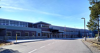
Truckee High School is one of two high schools in the Tahoe-Truckee Unified School District, which is based in the Lake Tahoe area town of Truckee in eastern Nevada County, California.
Tahoe Truckee Unified School District is a unified school district based in Truckee, California that educates students in the Truckee and northern Lake Tahoe areas. The district area encompasses 723 square miles, serving Placer County, Nevada County, and El Dorado County.
Brockway is an unincorporated community in Placer County, California. Brockway is located on the north shore of Lake Tahoe on State Line Point, adjacent to the Nevada state border. It lies at an elevation of 6266 feet.

The North American beaver had a historic range that overlapped the Sierra Nevada in California. Before the European colonization of the Americas, beaver were distributed from the arctic tundra to the deserts of northern Mexico. The California Golden beaver subspecies was prevalent in the Sacramento and San Joaquin River watersheds, including their tributaries in the Sierra Nevada. Recent evidence indicates that beaver were native to the High Sierra until their extirpation in the nineteenth century.

Martis Valley is a geographic area of 70 square miles (180 km2) in the United States, extending northward from the North Shore of Lake Tahoe, California, to the west of the California-Nevada border. It is located in Placer and Nevada Counties and is bisected by Martis Creek which flows north to the Truckee River.
Polaris was a historic ice farming community located nearly 3 miles east of Truckee, approximately at the intersection of modern day Glenshire Drive and Quail Lane.

Lake Tahoe Dam is a concrete gravity dam on the Truckee River, at the outlet of Lake Tahoe in Placer County, California.


![<span class="mw-page-title-main">Little Truckee River</span> River in [[Nevada County, California]] and [[Sierra County, California]], United States of America](https://upload.wikimedia.org/wikipedia/commons/thumb/8/81/Upper_little_truckee_river.jpg/320px-Upper_little_truckee_river.jpg)


