North Texas Regional Airport

Last updated
North Texas Regional Airport

Perrin Field
North Texas Regional Airport - Texas.jpg
Summary
Airport typePublic
Owner Grayson County, Texas
Serves Sherman / Denison
Elevation  AMSL 749 ft / 228 m
Coordinates 33°42′51″N096°40′25″W / 33.71417°N 96.67361°W / 33.71417; -96.67361
Map
USA Texas location map.svg
Airplane silhouette.svg
KGYI
Location in Texas
Runways
Direction LengthSurface
ftm
13/312,277694Asphalt
17L/35R9,0002,743Asphalt
17R/35L4,0081,222Asphalt
Statistics (2007)
Aircraft operations53,300
Based aircraft169
Source: FAA [1] and airport website [2]

North Texas Regional Airport / Perrin Field [2] ( IATA : PNX, ICAO : KGYI, FAA LID : GYI) is a county-owned airport in Grayson County, Texas between Sherman and Denison. [1] Formerly Grayson County Airport, the airport was renamed in November 2007. [2] Several buildings are occupied by businesses, Grayson County government agencies, and Grayson County College.

Contents

Most U.S. airports use the same three-letter location identifier for the FAA and IATA, but this airport is GYI to the FAA and PNX to the IATA (which assigned GYI to Gisenyi Airport in Gisenyi, Rwanda).

The northern extension of State Highway 289 passes the airport on the west side.

History

Front entrance sign at the North Texas Regional Airport North Texas Regional Airport.jpg
Front entrance sign at the North Texas Regional Airport

The airport is on the site of Perrin Air Force Base, which was built in 1941 and closed in 1971. [3] Since the closure, a group of local citizens have held the memory of Perrin together, hosting nine Perrin Field reunions since the early 1980s. The Perrin AFB Research Foundation was established in 1998. Today, in addition to serving as a general aviation airport, several businesses, as well as a juvenile detention center/boot-camp and adult probation center are built upon former barracks and nearby areas. The Perrin Air Force Base Historical Museum is located at the airport and Grayson County College uses several buildings. The college also operates the former base golf course.

After seeing the fighters take off from here as a young man, aviation expert Chesley Sullenberger (best known as the pilot of US Airways Flight 1549) became interested in flying. [4] [5]

In late 2018, the proposed Christian airline Judah 1 moved to North Texas Regional, but was subsequently unsuccessful in its efforts to obtain an air operator's certificate and begin scheduled flights. In early 2020, Judah 1 moved to Shreveport Regional Airport, citing a lack of hangar space and facilities suitable for Transportation Security Administration use at North Texas Regional; the manager of North Texas Regional stated that the move would have little impact, as Judah 1 had never started airline operations. [6]

On 1 January 2024, the Cavanaugh Flight Museum lost its lease at Addison Airport, closed indefinitely, and announced that its aircraft would be moved to North Texas Regional, but the museum would not state whether the collection would return to public display. [7]

Facilities

The airport covers 1,410 acres (570  ha ) at an elevation of 749 feet (228 m). It has three runways: 17L/35R, which measures 9,000 by 150 feet (2,743 x 46 m) and is made from asphalt/concrete; 17R/35L, which measures 4,008 by 100 feet (1,222 x 30 m) and is also made from asphalt/concrete, and 13/31, which measures 2,277 by 60 feet (694 x 18 m) and is made from asphalt. [1]

The airport has a Category I instrument landing system (ILS) to Runway 17L. The former USAF control tower resumed operations in mid-2008.

In the year ending April 30, 2007, the airport had 53,300 aircraft operations, an average of 146 per day: 98% general aviation, 2% military and <1% air taxi. 169 aircraft were then based at the airport: 73% single-engine, 11% multi-engine, 11% jet, 4% helicopter and 1% ultralight. [1]

See also

Related Research Articles

<span class="mw-page-title-main">Lubbock Preston Smith International Airport</span> Airport in Lubbock County, Texas

Lubbock Preston Smith International Airport is five miles north of Lubbock, in Lubbock County, Texas, United States. Originally Lubbock International Airport, it was renamed in 2004 for former Texas governor Preston E. Smith, an alumnus of Texas Tech University.

<span class="mw-page-title-main">Elmira Corning Regional Airport</span> Airport in Big Flats / Horseheads

Elmira Corning Regional Airport is in Chemung County, New York, seven miles northwest of Elmira and eight miles east of Corning. It is in the town of Big Flats but its mailing address is Horseheads, New York. The airport was formerly Elmira Regional Airport.

<span class="mw-page-title-main">Monroe Regional Airport (Louisiana)</span> Airport in Ouachita Parish

Monroe Regional Airport is a public use airport in Ouachita Parish, Louisiana, United States. The airport is owned by the City of Monroe and is located within the city limits three nautical miles (6 km) east of its central business district.

<span class="mw-page-title-main">La Crosse Regional Airport</span> Airport located in La Crosse, Wisconsin

La Crosse Regional Airport is a public airport located 5 nautical miles northwest of La Crosse, a city in La Crosse County, Wisconsin, United States. Until August 2013 the airport was called La Crosse Municipal Airport.

<span class="mw-page-title-main">Wichita Falls Regional Airport</span> Airport in Wichita Falls, Texas

Wichita Falls Regional Airport is a public and military use airport six miles north of Wichita Falls in Wichita County, Texas. Its runways and taxiways are shared with Sheppard Air Force Base; most operations are military, but American Eagle flies to Dallas/Fort Worth International Airport.

Rostraver Airport is a public use airport in Westmoreland County, Pennsylvania, United States.

Lancaster Regional Airport is two miles south of Lancaster, in Dallas County, Texas. Formerly Lancaster Airport, the National Plan of Integrated Airport Systems for 2011–2015 categorized it as a general aviation reliever airport.

<span class="mw-page-title-main">Marana Regional Airport</span> Airport in Pima County, Arizona

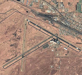
Marana Regional Airport, also known as Marana Northwest Regional Airport or Avra Valley Airport, is a non-towered, general aviation airport about 15 miles northwest of Tucson, Arizona in Marana a town in Pima County, Arizona, United States. In 1999, the airport was purchased from Pima County by the town of Marana.

<span class="mw-page-title-main">Winslow–Lindbergh Regional Airport</span> Airport in Navajo County, Arizona

Winslow–Lindbergh Regional Airport is 1 mile mile west of Winslow, in Navajo County, Arizona. The U.S. Forest Service has a firefighting air tanker base here. The airport was served by TWA and Frontier Airlines but now sees no airline service.

<span class="mw-page-title-main">Clarksville–Montgomery County Regional Airport</span> Airport in Tennessee

Clarksville–Montgomery County Regional Airport, or simply Outlaw Field, is seven miles northwest of Clarksville, in Montgomery County, Tennessee, United States. It is owned by the city of Clarksville and Montgomery County and is near Fort Campbell.

Taos Regional Airport is a public use airport eight nautical miles (15 km) northwest of the central business district of Taos, in Taos County, New Mexico, United States. It is owned by the Town of Taos. FAA's National Plan of Integrated Airport Systems for 2009–2013 classifies it as a general aviation airport.

<span class="mw-page-title-main">Concord-Padgett Regional Airport</span> Airport in North Carolina, United States

Concord-Padgett Regional Airport is a city-owned, public-use airport located seven nautical miles (13 km) west of the central business district of Concord, a city in Cabarrus County, North Carolina, United States. According to the FAA's National Plan of Integrated Airport Systems for 2009–2013, it is classified as a reliever airport for Charlotte Douglas International Airport.

<span class="mw-page-title-main">Denton Enterprise Airport</span> Airport in Denton County, Texas

Denton Enterprise Airport, also known as Denton Airport and previously Denton Municipal Airport, is a city-owned, public-use airport located three nautical miles (6 km) west of the central business district of Denton, a city in Denton County, Texas, United States.

Delaware County Regional Airport is in Delaware County, Indiana three miles northwest of Muncie. Owned by the Delaware County Airport Authority, it was formerly Delaware County Airport and Johnson Field. The National Plan of Integrated Airport Systems for 2011–2015 categorized it as a general aviation facility.

Marfa Municipal Airport is three miles north of Marfa in Presidio County, Texas. There is currently no scheduled airline service to the airport; until 1960 Trans-Texas DC-3s stopped at the former Marfa AAF, now abandoned, at 30.256N 103.882W east of Marfa.

<span class="mw-page-title-main">Aiken Regional Airport</span> Airport in near Aiken, South Carolina

Aiken Regional Airport is a city-owned public-use airport located five nautical miles (9 km) north of the central business district of Aiken, a city in Aiken County, South Carolina, United States. The airport serves the general aviation community, with no scheduled commercial airline service. Formerly, it was Aiken Air Force Station.

<span class="mw-page-title-main">Clarence E. Page Municipal Airport</span> Airport in Canadian County, Oklahoma

Clarence E. Page Municipal Airport is a public-use airport owned by the city of Oklahoma City and located in Canadian County, Oklahoma, United States. It is 15 nautical miles (28 km) west of the central business district of Oklahoma City, but still within its city limits. This airport is included in the FAA's National Plan of Integrated Airport Systems (2009–2013), which categorizes it as a general aviation airport.

<span class="mw-page-title-main">Huntsville Regional Airport</span> Airport in Texas, US

Bruce Brothers Huntsville Regional Airport, also known as Huntsville Municipal Airport, is a city-owned, public-use airport located two nautical miles (4 km) northwest of the central business district of Huntsville, a city in Walker County, Texas, United States. It is included in the National Plan of Integrated Airport Systems for 2011–2015, which categorized it as a general aviation facility.

Gisenyi Airport is an airport in Rwanda. It has IATA airport code GYI.

Judah 1 is a proposed airline promoted as an "aviation ministry" with a focus on the Christian missionary travel market. The company bills itself as "the world's first and only Christian airline."

References

  1. 1 2 3 4 FAA Airport Form 5010 for GYI PDF . Federal Aviation Administration. Effective July 2, 2009.
  2. 1 2 3 North Texas Regional Airport, official site
  3. "North Texas Regional Airport: History". Archived from the original on 2011-07-14. Retrieved 2009-07-23.
  4. Rivera, Ray (January 16, 2009). "A Pilot Becomes a Hero Years in the Making". The New York Times.
  5. Kaufmann, Carol (January 16, 2009). "Hudson River Hero". AARP Today. American Association of Retired Persons. Retrieved March 16, 2009.
  6. Hutchins, Michael (12 March 2020). "Proposed Christian airline announces departure from NTRA" . The Herald Democrat . Sherman, Texas. Retrieved 1 April 2020.
  7. Sullivan, Cole (January 1, 2024). "Historic Addison flight museum announces closure". WFAA. Dallas, Texas. Retrieved January 4, 2024.