
North Somerset is a unitary authority in the ceremonial county of Somerset, England. The council is based in Weston-super-Mare, the area's largest town. The district also contains the towns of Clevedon, Nailsea and Portishead, along with a number of villages and surrounding rural areas. Some southern parts of the district fall within the Mendip Hills, a designated Area of Outstanding Natural Beauty.

Portishead is a town and civil parish in the North Somerset unitary authority area, in the county of Somerset, England. With a population of 26,366 at the 2021 Census, the town is located on the Severn Estuary opposite Cardiff and Newport in Wales. The town is 8 miles (13 km) to the west of Bristol and 18 miles northeast of Weston-super-Mare.
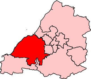
Woodspring was a constituency represented in the House of Commons of the Parliament of the United Kingdom from 1983 until 2010. It elected one Member of Parliament (MP) by the first past the post system of election. From 1992 until 2010, it was represented by Liam Fox, former Secretary of State for Defence. Fox went on to represent the new North Somerset constituency from 2010.

Easton in Gordano is a village in Somerset, England, about 4+1⁄2 miles (7 km) northwest of Bristol city centre. It is part of the civil parish of Pill and Easton-in-Gordano and within the unitary authority of North Somerset. In 2011 the population of the parish was 4,828.
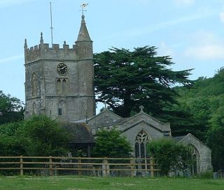
Clapton in Gordano is a village and civil parish in Somerset, England. It is situated within the unitary authority of North Somerset on the southern side of the Gordano Valley, immediately adjacent to the M5 motorway. The parish has a population of 348. There is a village football club, Clapton in Gordano FC. They currently run two sides with a view to continue progressing throughout the leagues. Their home ground is currently Clapton Lane, Portishead.
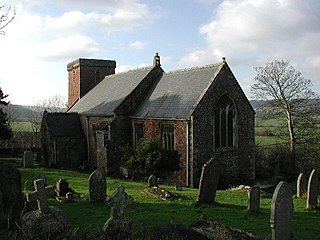
Weston in Gordano is a village and civil parish in Somerset, England. It is situated in the middle of the Gordano valley on the north side, and in the Unitary Authority of North Somerset, on the road between Clevedon and Portishead. The parish has a population of 301.

Walton in Gordano is a village and civil parish in North Somerset, England. It is situated in a small valley at the side of the south-western end of the Gordano Valley, about a mile from Clevedon. The parish has a population of 273.

Portbury is a village and civil parish in Somerset, England within the unitary authority of North Somerset. The parish includes the hamlet of Sheepway which is situated on the moorland at the northern edge of the Gordano valley, between the Gordano services on the M5 motorway and Portishead, near the Royal Portbury Dock. The parish has a population of 827.
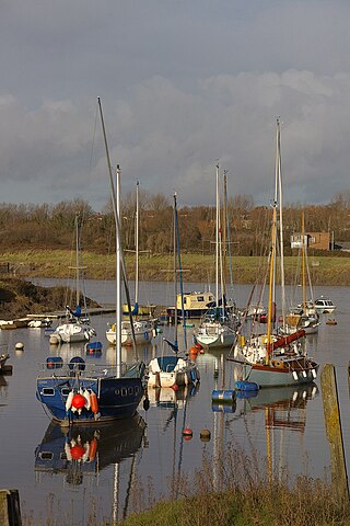
Pill is a village in North Somerset, England, situated on the southern bank of the Avon, about 4 miles (6 km) northwest of Bristol city centre. The village is the largest settlement in the civil parish of Pill and Easton-in-Gordano. The former hamlets of Lodway and Ham Green are now contiguous with Pill, and the village of Easton in Gordano is nearby. The parish extends northwest beyond the M5 motorway to include the Royal Portbury Dock.

North Somerset is a constituency represented in the House of Commons of the UK Parliament since 2010 by Liam Fox, a Conservative who served as Secretary of State for International Trade, a new position in the Cabinet, from 2016 to 2019.

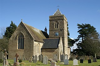
Winford is a village and civil parish within the Chew Valley, Somerset, England. It is within the unitary authority of North Somerset about 8 miles (12.9 km) south of Bristol. The parish has a population of 2,153.
Compton Dando is a small village and civil parish on the River Chew in the affluent Chew Valley in England. It is in the Bath and North East Somerset council area and ceremonial county of Somerset, and lies 7 miles (11.3 km) from Bristol, 8 miles (12.9 km) from Bath, and 3 miles (4.8 km) from Keynsham.

Worle is a village in the civil parish of Weston-Super-Mare, in the North Somerset district, in the ceremonial county of Somerset, England. It is joined to the seaside town of Weston-super-Mare on its western edge. It, however, maintains a very separate identity, and may now be bigger than its more famous neighbour. Worle pre-dates Weston and was mentioned in the Domesday Book of 1086. In the book, it is said that Worle was owned by Walter of Douai, and consisted of 750 acres (3.0 km2) and valued at 6.5 hides. "Walter of Douai holds of the King, Worle. Edgar held it in the time of King Edward, and gelded for six hides and a half." The parish church of St Martin's sits on the side of Worlebury Hill and overlooks the village.

Stowey is a small village and former civil parish, now in the parish of Stowey Sutton, in the Bath and North East Somerset district, in the ceremonial county of Somerset, England. It lies within the Chew Valley, south of Chew Valley Lake and north of the Mendip Hills, approximately 10 miles (16 km) south of Bristol on the A368 road Weston-super-Mare to Bath. Stowey and its neighbouring and larger village, Bishop Sutton, form the civil parish of Stowey Sutton.
Huntspill is a village and former civil parish on the Huntspill Level in Somerset, England. It lies on the A38 road, 1.5 miles (2.4 km) south of Highbridge. The village is the principal settlement in the civil parish of West Huntspill. In 2019 it had an estimated population of 1102.

Hutton is a village and civil parish in Somerset, England. The parish, which has a population of 2,582, is within the unitary authority of North Somerset and located on the western edge of the Mendip Hills, close to Weston-super-Mare.

Winscombe and Sandford, formerly just Winscombe, is a civil parish in the North Somerset district, in the ceremonial county of Somerset, England. It includes the villages of Winscombe and Sandford. In 2011 he parish had a population of 4,546. On 1 June 1992 the parish was renamed from "Winscombe" to "Winscombe and Sandford".
The Hundred of Portbury is one of the 40 historical Hundreds in the ceremonial county of Somerset, England, dating from before the Norman conquest during the Anglo-Saxon era although exact dates are unknown. Each hundred had a 'fyrd', which acted as the local defence force and a court which was responsible for the maintenance of the frankpledge system. They also formed a unit for the collection of taxes. The role of the hundred court was described in the Dooms (laws) of King Edgar. The name of the hundred was normally that of its meeting-place.

Clapton Moor is a 40-hectare (99-acre) Avon Wildlife Trust nature reserve and part of the Gordano Valley, Clapton Moor, Middle Bridge and rhynes Site of Nature Conservation Interest in Somerset, England.

