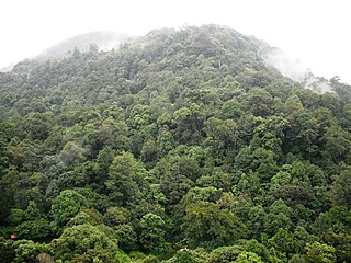
The South Western Ghats montane rain forests is an ecoregion in South India, covering the southern portion of the Western Ghats in Karnataka, Kerala and Tamil Nadu at elevations from 1,000 to 2,695 m. Annual rainfall in this ecoregion exceeds 2,800 mm (110 in).
The term Malabar rainforests refers to one or more distinct ecoregions recognized by biogeographers:
- the Malabar Coast moist forests formerly occupied the coastal zone to the 250 metre elevation
- the South Western Ghats moist deciduous forests grow at intermediate elevations
- the South Western Ghats montane rain forests cover the areas above 1000 metres elevation

The Chin Hills-Arakan Yoma montane forests is a tropical and subtropical moist broadleaf forest ecoregion in western Myanmar (Burma). Surrounded at lower elevations by moist tropical forests, this ecoregion is home a diverse range of subtropical and temperate species, including many species characteristic of the Himalayas, as well as many endemic species.

The Northern Indochina subtropical forests are a subtropical moist broadleaf forest ecoregion of northern Indochina, covering portions of Vietnam, Laos, Thailand, Myanmar, and China's Yunnan Province.
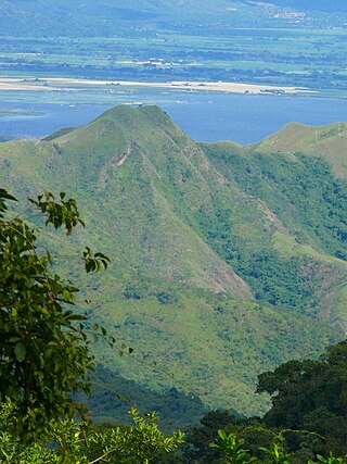
The Cordillera de la Costa montane forests is a montane ecoregion of the tropical and subtropical moist broadleaf forests biome, in the Venezuelan Coastal Range on the Caribbean Sea in northern Venezuela.

The Southeastern Indochina dry evergreen forests are a tropical dry broadleaf forest ecoregion of Indochina.
Nakai-Nam Theun National Park in Nakai District, Khammouane Province, Laos, is one of the last remaining wildernesses in Southeast Asia. Nakai-Nam Theun covers approximately 4,270 km2 of the Annamite Range and the adjacent Nakai Plateau in Khammouane and Bolikhamsai Provinces. It was designated a national park on 15 February 2019 by Prime Ministerial Decree No. 36, 15 February 2019. It is managed by the Ministry of Agriculture and Forestry (MAF). It is adjacent to the Vu Quang National Park of Vietnam.
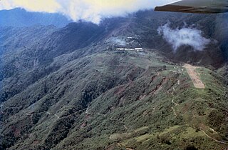
The Huon Peninsula montane rain forests is a tropical moist forest ecoregion in New Guinea. The ecoregion covers the mountains of northeastern New Guinea's Huon Peninsula.

The Hainan Island monsoon rain forests ecoregion covers mountainous interior of Hainan Island in China. The tropical forests receive over 1,000 mm/year of rain, heavily concentrated in the summer rainy season. The island has high levels of biodiversity, with over 4,200 plant species, 630 of which are endemic to the island. The region is under ecological pressure from deforestation for agriculture and timber extraction.

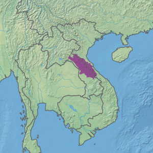
The Luang Prabang montane rain forests ecoregion covers elevations over 800 meters in the Luang Prabang mountains that straddle the border between northern Thailand and north-central Laos, and the highlands that stretch eastward across north-central Laos. While much of the forest cover has been degraded, there are still large areas of relatively untouched forest.

The Northern Vietnam lowland rain forests ecoregion covers the central-eastern coast of Vietnam from the Red River delta in the north to Tam Kỳ in the center of the country and neighboring adjacent parts of Laos. The region is one of the wet evergreen forests, with rain over 50 mm in every month. The forests have been highly degraded by human use, and the high levels of biodiversity have been pushed back into relatively small protected areas like Pu Mat National Park.
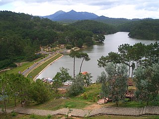
The Southern Annamites montane rain forests ecoregion covers a region of high biodiversity in the central and southern mountains of the Annamite Range in Vietnam. Terrain ranges from wet lowland forest to evergreen hardwood and conifer montane rain forest. There is a short dry season centered on January–February, but fog and dew are common throughout the year and support a lush forest character.

The Southern Vietnam lowland dry forests ecoregion covers the low, relatively arid coastal strip of southern Vietnam on the South China Sea. The region is in the rain shadow of the Southern Annamite Range, which blocks humid air from the west. Although approximately half of the ecoregion is forested to some degree, most has at some point been cleared for agriculture or degraded by extraction of hardwoods. There are few protected areas.

The Northern Khorat Plateau moist deciduous forests ecoregion covers a small area on the border between northeastern Thailand and Laos, in the transition zone between the drier Khorat Plateau to the south and the wetter Annamite Range and Luang Prabang Range mountains to the north. Much of the ecoregion has been converted to agriculture along the floodplain of the middle course of the Mekong River.
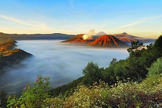
The Eastern Java–Bali montane rain forests ecoregion covers the higher altitude mountain rainforests on the eastern side of the island of Java, and most of the center of the island of Bali in Indonesia. The region has a number of active volcanoes, but is under pressure from growing human populations pushing into higher elevations and more marginal land. With elevations rising from sea level to 3,426 metres (11,240 ft), and precipitation varying between rainforest and drier forest levels, the area has many different forest types – evergreen, deciduous and semi-alpine.

The Sumatran montane rain forests ecoregion covers the mountainous elevations of the Barisan Mountains Range that runs the length of the southwestern side of the island of Sumatra in Indonesia. The ecoregion is almost completely surrounded by the lower elevation Sumatran lowland rain forests. The area is one of very high biodiversity - because of the relative isolation, and variety of forest types, there are 7 endemic species of mammals and eight endemic species of birds.

The Mindanao montane rain forests ecoregion covers the montane forests - the zone between the lowland forest and the treeline - in the mountains on the island of Mindanao in the Philippines. Because the ecoregion covers only elevations above 1,000 metres (3,300 ft), it exists in seven discontinuous patches surrounded by lowland rainforest. Biodiversity is high, both because of the isolation of separate mountain ranges that have led to species variation within the island, and because of the altitude zonation. Because most of the surrounding lowland forest has been cleared for human use, the montane regions have become an important refuge for rare and endemic species.

The Mindanao–Eastern Visayas rain forests ecoregion covers the lowland rain forests of the island of Mindanao and of the easternmost of the Visayas Islands in the Philippines. Although 63% of this ecoregion is covered with closed broadleaf evergreen forest or open forest, much of this has been disturbed in the past by human activity, and many of the rare species of the area have been relegated to the isolated areas or higher elevations.

The Western Java montane rain forests ecoregion covers the montane rain forest above 1,000 meters in the volcanic mountain ridges in the west of the island of Java in Indonesia. Several mammals and bird species are found only in this ecoregion, including the Javan mastiff bat (Otomops formosus) and the Volcano mouse (Mus vulcani). Only about one-fifth of the original rainforest remains in its original state, as human pressures are encroaching on the mountain slopes.

The Western Java rain forests ecoregion covers the lowland rain forests below 1,000 meters in elevation in the western half of the island of Java in Indonesia. There are a variety of forest types - evergreen, semi-evergreen, moist deciduous, and even some patches of freshwater swamp. The forests have degraded by conversion of the low areas to agriculture, and by logging. National parks protect some of the last remaining untouched rain forest. A number of endangered mammals are found in the ecoregion, including the Javan rhinoceros, the silvery gibbon, and the Javan surili.

