
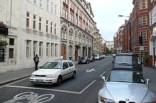
Northumberland Street is a street in the City of Westminster.
Northumberland Street is a street in the City of Westminster.
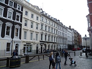
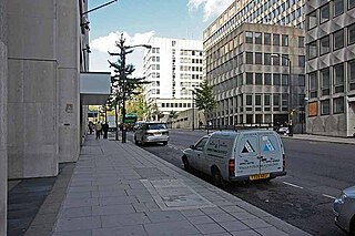
The street runs from Strand in the north to Northumberland Avenue in the south. On its east side it is joined by Corner House Street and Craven Passage. It is part pedestrianised in the section leading off the Strand.
Northumberland Street was originally known as Hartshorn Lane. The buildings in that lane were demolished to make way for Northumberland Street in the 1760s. [1]
Dramatist Ben Jonson (c. 1572–1637) spent his youth in Hartshorn Lane and may have been born there. [2]
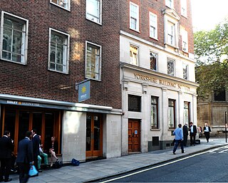
The Sherlock Holmes public house is located in the south of the street on the corner with Craven Passage.
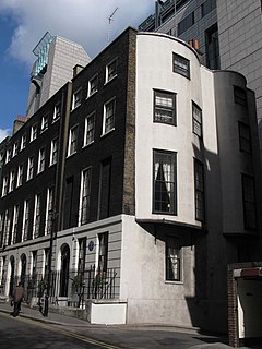
The Royal Institution Of Naval Architects is located at Nos. 8–9. [3]
The offices of the Association of Teachers and Lecturers are at No. 7. [4]
Drury Lane is a street on the eastern boundary of the Covent Garden area of London, running between Aldwych and High Holborn. The northern part is in the borough of Camden and the southern part in the City of Westminster.

Marble Arch is a 19th-century white marble-faced triumphal arch in London, England. The structure was designed by John Nash in 1827 to be the state entrance to the cour d'honneur of Buckingham Palace; it stood near the site of what is today the three-bayed, central projection of the palace containing the well-known balcony. In 1851, on the initiative of architect and urban planner Decimus Burton, a one-time pupil of John Nash, it was relocated to its current site. Following the widening of Park Lane in the early 1960s, the site became a large traffic island at the junction of Oxford Street, Park Lane and Edgware Road, isolating the arch. Admiralty Arch, Holyhead in Wales is a similar arch, also cut off from public access, at the other end of the A5.
The WC postcode area, also known as the London WC postcode area, is a group of postcode districts in central London, England. The area covered is of high density development, and includes parts of the City of Westminster and the London Boroughs of Camden and Islington, plus a very small part of the City of London.

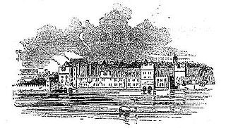
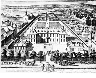
Northumberland House was a large Jacobean townhouse in London, so-called because it was, for most of its history, the London residence of the Percy family, who were the Earls and later Dukes of Northumberland and one of England's richest and most prominent aristocratic dynasties for many centuries. It stood at the far western end of the Strand from around 1605 until it was demolished in 1874. In its later years it overlooked Trafalgar Square.

Northumberland Avenue is a street in the City of Westminster, Central London, running from Trafalgar Square in the west to the Thames Embankment in the east. The road was built on the site of Northumberland House, the London home of the Percy family, the Dukes of Northumberland between 1874 and 1876, and on part of the parallel Northumberland Street.

Arundel House was a London town-house or palace located between the Strand and the River Thames, near the Church of St Clement Danes.
Cecil House refers to two historical mansions on The Strand, London, in the vicinity of the Savoy. The first was a 16th-century house on the north side, where the Strand Palace Hotel now stands. The second was built in the early 17th century on the south side nearly opposite, where Shell Mex House stands today.

Adelphi is a district of the City of Westminster in London. The small district includes the streets of Adelphi Terrace, Robert Street and John Adam Street. Of rare use colloquially, Adelphi is grouped with Aldwych as the greater Strand district which for many decades formed a parliamentary constituency and civil registration district.

Wych Street was in London where King, Melbourne and Australia Houses now stand on Aldwych. It ran west from the church of St Clement Danes on the Strand to meet the southern end of Drury Lane. It was demolished by the London County Council in around 1901, as part of redevelopment bisected by new street Aldwych, the east of which mimics its course, in a curved way so taking up land buildings stood on, and these works created Kingsway.
Savoy Place is a large red brick building on the north bank of the River Thames in London. It is on a street called Savoy Place; Savoy Hill and Savoy Street run along the sides of the building up to the Strand. In front is the Victoria Embankment, part of the Thames Embankment. Close by are Savoy Hill House, the Savoy Hotel and Waterloo Bridge. There are commanding views over to the South Bank and the London Eye.

The Sherlock Holmes is a Victorian era themed public house in Northumberland Street near Charing Cross railway station and Trafalgar Square which contains a large collection of memorabilia related to the fictional detective Sherlock Holmes. The original collection was put together for display in Baker Street in London during the Festival of Britain in 1951.
Burlington Gardens is a street in central London, on land that was once part of the Burlington Estate.
Henrietta Street is a street in Covent Garden, London, that was once home to a number of artists and later became the location of many publishing firms.
Craven Street is a street in the City of Westminster, London, near Strand. A number of notable historical figures have lived in the street which was the home of Benjamin Franklin when he lived in London before the American Revolution.
Essex Street is a street in the City of Westminster that runs from Milford Lane in the south to Strand in the north. It is joined by Little Essex Street on its western side and Devereux Court on the eastern side. It was laid out by Nicholas Barbon in around 1675 or 1680 and contains a number of listed buildings.

The Cheshire Cheese is a public house at 5 Little Essex Street, London WC2, on the corner with Milford Lane.

Henrietta Place, originally known as Henrietta Street, is a street in Marylebone in the City of Westminster in central London that runs from Marylebone Lane in the east to Cavendish Square in the west. It is joined on the north side by Welbeck Street and Wimpole Street, and on the south side by Vere Street, Chapel Place, and Old Cavendish Street.

Milford Lane is a narrow street in the City of Westminster that runs from Strand in the north to a brief walkway section leading to Temple Place in the south. It is joined by Little Essex Street and Essex Street on its eastern side. Maltravers Street once joined the lane to Arundel Street, but ceased to exist when building work at 190 Strand was completed.
Arundel Street is a street in the City of Westminster, London, that runs from Strand in the north to Temple Place in the south. It is on land once occupied by Arundel House and its gardens.

Catherine Street, originally known as Brydges Street, is a street in the City of Westminster, London. It runs from Russell Street in the north to Aldwych in the south. It is crossed midway by Tavistock Street and joined on the western side near Aldwych by Exeter Street.
![]() Media related to Northumberland Street, London at Wikimedia Commons Coordinates: 51°30′26.82″N0°7′32.39″W / 51.5074500°N 0.1256639°W
Media related to Northumberland Street, London at Wikimedia Commons Coordinates: 51°30′26.82″N0°7′32.39″W / 51.5074500°N 0.1256639°W
| | This London road or road transport-related article is a stub. You can help Wikipedia by expanding it. |