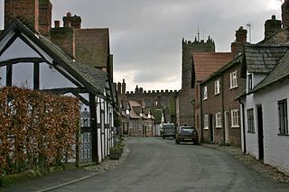
Great Budworth is a village and civil parish in Cheshire, England, four miles (6.4 km) north of Northwich off the A559 road, east of Comberbach, northwest of Higher Marston and southeast of Budworth Heath. Until 1948, Great Budworth was part of the Arley Hall estate.

Stowe is a civil parish and former village about two miles northwest of Buckingham in the unitary authority area of Buckinghamshire, England. The parish includes the hamlets of Boycott, Dadford and Lamport.

Thorpe Mandeville is a village and civil parish in West Northamptonshire, England about 6 miles (10 km) northeast of Banbury in neighbouring Oxfordshire. The hamlet of Lower Thorpe is just north of the village.

Great Milton is a village and civil parish in Oxfordshire, about 7 miles (11 km) east of Oxford. The 2011 Census recorded the parish's population as 1,042.
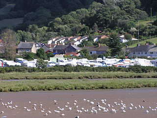
Axmouth is a village, civil parish and former manor in the East Devon district of Devon, England, near the mouth of the River Axe. The village itself is about 1 mile (1.6 km) inland, on the east bank of the Axe estuary. The parish extends along the estuary to the sea, and a significant distance to the east. The village is near Seaton and Beer which are on the other side of the Axe estuary. According to the 2001 census the parish had a population of 493.

Wilton is a small village in Redcar and Cleveland, North Yorkshire, England. In 1951 the parish had a population of 958.

Bobbing is a village and civil parish in the Swale district of Kent, England, about a mile north-west of Sittingbourne, and forming part of its urban area. The hamlet of Howt Green and village of Keycol are included within the parish. According to the 2011 census Bobbing parish had a population of 1,969.

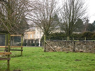
Sunningwell is a village and civil parish about 3+1⁄2 miles (6 km) south of Oxford, England. The parish includes the village of Bayworth and the eastern part of Boars Hill. The parish was part of Berkshire until the 1974 boundary changes transferred it to Oxfordshire. The 2011 Census recorded the parish population as 904.

Thorpe is a village in Surrey, England, between Egham, Virginia Water and Chertsey. It is centred 20 miles (32 km) WSW of Charing Cross and its land adjoins the circle of the M25, near the M3 — its ward covers 856 hectares (3.3 sq mi). Its traditional area with natural boundaries covers one square mile less.

Hornby Castle is a grade I listed fortified manor house on the edge of Wensleydale between Bedale and Leyburn, in the county of North Yorkshire, England.

Markenfield Hall is an early 14th-century moated manor house about 3 miles (5 km) south of Ripon, North Yorkshire, England. It is in the civil parish of Markenfield Hall, which in 2015 had an estimated population of 10. The estate was an extra parochial area in the Hundred of Burghshire. It was made a civil parish in 1858. On 11 November 2011 the parish was renamed to Markenfield Hall. It was part of the West Riding of Yorkshire until 1974, when under the Local Government Act 1972 it became part of the new county of North Yorkshire. It is part of the Borough of Harrogate.
There have been eight baronetcies created for persons with the surname Graham, two in the Baronetage of Nova Scotia, two in the Baronetage of England, one in the Baronetage of Great Britain and three in the Baronetage of the United Kingdom.
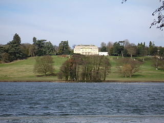
Gatton Park is a country estate set in parkland landscaped by Capability Brown at Gatton, near Reigate in Surrey, England.

The baronetcy of Conyers of Horden was created in the Baronetage of England on 14 July 1628 for John Conyers of Horden, County Durham.

Sockburn Hall is privately owned 19th-century country house at Sockburn, near Darlington, County Durham, England. It is a Grade II* listed building. As at 2008, both the Hall and adjoining Grade II coach house are listed by English Heritage on the Buildings at Risk Register, as is the adjacent ruined Grade I Church of All Saints.
The Castle at Castle Eden, County Durham, England, is an 18th-century, Palladian style, mansion house and a Grade II* listed building. No trace remains of the medieval castle of Robert the Bruce.
Sir Richard Graham, 1st Baronet of Esk was an English politician elected to the House of Commons. He fought in the English Civil War for the royalist army.
Hauxwell Hall or Hawkswell Hall is a grade II* listed 17th-century country house in West Hauxwell, North Yorkshire, England, some 5 miles south-west of Catterick.
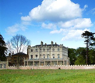
Norton Conyers is a civil parish in North Yorkshire, England, 3 miles (5 km) north of Ripon. There is no modern village in the parish. Most of the parish is occupied by the grounds of Norton Conyers House, which cover the site of a deserted medieval village.

Chilworth Manor is a historic country house located midway between Chilworth, Surrey and St Martha's Hill to the north. The manor is grade II listed by Historic England.

