Related Research Articles

Agincourt is a neighbourhood and former village in Toronto, Ontario, Canada. Agincourt is located in northeast Toronto, along Sheppard Avenue between Kennedy and Markham Roads. Before the creation of the "megacity" of Toronto in 1998, the area was part of Scarborough. It is officially recognized by the City of Toronto as occupying the neighbourhoods of Agincourt South–Malvern West and Agincourt North.
Port Union, also known as Centennial Scarborough is a neighbourhood in Toronto, Ontario, Canada. It is located in the south-east corner of Toronto, within the former suburb of Scarborough. The neighbourhood is bounded by Kingston Road to the north, Port Union Road to the east, the Lake Ontario shoreline to the south, and Highland Creek to the west.
Chapel Hill is a neighbourhood in the east end Ottawa, Ontario, Canada within the community of Orleans. It is considered an outer-suburb of Ottawa, and before the 2001 amalgamation of the city of Ottawa, it was part of the former City of Gloucester. Chapel Hill consists of mostly single family homes situated next to the National Capital Commission (NCC) Greenbelt and surrounding rural areas. The area is divided into two parts by Innes Road: Chapel Hill North and Chapel Hill South. The northern half is represented by the Chapel Hill North Community Association, while the southern half is represented by the Chapel Hill South Community Association. The boundaries of Chapel Hill North are St. Joseph Blvd (north), Boyer Rd (east), Innes Rd (south) and the greenbelt (west).

Orleans is a community in Ottawa, Ontario, Canada. It is located in the east end of the city along the Ottawa River, about 16 km (10 mi) from Downtown Ottawa. The Canada 2021 Census determined that Orléans' population was 125,937. Before being amalgamated into Ottawa in 2001, the community of Orléans was spread over two municipal jurisdictions, the eastern portion being in the pre-amalgamation City of Cumberland, the western portion in the City of Gloucester. According to the 2021 census, 75,453 people lived in the Cumberland portion of Orleans, while 50,484 lived in the Gloucester portion. Today, Orléans spans the municipal wards of Orléans East-Cumberland, Orléans West-Innes, and Orléans South-Navan. Orléans contains a significant francophone population.

Richview, formally known as Willowridge-Martingrove-Richview, is a neighbourhood in the city of Toronto, Ontario, Canada. It is bounded on the west by Highway 401 and on the north by the highway and by Dixon Road, Royal York Road on the east, and Eglinton Avenue West along the south. Richview was originally established as a postal village within the then-agricultural Etobicoke Township.
École secondaire publique Omer-Deslauriers is a French public school in the west of Ottawa, Ontario, Canada. It is named after the late Omer Deslauriers, an Ontarian educator and public serviceman who promoted establishment of several Francophone schools in Ottawa in the 1960s. Since August 2005, the school is located at 159 Chesterton Drive, and it enrols over 600 students as of 2024. The building was previously operated by the OCDSB, featuring the J.S. Woodsworth Secondary School until its closure in 2003.
Riverside South is a suburban community in Gloucester-South Nepean Ward in the south end of the city of Ottawa, Ontario, Canada, just southwest of Ottawa Macdonald–Cartier International Airport. Prior to amalgamation in 2001, the area was located in the city of Gloucester. Its population, according to the Canada 2021 Census, was 19,802.

For the settlement established by former slaves in Guyana known as Victoria Village see Victoria, Guyana
Parkwoods or sometimes referred to as Parkwoods-Donalda, is a neighbourhood in Toronto, Ontario, Canada. It is a geographically large neighbourhood located just south of Ontario Highway 401, west of Victoria Park Avenue, north of Lawrence Avenue East and east of the Don Valley Parkway.
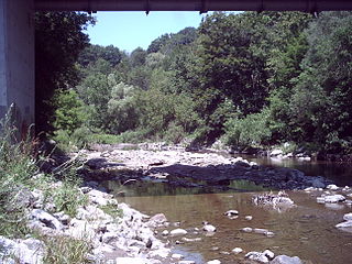
Fallingbrook is a neighbourhood in the community of Orleans, a suburb in the city of Ottawa, Ontario, Canada. It is located on the east edge of Orleans and is bounded by Tenth Line Road in the west, St. Joseph Boulevard to the north, Trim Road to the east and Innes Road to the south. Below the community of Fallingbrook flows the Ottawa River, and Petrie Island is the closest beach.

Crystal Beach is a neighbourhood in Ottawa, Ontario, Canada. It is located in the west end of Ottawa, in Bay Ward. The neighbourhood is triangular in shape, and its boundaries can broadly be described as Carling Avenue to the northeast, Moodie Drive to the west, and Corkstown Road to the south. It is. According to the Canada 2011 Census, the total population of the neighbourhood was 2,416.

The Goutte d'Or is a neighbourhood in Paris, located in the 18th arrondissement of Paris.
Avalon is a neighbourhood located in Orleans, a suburb in the east end of Ottawa, Ontario, Canada. Prior to amalgamation in 2001, the area was in the City of Cumberland.

The Upper Beaches is a neighbourhood in Toronto, Ontario, Canada. It is directly north of the Beaches area. It stretches from Coxwell Avenue in the west to Victoria Park in the east. The southern border is Kingston Road, while the northern boundary is generally considered to be the Canadian National Railway tracks between Gerrard Street and Danforth Avenue. The western part of the area was originally called Norway, and the larger area was once part of the Town of East Toronto. The name "Upper Beaches" was first used by developers and real estate agents around the period of 2001 to 2003 for the selling of houses on redeveloped land in the area, and was used as a marketing tag to attract buyers. The area was never considered part of the Beaches neighbourhood but was close to it. The city's current name for this area is East End Danforth, though that is rarely used. The city also includes the buildings along and just north of Danforth Avenue in the neighbourhood. The western portion between Woodbine Avenue and Coxwell is referred to by the city as Woodbine Corridor.
Queenswood Heights is a neighbourhood located in Orleans, the suburb in the east end of Ottawa, Ontario, Canada. Prior to amalgamation in 2001, the neighbourhood was in the Township of Cumberland. Queenswood Heights is bounded by St. Joseph Boulevard to the north, Tenth Line Road to the east, Innes Road to the south, and the former Cumberland-Gloucester boundary to the west (the Queenswood Heights Community Association considers Duford St. to be the western boundary). According to the Canada 2016 Census, the population of the neighbourhood was 11,031. Queenswood Heights spans 3.71 square kilometres.
Qualicum-Graham Park or Qualicum is a suburban neighbourhood in College Ward in the City of Ottawa, Ontario, Canada. It is located in the former City of Nepean in the west end of the city. Many of the residences in the area are executive homes situated on large lots (100x100) being built in the 1960s. Qualicum Street boasts large custom houses built by Bill Teron. The neighbourhood is bounded to the north by the Queensway, to the west by Richmond Road, to the south by Baseline Road, and to the east by Morrison Drive at the former Ottawa-Nepean border towards Redwood. Named after Qualicum Beach in British Columbia.

Chaperal is a neighbourhood located in the suburban Orleans area, in the east-end of the city of Ottawa, Ontario.

Maple Leaf is a neighbourhood in the city of Toronto, Ontario, Canada. It is located in the southwest of the North York district. Its approximate borders are Lawrence Avenue to the south, Culford Road to the west, Highway 401 to the north, and the CNR rail lines east of Keele Street to the east.
L'École Secondaire Catholique d'Embrun is a French-language Catholic high school located in Embrun, Ontario. It is managed by the Conseil scolaire de district catholique de l'Est ontarien.
Tanglewood, also known as Tanglewood-Hillsdale, is a suburban neighbourhood in Knoxdale-Merivale Ward in the city of Ottawa, Ontario, Canada. It is located within the former City of Nepean in the west end of the city. It is located in the federal and provincial ridings of Nepean-Carleton. It is informally bounded by CN Railway to the north, Merivale Road to the east, Hunt Club Road to the south, and Woodroffe Avenue to the west.
References
- ↑ "Google Maps".
- ↑ "Renaming and naming of streets to Brian Coburn Boulevard" . Retrieved 6 September 2013.
- ↑ Population calculated by combining Dissemination Areas 35061893, 35061892, 35061891, 35061890, 35061889
Places adjacent to Notting Gate | ||||||||||||||||
|---|---|---|---|---|---|---|---|---|---|---|---|---|---|---|---|---|
| ||||||||||||||||
45°28′20″N75°27′48″W / 45.47230°N 75.46325°W
| | This article relating to Ottawa and to Canada's National Capital Region is a stub. You can help Wikipedia by expanding it. |