Related Research Articles
The early history of Uganda comprises the history of Uganda before the territory that is today Uganda was made into a British protectorate at the end of the 19th century. Prior to this, the region was divided between several closely related kingdoms.

The Great Serpent Mound is a 1,348-feet-long (411 m), three-feet-high prehistoric effigy mound located in Peebles, Ohio. It was built on what is known as the Serpent Mound crater plateau, running along the Ohio Brush Creek in Adams County, Ohio. The mound is the largest serpent effigy known in the world.

Mounds State Park is a state park near Anderson, Madison County, Indiana featuring Native American heritage, and ten ceremonial mounds built by the prehistoric Adena culture indigenous peoples of eastern North America, and also used centuries later by Hopewell culture inhabitants. It is separate from the similarly named Mounds State Recreation Area. The park receives about 400,000 visitors annually.
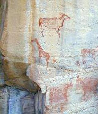
The Tsodilo Hills are a UNESCO World Heritage Site (WHS), consisting of rock art, rock shelters, depressions, and caves in Botswana, Southern Africa. It gained its WHS listing in 2001 because of its unique religious and spiritual significance to local peoples, as well as its unique record of human settlement over many millennia. UNESCO estimates there are over 4500 rock paintings at the site. The site consists of a few main hills known as the Child Hill, Female Hill, and Male Hill.

Kitara was a legendary state that covered significant parts of western Uganda and is regularly mentioned in the oral traditions of the Banyoro, Batooro and Banyankole.
Moorehead Circle was a triple woodhenge constructed about two millennia ago at the Fort Ancient Earthworks in the U.S. state of Ohio.

In archaeology, earthworks are artificial changes in land level, typically made from piles of artificially placed or sculpted rocks and soil. Earthworks can themselves be archaeological features, or they can show features beneath the surface.

The Holly Bluff site, sometimes known as the Lake George Site, and locally as "The Mound Place," is an archaeological site that is a type site for the Lake George phase of the prehistoric Plaquemine culture period of the area. The site is on the southern margin of the Mississippian cultural advance down the Mississippi River and on the northern edge of that of the Cole's Creek and Plaquemine cultures of the South." The site was first excavated by Clarence Bloomfield Moore in 1908 and tested by Philip Phillips, Paul Gebhard and Nick Zeigler in 1949.

The Dufuna canoe is a dugout canoe discovered in 1987 by a Fulani cattle herdsman a few kilometers from the village of Dufuna in the Fune Local Government Area, not far from the Komadugu Gana River, in Yobe State, Nigeria. Radiocarbon dating of a sample of charcoal found near the site dates the canoe at 8,500 to 8,000 years old, linking the site to Lake Chad. The canoe is 8.4 metres (28 ft) long and is 0.5 metres tall at it largest point. It is currently located in Damaturu, Nigeria.
Enkapune Ya Muto, also known as Twilight Cave, is a site spanning the late Middle Stone Age to the Late Stone Age on the Mau Escarpment of Kenya. This time span has allowed for further study of the transition from the Middle Stone Age to the Late Stone Age. In particular, the changes in lithic and pottery industries can be tracked over these time periods as well as transitions from a hunter-gatherer lifestyle to a herding lifestyle. Beads made of perforated ostrich egg shells found at the site have been dated to 40,000 years ago. The beads found at the site represent the early human use of personal ornaments. Inferences pertaining to climate and environment changes during the pre-Holocene and Holocene period have been made based from faunal remains based in this site.
Garden Creek site is an archaeological site located 24 miles (39 km) west of Asheville, North Carolina in Haywood County, on the south side of the Pigeon River and near the confluence of its tributary Garden Creek. It is near modern Canton and the Pisgah National Forest. The earliest human occupation at the site dates to 8000 BCE. The 12-acre site features remains of two villages (31Hw7) occupied first in the Woodland period and, most prominently, in the Pisgah phase associated with the South Appalachian Mississippian culture. A total of four earthwork mounds have been found at the site; three have been excavated.

The Marshall Site (15CE27) is an Early Mississippian culture archaeological site located near Bardwell in Carlisle County, Kentucky, on a bluff spur overlooking the Mississippi River floodplain. The site was occupied from about 900 to about 1300 CE during the James Bayou Phase of the local chronology and was abandoned sometime during the succeeding Dorena Phase. Its inhabitants may have moved to the Turk Site, which is located on the nearest adjacent bluff spur to the south, and which was founded about this time. It is several miles south of the Wickliffe Mounds Site.

Poverty Point State Historic Site/Poverty Point National Monument is a prehistoric earthwork constructed by the Poverty Point culture, located in present-day northeastern Louisiana. Evidence of the Poverty Point culture extends throughout much of the Southeastern Woodlands of the Southern United States. The culture extended 100 miles (160 km) across the Mississippi Delta and south to the Gulf Coast.
Kʼaxob is an archaeological site of the Maya civilization located in Belize. It was occupied from about 800 B.C. to A.D. 900. The site is located in northern Belize in the wetlands of Pulltrouser Swamp in proximity to the Sibun River Valley in central Belize. Research has shown that Kʼaxob was occupied from the Late Preclassic Period to the Early Postclassic Period. This period in time and the site is characterized by specific ceramic types as well as agriculture and an increase in social stratification. Kʼaxob is a village site centered on two pyramid plazas and later grew in size during the Early Classic Period to the Late Classic Period. The site includes a number of household, mounds and plazas. Kʼaxob is mostly based on residential and household living but also has some ritualistic aspects.

Mound 72 is a small ridgetop mound located roughly 850 meters (2,790 ft) to the south of Monks Mound at Cahokia Mounds near Collinsville, Illinois. Early in the site's history, the location began as a circle of 48 large wooden posts known as a "woodhenge". The woodhenge was later dismantled and a series of mortuary houses, platform mounds, mass burials and eventually the ridgetop mound erected in its place. The mound was the location of the "beaded burial", an elaborate burial of an elite personage thought to have been one of the rulers of Cahokia, accompanied by the graves of several hundred retainers and sacrificial victims.

The archaeology of Igbo-Ukwu is the study of an archaeological site located in a town of the same name: Igbo-Ukwu, an Igbo town in Anambra State in southeastern Nigeria. As a result of these findings, three excavation areas at Igbo-Ukwu were opened in 1959 and 1964 by Charles Thurstan Shaw: Igbo Richard, Igbo Isaiah, and Igbo Jonah. Excavations revealed more than 700 high quality artifacts of copper, bronze and iron, as well as about 165,000 glass, carnelian and stone beads, pottery, textiles and ivory beads, cups, and horns. The bronzes include numerous ritual vessels, pendants, crowns, breastplates, staff ornaments, swords, and fly-whisk handles.
Bigo bya Mugenyi also known as just Bigo (“city”), is an extensive alignment of ditches and berms comprising ancient earthworks located in the interlacustrine region of southwestern Uganda. Situated on the southern shore of the Katonga River, Bigo is best described as having two elements. The first consists of a long, irregular ditch and bank alignment with multiple openings that effectively creates an outer boundary by connecting to the Katonga River in the east and the Kakinga swamp to the west. Toward its eastern end the outer ditch branches further to the east to encompass a nearby crossing of the Katonga River. The second element consists of a central, interconnected group of four irregularly shaped ditch and bank enclosures that are connected to the Katonga River by a single ditch. Three mounds are associated with the central enclosures; two within and one immediately to the west. When combined, the Bigo earthworks extend for more than 10 kilometers. Resulting from radiometric dates collected from archaeological investigations conducted in 1960 and additional investigations undertaken at the Mansa earthworks site in 1988, 1994, and 1995, the Bigo earthworks have been dated to roughly AD 1300-1500, and have been called Uganda's "largest and most important ancient monument."
Munsa is an archaeological site in Uganda, located in the south-eastern part of Bunyoro, and is commonly recognized by a rocky hill known by the locals as "Bikegete", which is enclosed within an earthworks system of ancient ditches. The site is approximately 5 kilometres (3.1 mi) north-west of Kakumiro township in Bugangaizi County, Kakumiro District. "Munsa" is a Runyoro(Lunyoro/Runyoro Edited by Nicholas Aliganyira Nkuuna) name that means "in the trenches". The architects of the earthworks are unknown, although it has been speculated that the site can be linked to the Bachwezi. There is no evidence for this, however, and it seems likely that association of Munsa with the Bachwezi or Chwezi is a recent development.
Njoro River Cave is an archaeological site on the Mau Escarpment, Kenya, that was first excavated in 1938 by Mary Leakey and her husband Louis Leakey. Excavations revealed a mass cremation site created by Elmenteitan pastoralists during the Pastoral Neolithic roughly 3350-3050 BP. Excavations also uncovered pottery, beads, stone bowls, basket work, pestles and flakes. The Leakeys' excavation was one of the earliest to uncover ancient beads and tools in the area and a later investigation in 1950 was the first to use radiocarbon dating in East Africa.
Daima is a mound settlement located in Nigeria, near Lake Chad, and about 5 kilometers away from the Nigerian frontier with Cameroon. It was first excavated in 1965 by British archaeologist Graham Connah. Radiocarbon dating showed the occupations at Daima cover a period beginning early in the first millennium BC, and ending early in the second millennium AD. The Daima sequence then covers some 1800 years. Daima is a perfect example of an archaeological tell site, as Daima’s stratigraphy seems to be divided into three periods or phases which mark separate occupations. These phases are called Daima I, Daima II, and Daima III. Although these occupations differ from each other in multiple ways, they also have some shared aspects with one another. Daima I represents an occupation of a people without metalwork; Daima II is characterized by the first iron-using people of the site; and Daima III represents a rich society with a much more complex material culture.
References
- 1 2 3 4 5 6 7 8 9 10 11 12 13 14 15 16 17 18 19 20 21 22 Sutton, John E.G. (1998). Azania Journal of The British Institute in Eastern Africa Volume XXXIII 1998. Nairobi: Kenya Litho Ltd.
- 1 2 Reid, Andrew (2015). "Archaeological Ivory and the Impact of the Elephant in Mawogola". World Archaeology. 47 (3): 467–485. doi:10.1080/00438243.2015.1029592.
- 1 2 3 4 Reid, Andrew 1996 Ntusi and the Development of Social Complexity in Southern Uganda. In Aspects of African Archaeology. Edited by G. Pwiti and R. Soper. pp. 621-627. University of Zimbabwe Publications, Harare, Zimbabwe
- 1 2 Graham, Connah (2004). Forgotten Africa An Introduction to its Archaeology. New York, NY: Routledge. pp. 145–150. ISBN 0-415-30591-8.