
Wellington is a market town in rural Somerset, a county in the west of England, situated 7 miles (11 km) south west of Taunton, near the border with Devon, which runs along the Blackdown Hills to the south of the town. The town has a population of 14,549, which includes the residents of the parish of Wellington Without, and the villages of Tone and Tonedale.

Bishop's Hull is a village and civil parish in Somerset, England, in the western suburbs of Taunton. It includes the areas of Rumwell, Rumwell Park, Roughmoor and Longaller and is close to the River Tone. The parish, which includes the hamlet of Netherclay, has a population of 2,975 in total.

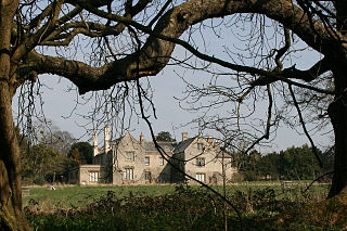
Cothelstone is a village and civil parish in Somerset, England, situated in the Quantock Hills six miles north of Taunton. The parish, which includes the hamlet of Toulton, has a population of 111.

Kingston St Mary is a village and parish in Somerset, England, situated at the southern end of the Quantock Hills 4 miles (6.4 km) north of Taunton. The village has a population of 921.

Lydeard St Lawrence or St Lawrence Lydiard is a village and civil parish in Somerset, England, situated 7 miles (11.3 km) north west of Taunton. The village has a population of 506. The parish includes the hamlets of Westowe, Hoccombe and Pyleigh, with its 16th century manor house.
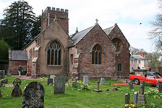
Nynehead is a village and civil parish in Somerset, England, situated on the River Tone, 7 miles (11 km) south-west of Taunton and 1.5 miles (2 km) north-west of Wellington. The village has a population of 415.

Ruishton is a village and civil parish in Somerset, England, situated on the River Tone and A358 road 2 miles (3.2 km) east of Taunton. The village has a population of 1,473. The parish includes the hamlet of Henlade.

Stoke St Gregory is a village and civil parish in Somerset, England, about 7 miles (11 km) east of Taunton. The village is on a low ridge of land between the River Tone to the north and West Sedgemoor to the south. The 2011 Census recorded the parish's population as 942.
Thornfalcon is a village and civil parish in Somerset, England, situated 4 miles (6.4 km) east of Taunton. The village has a population of 119. The parish includes the hamlet of Ash. The name comes from Thorn, and the personal name Fagun which was the Norman surname of Sir Gilbert of Thorn, whose family were lords of the manor until the 14th century.

West Bagborough is a village and civil parish in Somerset, England, about 5 miles (8.0 km) north of Taunton. In 2011, the village had a population of 358.

West Monkton is a village and civil parish in Somerset, England, situated 2 miles (3.2 km) north east of Taunton. The parish includes the hamlets of Monkton Heathfield, Bathpool, and Burlinch and the western parts of Coombe and Walford, and had a population of 2,787 at the 2011 census.
Wiveliscombe is a town and civil parish in Somerset, England, situated 9 miles (14 km) west of Taunton. The town has a population of 2,893. The Square, fronted by several listed structures, held the former market. The parish includes the nearby hamlet of Maundown.

Curry Rivel is a village and civil parish in Somerset, England, situated 6 miles (9.7 km) west of Somerton and 10 miles (16.1 km) east of Taunton in the South Somerset district. The parish has a population of 2,148. The parish includes the hamlet of Burton Pynsent.
Drayton is a village and civil parish in Somerset, England, focussed less than a mile from Curry Rivel and five miles southwest of Somerton in the South Somerset district. It adjoins the River Isle, near its confluence with the Parrett, and the former Westport Canal. The parish includes the hamlet of Midelney.

The Grade I listed buildings in Somerset, England, demonstrate the history and diversity of its architecture. The ceremonial county of Somerset consists of a non-metropolitan county, administered by Somerset County Council, which is divided into five districts, and two unitary authorities. The districts of Somerset are West Somerset, South Somerset, Taunton Deane, Mendip and Sedgemoor. The two administratively independent unitary authorities, which were established on 1 April 1996 following the breakup of the county of Avon, are North Somerset and Bath and North East Somerset. These unitary authorities include areas that were once part of Somerset before the creation of Avon in 1974.
Taunton Deane is a local government district with borough status in the English county of Somerset. In the United Kingdom, the term listed building refers to a building or other structure officially designated as being of special architectural, historical or cultural significance; Grade I structures are those considered to be "buildings of exceptional interest". Listing was begun by a provision in the Town and Country Planning Act 1947. Once listed, severe restrictions are imposed on the modifications allowed to a building's structure or its fittings. In England, the authority for listing under the Planning Act 1990 rests with Historic England, a non-departmental public body sponsored by the Department for Digital, Culture, Media and Sport; local authorities have a responsibility to regulate and enforce the planning regulations.
The 'Church of All Saints in Nynehead, Somerset, England dates from the 14th century and has been designated as a Grade I listed building.
Poundisford Park north of Pitminster, Somerset, England is an English country house that typifies progressive housebuilding on the part of the West Country gentry in the mid-16th century. The main house was built for William Hill around 1550 and has been designated as a Grade I listed building.

Taunton Deane is a local government district with borough status in the English county of Somerset. In the United Kingdom, the term listed building refers to a building or other structure officially designated as being of special architectural, historical or cultural significance; Grade II* structures are those considered to be "particularly significant buildings of more than local interest". Listing was begun by a provision in the Town and Country Planning Act 1947. Once listed, severe restrictions are imposed on the modifications allowed to a building's structure or its fittings. In England, the authority for listing under the Planning Act 1990 rests with Historic England, a non-departmental public body sponsored by the Department for Digital, Culture, Media and Sport; local authorities have a responsibility to regulate and enforce the planning regulations.
Taunton Deane was a local government district with borough status in Somerset, England. It merged with West Somerset to form Somerset West and Taunton on 1 April 2019. Its council was based in Taunton. The district was formed on 1 April 1974, under the Local Government Act 1972, by a merger of the Municipal Borough of Taunton, Wellington Urban District, Taunton Rural District, and Wellington Rural District. Taunton Deane was granted borough status in 1975, enabling the mayoralty of Taunton to be continued, when other districts did not have mayors. The district was given the name of an alternate form of the Taunton Deane Hundred.

