
Montgomery County is a county in the U.S. state of Tennessee. As of the 2020 United States census, the population was 220,069. The county seat is Clarksville. The county was created in 1796. Montgomery County is included in the Clarksville, TN–KY Metropolitan Statistical Area.

Trigg County is a county located on the far southwest border of the U.S. state of Kentucky. As of the 2020 census, the population was 14,061. Its county seat is Cadiz. Formed in 1820, the county was named for Stephen Trigg, an officer in the American Revolutionary War who was killed at the Battle of Blue Licks, now in Robertson County, Kentucky. It was a victory for British and allied troops.

Christian County is a county located in the U.S. state of Kentucky. As of the 2020 census, the population was 72,748. Its county seat is Hopkinsville. The county was formed in 1797. Christian County is part of the Clarksville, Tennessee–Kentucky Metropolitan Statistical Area.
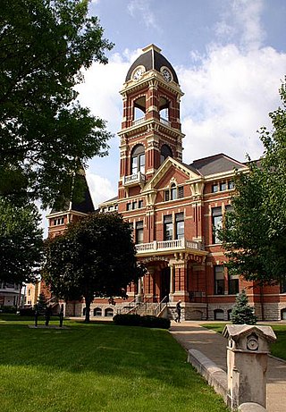
Campbell County is a county located in the northern part of the U.S. state of Kentucky. As of the 2020 census, the population was 93,076. Its county seats are Alexandria and Newport. The county was formed on December 17, 1794, from sections of Scott, Harrison, and Mason Counties and was named for Colonel John Campbell (1735–1799), a Revolutionary War soldier and Kentucky legislator. Campbell County, with Boone and Kenton Counties, is part of the Northern Kentucky metro community, and the Cincinnati-Middletown, OH-KY-IN Metropolitan Statistical Area.

Clarksville is a city in Johnson County, Arkansas, United States. As of the 2010 census the population was 9,178, up from 7,719 in 2000. As of 2018, the estimated population was 9,743. The city is the county seat of Johnson County. It is nestled between the Arkansas River and the foothills of the Ozark Mountains, and Interstate 40 and US Highway 64 intersect within the city limits. Clarksville-Johnson County is widely known for its peaches, scenic byways and abundance of natural outdoor recreational activities.

Council Grove is a city and county seat in Morris County, Kansas, United States. As of the 2020 census, the population of the city was 2,140. It was named after an agreement between American settlers and the Osage Nation allowing settlers' wagon trains to pass westward through the area on the Santa Fe Trail. Pioneers gathered at a grove of trees so that wagons could band together for their trip west.
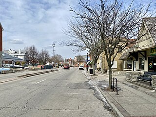
Fort Thomas is a home rule-class city in Campbell County, Kentucky, United States, on the southern bank of the Ohio River and the site of an 1890 US Army post. The population was 17,483 at the 2020 census, making it the largest city in Campbell County. It is part of the Cincinnati – Northern Kentucky metropolitan area.
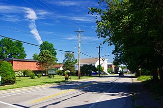
Silver Grove is a home rule-class city along the Ohio River in Campbell County, Kentucky, in the United States. The population was 1,154 at the 2020 census.

Crofton is a home rule-class city in Christian County, Kentucky, in the United States. The population was 653 as of the 2020 census, down from 749 at the 2010 census.
Fort Campbell North is a census-designated place (CDP) in Christian County, Kentucky, United States. It contains most of the housing for the Fort Campbell Army base within the Kentucky portion of the base. The population was 12,825 as of the 2020 census, down from 13,685 in the 2010 census.
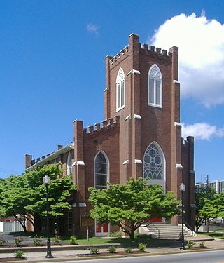
Hopkinsville is a home rule-class city in and the county seat of Christian County, Kentucky, United States. The population at the 2020 census was 31,180.

LaFayette, also informally written as La Fayette and Lafayette, is a home rule-class city in Christian County, Kentucky, in the United States. The population was 177 as of the 2020 census, up from 165 in the 2010 U.S. census. LaFayette is part of the Clarksville, Tennessee metropolitan area.

Pembroke is a home rule-class city in Christian County, Kentucky, in the United States. The population was 865 as of the 2020 census, stagnant from 869 as of the 2010 U.S. Census. It is part of the Clarksville, Tennessee metropolitan area.

Vine Grove is a home rule-class city in Hardin County, Kentucky, United States. The population was 6,559 as of the 2020 Census, up from 4,520 at the 2010 census. It is part of the Elizabethtown–Fort Knox Metropolitan Statistical Area.
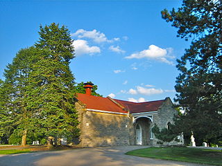
Fort Mitchell is a home rule-class city in Kenton County, Kentucky, United States. The population was 8,702 at the 2020 census. It is part of the Cincinnati metropolitan area.

Calhoun is a home rule-class city in McLean County, Kentucky, United States. The population was 725 at the 2020 census. It is the county seat of McLean County. It is included in the Owensboro, Kentucky Metropolitan Statistical Area.

Elkton is a home rule-class city in and the county seat of Todd County, Kentucky, United States. The population was 2,062 at the 2010 census.

Dover is a city in and the county seat of Stewart County, Tennessee, 67 miles (108 km) west-northwest of Nashville on the Cumberland River. Fort Donelson National Cemetery is in Dover. The population was 1,442 at the 2000 census and the 2010 census showed a population of 1,417.
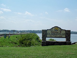
Clarksville is a town in Mecklenburg county in the U.S. state of Virginia, near the southern border of the commonwealth. The population was 1,139 at the 2010 census. Since the town has numerous buildings of the 18th-, 19th-, and early 20th-century architecture, the downtown area of Clarksville has been designated a Historic District on the National Register of Historic Places and Virginia's Historic Register. Clarksville claims the title of Virginia's only lakeside town. Nearby the town of Clarksville is Occoneechee State Park.

The Clarksville Metropolitan Statistical Area is defined by the United States Census Bureau as an area consisting of four counties – two in Tennessee and two in Kentucky – anchored by the city of Clarksville, Tennessee. The 2021 estimate placed the population at 329,864. As of 2020, the Clarksville Metropolitan Statistical Area is the 159th largest MSA in the United States.


