Greene County is located in the U.S. state of Missouri. As of the 2020 census, its population was 298,915. making it the fourth most-populous county in Missouri. Its county seat and most-populous city is Springfield. The county was organized in 1833 and is named after American Revolutionary War General Nathanael Greene.

Turners or Turner is a small unincorporated community in Greene County, Missouri, United States. It lies on the southeast side of the James River floodplain approximately 3.5 miles east of U.S. Route 65 in east Springfield. The community lies at the intersection of Routes D and J near the confluence of Turner Creek with the James River. The old St. Louis–San Francisco Railway passed through the community.

Logan is a school and small unincorporated community in southeastern Greene County, Missouri, United States. directly adjacent to Rogersville. It is located approximately 5 mi (8.0 km) west-northwest of Rogersville, one mile north of U.S. Route 60 and one mile west of Route 125. The community is centered on the school and includes several homes and the Logan Cemetery.
Ebenezer is an unincorporated community in Greene County, Missouri, United States. It lies two miles north of McDaniel Lake north of Springfield and 1.25 miles east of Route 13. The community is at the head of the King Branch of the North Dry Sac River.

Mill Grove is an unincorporated community in Mercer County, Missouri, United States. It is located approximately one mile west of U.S. Route 65 on Missouri Supplemental Route D or six miles south of Princeton. The Weldon River flows past the west side of the community.

Wilsons Creek is a 13.9-mile-long (22.4 km) waterway near Springfield, Missouri, United States. It is formed by the confluence of Jordan Creek and Fassnight Creek in southwest Springfield, just south of Bennett Street between Scenic Avenue and Kansas Expressway. It was the site of the Civil War Battle of Wilson's Creek and flows south through Wilson's Creek National Battlefield. It is a tributary of the James River which it joins in western Christian County. At Battlefield, the creek has an annual average discharge of 95 cubic feet per second.
Elixer is an unincorporated community in Dallas County, in the U.S. state of Missouri.
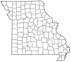
Olive is an unincorporated community in southeastern Dallas County, in the U.S. state of Missouri.
Spring Grove is an unincorporated community in Dallas County, in the U.S. state of Missouri. The community is situated on Missouri Route H and the Niangua River flows past, about 1.5 miles to the east. Buffalo is approximately six miles to the north-northwest.
Clear Creek is a stream in Greene County, Missouri, United States. It is a tributary of the Sac River.
Cody was an unincorporated community in southeastern Greene County, in the U.S. state of Missouri. It is currently within the city limits of Rogersville.
Harold is an unincorporated community in northwest Greene County, in the U.S. state of Missouri. Harold is located on Missouri Route 123, southeast of Walnut Grove and 1.5 miles east of Phenix.
Hickory Barren is an unincorporated community in northern Greene County, in the U.S. state of Missouri. The community is on Missouri Route H, two miles north of Fellows Lake. Fair Grove is approximately four miles to the northeast.
Mumford is an unincorporated community in Greene County in the U.S. state of Missouri. It is at the junction of Jones Branch and Pierson Creek, about 1.3 miles east of the current U.S. 65 bypass of east Springfield. The old St. Louis–San Francisco Railway passes just southwest of it. The old Mt. Pisgah School was located just to the north.
Palmetto is an unincorporated community in southeastern Greene County, in the U.S. state of Missouri. The community lies at an elevation of 1437 feet and is located near the headwaters of Turner Creek on the BNSF Railway, approximately two miles northwest of Rogersville. Henderson in western Webster County lies approximately 1.5 miles to the east along Missouri Route D.
Walnut Grove Township is an inactive township in Greene County, in the U.S. state of Missouri.
Compton is a historic community in western Webster County, in the U.S. state of Missouri. The post office was located at different locations in the area. One site was located along the bank of the James River along Missouri Route B, but a second location is approximately three-quarters of a mile to the southeast above Compton Branch. This second location is within or adjacent to the Compton Hollow Conservation Area and about three miles south of Northview. The Compton Limestone geologic formation was named for the community, because the type sections defining the unit were located in the vicinity.
Panther Valley is an unincorporated community in southwest Webster County, in the Ozarks of southwest Missouri. The community is located on Missouri Route KK and on the south side of Panther Creek. It is approximately four miles northwest of Fordland.
Sayers Creek or Sawyer Creek is a stream in Webster and Greene counties of southern Missouri. The headwaters of the stream are in Webster County just to the east of Rogersville and north of U. S. Route 60. The confluence with the James River in Greene County is north of Oak Grove Heights and just east of Missouri Route 125.
Knox is an unincorporated community in southwest Polk County, in the Ozarks of southwest Missouri, United States. A variant name for the community was Nox.