Oak Hill, Kansas

Last updated

Oak Hill, Kansas
Clay County Kansas Incorporated and Unincorporated areas Oak Hill Highlighted.svg
Location within Clay County and Kansas
Map of Clay Co, Ks, USA.png
Coordinates: 39°14′48″N97°20′35″W / 39.24667°N 97.34306°W / 39.24667; -97.34306 [1]
Country United States
State Kansas
County Clay
Platted 1872
Incorporated 1925
Area
[2]
  Total0.05 sq mi (0.13 km2)
  Land0.05 sq mi (0.13 km2)
  Water0.00 sq mi (0.00 km2)
Elevation
[1]
1,289 ft (393 m)
Population
 (2020) [3]
  Total24
  Density480/sq mi (180/km2)
Time zone UTC-6 (CST)
  Summer (DST) UTC-5 (CDT)
ZIP code
67432
Area code 785
FIPS code 20-51700
GNIS ID 2395284 [1]

Oak Hill is a city in Clay County, Kansas, United States. [1] As of the 2020 census, the population of the city was 24. [3]

Contents

History

Oak Hill was laid out in 1872. [4]

A post office was opened in 1871 in Oak Hill (also historically spelled Oakhill), and remained in operation until it was discontinued in 1995. [5]

In 1887, Atchison, Topeka and Santa Fe Railway built a branch line from Neva (3 miles west of Strong City) through Oak Hill to Superior, Nebraska. In 1996, the Atchison, Topeka and Santa Fe Railway merged with Burlington Northern Railroad and renamed to the current BNSF Railway. Most locals still refer to this railroad as the "Santa Fe".

Geography

According to the United States Census Bureau, the city has a total area of 0.05 square miles (0.13 km2), all of it land. [6]

Demographics

Historical population
CensusPop.Note
1930 147
1940 1470.0%
1950 92−37.4%
1960 69−25.0%
1970 41−40.6%
1980 35−14.6%
1990 13−62.9%
2000 35169.2%
2010 24−31.4%
2020 240.0%
U.S. Decennial Census

2010 census

As of the census [7] of 2010, there were 24 people, 11 households, and 7 families living in the city. The population density was 480.0 inhabitants per square mile (185.3/km2). There were 19 housing units at an average density of 380.0 per square mile (146.7/km2). The racial makeup of the city was 95.8% White and 4.2% from two or more races.

There were 11 households, of which 18.2% had children under the age of 18 living with them, 54.5% were married couples living together, 9.1% had a female householder with no husband present, and 36.4% were non-families. 27.3% of all households were made up of individuals, and 18.2% had someone living alone who was 65 years of age or older. The average household size was 2.18 and the average family size was 2.71.

The median age in the city was 46 years. 12.5% of residents were under the age of 18; 0.0% were between the ages of 18 and 24; 33.4% were from 25 to 44; 37.5% were from 45 to 64; and 16.7% were 65 years of age or older. The gender makeup of the city was 50.0% male and 50.0% female.

2000 census

As of the census [8] of 2000, there were 35 people, 13 households, and 6 families living in the city. The population density was 729.0 inhabitants per square mile (281.5/km2). There were 20 housing units at an average density of 416.6 per square mile (160.9/km2). Every resident is White.

There were 13 households, out of which 23.1% had children under the age of 18 living with them, 38.5% were married couples living together, 7.7% had a female householder with no husband present, and 53.8% were non-families. 46.2% of all households were made up of individuals, and 30.8% had someone living alone who was 65 years of age or older. The average household size was 2.69 and the average family size was 4.00.

In the city, the population was spread out, with 37.1% under the age of 18, 5.7% from 18 to 24, 28.6% from 25 to 44, 11.4% from 45 to 64, and 17.1% who were 65 years of age or older. The median age was 30 years. For every 100 females, there were 105.9 males. For every 100 females age 18 and over, there were 144.4 males.

The median income for a household in the city was $29,583, and the median income for a family was $46,250. Males had a median income of $20,625 versus $38,750 for females. The per capita income for the city was $11,326. There were no families and 2.9% of the population living below the poverty line, including no under eighteens and none of those over 64.

Education

The community is served by Clay County USD 379 public school district.

Related Research Articles

<span class="mw-page-title-main">Jewell County, Kansas</span> County in Kansas, United States

Jewell County is a county located in the U.S. state of Kansas. Its county seat and most populous city is Mankato. As of the 2020 census, the county population was 2,932. The county was named for Lewis Jewell, a Lieutenant Colonel of the 6th Regiment Kansas Volunteer Cavalry.

<span class="mw-page-title-main">Isabel, Kansas</span> City in Kiowa County, Kansas

Isabel is a city in Barber County, Kansas, United States. As of the 2020 census, the population of the city was 68.

<span class="mw-page-title-main">Pawnee Rock, Kansas</span> City in Barton County, Kansas, United States

Pawnee Rock is a city in Barton County, Kansas, United States. As of the 2020 census, the population of the city was 193.

<span class="mw-page-title-main">Aurora, Kansas</span> City in Cloud County, Kansas

Aurora is a city in Cloud County, Kansas, United States. As of the 2020 census, the population of the city was 56.

<span class="mw-page-title-main">Miltonvale, Kansas</span> City in Cloud County, Kansas

Miltonvale is a city in Cloud County, Kansas, United States. As of the 2020 census, the population of the city was 440.

<span class="mw-page-title-main">Manchester, Kansas</span> City in Dickinson County, Kansas

Manchester is a city in Dickinson County, Kansas, United States. As of the 2020 census, the population of the city was 47.
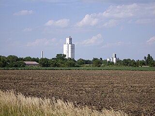
<span class="mw-page-title-main">Montezuma, Kansas</span> City in Gray County, Kansas

Montezuma is a city in Gray County, Kansas, United States. As of the 2020 census, the population of the city was 975.

<span class="mw-page-title-main">Burr Oak, Kansas</span> City in Jewell County, Kansas

Burr Oak is a city in Jewell County, Kansas, United States. As of the 2020 census, the population of the city was 140.

<span class="mw-page-title-main">Esbon, Kansas</span> City in Jewell County, Kansas

Esbon is a city in Jewell County, Kansas, United States. As of the 2020 census, the population of the city was 69.

<span class="mw-page-title-main">Webber, Kansas</span> City in Jewell County, Kansas

Webber is a city in Jewell County, Kansas, United States. As of the 2020 census, the population of the city was 30.

<span class="mw-page-title-main">Edgerton, Kansas</span> City in Kansas, United States

Edgerton is a city in Johnson County, Kansas, United States, and part of the Kansas City metropolitan area. As of the 2020 census, the population of the city was 1,748. It is home to a large BNSF intermodal train facility named Logistics Park Kansas City.

<span class="mw-page-title-main">Westwood Hills, Kansas</span> City in Kansas, United States

Westwood Hills is a city in Johnson County, Kansas, United States. As of the 2020 census, the population of the city was 400. It is the most densely populated city in the Kansas City Metropolitan Area at 6,240 people per square mile. It borders Kansas City, Missouri.

<span class="mw-page-title-main">Lakin, Kansas</span> City in Kearny County, Kansas

Lakin is a city in and the county seat of Kearny County, Kansas, United States. As of the 2020 census, the population of the city was 2,205.

<span class="mw-page-title-main">Council Grove, Kansas</span> City in Morris County, Kansas

Council Grove is a city and county seat in Morris County, Kansas, United States. As of the 2020 census, the population of the city was 2,140. It was named after an agreement between American settlers and the Osage Nation allowing settlers' wagon trains to pass westward through the area on the Santa Fe Trail. Pioneers gathered at a grove of trees so that wagons could band together for their trip west.

<span class="mw-page-title-main">Carbondale, Kansas</span> City in Osage County, Kansas

Carbondale is a city in Osage County, Kansas, United States. As of the 2020 census, the population of the city was 1,352. It is located south of Topeka along U.S. Route 75 four lane freeway.

<span class="mw-page-title-main">Raymond, Kansas</span> City in Rice County, Kansas

Raymond is a city in Rice County, Kansas, United States. It is named after Emmons Raymond, former Director of the Atchison, Topeka and Santa Fe Railway. As of the 2020 census, the population of the city was 85.

<span class="mw-page-title-main">Viola, Kansas</span> City in Sedgwick County, Kansas

Viola is a city in Sedgwick County, Kansas, United States. As of the 2020 census, the population of the city was 115.

<span class="mw-page-title-main">Oaks, Missouri</span> Village in Missouri, United States

Oaks is a village in Clay County, Missouri, United States. The population was 128 at the 2020 census. It is part of the Kansas City metropolitan area.

<span class="mw-page-title-main">Parkville, Missouri</span> City in Missouri, United States

Parkville is a city in Platte County, Missouri, United States and is a part of the Kansas City Metropolitan Area. The population was 7,177 at the 2020 census. Parkville is known for its antique shops, art galleries, and historic downtown. The city is home to Park University, English Landing Park, Platte Landing Park, and the National Golf Club of Kansas City. Large neighborhoods in Parkville include: Riss Lake, The National, Thousand Oaks, Creekside, Parkville Heights, River Hills, Riverchase, The Bluffs, Downtown, and Pinecrest.

<span class="mw-page-title-main">Mulvane, Kansas</span> City in Sedgwick and Sumner County, Kansas

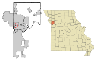
Mulvane is a city in Sedgwick and Sumner counties in the U.S. state of Kansas. As of the 2020 census, the population of the city was 6,286.

References

  1. 1 2 3 4 U.S. Geological Survey Geographic Names Information System: Oak Hill, Kansas
  2. "2019 U.S. Gazetteer Files". United States Census Bureau. Retrieved July 24, 2020.
  3. 1 2 "Profile of Oak Hill, Kansas in 2020". United States Census Bureau. Archived from the original on April 17, 2022. Retrieved April 17, 2022.
  4. Kansas State Historical Society (1916). Biennial Report of the Board of Directors of the Kansas State Historical Society. Kansas State Printing Plant. pp.  161.
  5. "Kansas Post Offices, 1828-1961 (archived)". Kansas Historical Society. Archived from the original on October 9, 2013. Retrieved June 7, 2014.
  6. "US Gazetteer files 2010". United States Census Bureau. Archived from the original on January 12, 2012. Retrieved July 6, 2012.
  7. "U.S. Census website". United States Census Bureau . Retrieved July 6, 2012.
  8. "U.S. Census website". United States Census Bureau . Retrieved January 31, 2008.

Further reading