Oak Hill, Tennessee

Last updated

Oak Hill
Davidson County Tennessee Incorporated and Unincorporated areas Oak Hill Highlighted 4754780.svg
Location of Oak Hill in Davidson County, Tennessee.
Coordinates: 36°05′16″N86°46′59″W / 36.0878369°N 86.7830548°W / 36.0878369; -86.7830548
Country United States
State Tennessee
County Davidson
Incorporated1952
Government
  Type Mayor-commission government
   Mayor Dale Grimes [1]
Area
[2]
  Total7.96 sq mi (20.61 km2)
  Land7.84 sq mi (20.32 km2)
  Water0.11 sq mi (0.29 km2)
Elevation
[3]
581 ft (177 m)
Population
 (2020) [4]
  Total4,891
  Density623.45/sq mi (240.73/km2)
Time zone UTC-6 (Central (CST))
  Summer (DST) UTC-5 (CDT)
FIPS code 47-54780 [5]
GNIS feature ID1296134 [3]
Website www.oakhilltn.us

Oak Hill is a city in Davidson County, Tennessee. The population was 4,529 at the 2010 census. [6] The Tennessee Governor's Mansion is located in the city. Although the city is administered under the Metropolitan Government of Nashville and Davidson County, it retains its own municipal government.

Contents

History

During the 1790s, Judge John Overton established a horse-breeding farm at Oak Hill known as Travellers Rest. After World War II Oak Hill, like other Nashville neighborhoods, saw an increase of new residents and homes being built. Oak Hill incorporated as a city in 1952, just before the governments of Davidson County and Nashville merged. [7]

Geography

According to the United States Census Bureau, the city has a total area of 8.0 square miles (20.6 km2), of which 7.8 square miles (20.3 km2) is land and 0.12 square miles (0.3 km2), or 1.50%, is water. [8]

Demographics

Historical population
CensusPop.Note
1960 4,490
1970 4,6453.5%
1980 4,609−0.8%
1990 4,301−6.7%
2000 4,4934.5%
2010 4,5290.8%
2020 4,8918.0%
Sources: [9] [10] [4]

As of the census [5] of 2000, there were 4,493 people, 1,816 households, and 1,367 families residing in the city. The population density was 570.4 inhabitants per square mile (220.2/km2). There were 1,894 housing units at an average density of 240.5 per square mile (92.9/km2). The racial makeup of the city was 96.26% White, 0.98% African American, 0.11% Native American, 1.65% Asian, 0.02% Pacific Islander, 0.27% from other races, and 0.71% from two or more races. Hispanic or Latino of any race were 0.76% of the population.

There were 1,816 households, out of which 30.8% had children under the age of 18 living with them, 68.3% were married couples living together, 5.6% had a female householder with no husband present, and 24.7% were non-families. 20.6% of all households were made up of individuals, and 10.6% had someone living alone who was 65 years of age or older. The average household size was 2.47 and the average family size was 2.88.

In the city, the population was spread out, with 22.7% under the age of 18, 4.0% from 18 to 24, 23.2% from 25 to 44, 32.0% from 45 to 64, and 18.2% who were 65 years of age or older. The median age was 45 years. For every 100 females, there were 95.3 males. For every 100 females age 18 and over, there were 92.0 males.

The median income for a household in the city was $90,174, and the median income for a family was $104,952. Males had a median income of $70,963 versus $42,500 for females. The per capita income for the city was $58,932, the fourth highest in the state. None of the families and 1.2% of the population were living below the poverty line, including no under eighteens and 1.8% of those over 64.

Recreation

The majority of Radnor Lake State Park is located in Oak Hill. [11] [12]

Landmarks

The Tennessee Governor's Mansion is in Oak Hill. [11] [13]

Education

It is within Metro Nashville Public Schools.

There are two public schools and three private schools in the city limits. [11] Public schools include Glendale Elementary School, [14] and John Overton High School. [15]

Private schools include Father Ryan High School of the Roman Catholic Diocese of Nashville, [16] Franklin Road Academy, [17] Oak Hill School, [18] and Benton Hall Academy. [19]

Related Research Articles

<span class="mw-page-title-main">Wilson County, Tennessee</span> County in Tennessee, United States

Wilson County is a county in the U.S. state of Tennessee. It is in Middle Tennessee. As of the 2020 census, the population was 147,737. Its county seat is Lebanon. The largest city is Mt. Juliet. Wilson County is part of the Nashville-Davidson–Murfreesboro–Franklin, TN Metropolitan Statistical Area.

<span class="mw-page-title-main">Williamson County, Tennessee</span> County in Tennessee, United States

Williamson County is a county in the U.S. state of Tennessee. As of the 2020 United States census, the population was 247,726. The county seat is Franklin, and the county is located in Middle Tennessee. The county is named after Hugh Williamson, a North Carolina politician who signed the U.S. Constitution. Williamson County is part of the Nashville-Davidson–Murfreesboro–Franklin, TN Metropolitan Statistical Area. In the 19th century, tobacco and hemp were cultivated here, and planters also raised blooded livestock, including horses and cattle.
<span class="mw-page-title-main">Sumner County, Tennessee</span> County in Tennessee, United States

Sumner County is a county located on the central northern border of Tennessee in the United States. As of the 2020 United States Census, the population was 196,281. Its county seat is Gallatin, and its most populous city is Hendersonville. The county is named after an American Revolutionary War hero, General Jethro Sumner.
<span class="mw-page-title-main">Smith County, Tennessee</span> County in Tennessee, United States

Smith County is a county in the U.S. state of Tennessee. As of the 2020 census, the population was 19,904. Smith County is located in the region of the state known as Middle Tennessee. Its county seat is Carthage. The county was organized in 1799 and is named for Daniel Smith, a Revolutionary War veteran who made the first map of Tennessee and served as a United States senator.

<span class="mw-page-title-main">Robertson County, Tennessee</span> County in Tennessee, United States

Robertson County is a county located on the central northern border of Tennessee in the United States. As of the 2020 United States Census, the population was 72,803 people. Its county seat is Springfield. The county was named for James Robertson, an explorer, founder of Nashville, and a state senator, who was often called the "Father of Middle Tennessee." Robertson County is a component of the Nashville-Davidson–Murfreesboro–Franklin, TN Metropolitan Statistical Area.

<span class="mw-page-title-main">Macon County, Tennessee</span> County in Tennessee, United States

Macon County is a county located in the U.S. state of Tennessee As of the 2020 census, the population was 25,216. Its county seat is Lafayette. Macon County is part of the Nashville-Davidson–Murfreesboro–Franklin, TN Metropolitan Statistical Area.
<span class="mw-page-title-main">Hardin County, Tennessee</span> County in Tennessee, United States

Hardin County is a county located in the U.S. state of Tennessee. As of the 2020 census, the population was 26,831. The county seat is Savannah. Hardin County is located north of and along the borders of Mississippi and Alabama. The county was founded in November 1819 and named posthumously for Col. Joseph Hardin, a Revolutionary War soldier and a legislative representative for the Province of North Carolina; the State of Franklin; and the Southwest Territory. Hardin County was the site of the Battle of Shiloh during the Civil War.

<span class="mw-page-title-main">Davidson County, Tennessee</span> County in Tennessee, United States

Davidson County is a county in the U.S. state of Tennessee. It is located in the heart of Middle Tennessee. As of the 2020 census, the population was 715,884, making it the 2nd most populous county in Tennessee. Its county seat is Nashville, the state capital and most populous city.

<span class="mw-page-title-main">Cheatham County, Tennessee</span> County in Tennessee, United States

Cheatham County is a county located in the U.S. state of Tennessee. As of the 2020 census, the population was 41,072. Its county seat is Ashland City. Cheatham County is located in Middle Tennessee, and is part of the Nashville-Davidson–Murfreesboro–Franklin, TN Metropolitan Statistical Area.

<span class="mw-page-title-main">Ashland City, Tennessee</span> Town in Tennessee, United States

Ashland City is a town and the county seat of Cheatham County, Tennessee. Located in Middle Tennessee, it is part of the Nashville-Davidson–Murfreesboro–Franklin, TN Metropolitan Statistical Area. As of the 2020 census, the town's population was 5,193.

<span class="mw-page-title-main">Pleasant View, Tennessee</span> City in Tennessee, United States

Pleasant View is a city on the northern border of Cheatham County. Located in Middle Tennessee, it is part of the Nashville-Davidson–Murfreesboro–Franklin, TN Metropolitan Statistical Area. As of the 2020 census, the city's population was 4,807.

<span class="mw-page-title-main">Berry Hill, Tennessee</span> City in Tennessee, United States

Berry Hill is a city in Davidson County, Tennessee. As of the 2020 census, the population was 2,112. As of 2023, the current mayor is Dennis Sheffield.

<span class="mw-page-title-main">Burns, Tennessee</span> Town in Tennessee, United States

Burns is a town in Dickson County, Tennessee, in the United States. It is part of the Nashville-Davidson–Murfreesboro–Franklin, TN Metropolitan Statistical Area. The population was 1,468 at the 2010 census.

<span class="mw-page-title-main">Decherd, Tennessee</span> City in Tennessee, United States

Decherd is a city in Franklin County, Tennessee, United States. The population was 2,379 at the 2020 census and 2,361 at the 2010 census.
<span class="mw-page-title-main">Chapel Hill, Tennessee</span> Town in Tennessee, United States

Chapel Hill is a town in northeastern Marshall County, Tennessee, United States. The town was named after Chapel Hill, North Carolina, by settlers from that area. The population was 1,717 as of the 2020 census.

<span class="mw-page-title-main">Hendersonville, Tennessee</span> City in Tennessee, United States

Hendersonville is the most populous city in Sumner County, Tennessee, on Old Hickory Lake. As of the 2020 census the city's population was 61,753.

<span class="mw-page-title-main">Portland, Tennessee</span> City in Tennessee, United States

Portland is a city in Sumner and Robertson counties in Tennessee. The population was 11,486 in 2010 according estimates by the U.S. census bureau and in 2020 the population was 13,156. Portland is a part of the Nashville Metropolitan Statistical Area.

Green Hill is a census-designated place (CDP) in western Wilson County, Tennessee. The population was 6,618 at the 2010 census.

<span class="mw-page-title-main">Tennessee Ridge, Tennessee</span> Town in Tennessee, United States

Tennessee Ridge is a town in Houston and Stewart counties in the U.S. state of Tennessee. The population was 1,332 at the 2020 census and 1,368 at the 2010 census.
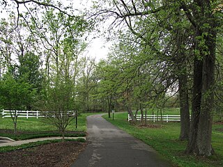
<span class="mw-page-title-main">White House, Tennessee</span> City in Tennessee, United States

White House is a city in Robertson and Sumner counties in the United States state of Tennessee. The population was listed as 12,982 in the 2020 census. It is approximately twenty-two miles north of downtown Nashville.

References

  1. "Board of Commissioners - Oak Hill, TN". oakhilltn.us. Retrieved September 20, 2020.
  2. "ArcGIS REST Services Directory". United States Census Bureau. Retrieved October 15, 2022.
  3. 1 2 U.S. Geological Survey Geographic Names Information System: Oak Hill, Tennessee
  4. 1 2 "Census Population API". United States Census Bureau. Retrieved October 15, 2022.
  5. 1 2 "U.S. Census website". United States Census Bureau . Retrieved January 31, 2008.
  6. "Profile of General Population and Housing Characteristics: 2010 Demographic Profile Data (DP-1): Oak Hill city, Tennessee". United States Census Bureau . Retrieved March 14, 2012.
  7. About Oak Hill, City of Oak Hill official website. Accessed September 1, 2015.
  8. "Geographic Identifiers: 2010 Demographic Profile Data (G001): Oak Hill city, Tennessee". United States Census Bureau . Retrieved March 14, 2012.
  9. "Census of Population and Housing: Decennial Censuses". United States Census Bureau . Retrieved March 4, 2012.
  10. "Incorporated Places and Minor Civil Divisions Datasets: Subcounty Resident Population Estimates: April 1, 2010 to July 1, 2012". Population Estimates. U.S. Census Bureau. Archived from the original on June 11, 2013. Retrieved December 11, 2013.
  11. 1 2 3 "Zoning Map". Oak Hill, Tennessee. Retrieved July 5, 2021.
  12. "Radnor Lake State Park" (PDF). Tennessee State Parks . Retrieved July 5, 2021. - Compare to the city map.
  13. "A look back at the Tennessee Governor's Residence". WKRN . Retrieved July 5, 2021. The official residence is located in the Oak Hill area of Nashville at 882 Curtiswood Lane S. - Compare address to map.
  14. https://glendale.mnps.org/ "800 Thompson Ave Nashville TN 37204"
  15. Compare to the address: "4820 Franklin Rd Nashville TN 37220"
  16. Compare to the Father Ryan address: "700 Norwood Drive Nashville, TN 37204"
  17. Compare to the address: " 4700 Franklin Pike Nashville, TN 37220 "
  18. https://www.oakhillschool.org/ "4815 Franklin Rd. Nashville, TN 37220"
  19. https://www.bentonhallacademy.org/ "5555 Franklin Pike Nashville, TN 37220"