
Rhode Island is a state in the New England region of the Northeastern United States. It borders Connecticut to its west; Massachusetts to its north and east; and the Atlantic Ocean to its south via Rhode Island Sound and Block Island Sound; and shares a small maritime border with New York, east of Long Island. Rhode Island is the smallest U.S. state by area and the seventh-least populous, with slightly fewer than 1.1 million residents as of 2020; but it has grown at every decennial count since 1790 and is the second-most densely populated state, after New Jersey. The state takes its name from the eponymous island, though nearly all its land area is on the mainland. Providence is its capital and most populous city.

Newport is a seaside city on Aquidneck Island in Rhode Island, United States. It is located in Narragansett Bay, approximately 33 miles (53 km) southeast of Providence, 20 miles (32 km) south of Fall River, Massachusetts, 74 miles (119 km) south of Boston, and 180 miles (290 km) northeast of New York City. It is known as a New England summer resort and is famous for its historic mansions and its rich sailing history. The city has a population of about 25,000 residents.

East Greenwich is a town and the county seat of Kent County, Rhode Island. The population was 14,312 at the 2020 census. East Greenwich is the wealthiest municipality within the state of Rhode Island. It is part of the Providence metropolitan statistical area and the Greater Boston combined statistical area.

Warwick is a city in Kent County, Rhode Island, United States, and is the third largest city in the state with a population of 82,823 at the 2020 census. Warwick is located approximately 12 miles (19 km) south of downtown Providence, Rhode Island, 63 miles (101 km) southwest of Boston, Massachusetts, and 171 miles (275 km) northeast of New York City.
Potowomut is an isolated neighborhood and a peninsula in Warwick, Rhode Island. It is bordered by the Town of East Greenwich to the northwest, and by North Kingstown to the southeast. Greenwich Bay surrounds all other sides.
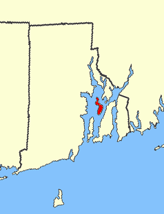
Prudence Island is the third-largest island in Narragansett Bay in the state of Rhode Island and part of the town of Portsmouth, Rhode Island, United States. It is located near the geographic center of the bay. It is defined by the United States Census Bureau as Block Group 3, Census Tract 401.03 of Newport County, Rhode Island. As of the 2010 census, the population was 278 people living on a land area of 14.43 km2.
Narragansett Bay divides the state of Rhode Island into two parts. The term East Bay refers to communities on the east side of the bay, including Bristol, Warren, Barrington, Tiverton, Little Compton, Newport, Middletown, Portsmouth and Jamestown. The city of East Providence is commonly included, especially the community of Riverside. The term West Bay refers to communities on the west side of the bay, such as Warwick, Cranston and East Greenwich. Jamestown and the towns on Aquidneck Island are sometimes known as "The Islands" along with Block Island.

Riverside is a neighborhood in the city of East Providence in the U.S. state of Rhode Island. Despite not being an incorporated city, Riverside has its own zip code, 02915, and is an acceptable mailing address according to the United States Postal Service. Riverside has a population of approximately 20,000 people.

The Sakonnet River is a tidal strait in the state of Rhode Island which flows approximately 14 miles (23 km) between Mount Hope Bay and Rhode Island Sound. It separates Aquidneck Island from the eastern portion of Newport County.

Apponaug is a neighborhood in central Warwick, Rhode Island, United States, situated on Apponaug Cove, a tributary to Greenwich Bay and nearby Narragansett Bay. The name Apponaug is a derivation of the Narragansett Indian word for "place of oysters". Indeed, Apponaug Cove holds one of the richest shellfish beds in the United States and was densely populated by the Narragansett people for many centuries prior to the arrival of European settlers.
Cowesett is a hillside neighborhood located in Warwick, Rhode Island.

New England Institute of Technology is a private university with its main campus in East Greenwich, Rhode Island. It was established in 1940 and Richard I. Gouse has been the president since 1971.
Norwood is a neighborhood in the city of Warwick, Rhode Island. Norwood is bounded by Route 37, the Pawtuxet River, Elmwood Avenue, and Post Road. Such borders mark the area traditionally served by the fire station previously located at the current site of the Norwood Boys & Girls Club.

Rhode Island's 2nd congressional district is a congressional district in southern and western Rhode Island. The district is currently represented by Democrat Seth Magaziner, who has represented the district since January 2023.

Chepiwanoxet is a neighborhood in Warwick, Rhode Island, with an island peninsula in Greenwich Bay, an arm of Narragansett Bay. The neighborhood straddles the Amtrak railroad lines, which lies just east of and parallel to the Post Road. Its boundaries are Neptune Street to the North, Alger Avenue to the South, Post Road to the West, and Greenwich Bay to the East. Chepiwanoxet Way, an underpass beneath the Amtrak lines, now serves as the only street access in and out of the neighborhood.

Wickenden Street in Fox Point, Providence, Rhode Island is a popular destination for students of the area's colleges and schools. The street is surrounded by schools and universities on the East Side of Providence's College Hill, including Brown University, RISD, Moses Brown School, & The Wheeler School.
Buttonwood Beach Historic District is a historic district bounded by Brush Neck Cove, Greenwich Bay, Cooper and Promenade Avenues in Warwick, Rhode Island. Buttonwood Beach is a bucolic neighborhood on the eastern limb of the Nausauket neck, located in the West Bay area of Warwick, Rhode Island. Buttonwoods is delimited by Nausauket and Apponaug to the west, Buttonwoods Cove to the north, Greenwich Bay to the south and Oakland Beach to the east. Buttonwood Beach was founded as a summer colony in 1871 by the Rev. Moses Bixby of Providence's Cranston Street Baptist Church, who was looking for a place to establish a summer colony by the shore for his congregation. He envisioned a community that would be similar to Oak Bluffs on Martha's Vineyard, where the Methodists established a summer campground in 1835. Today, this coastal neighborhood on Greenwich Bay is home to people from many different religious backgrounds.

Providence is the capital and most populous city of the U.S. state of Rhode Island. The county seat of Providence County, it is one of the oldest cities in New England, founded in 1636 by Roger Williams, a Reformed Baptist theologian and religious exile from the Massachusetts Bay Colony. He named the area in honor of "God's merciful Providence" which he believed was responsible for revealing such a haven for him and his followers. The city developed as a busy port, as it is situated at the mouth of the Providence River at the head of Narragansett Bay.

Fields Point is a historic park in the Washington Park neighborhood of Providence, Rhode Island jutting into Narragansett Bay right near the Providence River and Route 95.
Timeline of Newport, Rhode Island.

