
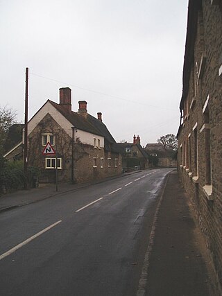
East Farndon is a small linear village and civil parish about one mile south of Market Harborough in West Northamptonshire, England. The village is close to the border with Leicestershire, and has a Leicestershire post code and telephone dialling code. At the time of the 2001 census, the parish's population was 258 people, increasing to 307 at the 2011 census.

Farnley is a district in Leeds, West Yorkshire, England, 2 miles (3.2 km) west of Leeds city centre, between Wortley, Bramley and the countryside around Pudsey and Gildersome, in the LS12 Leeds postcode area. It is part of the Leeds City Ward Farnley and Wortley with a population of 24,213 according to the 2011 Census. New Farnley is a nearby commuter village.

Barby is a village and civil parish about 5 miles (8 km) north of Daventry in Northamptonshire, England. The 2011 Census recorded the parish population as 2,336. Barby is located right off the M45 motorway a short spur from the M1 motorway to the A45 Trunk Road.
Walgrave is a village and civil parish in West Northamptonshire, England. At the time of the 2001 census, the parish's population was 822 people, increasing to 868 at the 2011 Census.

Staverton is a village and civil parish in the south-west of Northamptonshire, England. It is 2.3 miles west of Daventry, 7.9 miles east of Southam and 15.3 miles east of Leamington Spa. It straddles the A425 road from Daventry to Leamington. The Jurassic Way long-distance footpath between Banbury and Stamford passes through the village.
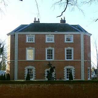
Hannington is a village in West Northamptonshire in England. At the time of the 2011 census the parish's population was 251 people.

Charwelton is a village and civil parish about 5 miles (8 km) south of Daventry in Northamptonshire, England. The 2011 Census recorded the parish's population as 220.

Weedon Bec, usually just Weedon, is a village and parish in West Northamptonshire, England. It is close to the source of the River Nene. The population of the civil parish at the 2011 census was 2,706.

Brasted is a village and civil parish in the Sevenoaks District of Kent, England. Brasted lies on the A25 road, between Sundridge and Westerham; the road is named Westerham Road, High Street and Main Road as it passes through the village east to west. Brasted is 6 km west of Sevenoaks town. The parish had a population of 1321 and includes the hamlets of Brasted Chart, Toys Hill and Puddledock. The village of Brasted has a number of 18th-century houses with several antique shops, pubs and residences. The parish church is dedicated to St Martin.

Aldenham is a village and civil parish in the borough of Hertsmere in Hertfordshire, England. The parish includes Radlett and Letchmore Heath as well as Aldenham village itself. The village of Aldenham lies 3.5 miles (5.6 km) north-east of Watford and 2 miles (3.2 km) southwest of Radlett. Aldenham was mentioned in the Domesday Book and is one of Hertsmere's 14 conservation areas. The village has eight pre-19th-century listed buildings and the parish itself is largely unchanged, though buildings have been rebuilt, since Saxon times when the majority of the land was owned by the abbots of Westminster Abbey.

Eydon is a village and civil parish in West Northamptonshire, about 8 miles (13 km) north-east of Banbury. The village is between 510 and 540 feet (160 m) above sea level on the east side of a hill, which rises to 580 feet (180 m) and is the highest point in the parish. The parish is bounded to the west by the River Cherwell, to the south by a stream that is one of its tributaries, and to the east and north by field boundaries.
Pavenham is a small village and civil parish on the River Great Ouse in the Borough of Bedford in Bedfordshire, England, about 6 miles (10 km) north-west of Bedford. Village amenities consist of St Peter's Church, a pub, Village hall, tennis Club, Cricket Club and golf club. The village is home to many clubs and societies including an active WI.
Mawsley is a newly built village and civil parish in North Northamptonshire, England. At the time of the 2011 census, the parish had a population of 2,320.

Barley is a village and civil parish in the district of North Hertfordshire, England. According to the 2001 census, it has a population of 659, increasing to 662 at the 2011 Census. The place-name refers to a lea or meadow and not to the grain-producing plant. Coincidentally to the southwest lies the village of Reed. The Prime Meridian passes to the west of Barley, which is located on the Royston to Saffron Walden road, as well as the medieval London to Cambridge road.
Cocking is a village, parish and civil parish in the Chichester district of West Sussex, England. The village is about three miles (5 km) south of Midhurst on the main A286 road to Chichester.
Ludford is a small village and civil parish in south Shropshire, England. The parish is situated adjacent to the market town of Ludlow and was, until 1895, partly in Herefordshire.
Faxton is an abandoned village and chapelry in the county of Northamptonshire in England. Nearby are the villages of Old, Lamport and Mawsley and the Northampton & Lamport Railway.

Westhampnett is a village, Anglican parish and civil parish in the district of Chichester in West Sussex, England, located 1 mile (1.6 km) northeast of Chichester on the former A27 road, now by-passed. The village is pre-Norman and is home to many listed buildings, including the Saxon church of St Peter, where three bishops of Chichester are buried. The parish of Westhampnett includes most of Goodwood estate, its golf course, motor-racing circuit and airfield.

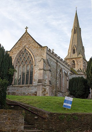
Duddington is a village and former civil parish, now in the parish of Duddington-with-Fineshade, in the North Northamptonshire district, in the ceremonial county of Northamptonshire, England. It is by the junction of the A47 and A43 roads, and is 9 kilometres (6 mi) southwest of the town of Stamford. The village is on the east bank of the River Welland which is the county boundary of Rutland. In 1961 the parish had a population of 184.
Normanton-on-the-Wolds is a small village and civil parish in Nottinghamshire, England. Population for the 2011 census was 245, increasing slightly to 251 residents at the 2021 census. The total area of the parish is 1.5 square miles.


