Bayswater Road is the main road running along the northern edge of Hyde Park in London. Originally part of the A40 road, it is now designated part of the A402 road.

Essex Road is a main road in Islington, London. It is part of the A104 and connects Islington High Street with Balls Pond Road via Essex Road railway station.

The Wood Street Compter was a small prison within the City of London in England. It was primarily a debtors' prison, and also held people accused of such misdemeanours as public drunkenness, although some wealthier prisoners were able to obtain alcohol through bribery. The prison was built and opened in 1555, replacing the earlier Bread Street Compter, from which many prisoners were transferred. Wood Street was closed and replaced by Giltspur Street Compter in 1791.

Gresham Street in the City of London is named after the English merchant and financier Thomas Gresham.

Wood Street is a street in the City of London, the historic centre and primary financial district of London. It originates in the south at a junction with Cheapside; heading north it crosses Gresham Street and London Wall. The northernmost end runs alongside The Postern, part of the Barbican estate, stopping at Andrewes House. Today Wood Street lies within the wards of Bassishaw and Cheap.

Piccadilly Arcade runs between Piccadilly and Jermyn Street in central London. It was opened in 1909, having been designed by Thrale Jell, and is a Grade II listed building.

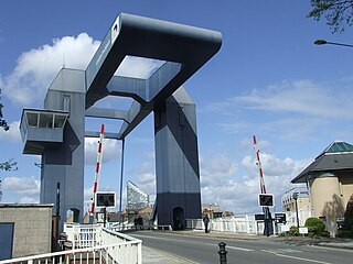
The A1206, also known as the Isle of Dogs Distributor Road, is a crescent-shaped ring road around the Isle of Dogs, in the East End of London. It is made up of Westferry Road, Manchester Road and Prestons Road and is the main road through the area, connecting parts of the London Docklands.

Conduit Street is a street in Mayfair, London. It connects Bond Street to Regent Street.

Maiden Lane is a street in Covent Garden, London, that runs from Bedford Street in the west to Southampton Street in the east. The painter J. M. W. Turner was born on this street in 1775.

Devereux Court, a street in the City of Westminster located just south of the Strand and east of Essex Street, is completely pedestrianised. This narrow lane is lined with well-preserved seventeenth-century buildings. The court's distinctive dog-leg layout has remained unchanged since its establishment in the 1670s on the grounds of Essex House, a stately home renowned for its expansive gardens.

South Audley Street is a major shopping street in Mayfair, London. It runs north to south from the southwest corner of Grosvenor Square to Curzon Street.

Lawrence Lane is a street in the City of London that runs from Trump Street in the south to Gresham Street in the north. Its final section in the north is pedestrianised. An alley also joins it to King Street in the north. It once ran south to join Cheapside but that end was blocked following post-Second World War rebuilding. It was known as St Lawrence Lane from the 13th to the 18th centuries due to its proximity to the church of St Lawrence Jewry and until King Street was built was the main route from Cheapside to the London Guildhall.

Honey Lane Market was an historic market near Cheapside in the City of London.

Warwick Crescent is a street in Little Venice, London. It connects Harrow Road with Westbourne Terrace Road, running along the southern edge of the Grand Union Canal.

The Green Man is a Grade II listed public house at 57 Berwick Street, in London's Soho.

Friday Street is a small street in the City of London, England.

The Maypole in the Strand was a landmark maypole on the Strand, London, that was in place during the 17th and early 18th centuries, on the site of the current St Mary le Strand church.

The Saracen's Head was an inn on the north side of the street to the west of the church of St Sepulchre-without-Newgate in Snow Hill, London. When Sarah Ann Mountain was in charge they made stagecoaches here and fifteen of them left each day for destinations including Birmingham and Leeds.

Sutherland Avenue is a street in Maida Vale in London, England. Located in the City of Westminster on the northern edge of Little Venice. it is an avenue running east to west from the Edgware Road to Harrow Road. Along the route it is crossed or joined by Randolph Avenue, Warrington Crescent, Lauderdale Road, Castellian Road, Warwick Avenue and Shirland Road. Elgin Avenue runs directly parallel to the north.

St Ann's Villas is a street in the Notting Hill area of London. Located in the Royal Borough of Kensington and Chelsea, it runs northwards from Royal Crescent. It is intersected by Queensdale Road.


