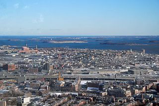
Baxter Boulevard is a road and parkway that wraps around the west side of Back Cove. The roadway served as the means to head north from downtown Portland before Tukey's Bridge, now on I-295, was built. The road was part of US Route 1 until May 2007.

Revere Beach Parkway is a historic parkway in the suburbs immediately north of Boston, Massachusetts. It begins at Wellington Circle in Medford, where the road leading to the west is the Mystic Valley Parkway, and the north-south road is the Fellsway, designated Route 28. The parkway proceeds east, ending at Eliot Circle, the junction of Revere Beach Boulevard and Winthrop Parkway in Revere. In between, the parkway passes through the towns of Everett and Chelsea. The parkway was built between 1896 and 1904 to provide access from interior communities to Revere Beach. It underwent two major periods of capacity expansion, in the 1930s and again in the 1950s. The parkway is designated as part of Route 16 west of Route 1A, and as part of Route 145 east of that point.

Ocean Parkway is a 4.86-mile (7.82 km) boulevard in the west-central portion of the New York City borough of Brooklyn. It is inventoried by the New York State Department of Transportation (NYSDOT) as New York State Route 908H (NY 908H), an unsigned reference route.
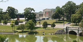
The public parks and parkways system of Buffalo, New York was originally designed by Frederick Law Olmsted and Calvert Vaux between 1868 and 1896. It was inspired in large part by the parkland, boulevards, and squares of Paris, France. It includes the parks, parkways and circles within the Cazenovia Park–South Park System and Delaware Park–Front Park System, both listed on the National Register of Historic Places and maintained by the Buffalo Olmsted Parks Conservancy.
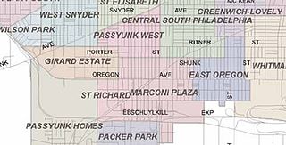
Marconi Plaza is an urban park square located in South Philadelphia, Philadelphia, Pennsylvania. The Plaza was named to recognize the 20th Century cultural identity in Philadelphia of the surrounding Italian-American enclave neighborhood and became the designation location of the annual Columbus Day Parade.

Eastern Parkway is a major boulevard that runs through a portion of the New York City borough of Brooklyn. The road begins at Grand Army Plaza and extends east, running parallel to Atlantic Avenue, along the crest of the moraine that separates northern from southern Long Island, to Ralph Avenue. There, it turns to the northeast, still following the moraine, until it terminates at Evergreen Cemetery where the moraine takes a steep climb towards a peak at Ridgewood Reservoir.

The Dorchesterway was a parkway planned by 19th century landscape designer Frederick Law Olmsted to be a continuation of the Emerald Necklace park network in Boston, Massachusetts. This plan, however, was never implemented.

Morton Street is a street in southern Boston, Massachusetts. It extends from the southeastern end of the Arborway in Jamaica Plain to Washington Street in the Lower Mills Village of Dorchester. Most of the road is a connecting parkway, signed as part of Massachusetts Route 203, that provides access to Boston's Emerald Necklace of parks. That portion of the road was listed on the National Register of Historic Places in 2005.
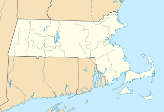
The Stony Brook Reservation Parkways are a group of historic parkways in Boston and Dedham, Massachusetts. They provide access to and within the Stony Brook Reservation, a Massachusetts state park. The roadways and the park are administered by the Massachusetts Department of Conservation and Recreation, a successor to the Metropolitan District Commission, which oversaw their construction. The roads consist of the Dedham, Enneking, and Turtle Pond Parkways and West Boundary Road. Two roads within the park, Smithfield Road and Reservation Road, are listed as non-contributing properties. The park roads were built between 1894 and 1956, and were listed on the National Register of Historic Places in 2006.

Winthrop Parkway is a historic parkway in Revere, Massachusetts. The parkway, built between 1909 and 1919 and now designated as part of Route 145, runs for about 0.75 miles (1.21 km), from Eliot Circle southeast to the Revere-Winthrop line. Acquisitions for its construction represent the last public purchase of oceanfront lands in Revere. It was listed on the National Register of Historic Places in 2004.

Nahant Beach Boulevard, also Nahant Causeway and Nahant Road is a historic road on the isthmus connecting Nahant, Massachusetts to the mainland at Lynn, Massachusetts. The road runs from the Lynn Rotary, its junction with Lynn Shore Drive and the Lynnway, about 1.5 miles (2.4 km) to Wilson Road in Nahant. It passes through Nahant Beach Reservation, a state park offering beach access on the isthmus. The road offers expansive views of the area coastlines and Boston Harbor. Both the park and the roadway are administered by the Massachusetts Department of Conservation and Recreation.

The Charles River Reservation Parkways are parkways that run along either side of the Charles River in eastern Massachusetts. The roads are contained within the Charles River Reservation and the Upper Charles River Reservation, and fall within a number of communities in the greater Boston metropolitan area. The Charles River parks extend from the Charles River Dam, where the Charles empties into Boston Harbor, to Riverdale Park in the West Roxbury neighborhood of Boston. Most of the roadways within the parks are listed on the National Register of Historic Places as a unit, although Storrow Drive and Memorial Drive are listed as part of the Charles River Basin Historic District.
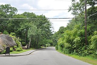
The Middlesex Fells Reservation Parkways are the roadways within and bordering on the Middlesex Fells Reservation, a state park in the northern suburbs of Boston, Massachusetts. The park includes portions of the towns of Malden, Medford, Melrose, Stoneham, and Winchester. The roads inside the park and around its perimeter have been listed on the National Register of Historic Places. Other portions of some of the roads are covered by more than one listing in the national register; see Fellsway Connector Parkways and Middlesex Fells Reservoirs Historic District.
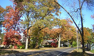
Furnace Brook Parkway is a historic parkway in Quincy, Massachusetts. Part of the Metropolitan Park System of Greater Boston, it serves as a connector between the Blue Hills Reservation and Quincy Shore Reservation at Quincy Bay. First conceived in the late nineteenth century, the state parkway is owned and maintained by the Massachusetts Department of Conservation and Recreation (DCR) and travels through land formerly owned by the families of John Adams and John Quincy Adams, passing several historic sites. It ends in the Merrymount neighborhood, where Quincy was first settled by Europeans in 1625 by Captain Richard Wollaston. The road was started in 1904, completed in 1916 and added to the National Register of Historic Places (NRHP) in 2004.

Blue Hills Parkway is a historic parkway that runs in a straight line from a crossing of the Neponset River, at the south border of Boston to the north edge of the Blue Hills Reservation in Milton, Massachusetts. It was built in 1893 to a design by the noted landscape architect, Charles Eliot, who is perhaps best known for the esplanades along the Charles River. The parkway is a connecting road between the Blue Hills Reservation and the Neponset River Reservation, and was listed on the National Register of Historic Places in 2003.

West Roxbury Parkway is a historic parkway running from Washington Street in Boston, Massachusetts, where the Enneking Parkway runs south, to Horace James Circle in Brookline, where it meets the Hammond Pond Parkway. The parkway serves as a connector between Stony Brook Reservation and Hammond Pond Reservation. West Roxbury Parkway was built between 1919 and 1929 and added to the National Register of Historic Places in 2006. The parkway is distinctive in the roadway system developed by the Metropolitan District Commission beginning around the turn of the 20th century in that it was built in collaboration with the City of Boston, and is maintained by the city.

Morrissey Boulevard is a six-lane divided coastal road in the Dorchester neighborhood of Boston, Massachusetts. It is owned and maintained by the Massachusetts Department of Conservation and Recreation (DCR).

William J. Day Boulevard, or Day Boulevard, is a coastal parkway in Boston, Massachusetts. Beginning at Morrissey Boulevard and Kosciuszko Circle at the northern extent of the Dorchester section of the city, it travels in a gently curving northeasterly direction 2.6 miles (4.2 km) through South Boston along beaches around the west and north shore of Dorchester Bay. It was named for William J. Day.

The Indianapolis Park and Boulevard System is a group of parks, parkways, and boulevards in Indianapolis, Indiana, that was designed by landscape architect George Edward Kessler in the early part of the twentieth century. Also known as the Kessler System, the district includes 3,474 acres (1,406 ha) and has shaped the city through the present day. This historic district was added to the National Register of Historic Places in 2003.
Southern Boulevard Parkway is a landscaped segment of south Broad Street in Philadelphia, Pennsylvania connecting Marconi Plaza and FDR Park from Oregon Avenue at Broad Street southward five intersections to the gateway entrance of the Philadelphia Navy Yard. The parkway consists of the central median landscaped area including the bordering east and west tree lined sidewalks and various sized green spaces which separates opposing lanes of traffic, and roadway intersections. Broad Street itself is a historic city street and this landscaped segment is bordered by an urban residential townhome community and the entrance to the major venues of the Philadelphia Sports Complex and Xfinity Live!, and the Philadelphia Navy Yard.


