
The A41 is a trunk road between London and Birkenhead, England. Now in parts replaced by motorways, it passes through or near Watford, Kings Langley, Hemel Hempstead, Aylesbury, Bicester, Solihull, Birmingham, West Bromwich, Wolverhampton, Newport, Whitchurch, Chester and Ellesmere Port.

Belvide Reservoir is a reservoir in South Staffordshire, England. It was built in 1833 to supply the Birmingham and Liverpool Junction Canal, and has been managed as a nature reserve since 1977. It has been used to study the effect of water level changes on bird populations.
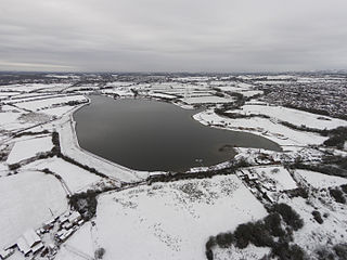
Chasewater is a reservoir located in the parish of Burntwood and the district of Lichfield in Staffordshire, England. Originally known as Norton Pool and Cannock Chase Reservoir, it was created as a canal feeder reservoir in 1797. The reservoir was created to directly supply the Wyrley and Essington Canal and maintain levels in the 160-mile (260 km) Birmingham Canal Network. During a period of great industrial growth in the Black Country region the maintenance of water levels in canal infrastructure was essential and Chasewater was in great demand. As canals became less essential for transport of goods during the mid-20th century, the reservoir diversified and became a popular public amenity with activities such as water-skiing, sailing, wakeboarding and cycling. Chasewater is the third largest reservoir by volume in the county of Staffordshire and the largest canal feeder reservoir in the West Midlands.

The Derwent Reservoir is a reservoir on the River Derwent, on the border between County Durham and Northumberland, in England. It is west of Consett. It is 3.5 miles (5.6 km) long) and covers an area of 4 km2 and has a maximum depth of 100 ft (30m) and when full, holds 11,000 million gallons (50,000,000m³).

The Bittell Reservoirs are located in Worcestershire between Barnt Green to the south and the Birmingham district of Longbridge to the north. They consist of the Upper and Lower reservoir. They were built to feed the Worcester and Birmingham Canal, which was finished in the 1790s, however, the reservoir was not completed until 1837. The 'Upper' reservoir is to ensure that the level of the canal is kept sufficiently high, even in times of drought. The 'Lower' reservoir(s) are compensatory reservoirs to ensure that the local area does not become parched in dry times.

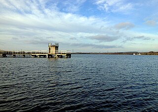
Edgbaston Reservoir, originally known as Rotton Park Reservoir and referred to in some early maps as Rock Pool Reservoir, is a canal feeder reservoir in Birmingham, England, maintained by the Canal & River Trust. It is situated close to Birmingham City Centre and is a Site of Importance for Nature Conservation.

Rudyard Lake is a reservoir in Rudyard, Staffordshire, located north-west of the town of Leek, Staffordshire. It was constructed in the late 18th century to feed the Caldon Canal. During the 19th century, it was a popular destination for daytrippers taking advantage of easy access using the newly constructed North Staffordshire Railway. The lake is still used for many water activities such as boating, canoeing, fishing and also for walks and recreational steam train trips.
Olton is an area/suburban village within the Metropolitan Borough of Solihull in the West Midlands, England. In the 13th century, the Lords of the Manor moved their seat and formed a new settlement, at the junction of two major roads. It was then that Ulverlei was being referred to as ‘Oulton’ to distinguish itself from nearby Solihull. Historically within the county of Warwickshire, the village has gradually become contiguous with Solihull to the southeast, though it retains the character of a large independent village.

The Brent Reservoir is a reservoir in North West London. It straddles the boundary between the boroughs of Brent and Barnet and is owned by the Canal & River Trust. The reservoir takes its informal name from a public house called The Welsh Harp, which stood nearby until the early 1970s. It is a 68.6-hectare (170-acre) biological Site of Special Scientific Interest (SSSI), the only SSSI in either borough and among more than 30 SSSIs in Greater London.
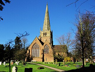
Solihull is a market town and the administrative centre of the Metropolitan Borough of Solihull in the West Midlands County, England. Solihull is situated on the River Blythe in the Forest of Arden area. The town had a population of 126,577 at the 2021 Census, and its wider borough had a population of 216,240 The town is located 8 miles southeast of Birmingham, 13 miles west of Coventry and 18 miles northwest of Warwick.
Wilton Water is a small reservoir, southwest of the village of Great Bedwyn in the English county of Wiltshire, which supplies the summit pound of the Kennet and Avon Canal with water. The reservoir lies in the parish of Grafton and collects rainfall from the eastern end of the Vale of Pewsey and the surrounding hills.

Winterburn Reservoir is located near the village of Winterburn in Malhamdale, North Yorkshire, England. It was constructed between 1885 and 1893 by Leeds civil engineers Henry Rofe and Edward Filliter to help maintain levels on the Leeds and Liverpool Canal. The cost of construction was estimated at £45,000. Its capacity is 281,504,000 imperial gallons (1.27974×10⁹ L; 338,072,000 US gal) and covers an area of 39.17 acres (15.85 ha)
The Warwickshire Cricket League is the biggest cricket league for clubs in Warwickshire. Its origins go back to 1989, and since 1998 it has acted as a feeder league to the Birmingham and District Premier League Aston Manor in 2005, Berkswell in 2006, & Sutton Coldfield 2014 gained successive promotions from Birmingham League Division Three the following season. Coventry and North Warwickshire Cricket Club are the current champions.

Tardebigge Engine House is a former canal-pumping engine house at Tardebigge, Worcestershire, England. It is grade II listed.
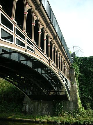
The Engine Arm Aqueduct near Smethwick, West Midlands, England, was built in 1825 by Thomas Telford to carry a water feeder, the Engine Arm, from Edgbaston Reservoir over the BCN New Main Line canal to the adjacent and parallel Old Main Line. It is a Scheduled Ancient Monument and is Grade II* listed.
The Manchester Bury & Bolton Reservoir, commonly called Elton Reservoir, is located near the A58 Bolton Road in Greater Manchester, about 3 km (1.8 mi) south west of the town of Bury. Constructed in 1842 at the height of the canal era, it remains today as legacy of the industrial era and a major leisure facility for residents of Bury, Bolton and North Manchester.

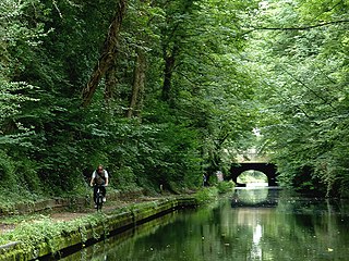
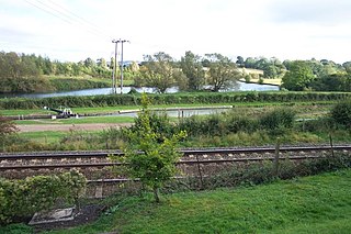
Earlswood Lakes is the modern name for three man-made reservoirs which were built in the 1820s at Earlswood in Warwickshire, England, to supply water to the Stratford-upon-Avon Canal. They still supply the canal, and also provide leisure facilities, including sailing, fishing, and walking. The northern banks of the lakes form the borough and county boundary with the Metropolitan Borough of Solihull and the West Midlands.
Cofton Reservoir is a canal feeder reservoir, south of the village of Cofton Hackett, Worcestershire in the United Kingdom. The reservoir is situated at the base of the Lickey Hills, 8.5 miles (13.7 km) south west of Birmingham. It is the highest of four Worcester and Birmingham Canal reservoirs in the upper catchments of the River Arrow. It was originally built in 1815 as a compensation reservoir for watermills, which would have otherwise been affected by the construction of the canal. It was later used as a water supply for the canal, a function for which it still serves.

