Onin Peninsula

Last updated
Onin Peninsula
Native name:
Semenanjung Onin
Nickname: Jazirah Onim
Indonesia Western New Guinea location map.png
Red pog.svg
Onin Peninsula
Onin Peninsula in Western New Guinea
Indonesia location map.svg
Red pog.svg
Onin Peninsula
Onin Peninsula in Indonesia
Geography
Coordinates 02°49′54.84″S132°5′5.82″E / 2.8319000°S 132.0849500°E / -2.8319000; 132.0849500
Adjacent to Seram Sea
Bintuni Bay
Administration
ProvinceFlag of West Papua (vectorised).svg  West Papua
Regency Fakfak
Largest settlement Fakfak
Demographics
Languages Onin language
Additional information
Time zone

The Onin Peninsula is a peninsula that forms part of the larger Bomberai Peninsula in the Fakfak Regency in West Papua. The Onin language is named after this peninsula.

Contents

Etymology

The Onin Peninsula is considered by some historians to be the place mentioned as "Wanin" in the Negarakertagama manuscript. [1] [2]

Ikang sakasanusasanusa Makasar Butun Banggawai Kuni Ggaliyao mwang i [ng] Salaya Sumba Solot Muar muwah tigang i Wandan Ambwan athawa Maloko Ewanin ri Sran ini Timur ning angeka nusatutur. [3]

One example of the use of Wanin as a local place name can be found in local Onim songs and local poetry in Wersar Village, Teminabuan, South Sorong Regency as follows:

Wndindi wdo wska wana Wanin woro are wdo whriak naima afaaf vein eeehhh. [4]

In English: Hopefully the lightning will bring change, so that the weather in Wanin (Onin) will be fine, so that we can sail across to Wanin (Onin).

The mention of the name "Wanin" as it changed to "Onin" became one of the oldest local indigenous names referring to the region on the island of Papua, on the opposite coast of the southern Doberai Peninsula, namely the northern coast of Bomberai Peninsula. [1] Based on the notes of Rumphius, Ternate people also call "Onin" by the name Woni. [2]

History

Another relationship that possibly shows the connection between Kondjol/Onim and the island of Java is the ownership of the clan's heirloom that resembles keris and the statue of Buddha, each Tehit clan usually has secret heirlooms called Qya-trifan used as symbol of the clan and believed to explain the clan's origin. [5] In this case Kondjol/Onim clan believed they were descendant of ancient migrants from Java, as explained in their local legends below:

There was an ancestor named Onain who fled from Java because of the Hindu-Buddhist and Islamic war to Bali. He kept the keris and the Buddha statue and fled to Ternate and arrived in the afternoon. In the evening, the Onain clan were well received by the Anggiluli clan and the next day they made a common house for each. Then there was another war so that the Anggiluli clan and Onain clan fled to the island of Papua. They know this because they once hunted birds of paradise. Then they said goodbye to the Sultan and left in the morning, when night fell, they lost each other because it was dark. The Anggiluli clan went to Ega Island, where they found an island resembling the letter 'O' so it was named Onin. Meanwhile, the Onain clan went to an island that resembles a 'kopiah', so they named this island with the Tidorean word for this hat, namely: Kowiai. [Catatan 1] [6] [7]

Kondjol/Onim clan also knows the figure called 'Raja Angguok', where he is considered to have played an active role in the spread of Christianity in Teminabuan, Ayamaru, Aitinyo, and Aifat. According to the notes of the Dutch civil officer, Dumas, on the Memorandum for the Afdeeling West New Guinea (1911), Angguok was the Dutch intermediary with the Papuans around the Kaibus River. There are many local songs that tell the story of Angguok's journey as a hero from the Kaibus River to the Seremuk River. He was a strong man who ruled over the coastal area from Inanwatan to Cape Sele. He was also a known slaver who captured slaves to be sold to the kingdoms in the Onin Peninsula or to the Salawati Kingdom in Raja Ampat Islands. [8]

Traditional kingdoms

In the Onin Peninsula there are three primary traditional kingdoms (petuanan), Fatagar Kingdom of the Uswanas clan, Atiati Kingdom of the Kerewaindżai clan, and the Rumbati Kingdom of the Bauw clan. Atiati founder (Mnau) and Rumbati founder (Nawa-nawa Bauw) were brothers, sons of Bau, believed to be a Javanese sailor from Gresik who married an Anggiluli woman and a Koiwai woman. [9] Initially, the centers of power of the three kingdoms were located side by side at the western tip of the Onin Peninsula, but because of the war that arose between the Rumbati kingdom on one side and the Fatagar kingdom and the Atiati kingdom on the other side in 1878. So the Fatagar kingdom and the Atiati kingdom moved their center of power to Ega Island. Some time later another dispute occurred between king Fatagar and king Atiati, caused king Atiati to move the center of his power to a place on the mainland coast of the Onin Peninsula, which was later called Atiati, is located opposite Ega Island. Meanwhile, because of the dispute, king Fatagar moved the center of his power to a place called Merapi, located east of the present town of Fakfak. [10]

Apart from the three kingdoms mentioned above, there were also several other kingdoms, namely kingdoms which were originally under the rule of the Rumbati kingdom, but then succeeded in gaining recognition as a separate kingdom, especially during the early days of pax neerlandica in 1898.

Notes

  1. The source writes Kowiai, possibly referring to Namatota Island. The original name was Kob'jai (Kobiyai) which was later known to Seram traders as Kowiai. It was the capital of Namatota Kingdom, and current Kampung Namatota.

Related Research Articles

<span class="mw-page-title-main">West Papua (province)</span> Province in Indonesia

West Papua, formerly Irian Jaya Barat, is a province of Indonesia located in the land of Papua. It covers most of the two western peninsulas of the island of New Guinea, the eastern half of the Bird's Head Peninsula and the whole of the Bomberai Peninsula, along with nearby smaller islands. The province is bordered to the north by the Pacific Ocean, to the west by Southwest Papua Province, the Halmahera Sea and the Ceram Sea, to the south by the Banda Sea, and to the east by the province of Central Papua and the Cenderawasih Bay. Manokwari is the province's capital and largest city. With an estimated population of 561,403 in mid-2022, West Papua is the least populous province in Indonesia after Southwest Papua, which was a part of West Papua until separated off in 2022.

<span class="mw-page-title-main">Waigeo</span> Island in Indonesia

Waigeo is an island in the Southwest Papua province of eastern Indonesia. The island is also known as Amberi or Waigiu. It is the largest of the four main islands in the Raja Ampat Islands archipelago, between Halmahera and about 65 kilometres to the northwest coast of New Guinea. The Dampier Strait separates it from Batanta, and the Bougainville Strait from the Kawe Islands to its northwest. The "inner sea" that nearly cleaves the island in two is Mayalibit Bay, also known as the Majoli Gulf.

<span class="mw-page-title-main">South Halmahera–West New Guinea languages</span> Subgroup of the Austronesian language family

The South Halmahera–West New Guinea (SHWNG) languages are a branch of the Malayo-Polynesian languages, found in the islands and along the shores of the Halmahera Sea in the Indonesian province of North Maluku and of Cenderawasih Bay in the provinces of Papua and West Papua. There are 38 languages.

<span class="mw-page-title-main">Bird's Head Peninsula</span> Peninsula in Indonesia

The Bird's Head Peninsula or Doberai Peninsula, is a large peninsula that makes up the northwest portion of the island of New Guinea, comprising the Indonesian provinces of Southwest Papua and West Papua. It is often referred to as The Vogelkop, and is so named because its shape looks like a bird's head on the island of New Guinea. The peninsula at the opposite end of the island is called the Bird's Tail Peninsula. The peninsula just to the south is called the Bomberai Peninsula.

<span class="mw-page-title-main">Misool</span> Island in Indonesia

Misool, formerly spelled Mysol or Misol, is one of the four major islands in the Raja Ampat Islands in Southwest Papua, Indonesia. Its area is 2,034 km2. The highest point is 561 m and the main towns are Waigama, located on the island's northwest coast, and Lilinta on the island's southeast coast.

<span class="mw-page-title-main">Salawati</span> Island in Indonesia

Salawati is one of the four major islands in the Raja Ampat Islands in Southwest Papua, Indonesia. Its area is 1,623 km2. Salawati is separated from New Guinea to the southeast by the Sele Strait, and from Batanta to the north by the Pitt Strait.

<span class="mw-page-title-main">Batanta</span> Island in Indonesia

Batanta is one of the four major islands in the Raja Ampat Islands in Southwest Papua province, Indonesia. Its area is 479.5 km² and its highest point is 1184 m. The Pitt Strait separates it from Salawati Island, while the Dampier Strait separates it from Waigeo Island.

Bomberai Peninsula is located in the Western New Guinea region. It is south of the Bird's Head Peninsula, and Bintuni Bay separates the two peninsulas. To the west lies the Sebakor Bay and to the south Kamrau Bay. On the southeast Arguni Bay lies between the peninsula and the Bird's Neck Isthmus.

<span class="mw-page-title-main">Teminabuan</span> Town in Southwest Papua, Indonesia

Teminabuan is a small town in South Sorong Regency, Southwest Papua, Indonesia. The town serves as the administrative capital of South Sorong Regency. It had a population of 11,627 at the 2010 Census and 19,491 at the 2020 Census. The town is located in the southwestern-central part of the Bird's Head Peninsula. The area was bombed between January and March 1967. It is served by Teminabuan Airport.

<span class="mw-page-title-main">Fakfak</span> Town in West Papua, Indonesia

Fakfak, also known as the District of Fakfak, is a town in West Papua and seat of the Fakfak Regency. It had a population of 12,566 at the 2010 Census, which rose to 18,900 at the 2020 Census. It is served by Fakfak Airport. It is the only town in West Papua with a significant Muslim Indian and Arab Indonesian presence.

The History of Western New Guinea refers to the history of the Indonesian western half of the island of New Guinea and other smaller islands to its west. This region was previously named Irian Jaya. The eastern half of the island is Papua New Guinea.

Tehit is a Papuan language of the Bird's Head Peninsula of New Guinea. Other spellings are Tahit, Tehid, and other names Kaibus, Teminabuan. Dialects are Tehit Jit, Mbol Fle, Saifi, Imyan, Sfa Riere, Fkar, Sawiat Salmeit.

Kowiai (Kuiwai) is an Austronesian language of the Bomberai Peninsula in New Guinea. According to the Atlas of Languages of Intercultural Communication in the Pacific and Asia, Kowiai is spoken in the coastal regions between Arguni and Etna bay.

<span class="mw-page-title-main">Kingdom of Kaimana</span> Islamic Kingdom in West Papua, Indonesia

The Kingdom of Kaimana or Kingdom of Sran is one of the oldest Muslim kingdoms in West Papua, Indonesia. The kingdom was established by Imaga, with the title Rat Sran Nati Pattimuni, traditionally in 1309.

<span class="mw-page-title-main">Machmud Singgirei Rumagesan</span> Raja al-Alam Ugar Pik-Pik Sekar

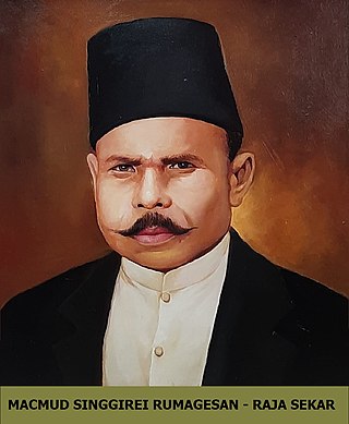
Machmud Singgirei Rumagesan was a king of Sekar and pro-integration activist from West Papua. He founded the movement Gerakan Tjendrawasih Revolusioner Irian Barat (GTRIB) in 1953, and became the member of Supreme Advisory Council in 1959. On 10 November 2020, Singgirei Rumagesan was posthumously declared a National Hero of Indonesia for his lifelong efforts to unite West Irian with Indonesia.

<span class="mw-page-title-main">Southwest Papua</span> Province with special status

Southwest Papua is the 38th province of Indonesia to be created, and was split off from West Papua on 8 December 2022. Despite being named southwest, it is a misnomer and this province is actually located in the northwest edge of Papua. The province comprises the Greater Sorong area which consists of Sorong City, Sorong Regency, South Sorong Regency, Maybrat Regency, Tambrauw Regency, and Raja Ampat Regency. The Bill (RUU) on the Establishment of the Southwest Papua Province was passed into law and therefore it became the 38th province in Indonesia.

<span class="mw-page-title-main">Salawati Kingdom</span> Islamic kingdom in Salawati Island, Southwest Papua

The Salawati Kingdom is the Islamic kingdom that once stood in Salawati Island, Raja Ampat Regency, Southwest Papua. The center of the Salawati kingdom was located in the Samate village which is currently located in the North Salawati district.

Petuanan Teminabuan, also called Petuanan Kaibus, is one of the four petuanan in the traditional government system of the Tehit people. This petuanan is considered the most influential among the three other petuanans. At first, Petuanan Teminabuan was under the area of influence of the Sailolof Kingdom which was centered in Sailolof, Salawati Island.

Tehit is an ethnic group that inhabits the southern part of the Doberai Peninsula. Their traditional settlements are concentrated around the Teminabuan district in South Sorong Regency. The population is 15,972 people according to 2010 Indonesian census.

References

  1. 1 2 Mansoben, Johszua Robert (1995). Sistem Politik Tradisional Di Irian Jaya. Jakarta: LIPI - RUL 1995. p. 69. ISBN   979-8258-06-1.
  2. 1 2 Fraassen, Ch. F. Van (1976). "DRIE PLAATSNAMEN UIT OOST-INDONESIË IN DE NAGARA-KERTAGAMA: GALIYAO, MUAR EN WWANIN EN DE VROEGE HANDELS-GESCHIEDENIS VAN DE AMBONSE EILANDEN". Bijdragen tot de Taal-, Land- en Volkenkunde. [Brill, KITLV, Royal Netherlands Institute of Southeast Asian and Caribbean Studies]. 132 (2/3): 293–305. ISSN   0006-2294. JSTOR   27863057 . Retrieved 2023-11-03.
  3. Mashad, Dhurorudin. Muslim Papua: Membangung Harmoni Berdasar Sejarah Agama di Bumi Cendrawasih (in Indonesian). Pustaka Al-Kautsar.
  4. Martin Slama and Jenny Munro, ed. (2015). From 'Stone Age' to 'Real Time' Exploring Papuan Temporalities, Mobilities, and Religiosities. Canberra: Australian National University Press. p. 110. ISBN   978-1-925022-43-8.
  5. Flassy, Marlina (2020-06-09). "Membangun Jati Diri Suku Tehit Kabupaten Sorong Selatan Papua Barat". CENDERAWASIH: Jurnal Antropologi Papua. Universitas Cenderawasih. 1 (1): 1–7. doi: 10.31957/jap.v1i1.1377 . ISSN   2774-552X.
  6. Martin Slama and Jenny Munro, ed. (2015). From 'Stone Age' to 'Real Time' Exploring Papuan Temporalities, Mobilities, and Religiosities. Canberra: Australian National University Press. p. 112. ISBN   978-1-925022-43-8.
  7. Mawara, Agustinus (2021-12-31). "PULAU MIWARA PUSAT NIAGA MASA LAMPAU: Tinjauan Sejarah Perdagangan Tradisional di Teluk Triton". Kebudayaan. Badan Standar, Kurikulum, dan Asesmen Pendidikan (Kemendikbud). 16 (2). doi: 10.24832/jk.v16i2.379 . ISSN   2685-8088.
  8. Martin Slama and Jenny Munro, ed. (2015). From 'Stone Age' to 'Real Time' Exploring Papuan Temporalities, Mobilities, and Religiosities. Canberra: Australian National University Press. p. 111. ISBN   978-1-925022-43-8.
  9. "SEJARAH SINGKAT KERAJAAN RUMBATI DI TANAH PAPUA". Manfasramdi. 2022-08-22. Retrieved 2024-03-10.
  10. Maga, Anwar (2018-02-14). "Kerajaan Atiati Fakfak memiliki raja baru". ANTARA News (in Indonesian). Retrieved 2022-04-30.
  11. "Mengenal Pertuanan Arguni di Fakfak, Papua Barat, yang Dipimpin oleh Raja". kumparan (in Indonesian). 2020-05-26. Retrieved 2022-05-09.