Oploo | |
|---|---|
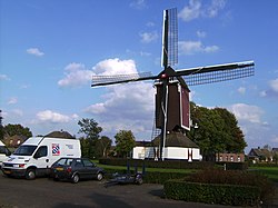 Wind mill De Korenbloem | |
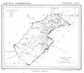
 Oploo Location in the province of North Brabant in the Netherlands  Oploo Oploo (Netherlands) | |
| Coordinates: 51°36′32″N5°52′25″E / 51.60889°N 5.87361°E | |
| Country | Netherlands |
| Province | North Brabant |
| Municipality | Land van Cuijk |
| Area | |
• Total | 21.43 km2 (8.27 sq mi) |
| Elevation | 18 m (59 ft) |
| Population (2021) [1] | |
• Total | 1,895 |
| • Density | 88/km2 (230/sq mi) |
| Time zone | UTC+1 (CET) |
| • Summer (DST) | UTC+2 (CEST) |
| Postal code | 5841 [1] |
| Dialing code | 0485 |
Oploo is a village in the Dutch province of North Brabant. It is located in the former municipality of Sint Anthonis. Since 2022 it has been part of the new municipality of Land van Cuijk.