
Greater Western Sydney (GWS) is a large region of the metropolitan area of Greater Sydney, New South Wales (NSW), Australia that generally embraces the north-west, south-west, central-west, far western and the Blue Mountains sub-regions within Sydney's metropolitan area and encompasses 13 local government areas: Blacktown, Blue Mountains, Camden, Campbelltown, Canterbury-Bankstown, Cumberland, Fairfield, Hawkesbury, Hills Shire, Liverpool, Parramatta, Penrith and Wollondilly. It includes Western Sydney, which has a number of different definitions, although the one consistently used is the region composed of ten local government authorities, most of which are members of the Western Sydney Regional Organisation of Councils (WSROC). Penrith, Hills Shire & Canterbury-Bankstown are not WSROC members. The NSW Government's Office of Western Sydney calls the region "Greater Western Sydney".

Wentworthville is a suburb in Sydney, in the state of New South Wales, Australia. Wentworthville is located 27 kilometres west of the Sydney central business district and is part of the Greater Western Sydney region. Wentworthville is split between the local government areas of the City of Parramatta and the Cumberland Council. Wentworthville is colloquially known as 'Wenty'.

Emu Plains is a suburb of Sydney in the state of New South Wales, Australia. It is 58 kilometres west of the Sydney central business district, in the local government area of the City of Penrith and is part of the Greater Western Sydney region.

Prospect is a suburb of Sydney, in the state of New South Wales, Australia. Prospect is located 32 kilometres west of the Sydney central business district in the local government area of the City of Blacktown and a small part of Cumberland City Council, is part of the Greater Western Sydney region. One of the oldest suburbs in Sydney, Prospect takes its name from the prominent nearby landmark of Prospect Hill - from the top of which people could get a prospect of the surrounding countryside.

Werrington is a suburb of Sydney, in the state of New South Wales, Australia. It is 49.3 kilometres (30.6 mi) west of the Sydney central business district, in the local government area of the City of Penrith and is part of the Greater Western Sydney region.

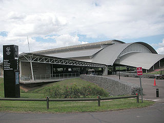
The City of Penrith is a local government area in the state of New South Wales, Australia. The seat of the city is located in Penrith, located about 50 kilometres (31 mi) west of Sydney's central business district. It occupies part of the traditional lands of the Darug people. First incorporated as a municipality on 12 May 1871, on 1 January 1949, the municipalities of Penrith, St Marys and Castlereagh and part of the Nepean Shire amalgamated to form a new Municipality of Penrith. Penrith was declared a City on 21 October 1959, and expanded westwards to include Emu Plains and Emu Heights, formerly part of the City of Blue Mountains, on 25 October 1963. As of the 2021 census the City of Penrith had an estimated population of 217,664.

St Marys is a suburb in western Sydney, in the state of New South Wales, Australia. It is 45 kilometres west of the Sydney central business district, in the local government area of the City of Penrith.

St Clair is a suburb of Sydney, in the state of New South Wales, Australia. It is 44 kilometres west of the Sydney central business district, in the local government area of the City of Penrith and is part of the Greater Western Sydney region. St Clair is within view of the Blue Mountains.

South Penrith is a suburb of Sydney, in the state of New South Wales, Australia. South Penrith is located 55 kilometres west of the Sydney central business district, in the local government area of the City of Penrith and is part of the Greater Western Sydney region.
Regentville is a suburb of Sydney, in the state of New South Wales, Australia. It is 56 kilometres west of the Sydney central business district, in the local government area of the City of Penrith, and is part of the Greater Western Sydney region. It is located on the eastern bank of the Nepean River, just south of Jamisontown.
Mulgoa is a village, located in the local government area of the City of Penrith, in the region of western Sydney, in the state of New South Wales, Australia. Mulgoa is located approximately 66 kilometres (41 mi) west of the Sydney central business district.
Kemps Creek is a suburb of Sydney, in the state of New South Wales, Australia. It is approximately 39 kilometres (24 mi) west of the Sydney central business district, in the local government areas of the City of Penrith and City of Liverpool. It is part of the Greater Western Sydney region.
Maroota is a suburb to the north-west of Sydney, New South Wales, Australia. Maroota is located 49 kilometres north-west of the Sydney central business district, in the local government areas of The Hills Shire and Hornsby Shire.
Bringelly is a suburb of Sydney, in the state of New South Wales, Australia. It is located on the Northern Road between Penrith and Camden. It has a public school. Bringelly is also the name of a local hill.

Cattai is an historic suburb of Sydney, in the state of New South Wales, Australia. It is located 44 kilometres north-west of the Sydney central business district and 30 kilometres north-west of Parramatta. It is in the local government areas of The Hills Shire and City of Hawkesbury. Cattai's state electoral district is Hawkesbury, and its federal electoral divisions are Berowra and Macquarie.

Chipping Norton is a suburb of Sydney, in the state of New South Wales, Australia. Chipping Norton is 27 kilometres south-west of the Sydney central business district, in the local government area of the City of Liverpool and is part of the South Western Sydney region.
Horsley Park is a suburb of Sydney in the state of New South Wales, Australia. Horsley Park is located 39 kilometres west of the Sydney central business district in the local government area of the City of Fairfield. Horsley Park is part of the Greater Western Sydney region. It is a semi-rural suburb, located 5 km west of Wetherill Park and 11 km north-west of Fairfield.
Bungarribee is a suburb of Blacktown, in the state of New South Wales, Australia. Bungarribee is located approximately 37 kilometres west of the Sydney central business district, in the local government area of the City of Blacktown and is part of the Greater Western Sydney region.
Blaxland Creek, a watercourse that is part of the Hawkesbury–Nepean catchment, is located in Greater Western Sydney, Australia.

Mamre is a heritage-listed former farm homestead complex, grain cropping, pastoral property and wool production and now residence, community facility, market gardening and nursery production located at Mamre Road in the western Sydney suburb of Orchard Hills in the City of Penrith local government area of New South Wales, Australia. It was built from 1822 to 1832. The property is owned by the New South Wales Department of Planning and Infrastructure. It was added to the New South Wales State Heritage Register on 2 April 1999.
