Ordsall, Nottinghamshire

Last updated

Ordsall
All Hallows Church Ordsall Nr Retford - geograph.org.uk - 74061.jpg
Nottinghamshire UK location map.svg
Red pog.svg
Ordsall
Location within Nottinghamshire
Population14,194 (Ward 2011)
District
Shire county
Region
Country England
Sovereign state United Kingdom
Post town RETFORD
Postcode district DN22
Dialling code 01777
Police Nottinghamshire
Fire Nottinghamshire
Ambulance East Midlands
UK Parliament
List of places
UK
England
Nottinghamshire
53°19′N0°57′W / 53.31°N 0.95°W / 53.31; -0.95

Ordsall is an area and former civil parish in Retford, in the Bassetlaw district of Nottinghamshire, England. The Bassetlaw ward of the same name had a population of 14,194 at the 2011 census. [1]

Contents

All Hallows' Church serves the village and is situated beside the River Idle at the south side of Ordsall, an area sometimes referred to as "Old Ordsall". The River Idle, along with the Great Northern Rail Line, divides Ordsall from Retford.

Ordsall is served by Ordsall Primary School, which is on Ordsall Road and from the age of 11 school children have the option of going to one of Retford's two secondary schools, Retford Oaks High School or Elizabethen High School.

The football team 'Ordsall Rangers' is the village football team.

History

There is no record of Ordsall before the days of William the Conqueror, when the land was chiefly marsh. In the Domesday Book of 1086, the name of the village is Ordeshale and in other early documents the name was Ordesale. In 1637 it was even printed on a map as Ardsall, however these corruptions of names are usual everywhere.

For centuries the parish of Ordsall consisted of the village and two small hamlets, Thrumpton and Whitehouses. Ordsall Parish became part of the Retford Area Team Ministry, the area covered by the former Retford Deanery, in April 2011. The ecclesiastical parish of Ordsall formerly covered a much larger area than Ordsall village. Whereas the village is bounded by the river and railway lines, the parish extended northwards towards the centre of East Retford as far as Albert Road. On 1 September 2019 a new Parish of Ordsall and Retford, St Michael was formed. This new parish comprises all the parts of the former Ordsall parish that lie on western bank of the river Idle, along with the ancient parish of West Retford. The areas of the ancient Ordsall Parish that lie on the eastern bank of the river Idle are now part of the Parish of Retford, St Saviours.

The ancient parish became a civil parish in 1866, but on 1 April 1921 the civil parish was abolished and absorbed into the Municipal Borough of East Retford. [2] In 1911 the civil parish had a population of 5690. [3]

Population

The population of the Parish, which includes the village of Ordsall and surrounding areas such as Thrumpton. The 2001 population is the population of the village alone.

YearPopulation
1801560
1811599
1821632
1831809
1841955
18511,342
18813,011
18913,852
19015,199
19115,690
20014,328
20114,215

All Hallows Church

The Anglican church, All Hallows is a Grade II* listed building. The first recorded rector is in 1277. The current building dates from that period but was rebuilt in the 19th century by TC Hine of Nottingham. The church has a short, square tower with diagonal buttresses that is thought to date from the 15th century. The upper parts of the tower had to be repaired in 1823 after it was struck by lightning. [4]

The church's east window is by Camm Brothers of Smethwick and dates from 1877, as is the window in the north aisle east (1881). In the chancel there is a window by James Powell and Sons (Flint memorial, 1923) and another by Charles Eamer Kempe (Hall memorial, 1905). There are a number of unusual brass plates in the south aisle, dating from the 17th and 18th centuries. In the north aisle is a memorial made of Nottinghamshire alabaster with kneeling figure between Corinthian columns (c 1600–20).

See also

Related Research Articles

<span class="mw-page-title-main">Retford</span> Market town in Nottinghamshire, England

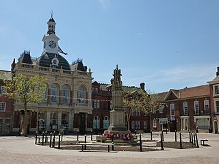
Retford, also known as East Retford, is a market town in the Bassetlaw District in Nottinghamshire, England. It lies on the River Idle and the Chesterfield Canal. Retford is located 26 miles (42 km) east of Sheffield, 23 miles (37 km) west of Lincoln and 31 miles (50 km) north-east of Nottingham. The population at the 2021 Census was 23,740. The town is bypassed by the A1 road.

<span class="mw-page-title-main">Rampton, Nottinghamshire</span> Human settlement in England

Rampton is a village in the civil parish of Rampton and Woodbeck, about 6 miles (10 km) east of Retford in the Bassetlaw district, in the county of Nottinghamshire, England. The parish is long and thin, extending about 7 miles (11 km) east–west but only about 1 mile (1.6 km) north–south. Its eastern boundary is the River Trent, which here also forms the county boundary with Lincolnshire.

<span class="mw-page-title-main">Ranskill</span> Village in Nottinghamshire, England

Ranskill is a village and civil parish in the Bassetlaw district of Nottinghamshire, England, with its nearest town being Retford approximately 5 miles south. The Ranskill parish according to the 2001 census has 2,226 residents, falling to 1,362 at the 2011 census, and improving to 1,435 at the 2021 census. There is also a Bassetlaw ward called Ranskill. This ward had a population of 2,417 at the 2011 census.

<span class="mw-page-title-main">Sutton cum Lound</span> Village and civil parish in Nottinghamshire, England

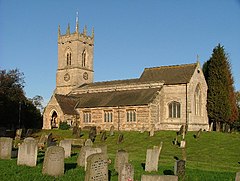
Sutton Cum Lound is a village located in Bassetlaw, north Nottinghamshire. It is located 3 miles from Retford. The civil parish is called Sutton. According to the 2001 census it had a population of 687, falling slightly to 673 at the 2011 census, and recovering to 683 at the 2021 census. The parish church of St Bartholomew is Norman, rebuilt in the Perpendicular style, with "unbridled curvilinear tracery" in the chancel windows. The village has a primary school. It borders the village of Barnby Moor which is about 1 mile away and is also very close to the village of Lound. The village has a number of public footpaths and walks such as those on Mire Hill.

<span class="mw-page-title-main">Misterton, Nottinghamshire</span> Village and civil parish in the Bassetlaw district of Nottinghamshire, England

Misterton is a village and civil parish in the Bassetlaw district of Nottinghamshire, England. The parish population at the 2011 census was 2,140, and has risen to 2,191 residents in the 2021 census.

<span class="mw-page-title-main">Lound, Nottinghamshire</span> Civil parish in England

Lound is a village in Nottinghamshire, England, four miles north of Retford. It had a population of 493 in the census of 2001, reducing to 471 at the 2011 census, and 454 in 2021. The village is of Danish origin dating from the 8th century with a street running along the spine of the village, leading on to Lound Low Road. The oldest houses are tofts which are endways on to the street with strips of land running back from the road. Nearby villages are Sutton cum Lound and Mattersey.

<span class="mw-page-title-main">South Leverton</span> Village and civil parish in Nottinghamshire, England

South Leverton is a village and civil parish in Bassetlaw, north Nottinghamshire, England, four miles from Retford. According to the 2001 census it has a population of 478, increasing marginally to 480 at the 2011 census, and more substantially to 514 at the 2021 census.

<span class="mw-page-title-main">Cottam, Nottinghamshire</span> Civil parish in England

Cottam is a village and civil parish in Nottinghamshire 8 miles east of Retford within the Bassetlaw district. The name is pronounced 'Cotum' locally.

<span class="mw-page-title-main">Hayton, Nottinghamshire</span> Civil parish in England

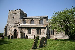
Hayton is a village in Nottinghamshire, England. It is located 4 miles north-east of Retford. According to the 2001 census it had a population of 386, decreasing marginally to 385 in the 2011 Census, but markedly more so in 2021 to 361. The parish church of St Peter is Norman, with 14th century windows.

<span class="mw-page-title-main">Sturton le Steeple</span> Village and civil parish in Nottinghamshire, England

Sturton le Steeple is a village located 6 miles (9.7 km) east of Retford, Nottinghamshire, England. According to the 2001 census it had a population of 497, reducing slightly to 486 at the 2011 census, but increasing to 545 residents in the 2021 census.

<span class="mw-page-title-main">Gamston, Bassetlaw</span> Civil parish in England

Gamston is a village and civil parish four miles south of Retford in the English county of Nottinghamshire. The village lies on the A638 road between Retford and the Markham Moor junction with the A1 and the A57 roads. The population of the civil parish as at the 2011 Census was 246, which increased to 253 in 2021. The River Idle lies to the west of the village.

<span class="mw-page-title-main">Our Lady and St Peter's Church, Bothamsall</span> Church in Bothamsall, England

Our Lady and St Peter's Church, Bothamsall is a Grade II listed parish church in the Church of England in Bothamsall. The church is part of the Lound Hall Estate, Bothamsall. The buildings repair costs are procured by the Lord of the manor.

<span class="mw-page-title-main">St Paul's Church, West Drayton</span> Church in Nottinghamshire, England

St Paul's Church is a Grade II* listed parish church in the Church of England in West Drayton, Nottinghamshire.

<span class="mw-page-title-main">All Saints' Church, South Leverton</span> Church in South Leverton, England

All Saints’ Church, South Leverton is a Grade II* listed parish church in the Church of England in South Leverton, Nottinghamshire.

<span class="mw-page-title-main">Albert Road drill hall, Retford</span>

The Albert Road drill hall is a former military installation in Retford.

<span class="mw-page-title-main">Headon, Nottinghamshire</span> Human settlement in England

Headon is a village in Headon cum Upton civil parish, in the Bassetlaw district, of the county of Nottinghamshire, England. The village is adjacent to the villages of Upton, Nether Headon, East Drayton, Eaton, Gamston, Woodbeck and Stokeham. In 2011 the parish, together with Stokeham had a population of 253. The area is 3.5 miles south east of the nearest market town Retford, 26 miles north east of the county town Nottingham and 125 miles north of London. There are 2 listed buildings in Headon village.

<span class="mw-page-title-main">South Wheatley, Nottinghamshire</span> Settlement in Nottinghamshire, England

South Wheatley is a village and former civil parish, now within the North and South Wheatley civil parish, of Bassetlaw district, in the county of Nottinghamshire, England. In 2001 South Wheatley parish had a population of 102. It is 130 miles north of London, 30 miles north east of the county town of Nottingham, and 5 miles north east of the Nottinghamshire town of Retford. There are 4 listed buildings in South Wheatley.

<span class="mw-page-title-main">North and South Wheatley</span> Civil parish in Nottinghamshire, England

North and South Wheatley is a civil parish in the Bassetlaw district, in the county of Nottinghamshire, England. The parish includes the villages of North Wheatley and South Wheatley. In 2021 the parish had a population of 610 residents. It is 130 miles north of London, 30 miles north east of the county town of Nottingham, and 5 miles north east of the Nottinghamshire town of Retford. The parish touches Bole, Clarborough and Welham, Clayworth, Hayton, Saundby, Sturton Le Steeple and West Burton. There are 18 listed buildings in North and South Wheatley.

<span class="mw-page-title-main">East Retford West (Bassetlaw electoral ward)</span> Electoral ward in England

East Retford West is an electoral ward in the district of Bassetlaw. The ward elects two councillors to Bassetlaw District Council using the first past the post electoral system, with each councillor serving a four-year term in office. The number of registered voters in the ward is 3,740 as of 2019.

Ordsall is a village in the Bassetlaw District of Nottinghamshire, England, near the market town of Retford. The village contains seven listed buildings that are recorded in the National Heritage List for England. Of these, one is at Grade II*, the middle of the three grades, and the others are at Grade II, the lowest grade. The listed buildings consist of a church, its former rectory, a war memorial in the churchyard, and houses and cottages with associated structures.

References

  1. "Bassetlaw ward population 2011". Neighbourhood Statistics. Office for National Statistics. Retrieved 13 April 2016.
  2. Vision of Britain website
  3. "Population statistics Ordsall AP/CP through time". A Vision of Britain through Time . Retrieved 26 July 2023.
  4. Historic England (1949). "Parish Church of All Hallows (1045228)". National Heritage List for England . Retrieved 28 January 2019.

Commons-logo.svg Media related to Ordsall at Wikimedia Commons