The London Borough of Newham is a London borough created in 1965 by the London Government Act 1963. It covers an area previously administered by the Essex county boroughs of West Ham and East Ham, authorities that were both abolished by the same act. The name Newham reflects its creation and combines the compass points of the old borough names. Situated in the East London part of Inner London, Newham has a population of 387,576, which is the third highest of the London boroughs and also makes it the 17th most populous district in England. The local authority is Newham London Borough Council.

Fordingbridge is a town and broader civil parish with a population of 6,000 on the River Avon in the New Forest District of Hampshire, England, near the Dorset and Wiltshire borders and on the edge of the New Forest, famed for its late medieval seven-arch bridge.

The Borough of Ashford is a local government district with borough status in Kent, England. It borders five other Kent districts, as well as East Sussex to the south-west. Ashford Borough Council's main offices are in the town of Ashford. The borough was formed on 1 April 1974, by the merger of the then Borough of Tenterden with Ashford urban district as well as the Rural Districts of East Ashford, West Ashford and Tenterden. Covering 58,000 hectares, it is the largest district by area in Kent.

Tenterden is a town in the borough of Ashford in Kent, England. It stands on the edge of the remnant forest the Weald, overlooking the valley of the River Rother. It was a member of the Cinque Ports Confederation. Its riverside today is not navigable to large vessels and its status as a wool manufacturing centre has been lost. Tenterden has several voluntary organisations, some of which are listed below, a large conservation area and seven large or very old public houses within its area. It has long distance walking and cycling routes within its boundaries.

Ham Street railway station is a Grade II listed stop on the Marshlink line in the village of Hamstreet, Kent, between Ashford International and Hastings. Services are provided by Southern.
Yaxham is a village and civil parish in centre of the English county of Norfolk. The parish includes the village of Yaxham, together with the neighbouring community of Clint Green. Together, they lay some 2 miles (3.2 km) south of Dereham and 20 miles (32 km) west of Norwich.

Mersham is a mostly agricultural large village and civil parish near Ashford in Kent, England. The population of the civil parish includes the area of Cheesman's Green now known as Finberry.

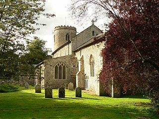
Hamstreet is a village in Kent, in South East England.

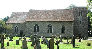
Warehorne is a village and civil parish in the south of the Ashford Borough of Kent, England. It is a scattered community centred on the Hamstreet to Tenterden road (B2067) around seven miles SSW of Ashford. The Royal Military Canal passes through the south of the civil parish.
Ruckinge is a village and civil parish in south Kent centred 5.5 miles (8.9 km) south of Ashford on the B2067 Hamstreet to Hythe road, with two settled neighbourhoods. It is, broadly defined, a narrow, fairly large rural parish of land which is about one quarter woodland.
Kenardington is a small clustered village and the centre of a relatively small rural civil parish of the same name, in the Ashford District of Kent, England. The village is centred 8 miles (13 km) southwest of Ashford on the B2067 Hamstreet to Tenterden road.
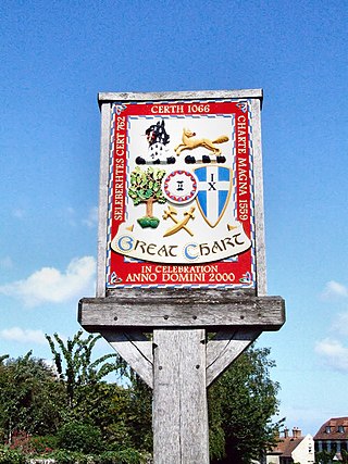
Great Chart is a village in the civil parish of Great Chart with Singleton in the Ashford Borough of Kent, England. The parish is split between the ancient village of Great Chart and the modern Singleton neighbourhood on the western outskirts of Ashford. The village centre of Great Chart is 2 miles (3.2 km) from the town centre. In 1961 the parish had a population of 969.

Hothfield is a village and civil parish in the Ashford Borough of Kent, England and is 3 miles north-west of Ashford on the A20. It is completely split in two by Hothfield Common.

Rolvenden is a village and civil parish in the Ashford District of Kent, England. The village is centred on the A28 Ashford to Hastings road, 5 miles (8.0 km) south-west of Tenterden.

Kingsnorth is a mixed rural and urban village and relatively large civil parish adjoining Ashford in Kent, England. The civil parish includes the district of Park Farm.

Molash is a civil parish and village in Kent, South East England. It contains a small part of an Area of Outstanding Natural Beauty (AONB) - the North Downs - and is on the A252 road between Canterbury, Ashford and Faversham. Each of these is centred 7 miles (11 km) away.
Smeeth is a mostly agricultural land use village and civil parish, centred 4 miles (6.4 km) east of Ashford in the Ashford Borough of Kent, England.

Woodchurch is a Kent village, the largest civil parish in the Borough of Ashford. It is centred 6 miles (9.7 km) from the market town of Ashford and 4 miles (6 km) from the Cinque Ports town of Tenterden, in Kent, South East England.

Snave is a very small hamlet on Romney Marsh in Kent, England centred close to the A2070 road 8 miles (13 km) south of Ashford. Its buildings are a few houses, barns and store sheds and the church of St Augustine which holds one service per year at harvest festival. In spring, the churchyard is heavily clad in daffodils. The church falls under the ecclesiastical parish of Orlestone with Snave, in the Diocese of Canterbury, but the civil parish administering local services is Brenzett.

Brenzett is a village and civil parish in the Folkestone and Hythe District of Kent, England. The village lies on the Romney Marsh, three miles (4.8 km) west of New Romney. The population of the civil parish includes the hamlet of Snave.

