South Cadbury is a village in the civil parish of South Cadbury and Sutton Montis, in the South Somerset council area of the English county of Somerset. The parish includes the village of Sutton Montis.

A civil parish is a country subdivision, forming the lowest unit of local government in England. There are 333 civil parishes in the ceremonial county of Cheshire, most of the county being parished. Cheshire East unitary authority is entirely parished. At the 2001 census, there were 565,259 people living in 332 parishes, accounting for 57.5 per cent of the county's population.

A civil parish is a subnational entity, forming the lowest unit of local government in England. There are 219 civil parishes in the ceremonial county of Lancashire; Blackpool is completely unparished; Pendle and Ribble Valley are entirely parished. At the 2001 census, there were 587,074 people living in the 219 parishes, accounting for 41.5 per cent of the county's population.

A civil parish is a subnational entity, forming the lowest unit of local government in England. There are 101 civil parishes in the ceremonial county of West Yorkshire, most of the county being unparished. At the 2001 census, there were 557,369 people living in the parishes, accounting for 26.8 per cent of the county's population.

A civil parish is a subnational entity, forming the lowest unit of local government in England. There are 21 civil parishes in the ceremonial county of West Midlands, most of the county being unparished; Dudley, Sandwell, Walsall and Wolverhampton are completely unparished. At the 2001 census, there were 89,621 people living in the parishes, accounting for 3.5 per cent of the county's population.

A civil parish is a country subdivision, forming the lowest unit of local government in England. There are 22 civil parishes in the ceremonial county of Merseyside, most of the county being unparished; Liverpool and Wirral are completely unparished. At the 2001 census, there were 177,663 people living in the parishes, accounting for 13.0 per cent of the county's population.

Marple Bridge is a district of Marple in the Metropolitan Borough of Stockport, Greater Manchester, England; it is sited on the River Goyt, which runs through the centre of the village.

Barling is a village and former civil parish, now in the civil parish of Barling Magna in Essex, England. It is located approximately 6 km (3.7 mi) northeast of Southend-on-Sea and is 29 km (18 mi) southeast from the county town of Chelmsford. The village is in the district of Rochford and in the parliamentary constituency of Rochford & Southend East. There is a Parish Council of Barling Magna. The village is served by one primary school, Barling Magna Primary Academy.
Mablethorpe and Sutton is a civil parish and town in East Lindsey, Lincolnshire, England. It is on the North Sea coast and includes Mablethorpe, Trusthorpe, Sutton-on-Sea and Sandilands along with the inland village of Thorpe. According to the 2001 census it had a population of 11,780, increasing to 12,531 at the 2011 Census.

Sutton and Cheam was a local government district in north east Surrey, England from 1882 to 1965.

Sutton-on-the-Hill is a parish in south Derbyshire eight miles (13 km) west of Derby. The population of the civil parish taken at the 2011 Census was 123. The village is widely spread out and contains both a church and a chapel. It was described as "a parish, with two townships and a hamlet" in the 1870s. Now it has no shop or post office and limited public transport links.

John Port Spencer Academy, formerly known as John Port School, is an academy and secondary school in the village of Etwall, Derbyshire, England.
Osleston is a hamlet which together with Thurvaston makes up the parish of Osleston and Thurvaston. The civil parish population at the 2011 Census was 267. It is 7.5 miles (12.1 km) north west of Derby.
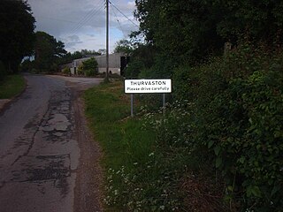
Thurvaston is a small village in South Derbyshire. In 1970 the population was put at 200. This represents a general fall since 1871 when the population was just below 400. As at the census 2011 the population is now listed in the civil parish of Osleston and Thurvaston.

Sutton Howgrave is a village in the Hambleton District of North Yorkshire, England. It is the only village in the civil parish of Sutton with Howgrave. The population of the parish was estimated at 70 in 2014.

Hoon is a civil parish within the South Derbyshire district, which is in the county of Derbyshire, England. It is a predominantly rural area with few residences or farms, Alongside with neighbouring Hatton village, it had a population of 2,785 residents in 2011. The parish is 110 miles (180 km) north west of London, 8 miles (13 km) south west of the county city of Derby, and 5 miles (8.0 km) north of the nearest market town of Burton-on-Trent in Staffordshire. It shares a border with the parishes of Church Broughton, Hatton, Hilton, Marston on Dove, Sutton on the Hill, as well as Tutbury.
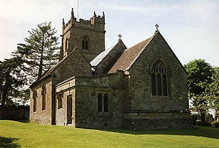
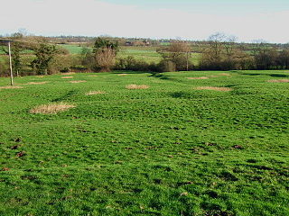
Osleston and Thurvaston is a civil parish in the South Derbyshire district of Derbyshire, England. The parish contains six listed buildings that are recorded in the National Heritage List for England. All the listed buildings are designated at Grade II, the lowest of the three grades, which is applied to "buildings of national importance and special interest". The parish contains the villages of Osleston and Thurvaston and is otherwise rural. The listed buildings consist of three farmhouses, a house with an attached outbuilding, a well house, and a chapel.
