Otterburn Training Area

Last updated

Otterburn Training Area
Otterburn
No way in - geograph.org.uk - 162730.jpg
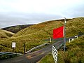
The southern entrance to Otterburn MoD camp
Northumberland UK location map.svg
Red pog.svg
Otterburn Training Area
Location within Northumberland
Coordinates 55°22′10″N2°18′20″W / 55.36944°N 2.30556°W / 55.36944; -2.30556
TypeTraining Area
Site information
Owner Ministry of Defence
OperatorFlag of the British Army.svg  British Army
Site history
Built1911
Built for War Office
In use1911 – present

The Otterburn Army Training Estate is a military training area near Otterburn, Northumberland, in northern England. It is owned by the Ministry of Defence (MoD) and operated by Landmarc on contract from the MoD's Defence Infrastructure Organisation. [1]

Contents

History

The site was established in 1911 [2] and covers about 242 square kilometres (93 sq mi) of the southern Cheviot Hills, 23% of the Northumberland National Park. [3] The National Park was established in 1956, 45 years after establishment of the Artillery Range. [4]

Otterburn is the UK's largest firing range, and is in frequent use. The ranges are used by AS-90 artillery and M270 Multiple Launch Rocket Systems; Otterburn is the only place in the UK where the MLRS can be fired, requiring an 11 mile long by 2 mile wide firing range. [2] [5] Because of the danger posed by live fire exercises, recreational use of the area is restricted, although it is possible for the public to use some parts of the estate subject to the relevant bylaws. The MoD publishes a booklet, Walks on Ministry of Defence Lands, which offers advice on this. [6]

Related Research Articles

<span class="mw-page-title-main">Ministry of Defence (United Kingdom)</span> UK Government department responsible for defence

The Ministry of Defence is a ministerial department of the Government of the United Kingdom. It is responsible for implementing the defence policy set by the government and serves as the headquarters of the British Armed Forces.

<span class="mw-page-title-main">Cape Wrath</span> Cape in Scotland

Cape Wrath is a cape in the Durness parish of the county of Sutherland in the Highlands of Scotland. It is the most north-westerly point in Great Britain.

<span class="mw-page-title-main">Holbeach Air Weapons Range</span> Military range in Lincolnshire, England

Holbeach Air Weapons Range is a United Kingdom Ministry of Defence academic air weapons range (AWR) situated between Boston and King's Lynn in the civil parish of Gedney on The Wash, in Lincolnshire, eastern England.

<span class="mw-page-title-main">Defence Infrastructure Organisation</span> Estate management organisation of the Ministry of Defence in the United Kingdom

Defence Infrastructure Organisation (DIO) is an operating arm of the Ministry of Defence (MoD) in the United Kingdom, which is responsible for the built and rural estate. Its chief executive is Mike Green.

<span class="mw-page-title-main">Penally</span> Village, parish and community in Wales

Penally is a coastal village, parish and community 1 mile (1.6 km) southwest of Tenby in Pembrokeshire, Wales. The village is known for its Celtic Cross, Penally Abbey, the neighbouring St. Deiniol's Well, WWI Practice trenches, and Penally Training Camp. In the community, though nearer to St Florence than Penally, is Carswell Medieval House, a Grade II* listed building.

Dundrennan Range is a weapons testing range on the Solway Firth, near Kirkcudbright in Dumfries and Galloway, in south west Scotland, it is part of the Ministry of Defence's Kirkcudbright Training Area.

<span class="mw-page-title-main">Donna Nook Air Weapons Range</span> Military range in Lincolnshire, England

Donna Nook Air Weapons Range is a Ministry of Defence air weapons range in East Lindsey, Lincolnshire, England. The range, as well as a now defunct airfield and radar station, were previously operated by the Royal Air Force and known as RAF Donna Nook.

<span class="mw-page-title-main">RAF Manorbier</span> Ministry of Defense High Velocity Missile range in Pembrokeshire, Wales

Royal Air Force Manorbier, or more simply RAF Manorbier, was a Royal Air Force airfield near Manorbier, Pembrokeshire, Wales. The site was first used in 1933 as a mixed civilian/military airfield and was the base for 'Y' Flight of No. 1 Anti-Aircraft Co-operation Unit RAF in 1937, using de Havilland DH.82 Queen Bee unmanned radio-controlled target drone. The airfield was passed on to the War Office in September 1946.

<span class="mw-page-title-main">Epynt Way</span>

The Epynt Way is a long-distance path created by the Ministry of Defence in 2004 around the perimeter of its 'Sennybridge Training Area (SENTA)' and artillery range on Mynydd Epynt in Powys, Wales. There is, understandably, virtually no public access across the land used by the MoD, pre-existing public rights of way and public roads having been closed, with only one or two exceptions. The establishment of the Epynt Way, section by section in recent years has gone some way to compensating for that reduction in public access across the area.

<span class="mw-page-title-main">Military training area</span> Overview of military training areas by country

A military training area, training area or training centre (Canada) is land set aside specifically to enable military forces to train and exercise for combat. Training areas are usually out of bounds to the general public, but some have limited access when not in use. As well as their military function, they often serve as important wildlife refuges. They are distinct from proving grounds which are designed for purposes such as testing weaponry or equipment.

<span class="mw-page-title-main">Dartmoor Training Area</span> Military training area in Devon, England

The Dartmoor Training Area (DTA) is a military training area on Dartmoor in Devon in southwest England. The area consists of approximately 13,000 hectares in the Dartmoor National Park.

<span class="mw-page-title-main">Castlemartin Training Area</span> Ministry of Defence direct-fire AFV live gunnery range in Pembrokeshire, Wales

Castlemartin Training Area is a British Army military training area and armoured fighting vehicle range located in the Welsh county of Pembrokeshire. It was originally established for tank training by the Royal Armoured Corps in 1938. The training area is located within the Pembrokeshire Coast National Park, on the South Pembrokeshire coast.

<span class="mw-page-title-main">Cheviot Hills</span> Upland between England and Scotland

The Cheviot Hills, or sometimes The Cheviots, are a range of uplands straddling the Anglo-Scottish border between Northumberland and the Scottish Borders. The English section is within the Northumberland National Park. The range includes The Cheviot, plus Hedgehope Hill to the east, Windy Gyle to the west, and Cushat Law and Bloodybush Edge to the south.

<span class="mw-page-title-main">Salisbury Plain Training Area</span> British military training ground

The Salisbury Plain Training Area is a large expanse of land on Salisbury Plain which is managed by the Defence Infrastructure Organisation on behalf of the Ministry of Defence.

Otterburn Tower is a Grade II listed castellated, three star country house hotel in Otterburn, Northumberland. It is set in 32 acres (13 ha) of deer park and woodland in the Northumberland National Park in northeastern England. Founded by a cousin of William the Conqueror in 1086, it was later owned by the Clan Hall, before being rebuilt in 1830 by Thomas James, a magistrate, on the site and using some of the stones from Otterburn Castle. Nearby Otterburn Hall was built in 1870 on land given to a Lord Douglas as recompense for the death of his ancestor James Douglas, 2nd Earl of Douglas in the Battle of Otterburn.

<span class="mw-page-title-main">Otterburn Hall</span> Country house and estate in Northumberland, England

Otterburn Hall is an English country house and estate in Otterburn, Northumberland. It is situated in 500 acres (200 ha) of deer park and woodland in the Northumberland National Park, northeastern England. The building was constructed in 1870 for Lord James Douglas, the land given to him as recompense for the death of Lord James Douglas, who fought at the Battle of Otterburn, and was killed near Otterburn Tower, itself founded in 1086, and rebuilt in 1830. Both Otterburn Hall and Otterburn Castle have been seats of landed gentry.

Defence Training Estate is an organisation within the United Kingdom Ministry of Defence. It is the operating division of the Defence Infrastructure Organisation, and is responsible for the management of the 78% of the MoD's estate allocated as Training Areas and Ranges. It provides sufficient and suitable estate to support the training requirements of the British Armed Forces, whilst ensuring environmental management and appropriate historical and archaeological preservation.

<span class="mw-page-title-main">MOD Shoeburyness</span> Military installation

MoD Shoeburyness is a military installation at Pig's Bay near Shoeburyness in Essex.

This is the structure of the British Armed Forces, as of October 2021.

References

  1. Frances Perraudin (24 August 2016). "Tributes paid to soldier killed in Otterburn live firing exercise". The Guardian .
  2. 1 2 "DTE Otterburn Public Information Leaflet" (PDF). Ministry of Defence. 4 March 2016.
  3. "Otterburn Ranges". Northumberland National Park. Retrieved 27 June 2018.
  4. "About us". Northumberland National Park. Retrieved 6 May 2024.
  5. Nicholas Schoon (26 April 1997). "Travel: Tanks for the wildlife". The Independent . Archived from the original on 2 December 2014.
  6. Walking guides on the Defence Estate, including Otterburn. Ministry of Defence