Related Research Articles
A Dutch oven or casserole dish (international) is a thick-walled cooking pot with a tight-fitting lid. Dutch ovens are usually made of seasoned cast iron; however, some Dutch ovens are instead made of cast aluminum, or ceramic. Some metal varieties are enameled rather than being seasoned, and these are sometimes called French ovens. The international name casserole dish is from the French casserole which means "cooking pot". They are similar to both the Japanese tetsunabe and the sač, a traditional Balkan cast-iron oven, and are related to the South African potjie, the Australian Bedourie oven and Spanish cazuela.

The Nokia 7610 is a Symbian OS smartphone introduced at CEBIT on 18 March 2004. It features a 1 megapixel camera with a design similar to 2003's Nokia 7600. It went on sale with a list price of €500 and came with a 64 MB MMC card. It runs on Nokia's Series 60 platform. It was marketed as a stylish and imaging device, and allowed direct Bluetooth photo printing. End-users can also use the 7610 with Nokia Lifeblog. Other pre-installed applications include the Opera Mobile web browser, RealPlayer pand Kodak Photo Sharing.

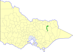
The County of Bogong is one of the 37 counties of Victoria which are part of the cadastral divisions of Australia, used for land titles. It is located south of the Murray River, east of the Ovens River, and west of the Mitta Mitta River. Mount Bogong is located there, the highest mountain in Victoria. The county was proclaimed in 1871.

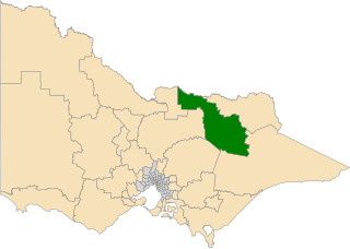
The County of Delatite is one of the 37 counties of Victoria which are part of the cadastral divisions of Australia, used for land titles. It is located south west of Ovens River. Wangaratta is partly located in the county, at the northern end.
The Electoral district of Wangaratta was an electoral district of the Victorian Legislative Assembly. It was created in the redistribution of 1904, the Electoral district of Wangaratta and Rutherglen being abolished.

The Shire of Yarrawonga was a local government area on the Murray River, in the Goulburn Valley region, about 260 kilometres (162 mi) northeast of Melbourne, the state capital of Victoria, Australia. The shire covered an area of 626.78 square kilometres (242.0 sq mi), and existed from 1891 until 1994.

The Shire of Bright was a local government area about 280 kilometres (174 mi) east-northeast of Melbourne, the state capital of Victoria, Australia. The shire covered an area of 3,108 square kilometres (1,200.0 sq mi), and existed from 1862 until 1994.
The Shire of Myrtleford was a local government area about 280 kilometres (174 mi) northeast of Melbourne, the state capital of Victoria, Australia. The shire covered an area of 800 square kilometres (308.9 sq mi), and existed from 1960 until 1994.

The Shire of Wangaratta was a local government area about 260 kilometres (162 mi) northeast of Melbourne, the state capital of Victoria, Australia. The shire covered an area of 919.24 square kilometres (354.9 sq mi), and existed from 1863 until 1994. The Shire did not include Wangaratta itself, which was governed by a separate local government.

The City of Wangaratta was a local government area located about 260 kilometres (162 mi) northeast of Melbourne, the state capital of Victoria, Australia. The city covered an area of 25.53 square kilometres (9.9 sq mi), and existed from 1863 until 1994. It was responsible for the urban area of Wangaratta.

NGC 5890 is an unbarred lenticular galaxy in the constellation Libra. It was discovered in April 1785 by Ormond Stone.

The Warby–Chiltern Box–Ironbark Region comprises a cluster of separate blocks of remnant box-ironbark forest habitat, with a collective area of 253 km2, in north eastern Victoria, south-eastern Australia.
North Eastern Province was an electorate of the Victorian Legislative Council. It was created in the redistribution of provinces in 1882 when the original provinces of Central and Eastern Provinces were abolished. The new North Eastern, North Central, Melbourne East, Melbourne North, Melbourne South and Melbourne West Provinces were then created.

The Murray was an electoral district of the Legislative Assembly in the Australian colony of Victoria from 1856 to 1877.

The Electoral district of Murray was one of the sixteen electoral districts of the original unicameral Victorian Legislative Council of 1851 to 1856.

Ovens was an electoral district of the Legislative Assembly in the Australian state of Victoria from 1856 to 1927. It was based in northern Victoria, bordered by the Ovens River in the south-west and included the town of Beechworth, Victoria.
Wangaratta and Rutherglen was an electoral district of the Legislative Assembly in the Australian state of Victoria from 1889 to 1904. It was located around the towns of Wangaratta and Rutherglen. When it was abolished in 1904, the new Electoral district of Wangaratta was created; John Bowser was the last member for Wangaratta and Rutherglen and the first for Wangaratta.

The Electoral district of Ovens was an electoral district of the old unicameral Victorian Legislative Council of 1851 to 1856. Victoria being a colony in Australia at the time. Ovens was added to the Council in 1855, along with four other districts.
The electoral district of Ovens Valley is an electoral district of the Victorian Legislative Assembly in Australia. It was created in the redistribution of electoral boundaries in 2013, and came into effect at the 2014 state election.
Montferrand was a fortress in the County of Tripoli, built in 1126.
References
36°35′20″S146°45′40″E / 36.5890°S 146.7610°E
| | This article about a railway station in Victoria (Australia) is a stub. You can help Wikipedia by expanding it. |