
Opak River is a river in central south area of Java island, Indonesia.
The Sembakung River is a river in Borneo that flows from Sabah, Malaysia to North Kalimantan, Indonesia, about 1600 km northeast of the capital Jakarta.
The Liman River is a river in northern Java, Indonesia.
Beet River is a river in northern West Java, Indonesia. It is a tributary of the Citarum River.
Pemali River is a river in northern Central Java, Indonesia, about 250 km east of the capital Jakarta.
Serang River is a river in northern Central Java, Indonesia, about 400 km east of the capital Jakarta. The largest tributary is Lusi River, which discharges into Serang River after passing the city of Purwodadi.
Lusi River is a river in northern Central Java, Indonesia, about 400 km east of the capital Jakarta. It is a tributary of the Serang River, meeting after passing the city of Purwodadi.
The Porong River is a river flowing through Sidoarjo, East Java, Indonesia, about 700 km east of the capital Jakarta. It is one of the main distributary of the Brantas River that discharges into Bali Sea, close to the Madura Strait, and is the main outlet for the Lusi mudflow.
The Widas River is a river in northern East Java, Indonesia. It is a tributary of the Brantas River.
The Setail River is a river in southeastern Java, Indonesia.

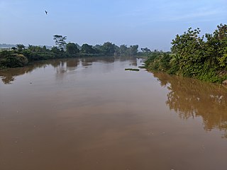
Kaso River, also Ci Kaso, is a river in Sukabumi Regency, West Java, Indonesia, about 140 km south of the capital Jakarta.
The Progo River is a river in southern central Java, Indonesia. The river passes through two provinces; Central Java and Yogyakarta Special Region. The source of the river is on the slopes of Mount Sindoro, Central Java.
The Sanen River is a river in southern East Java province, Java island, Indonesia, about 800 km east of the capital Jakarta.
The Jamboaye River is a river in the province of Aceh in northern Sumatra, Indonesia, about 1600 km northwest of the capital Jakarta.
Tungkal River is a river in Jambi province, Sumatra island, Indonesia, about 700 km northwest of the capital Jakarta.
The Bila River is a river in northern Sumatra, Indonesia, about 1200 km northwest of the capital Jakarta. It is a tributary of the Barumun River.
The Jelai-Bila River is a river of Central Kalimantan, Indonesia, about 600 km northeast of the capital Jakarta. Much of the land between the Lamandau River and the Jelai-Bila River is developed by agriculture.
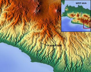
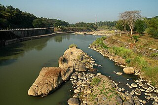
The Kaso River, also Ci Kaso, is a river in the Garut Regency of West Java, Indonesia, about 190 km southeast of the capital Jakarta. Coal-bearing sandstones, clays and limestones are typical geological traits of the Bandung area of southern Java. It flows past Pameungpeuk before flowing into the Indian Ocean.
The Tuntang is a major river of northern Central Java, Indonesia, about 400 km east of the capital Jakarta. It connects Lake Rawa Pening to the Java Sea, east of Semarang. There is a hydroelectric powerstation on the river near the lake.

The Ci Banten, or Ci Peteh, is a river in Banten province on the island of Java, Indonesia.

