PAGASA Planetarium

Last updated
PAGASA Planetarium
PAGASA Planetarium
Coordinates 14°38′41″N121°02′36″E / 14.6446°N 121.0432°E / 14.6446; 121.0432 Coordinates: 14°38′41″N121°02′36″E / 14.6446°N 121.0432°E / 14.6446; 121.0432
Type Planetarium
Owner Philippine Atmospheric, Geophysical and Astronomical Services Administration
Building details
PAGASA Planetarium
General information
StatusCompleted
LocationPAGASA Science Garden
AddressAgham Road
Town or cityQuezon City
CountryPhilippines
InauguratedSeptember 1977 (1977-09)

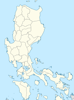
The PAGASA Planetarium is a planetarium within the grounds of the PAGASA Science Garden situated along Agham Road in Quezon City, Metro Manila, Philippines. [1] It is operated and owned by the Philippine Atmospheric, Geophysical and Astronomical Services Administration (PAGASA).

The planetarium was built in September 1977. [2] The facility is managed by PAGASA's Astronomy Research and Development Section (AsRDS) and Atmospheric, Geophysical and Space Sciences Branch (AGSSB). The planetarium has a maximum capacity of 100 people. [3]

In 1999, the AsRDS acquired a mobile planetarium which can be transported in areas outside Manila upon request. [3] The mobile planetarium has a maximum capacity of 50 people. [4]

Minor renovations were done in 2005 which includes the replacement of chairs which were in poor condition. [3]

See also

Related Research Articles

<span class="mw-page-title-main">2000 Pacific typhoon season</span> Typhoon season in the Western Pacific Ocean

The 2000 Pacific typhoon season marked the first year using names contributed by the World Meteorological Organization. It was a rather below-average season, producing a total of 23 tropical storms, 13 typhoons and 4 intense typhoons. The season ran throughout 2000, though typically most tropical cyclones develop between May and October. The season's first named storm, Damrey, developed on May 7, while the season's last named storm, Soulik, dissipated on January 4 of the next year.

<span class="mw-page-title-main">1974 Pacific typhoon season</span> Typhoon season in the Pacific Ocean

The 1974 Pacific typhoon season was the first season on record to not feature a Category 5 equivalent super typhoon; a feat later repeated by the 1977 and 2017 seasons. Even so, the season was overly active, with 32 tropical storms and 16 typhoons being developed this year. It has no official bounds; it ran year-round in 1974, but most tropical cyclones tend to form in the northwestern Pacific Ocean between June and December. These dates conventionally delimit the period of each year when most tropical cyclones form in the northwestern Pacific Ocean.

<span class="mw-page-title-main">1973 Pacific typhoon season</span> Time of tropical cyclone formation in the western Pacific during 1973

The 1973 Pacific typhoon season has no official bounds; it ran year-round in 1973, but most tropical cyclones tend to form in the northwestern Pacific Ocean between June and December. These dates conventionally delimit the period of each year when most tropical cyclones form in the northwestern Pacific Ocean.

<span class="mw-page-title-main">PAGASA</span> National weather, climate, and astronomy bureau of the Philippines

The Philippine Atmospheric, Geophysical and Astronomical Services Administration is the National Meteorological and Hydrological Services (NMHS) agency of the Philippines mandated to provide protection against natural calamities and to insure the safety, well-being and economic security of all the people, and for the promotion of national progress by undertaking scientific and technological services in meteorology, hydrology, climatology, astronomy and other geophysical sciences. Created on December 8, 1972, by reorganizing the Weather Bureau, PAGASA now serves as one of the Scientific and Technological Services Institutes of the Department of Science and Technology.

Typhoons in the Philippines can occur any time of the year, with the months of June to September being most active, with August being the most active individual month and May the least active. Approximately 20 tropical cyclones enter the Philippine area of responsibility yearly, an area which incorporates parts of the Pacific Ocean, the South China Sea, and the Philippine Archipelago. In each year, ten cyclones are usually expected to be typhoons, with five having the potential to be destructive ones. According to a 2013 Time Magazine article, the Philippines is "the most exposed country in the world to tropical storms". In the Philippine languages, tropical cyclones are generally called bagyo.

<span class="mw-page-title-main">Philippine Area of Responsibility</span> Philippine weather forecasting domain in the Northwest Pacific

The Philippine Area of Responsibility (PAR) is an area in the Northwestern Pacific where PAGASA, the Philippines' national meteorological agency, monitors weather occurrences. Significant weather disturbances, specifically tropical cyclones that enter or develop in the PAR, are given Philippine-specific names.

<span class="mw-page-title-main">2008 Pacific typhoon season</span> Typhoon season in the Western Pacific Ocean

The 2008 Pacific typhoon season was a below average season which featured 22 named storms, eleven typhoons, and two super typhoons. The season had no official bounds; it ran year-round in 2008, but most tropical cyclones tend to form in the northwestern Pacific Ocean between May and November. These dates conventionally delimit the period of each year when most tropical cyclones form in the northwestern Pacific Ocean.

<span class="mw-page-title-main">Philippine Institute of Volcanology and Seismology</span> Government agency in the Philippines

The Philippine Institute of Volcanology and Seismology is a Philippine national institution dedicated to provide information on the activities of volcanoes, earthquakes, and tsunamis, as well as other specialized information and services primarily for the protection of life and property and in support of economic, productivity, and sustainable development. It is one of the service agencies of the Department of Science and Technology.

<span class="mw-page-title-main">Climate of the Philippines</span> Climatic features of the Philippines

The Philippines has five types of climates: tropical rainforest, tropical monsoon, tropical savanna, humid subtropical and oceanic characterized by relatively high temperature, oppressive humidity and plenty of rainfall. There are two seasons in the country, the wet season and the dry season, based upon the amount of rainfall. This is also dependent on location in the country as some areas experience rain all throughout the year. Based on temperature, the warmest months of the year are March through October; the winter monsoon brings cooler air from November to February. May is the warmest month, and January, the coolest.

<span class="mw-page-title-main">Tropical Storm Maysak (2008)</span> Pacific severe tropical storm in 2008

Severe Tropical Storm Maysak, known in the Philippines as Tropical Storm Quinta-Siony, was recognised as the 19th tropical storm by the Japan Meteorological Agency. It was also recognised as the 24th tropical depression and the 22nd tropical storm by the Joint Typhoon Warning Center of the 2008 Pacific typhoon season.

<span class="mw-page-title-main">Tropical Depression Auring (2009)</span> Pacific tropical depression in 2009

Tropical Depression Auring formed as a tropical disturbance late on December 30, 2008, to the southeast of Manila in the Philippines. Over the next few days the disturbance gradually developed before early on January 3, the Philippine Atmospheric, Geophysical and Astronomical Services Administration (PAGASA) and the Japan Meteorological Agency (JMA), reported that the disturbance had intensified into the first tropical depression of the season with PAGASA assigning the name Auring to the depression. As the Depression was moving into a high level of vertical wind shear, it did not develop any further and late on January 5 as the baroclinic zone approached Auring, it was downgraded to an area of low pressure by the PAGASA before the JMA followed suit the next day as it was declared as dissipated by the JTWC.

<span class="mw-page-title-main">Timeline of the 2009 Pacific typhoon season</span>

This timeline documents all of the events of the 2009 Pacific typhoon season which was the period that tropical cyclones formed in the Western Pacific Ocean during 2009, with most of the tropical cyclones forming between May and November. The scope of this article is limited to the Pacific Ocean, north of the equator between 100°E and the International Date Line. Tropical storms that form in the entire Western Pacific basin are assigned a name by the Japan Meteorological Agency. Tropical depressions that form in this basin are given a number with a "W" suffix by the United States' Joint Typhoon Warning Center. In addition, the Philippine Atmospheric, Geophysical and Astronomical Services Administration (PAGASA) assigns names to tropical cyclones that enter or form in the Philippine area of responsibility. These names, however, are not in common use outside of the Philippines.

Prisco Duarte Nilo is a Filipino meteorologist. He is the former administrator of the Philippine Atmospheric, Geophysical and Astronomical Services Administration (PAGASA).

<span class="mw-page-title-main">Tropical Storm Rumbia (2013)</span> Pacific severe tropical storm in 2013

Severe Tropical Storm Rumbia, known in the Philippines as Tropical Storm Gorio, was a tropical cyclone that brought widespread flooding in areas of the Philippines and China late June and early July 2013. The sixth internationally named storm of the season, Rumbia formed from a broad area of low pressure situated in the southern Philippine Sea on June 27. Steadily organizing, the initial tropical depression moved towards the northwest as the result of a nearby subtropical ridge. On June 28, the disturbance strengthened to tropical storm strength, and subsequently made its first landfall on Eastern Samar in the Philippines early the following day. Rumbia spent roughly a day moving across the archipelago before emerging into the South China Sea. Over open waters, Rumbia resumed strengthening, and reached its peak intensity with winds of 95 km/h (50 mph) on July 1, ranking it as a severe tropical storm. The tropical cyclone weakened slightly before moving ashore the Leizhou Peninsula late that day. Due to land interaction, Rumbia quickly weakened into a low pressure area on July 2 and eventually dissipated soon afterwards.

<span class="mw-page-title-main">Typhoon Nari (2013)</span> Pacific typhoon in 2013

Typhoon Nari, known in the Philippines as Typhoon Santi, was a strong and deadly tropical cyclone that first struck Luzon before striking Vietnam. The storm was the 41st depression and the 8th typhoon in the 2013 typhoon season. Typhoon Nari was a deadly typhoon that made landfall in the Philippines and Vietnam. Nari made landfall on October 14, 2013 as a moderate category 1 typhoon.

<span class="mw-page-title-main">Effects of the 2013 Pacific typhoon season in the Philippines</span>

The effects of the 2013 Pacific typhoon season in the Philippines were considered some of the worst in decades. Throughout the year, series of typhoons impacted the country, with the worst damage especially death toll from Typhoon Haiyan during November.

<span class="mw-page-title-main">Typhoon Koppu</span> Pacific typhoon in 2015

Typhoon Koppu, known in the Philippines as Typhoon Lando, was a powerful and devastating tropical cyclone that struck Luzon in October 2015. It was the twenty-fourth named storm and the fifteenth typhoon of the annual typhoon season. Similar to Goni earlier in the year, Koppu originated from a tropical disturbance east of the Mariana Islands on October 10. Moving briskly west, the system consolidated into a tropical depression the following day and further into a tropical storm on October 13. Situated over the warm waters of the Philippine Sea, Koppu quickly deepened. The storm reached its peak intensity on October 17 with ten-minute sustained winds of 185 km/h (115 mph) according to the Japan Meteorological Agency (JMA). The Joint Typhoon Warning Center assessed Koppu to have been a Category 4-equivalent super typhoon with one-minute sustained winds of 240 km/h (150 mph). The storm subsequently made landfall at this strength near Casiguran, Philippines. Rapid weakening ensued due to interaction with the mountainous terrain of Luzon and the disheveled core of Koppu emerged over the South China Sea on October 19. Unfavorable environmental conditions inhibited reorganization and the system diminished to a tropical depression on October 21.

<span class="mw-page-title-main">PAGASA Observatory</span> Astronomical observatory in Quezon City

The PAGASA Astronomical Observatory also known as the PAGASA Observatory is an astronomical observatory in Quezon City, Metro Manila, Philippines within the University of the Philippines Diliman campus. Established in 1954 and managed by the Philippine Atmospheric, Geophysical and Astronomical Services Administration (PAGASA), the facility hosts the largest operational telescope in the Philippines.

<span class="mw-page-title-main">Tropical Cyclone Wind Signals</span> Weather alerts in the Philippines

The Tropical Cyclone Wind Signals are tropical cyclone alert levels issued by the Philippine Atmospheric, Geophysical, and Astronomical Services Administration (PAGASA) to areas within the Philippines that may be affected by tropical cyclone winds and their associated hazards.

References

  1. Flores, Helen (15 February 2016). "Pagasa offers free planetarium shows". Philippine Star. Retrieved 19 August 2016.
  2. "Astronomy in the Philippines - Historical Background". Philippine Atmospheric, Geophysical and Astronomical Services Administration. Retrieved 19 August 2016.
  3. 1 2 3 "Astronomy in the Philippines - Resources". Philippine Atmospheric, Geophysical and Astronomical Services Administration. Retrieved 19 August 2016.
  4. "Planetarium". Philippine Atmospheric, Geophysical and Astronomical Services Administration. Retrieved 19 August 2016.