
Geodesy or geodetics is the science of measuring and representing the geometry, gravity, and spatial orientation of the Earth in temporally varying 3D. It is called planetary geodesy when studying other astronomical bodies, such as planets or circumplanetary systems. Geodesy is an earth science and many consider the study of Earth's shape and gravity to be central to that science. It is also a discipline of applied mathematics.

The Transit system, also known as NAVSAT or NNSS, was the first satellite navigation system to be used operationally. The radio navigation system was primarily used by the U.S. Navy to provide accurate location information to its Polaris ballistic missile submarines, and it was also used as a navigation system by the Navy's surface ships, as well as for hydrographic survey and geodetic surveying. Transit provided continuous navigation satellite service from 1964, initially for Polaris submarines and later for civilian use as well. In the Project DAMP Program, the missile tracking ship USAS American Mariner also used data from the satellite for precise ship's location information prior to positioning its tracking radars.
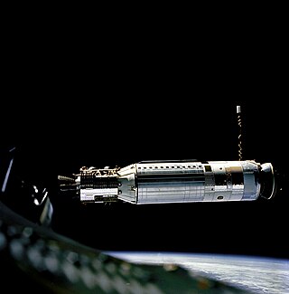
The RM-81 Agena was an American rocket upper stage and satellite bus which was developed by Lockheed Corporation initially for the canceled WS-117L reconnaissance satellite program. Following the division of WS-117L into SAMOS and Corona for image intelligence, and MIDAS for early warning, the Agena was later used as an upper stage, and an integrated component, for several programs, including Corona reconnaissance satellites and the Agena Target Vehicle used to demonstrate rendezvous and docking during Project Gemini. It was used as an upper stage on the Atlas, Thor, Thorad and Titan IIIB rockets, and considered for others including the Space Shuttle and Atlas V. A total of 365 Agena rockets were launched between February 28, 1959 and February 1987. Only 33 Agenas carried NASA payloads and the vast majority were for DoD programs.

In satellite laser ranging (SLR) a global network of observation stations measures the round trip time of flight of ultrashort pulses of light to satellites equipped with retroreflectors. This provides instantaneous range measurements of millimeter level precision which can be accumulated to provide accurate measurement of orbits and a host of important scientific data. The laser pulse can also be reflected by the surface of a satellite without a retroreflector, which is used for tracking space debris.

Project Echo was the first passive communications satellite experiment. Each of the two American spacecraft, launched in 1960 and 1964, were metalized balloon satellites acting as passive reflectors of microwave signals. Communication signals were transmitted from one location on Earth and bounced off the surface of the satellite to another Earth location.
Satellite geodesy is geodesy by means of artificial satellites—the measurement of the form and dimensions of Earth, the location of objects on its surface and the figure of the Earth's gravity field by means of artificial satellite techniques. It belongs to the broader field of space geodesy. Traditional astronomical geodesy is not commonly considered a part of satellite geodesy, although there is considerable overlap between the techniques.

A geodetic control network is a network, often of triangles, that are measured precisely by techniques of control surveying, such as terrestrial surveying or satellite geodesy. It is also known as a geodetic network, reference network, control point network, or simply control network.
Geodetic astronomy or astronomical geodesy (astro-geodesy) is the application of astronomical methods into geodetic networks and other technical projects of geodesy.

A balloon satellite, sometimes referred to as a "satelloon", is a satellite inflated with gas after it has been put into orbit.
Ajisai is a Japanese satellite sponsored by NASDA, launched in 1986 on the maiden flight of the H-I rocket. It is also known as the Experimental Geodetic Satellite (EGS), as it carries the Experimental Geodetic Payload (EGP).
Stellar triangulation is a method of geodesy and of its subdiscipline space geodesy used to measure Earth's geometric shape. Stars were first used for this purpose by the Finnish astronomer Yrjö Väisälä in 1959, who made astrometric photographs of the night sky at two stations together with a lighted balloon probe between them.

Thor-Agena was a series of orbital launch vehicles. The launch vehicles used the Douglas-built Thor first stage and the Lockheed-built Agena second stages. They are thus cousins of the more-famous Thor-Deltas, which founded the Delta rocket family.
Thor was a US space launch vehicle derived from the PGM-17 Thor intermediate-range ballistic missile. The Thor rocket was the first member of the Delta rocket family of space launch vehicles. The last launch of a direct derivative of the Thor missile occurred in 2018 as the first stage of the final Delta II.
Discoverer 1 was the first of a series of satellites which were part of the CORONA reconnaissance satellite program. It was launched on a Thor-Agena A rocket on 28 February 1959 at 21:49:16 GMT from Vandenberg Air Force Base in California. It was a prototype of the KH-1 satellite, but did not contain either a camera or a film capsule. It was the first satellite launched toward the South Pole in an attempt to achieve a polar orbit, but was unsuccessful. A CIA report, later declassified, concluded that "Today, most people believe the Discoverer 1 landed somewhere near the South Pole".

Discoverer 14, also known as Corona 9009, was a spy satellite used in the Corona program managed by Advanced Research Projects Agency (ARPA) of the Department of Defense and the United States Air Force. On 19 August 1960, usable photographic film images of the Soviet Union taken by the satellite were recovered by a C-119 recovery aircraft. This was the first successful recovery of film from an orbiting satellite and the first mid-air recovery of an object returning from Earth orbit.

ANNA 1B was a United States satellite launched on October 31, 1962, from Cape Canaveral, on a Thor-Ablestar rocket.
Discoverer 15, also known as Corona 9010, was a spy satellite used in the Corona program managed by Advanced Research Projects Agency (ARPA) of the Department of Defense and the United States Air Force. Launched on 13 September 1960, the satellite took reconnaissance photos of the Soviet Union. However, its recoverable film capsule was lost in the Pacific Ocean after reentry outside the recovery zone on 15 September.

Explorer 29, also called GEOS 1 or GEOS A, acronym to Geodetic Earth Orbiting Satellite, was a NASA satellite launched as part of the Explorer program, being the first of the two satellites GEOS. Explorer 29 was launched on 6 November 1965 from Cape Canaveral, Florida, with a Thor-Delta E launch vehicle.
Explorer 36 was a NASA satellite launched as part of the Explorer program, being the second of the two satellites GEOS. Explorer 36 was launched on 11 January 1968 from Vandenberg Air Force Base, with Thor-Delta E1 launch vehicle.


