
Luray is the county seat of Page County, Virginia, United States, in the Shenandoah Valley in the northern part of the Commonwealth. The population was 4,895 at the 2010 census.

Skyline Drive is a 105-mile (169 km) National Parkway that runs the entire length of the National Park Service's Shenandoah National Park in the Blue Ridge Mountains of Virginia, generally along the ridge of the mountains. The drive's northern terminus is at an intersection with U.S. Route 340 (US 340) near Front Royal, and the southern terminus is at an interchange with US 250 near Interstate 64 (I-64) in Rockfish Gap, where the road continues south as the Blue Ridge Parkway. The road has intermediate interchanges with US 211 in Thornton Gap and US 33 in Swift Run Gap. Skyline Drive is part of Virginia State Route 48, which also includes the Virginia portion of the Blue Ridge Parkway, but this designation is not signed.
The term Hòa Bình culture was first used by French archaeologists working in Northern Vietnam to describe Holocene period archaeological assemblages excavated from rock shelters. The related English adjective Hoabinhian became a common term in the English-based literature to describe stone artifact assemblages in Mainland Southeast Asia that contain flaked, cobble artifacts, dated to c. 10,000–2000 BCE. The term was originally used to refer to a specific ethnic group, restricted to a limited period with a distinctive subsistence economy and technology. More recent work uses the term to refer to artifacts and assemblages with certain formal characteristics. However, in 2016 a rockshelter was identified in Yunnan (China), where artifacts belonging to the Hoabinhian technocomplex were recognized. These artifacts date from 41,500 BCE.
Meadowcroft Rockshelter is an archaeological site located near Avella in Jefferson Township, Washington County, Pennsylvania, United States. The site is a rock shelter in a bluff overlooking Cross Creek, and contains evidence that the area may have been continually inhabited for more than 19,000 years. If accurately dated, it would be one of the earliest known sites with evidence of a human presence and continuous human occupation in the New World.

Gatecliff Rockshelter (26NY301) is a major archaeological site in the Great Basin area of the western United States that provides remarkable stratigraphy; it has been called the "deepest archaeological rock shelter in the Americas". Located in Mill Canyon of the Toquima Range in the Monitor Valley of central Nevada, Gatecliff Rockshelter has an elevation of 7,750 feet (2,360 m). David Hurst Thomas discovered Gatecliff Rockshelter in 1970 and began excavations in 1971. Full scale excavations occurred at Gatecliff Rockshelter for about seven field seasons in which nearly 33 feet (10 m) of sediments were exposed for a well-defined stratigraphic sequence. The well-preserved artifacts and undisturbed sediments at Gatecliff Rockshelter provides data and information have been applied to a range of research topics. Based on the analysis of the artifacts at Gatecliff Rockshelter, it can be determined that it was most likely a short-term field camp throughout prehistory. The latest evidence for human usage at Gatecliff occurs between ca. 5500 B.P. to 1250 B.P.

The Thunderbird Archaeological District, near Limeton, Virginia, is an archaeological district described as consisting of "three sites—Thunderbird Site, the Fifty Site, and the Fifty Bog—which provide a stratified cultural sequence spanning Paleo-Indian cultures through the end of Early Archaic times with scattered evidence of later occupation."
Mumba Cave, located near the highly alkaline Lake Eyasi in Karatu District, Arusha Region, Tanzania. The cave is a rich archaeological site noted for deposits spanning the transition between the Middle Stone Age and Late Stone Age in Eastern Africa. The transitional nature of the site has been attributed to the large presence of its large assemblage of ostrich eggshell beads and more importantly, the abundance of microlith technology. Because these type artifacts were found within the site it has led archaeologists to believe that the site could provide insight into the origins of modern human behavior. The cave was originally tested by Ludwig Kohl-Larsen and his wife Margit in their 1934 to 1936 expedition. They found abundant artifacts, rock art, and burials. However, only brief descriptions of these findings were ever published. That being said, work of the Kohl-Larsens has been seen as very accomplished due to their attention to detail, especially when one considers that neither was versed in proper archaeological techniques at the time of excavation. The site has since been reexamined in an effort to reanalyze and complement the work that has already been done, but the ramifications of improper excavations of the past are still being felt today, specifically in the unreliable collection of C-14 data and confusing stratigraphy.
Barton Village Site, also known as the Herman Barton Indian Village Archeological Site, is a large, multi-component archaeological site near Cumberland in Allegany County, Maryland.

Franktown Cave is located 25 miles south of Denver, Colorado on the north edge of the Palmer Divide. It is the largest rock shelter documented on the Palmer Divide, which contains artifacts from many prehistoric cultures. Prehistoric hunter-gatherers occupied Franktown Cave intermittently for 8000 years beginning about 6400 B.C. The site held remarkable lithic and ceramic artifacts, but it is better known for its perishable artifacts, including animal hides, wood, fiber and corn. Material goods were produced for their comfort, task-simplification and religious celebration. There is evidence of the site being a campsite or dwelling as recent as AD 1725.
The Cherry Creek Rockshelter is an archaeological site in central Colorado, located within modern-day Castlewood Canyon State Park near Franktown, Colorado. Current research indicates that it was used by Native American inhabitants beginning in the Archaic period. The site is situated on the Palmer Divide, which allowed for a unique prehistoric environment that contributed to an abundance of food and water sources, as well as lithic materials for tool-making. These factors, combined with the structure and situation of the shelter itself, made the site a particularly attractive environment for prehistoric peoples to settle in. Archaeological study of the site began in 1955, with the most current original research concluding in 2002.

Site AU-154 is an archaeological site in Shenandoah National Park, in Augusta County, Virginia, United States.

The Blackrock Springs Site (44-AU-167) is an archaeological site in Shenandoah National Park, in Augusta County, Virginia, United States.

The Cliff Kill Site (44-MD-138) is an archaeological site in Shenandoah National Park, in Madison County, Virginia, United States. Its name derives from the discoverers' supposition that it was originally used as a buffalo jump.
The Gentle Site (44-MD-112) is an archaeological site in Shenandoah National Park, in Madison County, Virginia, United States.

The Rockhouse Cliffs Rockshelters are a pair of rockshelters in the far southern region of the U.S. state of Indiana. Located amid broken terrain in the Hoosier National Forest, the shelters may have been inhabited for more than ten thousand years by peoples ranging from the Early Archaic period until the twentieth century. As a result of their extensive occupation and their remote location, they are important and well-preserved archaeological sites and have been named a historic site.
The White Site is a prehistoric archaeological site located northeast of Hickman in Fulton County in the southwestern corner of the U.S. state of Kentucky. Discovered in the 1980s, it was occupied during a long period of time by peoples of multiple cultures, and it has been named a historic site.
Craig Run East Fork Rockshelter is a historic archaeological site located near Mills Mountain, Webster County, West Virginia. It is one of a number of prehistoric rock shelters on the Gauley Ranger District, Monongahela National Forest, that are known to have been utilized prehistorically from the Middle Archaic through the Late Woodland period, c. 6000 B.C. – 1200 A.D. In more recent history, the Craig Run rock shelter is known to have served as a stable for a donkey which was employed in the locust post industry.
Laurel Run Rockshelter is a historic archaeological site located near Coe, Webster County, West Virginia. It is one of a number of prehistoric rock shelters on the Gauley Ranger District, Monongahela National Forest, that are known to have been utilized prehistorically from the Middle Archaic through the Late Woodland period, c. 6000 B.C.-1200 A.D. There are some indications that the Laurel Run rock shelter may have been utilized during the Early Archaic period, c. 8000-6000 B. C.

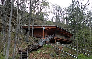
The Hidden Valley Rockshelter (44-BA-31) is a significant archaeological site located near the community of Warm Springs in Bath County, Virginia, United States. A large rockshelter located near the Jackson River, it has been occupied by humans for thousands of years, and it has been named a historic site.
The St. Croix River Access Site is a prehistoric Native American archaeological site on the St. Croix River in Stillwater Township, Minnesota, United States. It consists of a habitation site with a large quantity of stone tool artifacts, occupied from roughly 800 to 1700 CE. It was listed on the National Register of Historic Places in 1984 for having local significance in the theme of archaeology. It was nominated for its scientific potential to illuminate Late Woodland period cultural relationships, lithic technology, and resource use.


