Arunachal Pradesh is a state in Northeastern India. It was formed from the erstwhile North-East Frontier Agency (NEFA) region, and became a state on 20 February 1987. It borders the states of Assam and Nagaland to the south. It shares international borders with Bhutan in the west, Myanmar in the east, and a disputed border with China in the north at the McMahon Line. Itanagar is the state capital of Arunachal Pradesh. Arunachal Pradesh is the largest of the Seven Sister States of Northeast India by area. Arunachal Pradesh shares a 1,129 km border with China's Tibet Autonomous Region.

Ziro is a town and the district headquarters of the Lower Subansiri district in the Indian state of Arunachal Pradesh. It is included the Tentative List for UNESCO's World Heritage Site for the Apatani cultural landscape. The part of the town which is the centre of economic activities and where the administrative offices are located is called as Hapoli or locally known by the Apatanis as "Hao-Polyang".

Itanagar is the capital and largest town of the Indian state of Arunachal Pradesh. The seat of Arunachal Pradesh Legislative Assembly, the seat of government of Arunachal Pradesh, and the seat of Gauhati High Court permanent bench at Naharlagun are all in Itanagar. Being the hub of all the major economic bases, Itanagar along with the adjacent town of Naharlagun comprising the administrative region of Itanagar Capital Complex Region stretching from the Itanagar Municipal limit at Chandranagar Town extended till Nirjuli Town, is a major junction of Cultural, economic, fashion, education and recreational activities.

Lower Subansiri district (Pron:/su:bənˈsɪɹi/) is one of the 25 administrative districts of the state of Arunachal Pradesh in northeastern India.
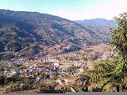
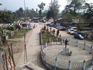
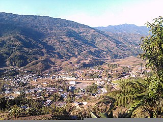
Seppa is the headquarters of the East Kameng district in the state of Arunachal Pradesh in India. Sapla means 'marshy' land in the local dialect. It lies on the bank of Kameng River and there is a helipad there. It is located 160 kilometres (99 mi) from Itanagar and 213 kilometres (132 mi) from Tezpur (Assam) connected by motorable road. The village of Seppa has two out of the sixty Vidhan Sabha Constituencies of Arunachal Pradesh. They are Seppa East and Seppa West.
Tezu is a census town and the headquarters of Lohit district in the Indian state of Arunachal Pradesh. It is the fifth largest town in Arunachal Pradesh and one of its most developed.
Daporijo is a census town in the Upper Subansiri district, Indian state of Arunachal Pradesh in the Northeast of India.

Yingkiong is a town in and the administrative headquarters of Upper Siang district in the Northeast Indian state of Arunachal Pradesh. It is located 250 kilometres (160 mi) north of Itanagar, the capital of the state, and 1 kilometre (0.62 mi) east of the River Siang. According to the 2011 Census, the town has a total population of 8,573.

Aalo, formerly Along, is a census town and headquarter of the West Siang district district of the Indian state of Arunachal Pradesh. It is located 137 kilometres (85 mi) from Likabali, which is at the border of Assam and Arunachal Pradesh.

Kurung Kumey district is one of the 26 districts of the northeastern Indian state of Arunachal Pradesh, with its district headquarters in Koloriang.
Deomali is a census town in Tirap district in the state of Arunachal Pradesh, India. The small sub-divisional town has scenic beauty and is surrounded by hills, tea gardens, forests and rivers.

Papum Pare district is an administrative district in the state of Arunachal Pradesh in India. As of 2011, it is the most populous district of Arunachal Pradesh.
Nirjuli is a town in the Papum Pare district of Arunachal Pradesh in Northeast India. It is 19 km (12 mi) away from Itanagar, the capital of Arunachal Pradesh, and it takes about 40–45 minutes by road from Nirjuli to Itanagar. The National Highway 52A is a highway that runs through the town and provides the primary platform for easy transportation and access within the town and to the outside world as well. The Pare River, the only river flowing by the town which adds to its exquisite beauty, and ultimately flows into the Brahmaputra River.
Koloriang is a hilly district headquarters town of Kurung Kumey district in Arunachal Pradesh, India, bordering Tibet. It has an altitude of 1,000 metres (3,300 ft) and is surrounded by high mountains all around and is located in the right bank of river Kurung, one of the major tributaries of Subansiri river. The climate is rainy and hot during summer and very cold in winter. Located at an altitude of 1,040 metres above sea level, this town is also an old administrative centre. It is about 257 km from state capital, Itanagar.
New Palin is a town in the Kra Daadi district of Arunachal Pradesh and camp office of the district Administration of Kra Daadi district. Inhabited by Nyishi tribe, it is the largest town of the Kra Daadi District. It is located at Latitude 28.15285, Longitude 94.12288. It has a population of 9896 as per 2011 census.
Kra Daadi is a district in Arunachal Pradesh in north-eastern India. It was carved out of Kurung Kumey district on 7 February 2015.

The following outline is provided as an overview of and topical guide to Arunachal Pradesh:
Pakke Kessang is a town in the Indian state of Arunachal Pradesh. It is located in Pakke-Kessang district, which has been carved out of the East Kameng district along with five administrative units, namely Pakke Kessang, Seijosa, Pijerang, Passa Valley, and Dassing-Passo with district headquarters at Lemmi.
Nyapin, known as Nyoping to natives, is a subdivision of Kurung Kumey district in the Indian state of Arunachal Pradesh.

Pakke-Kessang is a district located in the state of Arunachal Pradesh in the Northeast of India. The district used to be a part of the neighboring district, East Kameng, and was created out of its five southernmost administrative units: Pijerang, Passa Valley, Pakke-Kessang, Dissing Passo and Seijosa. The district headquarters of Pakke-Kessang is located at Lemmi.