Chamarajanagar or Chamarajanagara is the southernmost district in the state of Karnataka, India. It was carved out of the original larger Mysore District in 1998. Chamarajanagar town is the headquarters of this district.

Mandya is a city in the state of Karnataka. It is the headquarter of Mandya district and is located 45 kilometres (28 mi) from Mysore and 100 kilometres (62 mi) from Bangalore.

Mysore division, officially Mysuru division, is an administrative division in the southern Indian state of Karnataka. It is one of four administrative divisions in Karnataka, the others being Bangalore division, Belagavi division, and Kalaburagi division. Mysore division comprises eight districts of Karnataka, namely, Chamarajanagar, Chikmagalur, Dakshina Kannada, Hassan, Kodagu, Mandya, Mysore and Udupi district. The city of Mysore is the administrative headquarters of the division. Mysore division covers parts of historical Old Mysore region and southern part of Coastal Karnataka.The total area of the division is 43,503 sq.km. The total population as of 2011 census is 12,563,598.
Arsikere is a city and taluka in the Hassan district in the state of Karnataka, India. It is the second largest city in Hassan district, demographically. Arsikere city municipal council consists of 35 wards. This region is known for its coconut production and is also called Kalpataru Nadu. Arsikere Junction is a major railway junction in the South Western Railway which links Mangalore and Mysore to North Karnataka and a central place for tourists who visit nearby places that do not have rail access, such as Belur, Halebidu and Shravanabelagola, Harnahalli, and Kodimata.
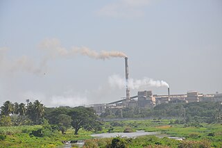
Bhadravati or Bhadravathi is an industrial city or Steel Town and taluk in the Shivamogga District of the Indian state of Karnataka. It is situated at a distance of about 255 kilometres (158 mi) from the state capital Bengaluru and at about 20 kilometres (12 mi) from the district headquarters, Shivamogga. The town is spread over an area of 67.0536 square kilometres (25.8895 sq mi) and has a population of 151,102 as per the census held in 2011.
Mandya district is an administrative district of Karnataka, India. The district is bordered on the south by Mysore and Chamarajangar districts, on the west by Hassan district, on the north by Tumkur district and on the east by Ramanagara district. The district Mandya was carved out of larger Mysore district in the year 1939.
Chikkaballapur is the district headquarters of the newly created Chikkaballapur district in the state of Karnataka, India, which was carved out from Kolar district. It is located within 3 km of Muddenahalli. A $400 million Pharmaceutical SEZ is coming up in Chikkaballapur on 325 acres (1.32 km2), the first of its kind in India. Furthermore, the noted Traveler Bunglow is being converted into a state-of-the-art bus terminus. A new district government headquarters and police headquarters is being constructed at a cost of $5 million. In addition, the state government is releasing over $10 million to develop the city and expand underground sanitary systems. It is a regional transport and educational hub, and is a major site for grape, grain, and silk cultivation"

Kollegala is the Major taluk in the Chamarajanagara District of Karnataka State in the south of India. Kollegala is well known for its silk industry which attracts traders from all over the state.

Holenarasipura is a town and taluk in Hassan district of Karnataka. The town is situated on the banks of the Hemavati, one of the tributaries of the Kaveri.

Gonikoppal is a census town in the Kodagu district of the Indian state of Karnataka.
Pavagada or Pamukonda is a town and a taluk in the Tumkur district of Karnataka, India. Historically it was part of the Mysore kingdom. Though it is geographically connected to Chitradurga district inside state of Karnataka, it comes under Tumkur district. It is 157.8 km from state capital of Bengaluru. Uttara Pinakini river flows into this Taluk. Pavagada Taluk falls on the border of Karnataka, hence a majority of the population are bilingual speaking Kannada and Telugu. The town is famous for its fort located on the hill, Kote Anjaneya temple at the foothills and also the temple of Sri Shani Mahatma.

Karnataka, a state in South India has a well-developed transport system. Its capital city, Bengaluru is well-connected by air to domestic and international destinations and the Kempegowda International Airport (KIA) in the city is one of the busiest airports in India. It was also the headquarters of the airlines Air Deccan and Kingfisher Airlines. The road transport is also well developed in the state with many National and State highways providing means for fast transportation. The headquarters of the South-Western Railway division of Indian Railways is located at Hubballi and this division governs most of the railway network in the state. Konkan Railway which passes along the coastal region of the state is considered one of the toughest engineering projects being undertaken in India till date. Buses, cars and trains are the means of transport for moving across distant places in Karnataka. For transportation within the city or town limits; motorbikes, cars, autorickshaws and buses are used. With the advent of low-cost airlines, many people are choosing to travel via air as well.

Ramanagara District is one of the 31 districts of Karnataka state in southern India. Ramanagara City is the administrative headquarters of this district. The district is part of Bangalore Division.

Yachenahalli is a panchayat town in Mysore district in the state of Karnataka, India. It is located 35 km from Mysore and 17 km from Mandya. The nearest city is Bannur with 10 km distance.

Sagara is a city located in the Indian state of Karnataka. It is also a sub divisional and a taluk headquarters. Located in the Sahyadri Mountain range on the banks of river Varada, it is known for its proximity to Jog Falls and to the historical places of Ikkeri, Keladi and Varadamoola. The river Varada originates near Varada-moola. Sagara subdivision consists of Sagara, Soraba, Hosanagara and Shikaripur taluks.

Narayanapura is a small village in Mandya district of Karnataka state, India. Narayanapura is located 18.7 km (11.6 mi) north of Pandavapura town near Mysore city.
Shingapoore is a small village in the Mandya district of the Indian state of Karnataka. It is located 5 km north of the Narayanapura village, near the town of Pandavapura.

Kere Thonnur is a small village in the Mandya district of Karnataka state, India.

Chinakurali is a village in Pandavapura, Mandya, Karnataka, India.

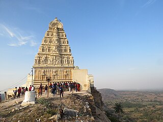
Kunti Betta is a set of two rocky hills in Pandavapura, Mandya district, Karnataka. The hills sit at an elevation of 878 m. Kunti Betta lies not far from Thonnur Lake, and is situated at a distance of 130 km from Bangalore. According to local legend, the Pandavas, a group of five brothers who are the central figures of the Indian epic Mahabharata, and their mother, Kunti concluded their exile at the location, thus earning the town and the hills the names Pandavapura and Kunti Betta, respectively. A temple at the foot of the hill is also associated with Kunti. Kunti Betta is a popular trekking destination among tourists. The spot is especially renowned for night trekking and camping. Kunti Betta is also less commonly known as French Rocks, named after a regiment of French soldiers who had assisted rulers Hyder Ali and Tipu Sultan in their war against the British and were garrisoned at the place.