
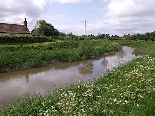
The River Parrett flows through the counties of Dorset and Somerset in South West England, from its source in the Thorney Mills springs in the hills around Chedington in Dorset. Flowing northwest through Somerset and the Somerset Levels to its mouth at Burnham-on-Sea, into the Bridgwater Bay nature reserve on the Bristol Channel, the Parrett and its tributaries drain an area of 660 square miles (1,700 km2) – about 50 per cent of Somerset's land area, with a population of 300,000.

The Calder and Hebble Navigation is a broad inland waterway, with locks and bridge holes that are suitable for 14-foot-wide (4.3 m) boats, in West Yorkshire, England. Construction to improve the River Calder and the River Hebble began in 1759, and the initial scheme, which included 5.7 miles (9.2 km) of new cuts, was completed in 1770 and has remained navigable since it was opened. Significant improvements were made, including the Salterhebble branch to Halifax, opened in 1828, and ever-longer cuts to bypass river sections. Trade was assisted by the opening of the Rochdale Canal in 1804, which provided a through route from Sowerby Bridge to Manchester. There were plans to abandon the river sections completely in the 1830s, but these were modified as the needs of mill owners and other riparian landowners were recognised.

The Kennet and Avon Canal is a waterway in southern England with an overall length of 87 miles (140 km), made up of two lengths of navigable river linked by a canal. The name is used to refer to the entire length of the navigation rather than solely to the central canal section. From Bristol to Bath the waterway follows the natural course of the River Avon before the canal links it to the River Kennet at Newbury, and from there to Reading on the River Thames. In all, the waterway incorporates 105 locks.

The Bridgwater and Taunton Canal is a canal in the south-west of England between Bridgwater and Taunton, opened in 1827 and linking the River Tone to the River Parrett. There were a number of abortive schemes to link the Bristol Channel to the English Channel by waterway in the 18th and early 19th centuries. These schemes followed the approximate route eventually taken by the Bridgwater and Taunton Canal, but the canal was instead built as part of a plan to link Bristol to Taunton by waterway.

The canal network of the United Kingdom played a vital role in the Industrial Revolution. The UK was the first country to develop a nationwide canal network which, at its peak, expanded to nearly 4,000 miles in length. The canals allowed raw materials to be transported to a place of manufacture, and finished goods to be transported to consumers, more quickly and cheaply than by a land based route. The canal network was extensive and included feats of civil engineering such as the Anderton Boat Lift, the Manchester Ship Canal, the Worsley Navigable Levels and the Pontcysyllte Aqueduct.
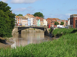
The River Tone is a river in the English county of Somerset. The river is about 33 kilometres (21 mi) long. Its source is at Beverton Pond near Huish Champflower in the Brendon Hills, and is dammed at Clatworthy Reservoir. The reservoir outfall continues through Taunton and Curry and Hay Moors, which are designated as a Site of Special Scientific Interest. Finally, it flows into the River Parrett at Burrowbridge.
The Grand Western Canal ran between Taunton in Somerset and Tiverton in Devon in the United Kingdom. The canal had its origins in various plans, going back to 1796, to link the Bristol Channel and the English Channel by a canal, bypassing Lands End. An additional purpose of the canal was the supply of limestone and coal to lime kilns along with the removal of the resulting quicklime, which was used as a fertiliser and for building houses. This intended canal-link was never completed as planned, as the coming of the railways removed the need for it.
The Glastonbury Canal ran for approximately 14 miles (23 km) through two locks from Glastonbury to Highbridge in Somerset, England, where it entered the River Parrett and from there the Bristol Channel. The canal was authorised by Parliament in 1827 and opened in 1834. It was operated by the Glastonbury Navigation and Canal Company. Most of it was abandoned as a navigation in 1854, when a railway was built along the towpath.
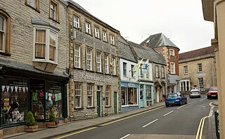
Langport is a town and civil parish in Somerset, England, 5 miles (8 km) west of Somerton. The parish, which covers only part of the town, has a population of 3,578. Langport is contiguous with Huish Episcopi, a separate parish that includes much of the town's outskirts.

The Somerset Coal Canal was a narrow canal in England, built around 1800. Its route began in basins at Paulton and Timsbury, ran to nearby Camerton, over two aqueducts at Dunkerton, through a tunnel at Combe Hay, then via Midford and Monkton Combe to Limpley Stoke where it joined the Kennet and Avon Canal. This link gave the Somerset coalfield access east toward London. The longest arm was 10.6 miles (17.1 km) long with 23 locks. From Midford an arm also ran via Writhlington to Radstock, with a tunnel at Wellow.

Burrowbridge is a village and civil parish in Somerset, England, situated on the River Parrett and the A361 road on the edge of the Somerset Levels. It is located 5 miles (8.0 km) southeast of Bridgwater, and has a population of 508.

The Driffield Navigation is an 11-mile (18-kilometre) waterway, through the heart of the Holderness Plain to the market town of Driffield, East Riding of Yorkshire, England. The northern section of it is a canal, and the southern section is part of the River Hull. Construction was authorised in 1767, and it was fully open in 1770. Early use of the navigation was hampered by a small bridge at Hull Bridge, which was maintained by Beverley Corporation. After protracted negotiation, it was finally replaced in 1804, and a new lock was built to improve water levels at the same time. One curious feature of the new works were that they were managed quite separately for many years, with the original navigation called the Old Navigation, and the new works called the New Navigation. They were not fully amalgamated until 1888.
The Market Weighton Canal ran 9.5 miles (15.3 km) from the Humber Estuary to its terminus near Market Weighton. It gained its Act of Parliament in 1772 and opened in 1782. The 3.5 miles (5.6 km) closest to Market Weighton was abandoned in 1900 and the right of navigation through Weighton lock was lost in 1971. However, as of 2002 the lock was passable and the canal usable up to the junction with the River Foulness where silt has made it impassable. Also there is no right of navigation under the M62 motorway bridge to the north of Newport.

King's Sedgemoor Drain is an artificial drainage channel which diverts the River Cary in Somerset, England along the southern flank of the Polden Hills, to discharge into the River Parrett at Dunball near Bridgwater. As the name suggests, the channel is used to help drain the peat moors of King's Sedgemoor. There was opposition to drainage schemes from the local inhabitants, who feared that they would lose their common grazing rights. However, the main channel was constructed between 1791 and 1795, and despite some defects, brought some relief from flooding to the area.

The Westport Canal was built in the late 1830s to link Westport and Langport in Somerset, England. It was part of a larger scheme involving improvements to the River Parrett above Burrow Bridge. Langport is the point at which the River Yeo joins the River Parrett and the intention was to enable trade via the port at Bridgwater. It remained in use until the 1870s, but closed when the Somerset Drainage Commissioners took over control of the River Parrett. Despite a petition against closure by local people, the Commissioners ruled that navigation of the canal must cease due to their interpretation of the Act which gave them control of it, leaving the canal to serve as a drainage channel since 1878.

The Middle Level Navigations are a network of waterways in England, primarily used for land drainage, which lie in The Fens between the Rivers Nene and Great Ouse, and between the cities of Peterborough and Cambridge. Most of the area through which they run is at or below sea level, and attempts to protect it from inundation have been carried out since 1480. The Middle Level was given its name by the Dutch Engineer Cornelius Vermuyden in 1642, who subsequently constructed several drainage channels to make the area suitable for agriculture. Water levels were always managed to allow navigation, and Commissioners were established in 1754 to maintain the waterways and collect tolls from commercial traffic.

The Ivelchester and Langport Navigation was a scheme to make the River Ivel navigable from Langport to Ilchester, in Somerset, England. Work started in 1795, but the scheme was effectively bankrupt by 1797, and construction of the locks was never completed.

The earliest known infrastructure for transport in Somerset is a series of wooden trackways laid across the Somerset Levels, an area of low-lying marshy ground. To the west of this district lies the Bristol Channel, while the other boundaries of the county of Somerset are along chains of hills that were once exploited for their mineral deposits. These natural features have all influenced the evolution of the transport network. Roads and railways either followed the hills, or needed causeways to cross the Levels. Harbours were developed, rivers improved, and linked to sources of traffic by canals. Railways were constructed throughout the area, influenced by the needs of the city of Bristol, which lies just to the north of Somerset, and to link the ports of the far south-west with the rest of England.
The Port of Bridgwater is a port, originally located in the town of Bridgwater, Somerset, England. Created under the Bridgwater Navigation and Quays Act 1845 it extends from Brean Down to Hinkley Point in Bridgwater Bay, and parts of the rivers Parrett, River Brue and River Axe. Although no ships now dock in the town, in 2001 103,613 (metric) tonnes of cargo were handled within the area of the Port Authority, most of which were stone products through the wharf at Dunball.

