Green Valley is an unincorporated community and census-designated place (CDP) in Pima County, Arizona, United States. The population was 22,616 at the 2020 census.

Sonoita is a census-designated place (CDP) in Santa Cruz County, Arizona, United States. The population was 803 at the 2020 census.

Loyola is a census-designated place in Santa Clara County, California, United States. The population was 3,491 at the 2020 census. It was ranked as one of the wealthiest neighborhoods in America, with homes ranging from cottages to sprawling ranch houses and mansions. The woodsy area is the home of the Los Altos Golf & Country Club and is located between the city of Los Altos and the town of Los Altos Hills. It is also the home of the Facebook House. The neighborhood is named for Ignatius of Loyola, a Spanish saint and founder of the Jesuits.

Aptos is an unincorporated town in Santa Cruz County, California. The town is made up of several small villages, which together form Aptos: Aptos Hills-Larkin Valley, Aptos Village, Cabrillo, Seacliff, Rio del Mar, and Seascape. Together, they have a combined population of 24,402.

Ben Lomond is a census-designated place (CDP) in Santa Cruz County, California, United States, and also the name of the mountain to the west. The CDP includes the communities of Glen Arbor and Brackney. The population was 6,337 at the 2020 census.

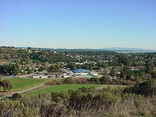
Felton is a census-designated place (CDP) in Santa Cruz County, California, United States. The population was 4,489 as of 2020 census and according to the United States Census Bureau, the CDP has a total area of 4.6 square miles (12 km2), all of it land.
Soquel is an unincorporated town and census-designated place (CDP) in Santa Cruz County, California, located on the northern coast of Monterey Bay. The population was 9,980 at the 2020 census.
Palm Aire, Florida was an unincorporated census-designated place in Broward County, Florida consisting of residential property, commercial businesses, and four golf courses. Palm Aire describes both Palm Aire Village, a collection of single-family houses, and Palm Aire Country Club, a 5,000-acre (20 km2) property with condominiums, villas, estate homes, and four golf courses. It is now part of the cities of Fort Lauderdale and Pompano Beach.

Santa Ana Pueblo is a census-designated place (CDP) in Sandoval County, New Mexico, United States. As of the 2000 census, the CDP had a total population of 479. It is part of the Albuquerque Metropolitan Statistical Area. The Pueblo, named Tamaya in Keres, administers a total reservation land of 73,000 acres (295 km2) in the Rio Grande valley and is composed of Native Americans who speak an eastern dialect of the Keresan languages.
Hollins is a census-designated place (CDP) in Botetourt and Roanoke County, Virginia, United States. Hollins covers much of the area known locally as "North County". The population was 15,574 at the 2020 census. It is part of the Roanoke Metropolitan Statistical Area. The area is also the home of Hollins University in addition to four properties listed on the National Register of Historic Places: the Black Horse Tavern-Bellvue Hotel and Office, Harshbarger House, the Hollins College Quadrangle, and Old Tombstone.
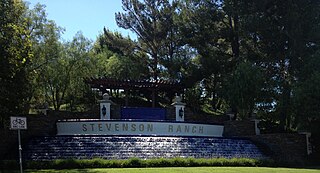
Stevenson Ranch is an unincorporated community in the Santa Clarita Valley of Los Angeles County, California. Stevenson Ranch is set in the foothills of the Santa Susana Mountains and lies west of Interstate 5 and the city of Santa Clarita. Stevenson Ranch encompasses about 6.4 square miles (17 km2). About 1,000 acres (4.0 km2) are set aside as parks, recreation areas, and open space. A master-planned community, it was approved by the county in 1987. The population was 20,178 at the time of the 2020 census. For statistical purposes, the Census Bureau has designated it a census-designated place (CDP).

Alister MacKenzie was a golf course architect whose course designs span four continents. Originally trained as a surgeon, MacKenzie served as a civilian physician with the British Army during the Boer War where he first became aware of the principles of camouflage. During the First World War, MacKenzie made his own significant contributions to military camouflage, which he saw as closely related to golf course design.
Tom Doak is a golf course architect. He has 6 courses ranked among the top 100 in the world according to the "Top 100 Courses in the World" March 2021 list compiled by Golf Magazine. These include Pacific Dunes in Oregon, Ballyneal in Colorado, Barnbougle Dunes in Tasmania and Cape Kidnappers in New Zealand. Doak lives in Michigan.
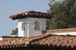
Pasatiempo Golf Club is an 18-hole golf club on the West Coast of the United States, located in Pasatiempo, Santa Cruz County, California.
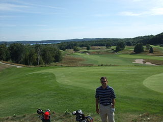
Crystal Downs Country Club is a private country club and unincorporated community in Benzie County in the U.S. state of Michigan. The community is located within Lake Township on the shores of Lake Michigan. For statistical purposes, the United States Census Bureau defined the community as a census-designated place for the first time for the 2010 census. At the census, the CDP had a population of 47 and a total land area of 1.26 square miles (3.3 km2).
The Union League Golf and Country Club of San Francisco was constructed in 1929 in Millbrae, California, United States. It was one of the most ambitious golf and country club projects of its era in Northern California. It was conceived in the prosperous time that proceeded the Great Depression by a prominent group of San Francisco businessmen who would spare no expense during the design-phase of the project. The golf course was designed by Alister MacKenzie who considered it one of the top three courses on the West Coast. The unforeseen economic downturn of the Great Depression caused the club to become financially insolvent and in 1933 it was reorganized as Millbrae Country Club. In 1945 the club was named Green Hills Country Club.
Paradise Park is a census-designated place (CDP) in Santa Cruz County, California. Paradise Park sits at an elevation of 92 feet (28 m). The 2020 United States census reported Paradise Park's population was 550, which is up from 389 people in the 2010 census.
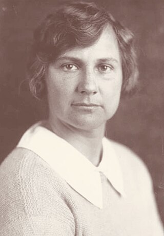
Marion B. Hollins was an American amateur golfer. She is known as an athlete and as a golf course developer, one of the only known female golf course developers in history. She won the 1921 U.S. Women's Amateur and was runner-up in 1913. She also had many other amateur wins. She was the captain of the first U.S. Curtis Cup team in 1932.
Lake Royale is a census-designated place (CDP) in southeastern Franklin County, North Carolina, United States. The population was 3,392 at the 2020 census.

Julian Pitzer Graham, nicknamed “Spike” was an American photographer. His legacy is over 40,000 photographs and negatives of many famous people that visited and lived on the Monterey Peninsula. Between 1924 and 1963, Graham, was an independent, official photographer for Del Monte Properties, which is known today as the Pebble Beach Company. His photographs appeared in magazines such as Life and National Geographic, national and international newspapers, books, fashion layouts, and promotional material used for advertising the Pebble Beach Company. Graham's photographs chronicle the history of the Monterey Peninsula which includes the creation of Cypress Point Golf Club, Pebble Beach Golf Links and the Monterey Peninsula Country Club. His career lasted 39 years until his death at his home in Carmel Valley, California on March 13, 1963.

