Patkata, West Bengal

Last updated

Patkata
Village
West Bengal location map.svg
Red pog.svg
Patkata
India location map.svg
Red pog.svg
Patkata
Coordinates: 26°34′15″N88°40′17″E / 26.57083°N 88.67139°E / 26.57083; 88.67139
Country Flag of India.svg  India
State West Bengal
District Jalpaiguri
Block Jalpaiguri
Government
  Type Gram Panchayat
Area
  Total71.92 km2 (27.77 sq mi)
Elevation
89 m (292 ft)
Population
 (2011)
  Total43,360
  Density600/km2 (1,600/sq mi)
Languages
  Official Bengali
  Other Urdu, Nepali, English
Time zone UTC+5:30 (IST)
PIN
735133
STD code 03561
Vehicle registration WB-71, WB-72

Patkata is a village in the suburb of Jalpaiguri, Jalpaiguri District, West Bengal, India. It is located near the border with Bangladesh, approximately 4 kilometres northwest of the city center of Jalpaiguri. As of the year 2011, the village has a total population of 43,360. [1]

Contents

Geography

Patkata is situated on the western shore of Teesta River. The West Bengal State Highway 12A passes through the south of the village. It covers an area of 7192.4 hectares. [2]

Healthcare

1 Primary Health Sub-Centre , 2 RMP doctors are available in this village. [3]

Education

Government Pre Primary, Private Pre Primary, Govt Primary and Govt Secondary Schools and one technical college are available in this village.

Demographics

According to the 2011 Indian Census, Patkata has 9,717 households. Among the 43,360 inhabitants, 22,203 are male, and 21,157 are female. The total literacy rate is 60.87%, with 15,100 of the male population and 11,294 of the female population being literate. [1]

Related Research Articles

<span class="mw-page-title-main">Harishchandrapur I</span> Community development block in West Bengal, India

Harishchandrapur I is a community development block that forms an administrative division in Chanchal subdivision of Malda district in the Indian state of West Bengal.

<span class="mw-page-title-main">Ratua I</span> Community development block in West Bengal, India

Ratua I is a community development block that forms an administrative division in Chanchal subdivision of Malda district in the Indian state of West Bengal.

<span class="mw-page-title-main">Harirampur (community development block)</span> Community development block in West Bengal, India

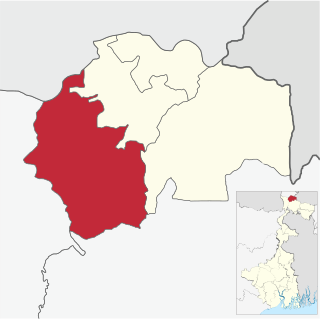
Harirampur is a community development block that forms an administrative division in Gangarampur subdivision of Dakshin Dinajpur district in the Indian state of West Bengal.

<span class="mw-page-title-main">Kalimpong I</span> Community development block in West Bengal, India

Kalimpong I is a community development block that forms an administrative division in the Kalimpong subdivision of the Kalimpong district in the Indian state of West Bengal.

<span class="mw-page-title-main">Gorubathan (community development block)</span> Community development block in West Bengal, India

Gorubathan is a community development block that forms an administrative division in the Kalimpong subdivision of the Kalimpong district in the Indian state of West Bengal.

<span class="mw-page-title-main">Jalpaiguri (community development block)</span> Community development block in West Bengal, India

Jalpaiguri is a community development block that forms an administrative division in the Jalpaiguri Sadar subdivision of the Jalpaiguri district in the Indian state of West Bengal.

<span class="mw-page-title-main">Maynaguri (community development block)</span> Community development block in West Bengal, India

Maynaguri is a community development block that forms an administrative division in the Jalpaiguri Sadar subdivision of the Jalpaiguri district in the Indian state of West Bengal.

<span class="mw-page-title-main">Dhupguri (community development block)</span> Community development block in West Bengal, India

Dhupguri is a community development block that forms an administrative division in the Dhupguri subdivision of the Jalpaiguri district in the Indian state of West Bengal.

<span class="mw-page-title-main">Rajganj (community development block)</span> Community development block in West Bengal, India

Rajganj is a community development block that forms an administrative division in Jalpaiguri Sadar subdivision of Jalpaiguri district in the Indian state of West Bengal.

<span class="mw-page-title-main">Mal (community development block)</span> Community development block in West Bengal, India

Mal is a community development block that forms an administrative division in the Malbazar subdivision of the Jalpaiguri district in the Indian state of West Bengal.

<span class="mw-page-title-main">Matiali (community development block)</span> Community development block in West Bengal, India

Matiali is a community development block that forms an administrative division in the Malbazar subdivision of the Jalpaiguri district in the Indian state of West Bengal.

<span class="mw-page-title-main">Nagrakata (community development block)</span> Community development block in West Bengal, India

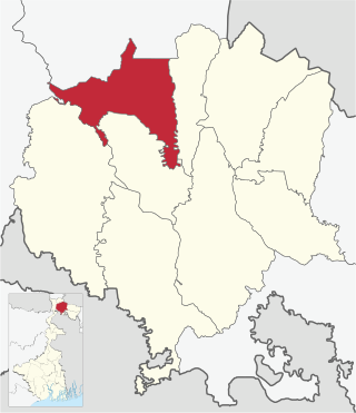
Nagrakata is a community development block that forms an administrative division in the Malbazar subdivision of the Jalpaiguri district in the Indian state of West Bengal.The Nagrakata CD block has an area of 397.48 km2. It has 1 panchayat samity, 5 gram panchayats, 91 gram sansads, 34 mouzas and 33 inhabited villages. Nagrakta police station serves this block. Headquarters of this CD block is at Nagrakata.

<span class="mw-page-title-main">Madarihat-Birpara (community development block)</span> Community development block in West Bengal, India

Madarihat-Birpara is a community development block that forms an administrative division in the Alipurduar subdivision of the Alipurduar district in the Indian state of West Bengal.

<span class="mw-page-title-main">Alipurduar I</span> Community development block in West Bengal, India

Alipurduar I is a community development block that forms an administrative division in the Alipurduar subdivision of the Alipurduar district in the Indian state of West Bengal.

<span class="mw-page-title-main">Alipurduar II</span> Community development block in West Bengal, India

Alipurduar II is a community development block that forms an administrative division in the Alipurduar subdivision of the Alipurduar district in the Indian state of West Bengal.

<span class="mw-page-title-main">Falakata (community development block)</span> Community development block in West Bengal, India

Falakata is a community development block that forms an administrative division in the Alipurduar subdivision of the Alipurduar district in the Indian state of West Bengal.

<span class="mw-page-title-main">Kalchini</span> Community development block in West Bengal, India

Kalchini is a community development block that forms an administrative division in the Alipurduar subdivision of the Alipurduar district in the Indian state of West Bengal.

<span class="mw-page-title-main">Kumargram</span> Community development block in West Bengal, India

Kumargram is a community development block that forms an administrative division in the Alipurduar subdivision of the Alipurduar district in the Indian state of West Bengal.

<span class="mw-page-title-main">Mathabhanga II</span> Community development block in West Bengal, India

Mathabhanga II is a community development block that forms an administrative division in the Mathabhanga subdivision of the Cooch Behar district in the Indian state of West Bengal.

<span class="mw-page-title-main">Haldibari (community development block)</span> Community development block in West Bengal, India

Haldibari is a community development block that forms an administrative division in the Mekhliganj subdivision of the Cooch Behar district in the Indian state of West Bengal.

References

  1. 1 2 "Basic Population Figures of India, States, Districts, Sub-District and Village, 2011". censusindia.gov.in. Archived from the original on 2 March 2023. Retrieved 19 April 2023.
  2. "Map of Patkata village in Jalpaiguri tahsil, Jalpaiguri, West Bengal". villagemap.net. Retrieved 19 April 2023.
  3. "Health & Family Welfare Department" (PDF). Health Statistics – Rural Hospitals. Government of West Bengal. Retrieved 2 July 2020.