Pemberton, Greater Manchester

Last updated

Pemberton
Pemberton Carnegie Library.jpg
Pemberton Carnegie Library
Greater Manchester UK location map 2.svg
Red pog.svg
Pemberton
Location within Greater Manchester
Population13,982 (2011 Census)
OS grid reference SD555045
Metropolitan borough
Metropolitan county
Region
Country England
Sovereign state United Kingdom
Post town WIGAN
Postcode district WN5
Dialling code 01942
Police Greater Manchester
Fire Greater Manchester
Ambulance North West
UK Parliament
List of places
UK
England
Greater Manchester
53°32′10″N2°40′26″W / 53.5360°N 2.6738°W / 53.5360; -2.6738

Pemberton is an area of Wigan, [1] in Greater Manchester, England. [2] It lies on the southwestern bank of the River Douglas, [3] and east of the M6 motorway. The area is contiguous with Orrell and as a ward has a population of 13,638, [1] increasing to 13,982 at the 2011 Census. [4]

Contents

Historically a part of Lancashire, Pemberton was formerly a township and parish in the hundred of West Derby. Following the Industrial Revolution, Pemberton became a densely populated industrial district comprising a variety of coal mines, stone-quarries, brick manufactories, and cotton mills. [3] [5] Coal mining was the principal industry of what was described in 1911 as an "unpicturesque, bare and open" area. [3] The former Pemberton Urban District, along with Wigan Municipal Borough merged to form the County Borough of Wigan in 1904. [2] [6]

History

The name Pemberton derives from Penn-bere-tūn, which is believed to be a combination of the Celtic penn meaning hill, the Old English bere meaning barley plus the Old English suffix of -ton meaning a farm or settlement. [7] [8]

Unmentioned in the Domesday Book of 1086, Pemberton does not appear in records until 1212, when it was documented to have been a thegnage estate, or manor, comprising "two plough-lands", with an annual rate of 20  shillings payable by the tenant, Alan de Windle, to King John. [3]

There were several collieries in the area, and sandstone was also quarried. At Newtown were cotton mills and iron works. A well at Lamberhead Green (Pingate) was noted for its excellent water quality.[ citation needed ] The area is served by Pemberton railway station.

Governance

Pemberton was formerly a township in Wigan ecclesiastical parish, [9] in the hundred of West Derby, and was recognised as a civil parish in 1866. From 1894 to 1904, the Pemberton parish constituted the Pemberton Urban District. [10] In 1904 the urban district was abolished with its territory transferred to the borough [2] and local government County Borough of Wigan. [2] [6] [11] The 1911 Encyclopædia Britannica describes Pemberton as being part of Wigan (which then formed 5082 acres). [12] In 1920, the Pemberton parish was abolished and its former area was used to enlarge the Wigan parish, making the area of the parish and county borough identical. [13] Pemberton today is considered part of Wigan for purposes of the Office for National Statistics, and in most reputable contemporary publications. [14] This is also the approach taken also in several other modern online sources, which omit Pemberton as a standalone settlement. [15] [16]

Electoral Ward

The electoral ward of Pemberton is represented by three elected councillors. The ward covers the following neighbourhoods:

Wigan Council Members for Pemberton

NamePartyOffices
Cllr. Paul Prescott Labour Portfolio Holder for Planning, Environmental Services and Transport
Cllr. Jeanette Prescott Labour
Cllr. Eileen Rigby Labour

Geography

Described in 1911 as "unpicturesque, bare and open", [3] Pemberton is predominantly made up of privately owned homes and local authority maintained housing, including Newtown, Worsley Mesnes, Norley Hall, Worsley Green and Marsh Green. Pemberton and its adjoining district of Orrell form one continuous residential area.

The soil is clay and loam, over Coal Measures and stone. [3]

See also

Related Research Articles

<span class="mw-page-title-main">Metropolitan Borough of Wigan</span> Borough of Greater Manchester, England

The Metropolitan Borough of Wigan is a metropolitan borough of Greater Manchester, England. It is named after its largest town, Wigan but covers a far larger area which includes the towns of Atherton, Ashton-in-Makerfield, Golborne, Hindley, Ince-in-Makerfield, Leigh and Tyldesley. The borough also covers the villages and suburbs of Abram, Aspull, Astley, Bryn, Hindley Green, Lowton, Mosley Common, Orrell, Pemberton, Shevington, Standish, Winstanley and Worsley Mesnes. The borough is also the second-most populous district in Greater Manchester.

<span class="mw-page-title-main">Farnworth</span> Human settlement in England

Farnworth is a town in the Metropolitan Borough of Bolton, Greater Manchester, England, 2 miles (3.2 km) southeast of Bolton, 4 miles south-west of Bury (7 km), and 8 miles (12.9 km) northwest of Manchester.

<span class="mw-page-title-main">Worsley</span> Village in Greater Manchester, England

Worsley is a village in the City of Salford, Greater Manchester, England, which in 2014 had a population of 10,090. It lies along Worsley Brook, 6 miles (9.7 km) west of Manchester.

<span class="mw-page-title-main">Boothstown</span> Human settlement in England

Boothstown is a suburban village in the City of Salford in Greater Manchester, England. Boothstown forms part of the Boothstown and Ellenbrook ward, which had a population at the 2011 Census of 9,599. The village is within the boundaries of the historic county of Lancashire, west of the City of Salford, bordered to the north by the East Lancashire Road A580 and to the south by the Bridgewater Canal. Historically, it was a hamlet partly in Worsley township in the parish of Eccles, and partly in Tyldesley in the parish of Leigh.

<span class="mw-page-title-main">Orrell, Greater Manchester</span> Human settlement in England

Orrell is a suburb of Wigan in the Metropolitan Borough of Wigan, Greater Manchester, England. The population of the ward had fallen at the 2011 Census to 11,513. The area lies 3 miles (4.8 km) to the west of Wigan town centre. The area is contiguous with Pemberton.
<span class="mw-page-title-main">Atherton, Greater Manchester</span> Town in Greater Manchester, England

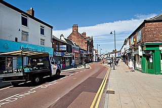
Atherton is a town in the Metropolitan Borough of Wigan in Greater Manchester, England and historically part of Lancashire. The town, including Hindsford, Howe Bridge and Hag Fold, is 5 miles (8.0 km) south of Bolton, 7 miles (11.3 km) east of Wigan, and 10 miles (16.1 km) northwest of Manchester. From the 17th century, for about 300 years, Atherton was known as Chowbent, which was frequently shortened to Bent, the town's old nickname. During the Industrial Revolution, the town was a key part of the Manchester Coalfield.

<span class="mw-page-title-main">Standish, Greater Manchester</span> Human settlement in England

Standish is a small town in the Metropolitan Borough of Wigan, Greater Manchester, England. Within the boundaries of the historic county of Lancashire, it is on the A49 road between Chorley and Wigan, near Junction 27 of the M6 motorway. The population of the town was 13,278 in the 2011 census.
<span class="mw-page-title-main">Wigan (UK Parliament constituency)</span> Parliamentary constituency in the United Kingdom, 1885 onwards

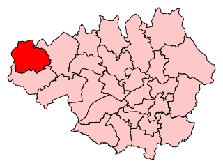
Wigan is a constituency in Greater Manchester, represented in the House of Commons of the UK Parliament since 2010 by Lisa Nandy of the Labour Party, who also serves as the Shadow Housing and Levelling Up Secretary.
<span class="mw-page-title-main">Abram, Greater Manchester</span> Human settlement in England

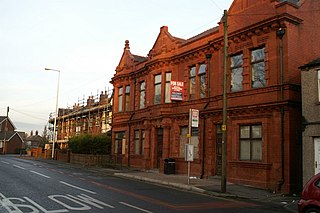
Abram is a village and electoral ward in the Metropolitan Borough of Wigan, Greater Manchester, England. It lies on flat land on the northeast bank of the Leeds and Liverpool Canal, 2 miles (3.2 km) west of Leigh, 3 miles (4.8 km) southeast of Wigan, and 14.5 miles (23 km) west of Manchester. Abram is a dormitory village with a population of 9,855.

<span class="mw-page-title-main">Astley, Greater Manchester</span> Human settlement in England

Astley is a village in the Metropolitan Borough of Wigan, Greater Manchester, England. Within the boundaries of the historic county of Lancashire, it is crossed by the Bridgewater Canal and the A580 East Lancashire Road. Continuous with Tyldesley, it is equidistant from Wigan and Manchester, both 8.3 miles (13.4 km) away. Astley Mosley Common ward had a population of 11,270 at the 2011 Census.
<span class="mw-page-title-main">Tyldesley</span> Market town in Greater Manchester, England

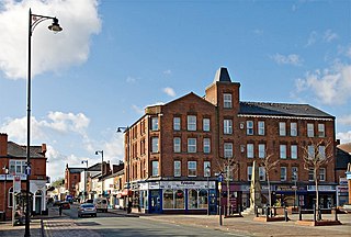
Tyldesley is a market town in Metropolitan Borough of Wigan in Greater Manchester, England. Within the boundaries of the historic county of Lancashire, it is north of Chat Moss near the foothills of the West Pennine Moors, 8 miles (12.9 km) southeast of Wigan and 9 miles (14.5 km) northwest of Manchester. At the United Kingdom Census 2001, the Tyldesley built-up area subdivision, excluding Shakerley, had a population of 16,142.
<span class="mw-page-title-main">Walkden</span> Town in City of Salford, Greater Manchester, England

Walkden is a town in the City of Salford in Greater Manchester, England, six miles northwest of Salford, and seven miles of Manchester.

The County Borough of Wigan was, from 1889 to 1974, a local government district centred on Wigan in the northwest of England. It was alternatively known as Wigan County Borough.

<span class="mw-page-title-main">Wigan</span> Town in Greater Manchester, England

Wigan is a town in Greater Manchester, England, on the River Douglas. The town is midway between the two cities of Manchester, 16 miles (25.7 km) to the south-east, and Liverpool, 17 miles (27 km) to the south-west. Bolton lies 10 miles (16 km) to the north-east and Warrington 12 miles (19 km) to the south. It is the largest settlement in the Metropolitan Borough of Wigan and is its administrative centre. The town has a population of 107,732 and the wider borough of 330,714. Wigan is part of the historic county of Lancashire.

<span class="mw-page-title-main">Ellenbrook, Greater Manchester</span> Human settlement in England

Ellenbrook is a suburb of Worsley, in the City of Salford in Greater Manchester, England. Ellenbrook is 6.8 miles (10.9 km) west of Manchester, 5 miles (8.0 km) west of Salford and 4.6 miles (7.4 km) south of Bolton. Historically a part of Lancashire, it is close to Astley, Mosley Common and Walkden, by the East Lancashire Road.

<span class="mw-page-title-main">Wigan Metropolitan Borough Council</span> Local authority for Wigan, England

The Wigan Metropolitan Borough Council is the local authority for the Metropolitan Borough of Wigan in the United Kingdom. It consists of 75 Councillors with one-third being elected every three years in four. The borough is separated into 25 wards. Councillors are democratically accountable to the ward they are elected to represent. Each ward is represented on the council by three council members.

<span class="mw-page-title-main">Municipal Borough of Farnworth</span>

The Municipal Borough of Farnworth was a local government district centred on the town of Farnworth in the administrative county of Lancashire, England. A local board of health had been established for Farnworth in 1863, which was reconstituted as an urban district in 1899, before being granted a charter of incorporation to become a municipal borough in 1939. Following abolition of the local authority in 1974, Farnworth became an unparished area of the Metropolitan Borough of Bolton in Greater Manchester.
<span class="mw-page-title-main">Roe Green</span> Human settlement in England

Roe Green is a suburban area of Worsley, in the City of Salford, Greater Manchester, England. Historically in Lancashire, it was anciently a hamlet built around what is now the village green. It is the largest of the City of Salford's conservation areas, selected because of its village green, an unusual feature in the region. Roe Green is adjacent to junction 13 of the M60 motorway.

References

Notes

  1. 1 2 Pemberton, 2001 United Kingdom Census, neighbourhood.statistics.gov.uk. URLs accessed 11 November 2008.
  2. 1 2 3 4 "Greater Manchester Gazetteer". Greater Manchester County Record Office. Places names - O to R. Archived from the original on 18 July 2011. Retrieved 3 April 2007.
  3. 1 2 3 4 5 6 Brownbill & Farrer 1911 , pp. 78–83.
  4. "Wigan ward population 2011" . Retrieved 10 January 2016.
  5. Great Britain Historical GIS, Descriptive Gazetteer entry for Pemberton, visionofbritain.org.uk
  6. 1 2 Vision of Britain - Pemberton CP
  7. Hanks 2003 , p. 69.
  8. University of Nottingham's Institute for Name-Studies. "Pemberton". nottingham.ac.uk. Retrieved 11 November 2008.
  9. Pemberton, Genuki - England and Ireland Genealogy - URL accessed 16 February 2007.
  10. Pemberton Urban District Council, nationalarchives.gov.uk. Retrieved 16 February 2007.
  11. Ext.and appl.in pt.(mods.) - L.G.B. Provisional.Order.Confn.(No.13) 1904 (c.clxii), art.11 of Wigan (Extn.) O.
  12. Encyclopædia Britannica Eleventh Edition, (1911)
  13. Vision of Britain Archived 2007-10-01 at the Wayback Machine - Wigan CP (historic map Archived 2007-10-01 at the Wayback Machine )
  14. Youngs, F. (1991), Local Administrative Units: Northern England, London: Royal Historical Society, p. 192
  15. Towns & Villages of Wigan, manchester2002-uk.com. Retrieved 4 April 2007.
  16. ROUND AND ABOUT WIGAN, spinningtheweb.org.uk. Retrieved 4 April 2007.
  17. http://manchestergazette.co.uk/archives/11573%5B%5D

Bibliography

  • Brownbill, J; Farrer, W (1911), A History of the County of Lancaster: Volume 5, Victoria County History, ISBN   978-0-7129-1055-2
  • Hanks, Patrick (2003), Dictionary of American Family Names, Oxford University Press, ISBN   978-0-19-508137-4
  • Lewis, Samuel (1848), A Topographical Dictionary of England, Institute of Historical Research, ISBN   978-0-8063-1508-9