Pemberton, Minnesota

Last updated

Pemberton
Nickname: 
The Pit
Motto: 
"Where tomorrow begins today"
Blue Earth County Minnesota Incorporated and Unincorporated areas Pemberton Highlighted.svg
Location of Pemberton, Minnesota
Coordinates: 44°00′31″N93°47′02″W / 44.00861°N 93.78389°W / 44.00861; -93.78389
CountryUnited States
State Minnesota
County Blue Earth
Founded1907
IncorporatedApril 26, 1946
Government
  TypeMayor - Council
  MayorKen Spielman
Area
[1]
  Total0.19 sq mi (0.49 km2)
  Land0.19 sq mi (0.49 km2)
  Water0.00 sq mi (0.00 km2)
Elevation
[2]
1,047 ft (319 m)
Population
 (2020) [3]
  Total229
  Estimate 
(2021) [4]
232
  Density1,218.09/sq mi (470.89/km2)
Time zone UTC-6 (CST)
  Summer (DST) UTC-5 (CDT)
ZIP code
56078
Area code 507
FIPS code 27-50200 [5]
GNIS feature ID2396175 [2]
Website pembertonmn

Pemberton is a city in Blue Earth County, Minnesota, United States. The population was 229 at the 2020 census. [3] It is part of the Mankato-North Mankato Metropolitan Statistical Area.

Contents

History

The area of Pemberton had businesses as early as 1894. While many of these building burned prior to the Alphabet Railroad coming through, land was platted in 1907 for the town with the plans for a depot. The town is named for one of the railroad officials. [6]

Geography

According to the United States Census Bureau, the city has a total area of 0.18 square miles (0.47 km2), all land. [7]

Demographics

Historical population
CensusPop.Note
1950 152
1960 17716.4%
1970 128−27.7%
1980 20862.5%
1990 2289.6%
2000 2467.9%
2010 2470.4%
2020 229−7.3%
2021 (est.)232 [4] 1.3%
U.S. Decennial Census [8]
2020 Census [3]

2010 census

As of the census of 2010, there were 247 people, 91 households, and 68 families living in the city. The population density was 1,372.2 inhabitants per square mile (529.8/km2). There were 98 housing units at an average density of 544.4 per square mile (210.2/km2). The racial makeup of the city was 98.0% White, 0.4% Asian, 1.2% from other races, and 0.4% from two or more races. Hispanic or Latino of any race were 3.2% of the population.

There were 91 households, of which 37.4% had children under the age of 18 living with them, 57.1% were married couples living together, 14.3% had a female householder with no husband present, 3.3% had a male householder with no wife present, and 25.3% were non-families. 19.8% of all households were made up of individuals, and 4.4% had someone living alone who was 65 years of age or older. The average household size was 2.71 and the average family size was 3.10.

The median age in the city was 33.4 years. 30.8% of residents were under the age of 18; 6.1% were between the ages of 18 and 24; 32% were from 25 to 44; 21.9% were from 45 to 64; and 9.3% were 65 years of age or older. The gender makeup of the city was 47.4% male and 52.6% female.

2000 census

As of the census of 2000, there were 246 people, 84 households, and 64 families living in the city. The population density was 1,196.4 inhabitants per square mile (461.9/km2). There were 86 housing units at an average density of 418.2 per square mile (161.5/km2). The racial makeup of the city was 99.19% White, and 0.81% from two or more races.

There were 84 households, out of which 41.7% had children under the age of 18 living with them, 64.3% were married couples living together, 8.3% had a female householder with no husband present, and 23.8% were non-families. 19.0% of all households were made up of individuals, and 7.1% had someone living alone who was 65 years of age or older. The average household size was 2.93 and the average family size was 3.44.

In the city, the population was spread out, with 29.7% under the age of 18, 12.6% from 18 to 24, 30.1% from 25 to 44, 19.9% from 45 to 64, and 7.7% who were 65 years of age or older. The median age was 31 years. For every 100 females, there were 103.3 males. For every 100 females age 18 and over, there were 98.9 males.

The median income for a household in the city was $39,167, and the median income for a family was $42,222. Males had a median income of $25,714 versus $22,361 for females. The per capita income for the city was $17,640. None of the families and 4.1% of the population were living below the poverty line, including no under eighteens and 21.1% of those over 64.

Related Research Articles

<span class="mw-page-title-main">Fairbank, Iowa</span> City in Iowa, United States

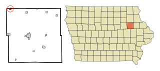
Fairbank is a city in Buchanan and Fayette counties in the U.S. state of Iowa. The population was 1,111 at the time of the 2020 census.

<span class="mw-page-title-main">Maynard, Iowa</span> City in Iowa, United States

Maynard is a city in Fayette County, Iowa, United States. The population was 476 at the time of the 2020 census.

<span class="mw-page-title-main">Webster, Iowa</span> City in Iowa, United States

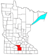
Webster is a city in Keokuk County, Iowa, United States. The population was 94 at the time of the 2020 census.

<span class="mw-page-title-main">Mayfield, Kansas</span> City in Sumner County, Kansas

Mayfield is a city in Sumner County, Kansas, United States. As of the 2020 census, the population of the city was 75.

<span class="mw-page-title-main">Ogema, Minnesota</span> City in Minnesota, United States

Ogema is a city in Becker County, Minnesota, United States. The population was 208 at the 2020 census.

<span class="mw-page-title-main">Lilydale, Minnesota</span> City in Minnesota, United States

Lilydale is a city in Dakota County, Minnesota, United States. The population was 623 at the 2010 census.

<span class="mw-page-title-main">Marble, Minnesota</span> City in Minnesota, United States

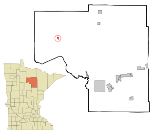
Marble is a city in Itasca County, Minnesota, United States. It is part of the chain of small mining towns known as the Iron Range. The population was 701 at the 2010 census.

<span class="mw-page-title-main">Squaw Lake, Minnesota</span> City in Minnesota, United States

Squaw Lake is a city in Itasca County, Minnesota, United States. The population was 98 at the 2020 census.

<span class="mw-page-title-main">Maplewood, Minnesota</span> City in Minnesota, United States

Maplewood is a city in Ramsey County, Minnesota, United States. The population was 42,088 at the 2020 census. Maplewood is ten minutes' drive from downtown Saint Paul. It stretches along the northern and eastern borders of Saint Paul.

<span class="mw-page-title-main">St. Rosa, Minnesota</span> City in Minnesota, United States

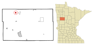
Saint Rosa is a city in Stearns County, Minnesota, United States. The population was 58 at the 2020 census. It is part of the St. Cloud Metropolitan Statistical Area.

<span class="mw-page-title-main">Lake Lafayette, Missouri</span> City in Missouri, United States

Lake Lafayette is a city in Lafayette County, Missouri, and is part of the Kansas City metropolitan area within the United States. The population was 327 at the 2010 census.

<span class="mw-page-title-main">Flordell Hills, Missouri</span> City in Missouri, United States

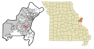
Flordell Hills is a city in St. Louis County, Missouri, United States. The population was 822 at the 2010 census.

<span class="mw-page-title-main">Velda City, Missouri</span> City in Missouri, United States

Velda City is a city in St. Louis County, Missouri, United States. The population was 1,420 at the 2010 census.

<span class="mw-page-title-main">Fifty Lakes, Minnesota</span> City in Minnesota, United States

Fifty Lakes is a city in Crow Wing County, Minnesota, United States. The population was 387 at the 2010 census. It is part of the Brainerd Micropolitan Statistical Area.

<span class="mw-page-title-main">Warson Woods, Missouri</span> City in Missouri, United States

Warson Woods is a city in St. Louis County, Missouri, United States. The population was 1,962 at the 2010 census.

<span class="mw-page-title-main">Pemberton Heights, New Jersey</span> Populated place in Burlington County, New Jersey, US

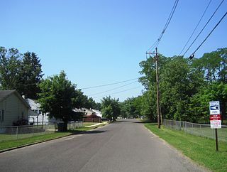
Pemberton Heights is an unincorporated community and census-designated place (CDP) located within Pemberton Township, in Burlington County, in the U.S. state of New Jersey. As of the 2010 United States Census, the CDP's population was 2,423.

<span class="mw-page-title-main">Oberon, North Dakota</span> City in North Dakota, United States

Oberon is a city in Benson County, North Dakota, United States. The population was 101 at the 2020 census. Oberon was founded in 1886.

<span class="mw-page-title-main">North River, North Dakota</span> City in North Dakota, United States

North River is a city in Cass County, North Dakota, United States. The population was 55 at the 2020 census. North River was founded in 1973. It is a suburb/bedroom community directly adjacent to the city of Fargo.

<span class="mw-page-title-main">Milton, North Dakota</span> City in North Dakota, United States

Milton is a city in Cavalier County, North Dakota, United States. The population was 39 at the 2020 census. Milton was founded in 1887.

<span class="mw-page-title-main">Camden-on-Gauley, West Virginia</span> Town in West Virginia, United States

Camden-on-Gauley is a town in Webster County, West Virginia, United States, along the Gauley River. The population was 126 at the 2020 census.

References

  1. "2020 U.S. Gazetteer Files". United States Census Bureau. Retrieved July 24, 2022.
  2. 1 2 U.S. Geological Survey Geographic Names Information System: Pemberton, Minnesota
  3. 1 2 3 "Explore Census Data". U.S. Census Bureau . Retrieved March 4, 2022.
  4. 1 2 "City and Town Population Totals: 2020-2021". United States Census Bureau. March 13, 2023. Retrieved March 13, 2023.
  5. "U.S. Census website". United States Census Bureau . Retrieved January 31, 2008.
  6. Schrader, Julie (1990). The Heritage of Blue Earth County. Curtis Media Corporation. pp. 427–28.
  7. "US Gazetteer files 2010". United States Census Bureau. Archived from the original on July 2, 2012. Retrieved November 13, 2012.
  8. "Census of Population and Housing". Census.gov. Retrieved June 4, 2015.