Rumours that a railway line would possibly extend up the Pemberton Valley revived interest in farmland.[5] In 1890, speculators bought and resold 1,800 hectares (4,500 acres), but few owners became residents.[6] Carl Abraham Hartzell, who settled in 1891, is remembered for raising pigs, plowing with oxen, and eccentric behaviour.[7] In a plea for better roading, he stated in 1901 that an acre could produce 680 kilograms (1,500lb) of grain or 12 tons of potatoes.[8] Farther northwestward, at about 28 kilometres (17mi) from Pemberton, Duncan Morrison settled in 1897.[9] Around 1904, preemptions were made by James Ryan on the local creek named after him and by Arthur Keirstead about 40 kilometres (25mi) from Pemberton.[10]
The Rockside, about 6 kilometres (4mi) from Pemberton, was a natural obstacle. When Jack Ronayne and his brothers blasted a passage in 1906, their wagon was the first to reach the upper valley.[11] At this time, James Punch settled locally.[12]
Jack Ronayne also kept weather records for the government and was first to realize that the high livestock losses in the valley were due to goitre, which was treatable by administering iodine doses.[13] Crops such as hay and potatoes, which had been grown mainly for local use, found new customers with the arrival of the Pacific Great Eastern Railway (PGE) construction crews in 1913.[14] The establishment of the railway enabled crops, milk, and cream to be shipped out. Previously, sizeable farms were few. The formerly smaller subsistence operations soon planted greater acreages of wheat, oats and peas, and expanded dairy farming.[15]
Founded in 1925, the Pemberton Valley Farmers Institute promoted advances in agriculture. Disease-free potato varieties became a speciality. During the 1930s, professionals from the Department of Agriculture were judging the exhibits at the fall fairs held at the Pemberton Meadows school.[16]
In 1961, agriculture remained a principal activity in the general Pemberton area[17] but had declined by the early 1980s. By the end of that decade, agriculture had all but disappeared as an employer.[18]
The Pemberton Farmer's Institute continues to oversee the growing of certified virus-free seed potatoes.[19]
The annual Slow Food Cycle Sunday is a 50-kilometre (31mi) bicycle tour of Pemberton Meadows, which was founded in 2005 at Helmer's Organic Farm.[20] This agri-tourism event provides cyclists with the opportunity to purchase or sample local produce at participating farms along the route.[21]
Established in the Pemberton Valley in 2013, with the growing of Canada's first proprietary, patented hop called Sasquatch, Hops Connect expanded to multiple facilities and distribution centres to better serve the craft brewing industry across Canada.[22]
Forestry
Around 1905, the Perkins mill assisted many new settlers with materials for their homesteads. In 1907, Patrick G.Dermody arrived. He established a water-powered mill at the falls on Ryan Creek.[23]
From the mid-1920s, logging and sawmill jobs were attracting new people.[24] Mobile mills, powered by gasoline motors, were set up on farms.[25] Pole and tie manufacturing rapidly expanded.[26] Cut poles were dragged overland or rafted downriver to Mile 60 (east of Pemberton) for loading onto railway cars.[25] In 1929, several flat-deck trucks were purchased to haul ties to the railway.[27]
In 1950, Fleetwood Logging Co. introduced large scale logging. At a camp on the upper end of Lillooet Lake, the company hauled using A-frame logging structures supplemented by crawler tractors.[28] Three loading yards existed near the train station.[29]
By 1972, 100 logging trucks a day headed south from the timber leases in the upper Lillooet River region through to Squamish in the south. In 1973, the BC Forest Service built a new office in Pemberton, which closed and moved to Squamish in the 1990s.[30]
In 1961, forestry was a principal activity in the general Pemberton area.[17] By the early 1980s, forestry remained the largest employer.[18] By 1991, only 13 per cent of total employment was in forestry.[31]
Community
On reopening, the post office relocated about 13 kilometres (8mi) up the trail to Hartzell's property,[32] who was postmaster 1904–1912.[33] Damage from spring and fall floods and mosquito infestations shattered most dreams, causing many settlers to depart.[34]
Christine Lanoville was the inaugural teacher when the Pemberton Meadows school opened in August 1915, but the schoolhouse was not completed until four months later.[35] In 1929, a new school building was erected.[36] In 1956, the replacement had two rooms, but the second room was used for only two years because enrolments declined.[37]
Erected in 1925, the Boys' Club hall was as a venue for community dances. The upper valley hall, which replaced the former around 1932, collapsed under the weight of snow in the 1970s.[38] In the 1930s, Joseph Prendergast opened a log cabin store with a barber's chair. He was the first licensed barber.[39]
In 1951, the post office closed.[33] That year, electricity came to the valley,[40] which allowed movies to be shown in the Boys' Club hall.[41]Jack Taillefer lived in Pemberton where he ran a garage. As the only electrician and plumber, wiring work in the valley became so plentiful that he sold the garage.[42]
Trails, roads, ferries, and bridges
The trail up the valley was in such poor condition in the early 1900s that Hartzell, Morrison, and others often used canoes. Prior to 1906, when the Ronayne brothers blasted the Rockslide, settlers to the northwest did not own wagons.[43]
The approximate distances by road from Pemberton of the cross-river ferries were 5 kilometres (3.1mi) for Dermody, 19 kilometres (12mi) for Ronayne, and 25 kilometres (16mi) for Crown Mountain.[44] Dermody was an unspecified ferry, intermittently subsidized 1921–1933.[45] Ronayne was a pontoon ferry,[46] subsidized 1926–1934.[47] Crown Mountain was a raft ferry, subsidized 1926–1945.[48] These ferries likely operated for longer periods. The Ronayne one still existed in 1940.[49] In the early 1950s, the capsizing of a raft ferry in which two occupants drowned may well have been the Crown Mountain one.[50]
The gravelling and ditching of the valley road began in the early 1950s.[51] About 2000, the road was paved.
Floods
In 1912, government help was sought to address flooding. The blasting of river obstructions a few months later provided only partial relief.[52]
In fall 1940, heavy rains breached inadequate dykes causing serious crop and livestock losses and property damage.[53]
After years of petitioning, the Pemberton Dyking District was formed in 1947 to manage drainage and flood control in the Pemberton Valley. In a tri-partite agreement with federal and provincial governments, the organization dyked and straightened the Lillooet River lowering the level by 4.6 metres (15ft). The project was carried out under the Prairie Farmer's Rehabilitation Act. The new land made available by the drainage project brought a rush of new settlers in the late 1940s–1950s.[54] The project was only half completed before the 1948 floods, which inundated the lower valley farms.[55]
The ongoing drainage program made abandoned farms viable and created new farmland from swamps.[56]
In 1984, the next most significant flood caused extensive damage. In 2003, flooding impacted the southern end of the valley.[57]
The flood risk from the Lillooet River was increased by the 2010 Capricorn Creek landslide, the largest in recorded Canadian history. The resulting sediment moving downstream has made the river shallower, reducing flow capacity and increasing vulnerability to floods.[58]
Bowen Island, British Columbia, is an island municipality that is part of Metro Vancouver. Bowen Island is within the jurisdiction of the Islands Trust. Located in Howe Sound, it is approximately 6 kilometres (3.7 mi) wide by 12 kilometres (7.5 mi) long, with the island at its closest point about 3 kilometres (1.9 mi) west of the mainland. There is regular ferry service from Horseshoe Bay provided by BC Ferries, as well as semi-regular water taxi services. The population of 4,256 is supplemented in the summer by roughly 1,500 visitors, as Bowen Island regularly receives travelers in the summer season. The island has a land area of 50.12 km2 (19.35 sq mi).
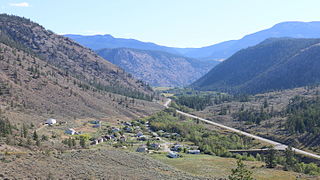
Lillooet is a district municipality in the Squamish-Lillooet region of southwestern British Columbia. The town is on the west shore of the Fraser River immediately north of the Seton River mouth. On BC Highway 99, the locality is by road about 100 kilometres (62 mi) northeast of Pemberton, 64 kilometres (40 mi) northwest of Lytton, and 172 kilometres (107 mi) west of Kamloops.
Highway 99, also known as the Fraser Delta Thruway south of Vancouver, and the Sea to Sky Highway, Squamish Highway, or Whistler Highway north of Vancouver, is the major north–south artery running through the Greater Vancouver area of British Columbia from the U.S. border, up Howe Sound through the Sea to Sky Country to Lillooet, and connecting to Highway 97 just north of Cache Creek. The highway's number was derived from the former U.S. Route 99, with which the highway originally connected to at the border. The highway currently connects with Interstate 5 at the United States border.
The Squamish-Lillooet Regional District is a quasi-municipal administrative area in British Columbia, Canada. It stretches from Britannia Beach in the south to Pavilion in the north. Lillooet, Pemberton, Whistler and Squamish are the four municipalities in the regional district. Its administrative offices are in the Village of Pemberton, although the district municipalities of Squamish, Whistler, and Lillooet are all larger population centres. The district covers 16,353.68 km² of land area.
The Fraser Valley Regional District (FVRD) is a regional district in British Columbia, Canada. Its headquarters are in the city of Chilliwack. The FVRD covers an area of 13,361.74 km² (5,159 sq mi). It was created in 1995 by an amalgamation of the Fraser-Cheam Regional District and Central Fraser Valley Regional District and the portion of the Dewdney-Alouette Regional District from and including the District of Mission eastwards.
Shalalth and South Shalalth are unincorporated communities on the northern shore near the western end of Seton Lake in the Squamish-Lillooet region of southwestern British Columbia. The localities are by road about 63 kilometres (39 mi) northwest of Lillooet, but only 24 kilometres (15 mi) by rail.
The Lillooet Cattle Trail, also known as the Lillooet-Burrard Cattle Trail and also as the Lillooet Trail, was an unusual and daring public works undertaking by the Province of British Columbia in the 1877, and was the largest 19th Century public works expenditure at $35,000 of the new province since its joining Canada in 1871.
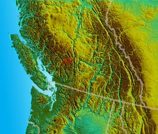
The Lillooet River is a major river of the southern Coast Mountains of British Columbia. It begins at Silt Lake, on the southern edge of the Lillooet Crown Icecap about 80 kilometres northwest of Pemberton and about 85 kilometres northwest of Whistler. Its upper valley is about 95 kilometres in length, entering Lillooet Lake about 15 km downstream from Pemberton on the eastern outskirts of the Mount Currie reserve of the Lil'wat branch of the St'at'imc people. From Pemberton Meadows, about 40 km upstream from Pemberton, to Lillooet Lake, the flat bottomlands of the river form the Pemberton Valley farming region.
The Cayoosh Range is the northernmost section of the Lillooet Ranges, which are a subrange of the Pacific Ranges of the Coast Mountains in British Columbia, Canada. The range covers an area of c. 3770 km² and is approximately 65 km (40 mi) SW to NE and about 20 km (12 mi) SE to NW.
Pemberton is a village municipality in the Squamish-Lillooet region of southwestern British Columbia. This Pemberton Valley community is on the southwest shore of the Lillooet River and northeast shore of Pemberton Creek. On BC Highway 99, the locality is by road about 153 kilometres (95 mi) north of Vancouver, 33 kilometres (21 mi) northeast of Whistler, and 100 kilometres (62 mi) southwest of Lillooet.
Clinton is a village in British Columbia, Canada, located approximately 40 km (25 mi) northwest of Cache Creek and 30 km south of 70 Mile House.
Vancouver Coastal Health (VCH) is a regional health authority that provides health services including primary, secondary, tertiary and quaternary care, home and community care, mental health services, population and preventive health and addictions services in part of Greater Vancouver and the Coast Garibaldi area.
Mount Currie is in the Squamish-Lillooet region of southwestern British Columbia. On BC Highway 99, the locality is by road about 160 kilometres (99 mi) north of Vancouver, 39 kilometres (24 mi) northeast of Whistler, and 92 kilometres (57 mi) southwest of Lillooet.
The Lil'wat First Nation, a.k.a. the Lil'wat Nation or the Mount Currie Indian Band, is a First Nation band government located in the southern Coast Mountains region of the Interior of the Canadian province of British Columbia. It is a member of the Lillooet Tribal Council, which is the largest grouping of band governments of the St'at'imc or Stl'atl'imx people. Other St'at'imc governments include the smaller In-SHUCK-ch Nation on the lower Lillooet River to the southwest, and the independent N'quatqua First Nation at the near end of Anderson Lake from Mount Currie, which is the main reserve of the Lil'wat First Nation, and also one of the largest Indian reserves by population in Canada.
Pavilion is an unincorporated community on the eastern side of the Fraser River in the South Cariboo region of southwestern British Columbia. The place is near Mile 21 of the Old Cariboo Road. On BC Highway 99, the locality is by road about 36 kilometres (22 mi) northeast of Lillooet and 135 kilometres (84 mi) west of Kamloops.
Skatin is a community of under 100 persons in Skatin First Nations, aka the Skatin Nations, a Band government of the larger Band of the In-SHUCK-ch Nation, part of the St'at'imc people who are also referred to as Lower Stl'atl'imx. Skatin, the official new name, reverts to the traditional pre-colonial/pre-Columbian name. The alternate past name still commonly used by outsiders, Skookumchuck, is the St'at'imcets version of the Chinook Jargon Skookumchuck, meaning Strong Waters, i.e. rapids. The town site is 4 km south of T'sek Hot Spring, formerly named both Saint Agnes Well and Skookumchuck Hot Springs. The community is 28 km south of the outlet of Lillooet Lake on the east side of the Lillooet River. It is approximately 75 km south of the town of Pemberton and the large reserve of the Lil'wat branch of the St'at'imc at Mount Currie, British Columbia. See Skatin First Nations for details about the complicated Band(s) structure.
The Pemberton Icefield or Pemberton Icecap, is the southernmost of the series of very large icefields studding the Pacific Ranges of the southern Coast Mountains in British Columbia, Canada.
Birken is an unincorporated community on the north shore of Gates Lake in the Squamish-Lillooet region of southwestern British Columbia. On Pemberton Portage Road, the locality is by road about 182 kilometres (113 mi) north of Vancouver and 62 kilometres (39 mi) northeast of Whistler.
Parsonville is a ghost town on the east shore of the Fraser River approximately opposite Lillooet. On BC Highway 99, the locality is by road about 100 kilometres (62 mi) northeast of Pemberton, 64 kilometres (40 mi) northwest of Lytton, and 172 kilometres (107 mi) west of Kamloops.
A series of ferries and bridges have crossed the Fraser River in the vicinity of Lillooet in the Squamish-Lillooet region of southwestern British Columbia. From the 1850s, these crossings have connected both north–south and local traffic.
References
Decker, Frances; Fougberg, Margaret; Ronayne, Mary (1978). Pemberton: The History of a Settlement, rev. ed. Pemberton Pioneer Women.
This page is based on this Wikipedia article Text is available under the CC BY-SA 4.0 license; additional terms may apply. Images, videos and audio are available under their respective licenses.