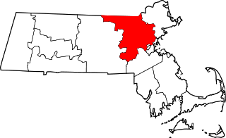
The Chelmsford Center Historic District is a historic district encompassing the historic heart of the town of Chelmsford, Massachusetts. It extends from the town's central square in the east, where the intersection of Billerica Road and Chelmsford Street is located, west beyond the junction of Littleton and North Roads with Westford Street, and from there north along Worthen Road. It includes the area that was the 17th-century heart of the town, including its common and first burying ground, and has been the town's civic heart since its founding.

The Sturbridge Common Historic District encompasses the historic center of Sturbridge, Massachusetts. Encompassing some 138 acres (56 ha), the district is focused around the town common, which was laid out when the town established in 1738. The district is roughly linear, extending along Main Street from its junction with Interstate 84 eastward to Hall Road. The district also extends for short distances along Haynes, Maple, and Charlton Streets. Although most of the properties in the district are residential, the institutional properties, including the 1838 Greek Revival Town Hall, the 1896 Joshua Hyde Library building, and the 1922 Federated Church. The oldest building in the district is the c. 1772 Publick House, a tavern which has dominated the south side of the district since its construction.

The Old Centre Historic District is a historic district encompassing the historic town center of Winchendon, Massachusetts. It includes the town's first cemetery, the First Congregational Church, and the oldest surviving house in town, and only one building constructed after 1850. The district was added to the National Register of Historic Places in 1987.

The Center Village District encompasses the historic village center of Lancaster, Massachusetts. Settled in 1643, it has few traces of its early history, but is now a well-kept rural town center with a predominantly residential and civic character. It includes the First Church of Christ, Lancaster, which is a U.S. National Historic Landmark, and was listed on the National Register of Historic Places in 1977.

Royalston Common Historic District is a historic district encompassing the historic village center of Royalston, Massachusetts. Centered on a long town common laid out in 1752, it is one of the best surviving examples of an 18th-century town center in the state. The district was listed on the National Register of Historic Places in 1976. The common was named as one of the 1,000 places to visit in Massachusetts by the Great Places in Massachusetts Commission.

The Harvard Center Historic District is a historic district encompassing the traditional village center of Harvard, Massachusetts, USA. The district is centered on the town common, a triangular grassy space bounded by Elm Street, Still River Road, and Ayer Road. The common is ringed by residences, civic and religious buildings, and a small commercial area. The common was laid out when the town was founded in 1732, and has grown, mainly in periods of growth at the late 18th and late 19th/early 20th centuries. Most of the village's buildings post-date 1831. The district was added to the National Register of Historic Places in 1997.

The East Bridgewater Common Historic District is a historic district encompassing the historic town center of East Bridgewater, Massachusetts. The district is centered on the town common, which was established in 1721, and radiates along Central Street away from the common. The oldest houses in the district date to 1703, and the Old Graveyard is also known to have been in use by that time. The First Parish Church, a focal point of the common area, was built in 1794 and extensively restyled in the 1850s. Town offices are now housed in the estate house of the Aaron Hobart, built in the 1850s in the Italianate style.

The Norwell Village Area Historic District encompasses the village center of Norwell, Massachusetts. It is centered on the town common, first laid out in the 1640s, around which a number of public buildings are located, and radiates away along Main, Central, West, River, and Dover Streets. There are 34 buildings in the district, predominantly residential and representing a cross-section of architectural styles from the 18th to the early 20th centuries. Prominent buildings include the 1830 First Parish Church, the 1874 Italianate-style James Library building, and the 1934 Colonial Revival Cushing Memorial Town Hall.

The Princeton Center Historic District is a historic district encompassing the 19th century center of Princeton, Massachusetts. The district is centered at the junction of Hubbardston and Mountain Roads, and includes the town common, town hall, public library, and First Congregational Church. When first listed on the National Register of Historic Places in 1999, the district encompassed 11 acres (4.5 ha), and included only the common, town hall, and library; it was expanded in 2006 to 165 acres (67 ha), and included much of the village of Princeton Center.

The Franklin Common Historic District is a historic district encompassing the traditional village center of Franklin, Massachusetts. The primary focus of the district is the town common, a roughly triangular green which took shape in the mid-18th century. The district includes the buildings that abut the green, and extends northward along Main Street to its junction with Lincoln Street, where the Red Brick School is located. The Dean Junior College Historic District abuts this district to the south. The district is predominantly residential in character, with several civic and religious institutional buildings facing the common. The latter group are dominated by the Federated Church, and the Roman Catholic St. Mary's Church complex, which includes three buildings from the 1920s to 1955.

The East Hawley Center Historic District encompasses the principal institutional center of the town of Hawley, Massachusetts, with a history dating to the 1780s. Although it was settled in the late 18th century, issues with Hawley's boundaries meant that the development of a central village did not take place until later. East Hawley was developing as a local transportation hub by the mid 1820s, with several roads converging in the area. The establishment of a store and post office, and the relocation of the Congregational Church into the area cemented its importance in the town's civic life. There was some industrial mill activity in the area during the 19th century, but this came to an end near the end of the century, and only a mill pond remains. The district was listed on the National Register of Historic Places in 1992.

The Montague Center Historic District encompasses the well-preserved 19th century village center of Montague, Massachusetts. Montague Center, one of the town's five villages, is the civic heart of the town, and was also an active industrial area in the 19th century. The district was listed on the National Register of Historic Places in 2001.

The Belchertown Center Historic District is a historic district which encompasses the historic village center of Belchertown, Massachusetts. Centered on Belchertown's 1,200-foot (370 m) common, the district includes 55 contributing properties along South Main Street, Maple Street, and a few adjacent streets. It was listed on the National Register of Historic Places in 1982.

The Bradford Common Historic District is a historic district encompassing the former town center of Bradford, now a village of Haverhill, Massachusetts. Centered on the former town common at South Main and Salem Streets, the area served as Bradford's civic and commercial center from about 1750 until its annexation by Haverhill in 1897, and retains architecture from the 18th to early 20th centuries. It was added to the National Register of Historic Places in 1977.
The Framingham Centre Common Historic District encompasses the historic early center of Framingham, Massachusetts. It is centered on the old town common, which is west of Edgell Road, a short way north of the busy commercial corridor of Massachusetts Route 9. The district includes 28 buildings, among them important early civic structures such as the Village Hall, old Edgell Memorial Library, First Parish Church, and the former Framingham Academy building.

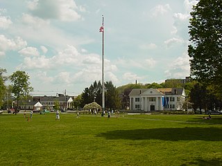
The Shirley Center Historic District encompasses the original historic center of Shirley, Massachusetts. The district is centered on the 1753 town common area, from which five roads radiate away. The district includes the buildings that surround the common, as well as some that line these roads. The district includes Shirley's town hall and First Parish Congregational Church.

The Wilmington Centre Village Historic District encompasses the historic center of the town of Wilmington, Massachusetts. It stretches along Church and Middlesex Streets, from the town common in the southwest to the Old Burial Ground in the northeast. The area was established as a local civic center in the 1730s with the construction of a meeting house and the cemetery. The village center experienced some growth in the early decades of the 19th century due to the presence of a factory-style bakery, but it suffered from a lack of railroad connections in later years. The town common, which anchors the southern end of the district, was laid out in the 1890s.

The Common Historic District is a historic district encompassing the civic and institutional heart of Reading, Massachusetts. The district is centered on the town common, at the intersection of Main and Salem Streets. The common has been communally owned since at least 1737, with the original burying ground to the north. In 1769 the area's first meeting house was built, giving the area a sense of identity separate from portions of Reading that would later be set off as Wakefield and North Reading. Since then the area has become a focal point for religious and civic institutions in the town.

The Common District encompasses the main civic center of Wakefield, Massachusetts. It is centered on the historic town common, just south of Lake Quannapowitt, which was laid in 1644, when it became the heart of Old Reading. The area was separated from Reading as South Reading in 1818, and renamed Wakefield in 1868. The 25 acre district includes the buildings that line the common on Common Street and Main Street, which include the town hall, public library, YMCA, and several churches. It was listed on the National Register of Historic Places in 1990.

The Berkley Common Historic District is a historic district encompassing the historic heart of Berkley, Massachusetts. The town's village center is located near its geographic center, roughly midway between Massachusetts Route 24 and the Taunton River. Its central focus is the triangular town common, bounded by Main, Locust, and Porter Streets. The common is flanked by a number municipal and civic buildings, and has been the town's focus of civic life for more about 275 years.