Peralta Stones

Last updated
Front View of the Peralta Stones PERALTA STONES 1.jpg
Front View of the Peralta Stones
Front Back of the Peralta Stones PERALTA STONES 2.jpg
Front Back of the Peralta Stones

The Peralta Stones are a set of engraved stones suppsedly indicating the location of the Lost Dutchman's Gold Mine, in Arizona, United States. [Note 1]

Contents

The story goes that the stones are named for an obscure "Peralta family", supposedly an old and powerful Mexican family. Some people named Peralta owned a cattle ranch that included what is now Oakland, California at the time of the Mexican–American War. Another Peralta, Pedro de Peralta, was the governor of the Spanish territory in New Mexico, and picked the site for Santa Fe. Nevertheless, the Peralta surname is common in Spain and Mexico, and it became associated with the "Peralta" mine by James Reavis. Reavis popularized the idea of a rich Peralta family in Arizona in 1882 when he tried to assert a phony Peralta Spanish land grant which included a huge swath of Arizona and New Mexico, including the Superstition Mountains. His forged Peralta genealogy was exposed, and he served a prison sentence for fraud. According to current legend, but not supported by the historical record, some Peraltas mined in the Superstition Mountains. The first written reference to a “Peralta mine” in the Superstitions was in 1895, by writer Pierpont C. Bicknell. [2]

Description

"Hidden Heart" of the Peralta Stones CROSS TRIANGLE.jpg
"Hidden Heart" of the Peralta Stones
"Hidden Heart" of the Peralta Stones HIDDEN HEART 1.jpg
"Hidden Heart" of the Peralta Stones

The stones consist of "two red sandstone tablets and a heart-shaped rock made of red quartzite. Each block is approximately 8.25” (~ 21 cm) by 14” (~35.6 cm) and 2” thick, weighing about 25 lbs. Each red stone block is carved with lines and one long line. When the two blocks are placed side by side and the stone heart is inserted the long line has 18 dots pecked into it. This style of map is known as a Post Road Map and it is a style used in Mexico and Spain during the Mexican–American War. Inscribed on the stones is the date 1847, and one stone contains a Sunken relief or intaglio of a heart, into which the heart-shaped stone fits perfectly. The back of the stone that the heart-shaped stone fits into has the outline of a cross carved into it.

There is confusion about the discovery of the Peralta Stones. Some sources say they were found by a man named "Jack" [3] in 1956 [4] (one source says 1952, [2] another 1949 [3] ) near the main highway that goes southeast from Apache Junction, Arizona,. in the vicinity of Black Point (33°16'19.86"N by 111°19'38.36"W). Another item found at this site is known as the Latin Heart.

The two red sandstone map pieces are displayed with a third white sandstone of similar size and weight as the red ones. The history of the white stone was cited by an author using the moniker ‘Azmula’. Azmula cites the history in the Superstition Mountain Journal, issue 27 of 2009. He attributes the original citation to M. Kraig Roberts. Mr. Roberts's article is titled “History of the Chain Of Possession Of The Stone Maps”. The Journal article is a history of the white stone. The white sandstone has a side showing a Priest who is assembling the Peralta Stones to form the map. The reverse side is known as the Horse Map. The Priests Stone contains Spanish text that states that to find the gold you must find the heart.

The story of the Peralta Stones' discovery and the stones themselves are not very convincing to most researchers. The engravings appear to have been created using modern power tools, with modern symbols, and modern Spanish.

Father Charles Polzer, an ethnohistorian associated with the Arizona State Museum, is convinced the stones are fakes. Among other reasons, he says that the modern valentine-shaped symbol used to denote a heart was a symbol unknown to 19th-century Spaniards. [5]

Treasure map

Aerial Photo of 'Noto Triangulum' of the Latin Heart NOTO TRIANGULUM.jpg
Aerial Photo of ‘Noto Triangulum’ of the Latin Heart
Latin Heart Axis LATIN HEART AXIS.jpg
Latin Heart Axis
Latin Heart: Fornix (Arch) LATIN HEART FORNIX.jpg
Latin Heart: Fornix (Arch)
Latin Heart Peralta gold mine: mesothermal quartz vein with gold ore PERALTA MINE LEDGE.jpg
Latin Heart Peralta gold mine: mesothermal quartz vein with gold ore
Table of GPS Coordinates of the 18 Peralta Stone Map Posts. POST GPS COORDS.jpg
Table of GPS Coordinates of the 18 Peralta Stone Map Posts.

According to local lore, the stones contain a map indicating the location of the Lost Dutchman's Gold Mine. Various claims have been made about the location of the gold mine based on an interpretation of the stones, and such claims appear at regular intervals—though no one has yet recovered a flake of Jacob Waltz's gold. [2]

Claims about interpretations of the map are many, as are accounts of the stones' origins, and most of those claims are made in self-publishing printers.

According to Lon Safko, the stones were made by the Peralta family and handed down for generations. [6]

Danny Adams, in 2005, read the map as a coded message and claims the stones were made by Ted DeGrazia, a painter and art collector rumored to have burned (or buried) a collection of art worth $5 million rather than pay taxes on his property; Adams claims one of the stones reads "Be ready boy, are on a map on Arizona county scale, scale map" and aided by numerological analysis locates the mine in Upper Labarge Canyon. The treasure of paintings, supposedly hidden in the mine, is also connected, somehow, to a conspiracy of 50 businessmen from the Phoenix area to hide DeGrazia's work. [7]

In 2007, William and Michael Johnson (originally from Massachusetts) said that they had identified a privately owned cave as the mine, based on the clues left in the Peralta Stones. [8]

Location

The Peralta Stones were held at the Arizona Museum of Natural History, 53 N. Macdonald, in Mesa, Arizona, previously known as the Mesa Southwest Museum. In June 2009, they were to go on extended display at the Superstition Mountain Museum, 4087 N. Apache Trail, [9] [10] in Apache Junction, Arizona. [11] [1] As of September, 2012, the stones are once again displayed at the Arizona Museum of Natural History.

See also

Lost Dutchman State Park

Notes

  1. The "Dutchman" was a German immigrant named Jacob Waltz. [1]

Related Research Articles

<span class="mw-page-title-main">Apache Junction, Arizona</span> City in Arizona, United States

Apache Junction is a city in Pinal and Maricopa counties in the state of Arizona. As of the 2020 census, the population was 38,499, most of whom lived in Pinal County. It is named for the junction of the Apache Trail and Old West Highway. The area where Apache Junction is located used to be known as Youngberg. Superstition Mountain, the westernmost peak of the Superstition Mountains, is to the east.

<span class="mw-page-title-main">James Reavis</span> 19th-century American forger and fraudster

James Addison Reavis, later using the name James Addison Peralta-Reavis, the so-called Baron of Arizona, was an American forger and fraudster. He is best known in association with the Peralta land grant, also known as the Barony of Arizona, a pair of fraudulent land claims, which if certified, would have granted him ownership of over 18,600 square miles (48,200 km2) of land in central Arizona Territory and western New Mexico Territory. During the course of the fraud, Reavis collected an estimated US$5.3 million in cash and promissory notes through the sale of quitclaims and proposed investment plans.

Peralta may refer to:

<span class="mw-page-title-main">Superstition Mountain</span> Landform in Arizona, United States

Superstition Mountain is a prominent mountain and regional landmark located in the Phoenix metropolitan area of Arizona, immediately east of Apache Junction and north of Gold Canyon. It anchors the west end of the Superstition Mountains and is a popular outdoor recreation destination, home to numerous trails for hiking and horseback riding. The legend of the Lost Dutchman's Gold Mine centers around the mountain.

<span class="mw-page-title-main">Lost Dutchman's Gold Mine</span> Alleged lost gold mine in the Superstition Mountains

The Lost Dutchman's Gold Mine is, according to legend, a rich gold mine hidden in the southwestern United States. The location is generally believed to be in the Superstition Mountains, near Apache Junction, east of Phoenix, Arizona. There have been many stories about how to find the mine, and each year people search for the mine. Some have died on the search.

<span class="mw-page-title-main">Tortilla Flat, Arizona</span> Unincorporated community in the state of Arizona, United States

Tortilla Flat is a small unincorporated community in far eastern Maricopa County, Arizona, United States. It is located in the central part of the state, northeast of Apache Junction. It is the last surviving stagecoach stop along the Apache Trail. According to the Gross Management Department of Arizona's main U.S. Post Office in Phoenix, Tortilla Flat is presumed to be Arizona's smallest official "community" having a U.S. Post Office and voting precinct. The town has a population of 6. Tortilla Flat can be reached by vehicles on the Apache Trail, via Apache Junction.

George Maurice "Doc" Willing, Jr. was an American physician, prospector, and political lobbyist. He is known for his time as an unelected delegate to the United States Congress for Jefferson Territory and as the person who introduced James Reavis to the fraudulent Peralta land grant.

<span class="mw-page-title-main">Index of Arizona-related articles</span>

The following is an alphabetical list of articles related to the U.S. state of Arizona.

<span class="mw-page-title-main">Superstition Mountains</span> Landform near Phoenix, Arizona

The Superstition Mountains is a range of mountains in Arizona located to the east of the Phoenix metropolitan area. They are anchored by Superstition Mountain, a large mountain that is a popular recreation destination for residents of the Phoenix, Arizona, area. They are roughly bounded by U.S. Route 60 on the south, Arizona State Route 88 on the northwest, and Arizona State Route 188 on the northeast.

The Peralta massacre was the alleged killing of a Mexican family by Apaches in about 1848. It is generally featured as an element of the legend of the Lost Dutchman's Gold Mine.

<span class="mw-page-title-main">Arizona State Route 88</span> Highway in Arizona

State Route 88 is a long state highway in the U.S. state of Arizona. It runs from U.S. Route 60 in Apache Junction through desert terrain to SR 188 near Roosevelt Dam. Following the Salt River for much of its length, the section east of Tortilla Flat is known as the Apache Trail and is part of the National Forest Scenic Byway system. The Apache Trail was built in the mid-1920s and the number 88 was assigned in 1927. An eastern extension of State Route 88 to Globe, Arizona was redesignated as State Route 188 on August 20, 1999.

The Lost Adams Diggings is a Southwestern treasure story that refers to the existence of a canyon rich in gold deposits somewhere in western New Mexico in the early 1860s.

<i>Lust for Gold</i> 1949 film by S. Sylvan Simon

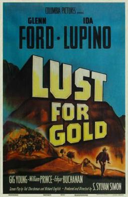
Lust for Gold is a 1949 American Western film directed by S. Sylvan Simon and starring Ida Lupino and Glenn Ford. The film is about the legendary Lost Dutchman gold mine, starring Ford as the "Dutchman" and Lupino as the woman he loves. The historical events are seen through a framing device set in the contemporary 1940s. It was based on the book Thunder God's Gold by Barry Storm. Part of the film was shot on location in Arizona's Superstition Mountains.

<span class="mw-page-title-main">Lost Dutchman State Park</span> State park in Arizona, United States

Lost Dutchman State Park is a 320-acre (129 ha) state park located in northwestern Pinal County, Arizona on the Apache Trail north of Apache Junction, near the Superstition Mountains in central Arizona. It is named after the Lost Dutchman's Gold Mine, a famously lost gold mine legendary in the tales of the Old West. It is accessible about 40 miles (64 km) east of Phoenix via U.S. Highway 60, the Superstition Freeway.

Montezuma's treasure is a legendary buried treasure said to be located in the Casa Grande ruins or elsewhere in the Southwestern United States and Mexico. The legend is one of many treasure stories in American folklore. Thomas Penfield wrote, "There is not the slimmest thread of reality in this story which is common throughout Mexico and the southwestern United States. There are some puzzling aspects but the story, nevertheless, adds up to pure legend."

"The Dutchman's Secret" is a 1999 Donald Duck comic story by Don Rosa. It is a direct sequel to his 1998 story The Vigilante of Pizen Bluff and is one of his most historically accurate stories.

Pedro de Peralta was Governor of New Mexico between 1610 and 1613 at a time when it was a province of New Spain. He formally founded the city of Santa Fe, New Mexico in 1610. In August 1613 he was arrested and jailed for almost a year by the Franciscan friar Isidro Ordóñez. Later, he was vindicated by the Mexican Inquisition and held a number of other senior posts in the Spanish imperial administration.

<span class="mw-page-title-main">Pioneer and Military Memorial Park</span> United States historic place in Phoenix, Arizona

The Pioneer and Military Memorial Park is the official name given to seven historic cemeteries in Phoenix, Arizona. The cemeteries were founded in 1884 in what was known as "Block 32". On February 1, 2007, "Block 32" was renamed Pioneer and Military Memorial Park. The Pioneer and Military Memorial Park is listed in the National Register of Historic Places. The historic Smurthwaite House, which is also listed in the National Register of Historic Places, is located on the grounds of the Pioneer and Military Memorial Park and is used as the cemetery's main office. Pioneer and Military Memorial Park is the final resting place of various notable pioneers of Arizona.

<span class="mw-page-title-main">Silly Mountain (Arizona)</span> Mountain in Arizona, USA

Silly Mountain, also known as "Roadside Benchmark", is a mountain in Arizona, United States, located near the city of Apache Junction. It is part of the Superstition Mountain range. The elevation of the mountain is 2,139 feet (652 m), and the prominence is 358 feet (109 m).

References

  1. 1 2 "The Jacob Waltz "Lost Dutchman" Exhibit | Superstition Mountain Museum". Archived from the original on 2012-06-17.
  2. 1 2 3 Hudnall, Ken; Sharon Hudnall (2005). Spirits of the Border IV: The History and Mystery of New Mexico. Vol. 4. Omega Press. pp. 43–44. ISBN   978-0-9754923-4-5 . Retrieved 30 January 2010.
  3. 1 2 Harmon, Katharine (2004). You are here : personal geographies and other maps of the imagination (1st ed.). New York, NY: Princeton Architectural Press. p. 114. ISBN   1568984308.
  4. Rawson, Bill (7 August 1985). "Ban on new claims doesn't stop search for Lost Dutchman Gold Mine". The Telegraph (Nashua). p. 44. Retrieved 30 January 2010.
  5. Anderson, Craig (7 December 2007). "Brothers stake claim to 'Lost Dutchman". Metro Phoenix: East Valley Tribune. Archived from the original on 18 December 2007. ...19th-century Spaniards did not represent hearts with the valentine shape used today.
  6. Safko, Lon S. (2005). Gratuitous Serendipity: The Right Place, the Right Time. iUniverse. pp. 15–19. ISBN   978-0-595-34186-3.
  7. Adams, Danny A. (2005). The Lost Dutchman Lies. Finders Keepers. pp. 27–34. ISBN   9781599756059.
  8. Anderson, J. Craig (7 December 2007). "Brothers stake claim to 'Lost Dutchman". East Valley Tribune. Archived from the original on December 18, 2007. Retrieved 30 January 2010.
  9. Ward, Greg (2003). The rough guide to Southwest USA. Rough Guides. p. 234. ISBN   978-1-84353-080-0.
  10. "Things to Do in Arizona on Saturday, January 5, 2008". Arizona Reporter. 5 January 2008. Retrieved 30 January 2010.
  11. Archived April 21, 2013, at the Wayback Machine