Perry, Florida

Last updated

Perry, Florida
City of Perry
Perry City Hall.JPG
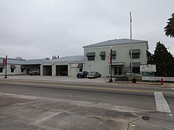
Perry City Hall and Fire Department
Motto: 
North Florida's Shining Star
Taylor County Florida Incorporated and Unincorporated areas Perry Highlighted.svg
Location in Taylor County and the state of Florida
Coordinates: 30°6′52″N83°34′57″W / 30.11444°N 83.58250°W / 30.11444; -83.58250
Country Flag of the United States.svg  United States
State Flag of Florida.svg  Florida
County   Taylor
Incorporated 1903
Government
  Type Council-Manager
   Mayor Ward Ketring
   Vice Mayor Diane Landry
   Council Members Shirley Hampton, Bill Brynes and Venita Woodfaulk
   City Manager John Hart II
   City Attorney C. Hope Demps
Area
[1]
  Total9.43 sq mi (24.43 km2)
  Land9.43 sq mi (24.43 km2)
  Water0.00 sq mi (0.00 km2)
Elevation
46 ft (14 m)
Population
 (2023)
  Total7,059
  Density731.34/sq mi (282.37/km2)
Time zone UTC-5 (Eastern (EST))
  Summer (DST) UTC-4 (EDT)
ZIP codes
32347-32348
Area code 850
FIPS code 12-56150 [2]
GNIS feature ID0288724 [3]
Website cityofperry.net

Perry is a city and the county seat of Taylor County, Florida, United States. As of 2020, the population recorded by the U.S. Census Bureau was 6,898. [4] The city was named for Madison Perry, fourth governor of the state of Florida and a Confederate colonel during the American Civil War. [5]

Contents

History

In 1922, Perry was a very small town of less than 2,000 people. During this time, a murder happened and three people were lynched for the crimes. Private retribution against the suspected families and those that gave them support ensued. The Perry Massacre occurred in Perry on the 14th and 15 December 1922, during which whites hanged Charles Wright and attacked the black community of Perry after the murder of a white schoolteacher. [6] On the day following Wright's lynching two more black men were shot and hanged; whites then burned the town's black school, Masonic lodge, church, amusement hall, and several families' homes. [6] [7] [8]

Firefighters battling a blaze [9] at a natural gas plant in August 1998 were injured when an explosion ripped through the area, sending a mammoth fireball into the sky. The flames destroyed at least six houses and several vehicles and forced the evacuation of 100 homes within two miles of the plant. Four firefighters were hospitalized with non-life-threatening injuries.

In August 2023, Hurricane Idalia impacted Florida. Perry was in the path of the storm and suffered damage across the city.

Geography

The exact coordinates for Perry's location is at 30°06′52″N83°34′57″W / 30.114311°N 83.582609°W / 30.114311; -83.582609 . [10]

According to the United States Census Bureau, the city has a total area of 9.3 square miles (24 km2), all land.

Perry is approximately 50 miles (80 km) southeast of Tallahassee. [11]

Climate

Climate data for Perry, Florida, 1991–2020 normals, extremes 1897present
MonthJanFebMarAprMayJunJulAugSepOctNovDecYear
Record high °F (°C)85
(29)
87
(31)
90
(32)
95
(35)
100
(38)
103
(39)
104
(40)
102
(39)
99
(37)
95
(35)
93
(34)
89
(32)
104
(40)
Mean maximum °F (°C)79.0
(26.1)
81.2
(27.3)
85.0
(29.4)
88.3
(31.3)
93.7
(34.3)
96.4
(35.8)
96.8
(36.0)
96.2
(35.7)
94.1
(34.5)
90.2
(32.3)
85.2
(29.6)
80.3
(26.8)
98.3
(36.8)
Mean daily maximum °F (°C)66.0
(18.9)
69.3
(20.7)
74.5
(23.6)
79.9
(26.6)
86.0
(30.0)
89.2
(31.8)
90.4
(32.4)
89.9
(32.2)
87.7
(30.9)
81.7
(27.6)
74.1
(23.4)
68.3
(20.2)
79.8
(26.6)
Daily mean °F (°C)54.7
(12.6)
57.8
(14.3)
62.6
(17.0)
68.1
(20.1)
74.9
(23.8)
80.1
(26.7)
81.8
(27.7)
81.7
(27.6)
79.0
(26.1)
71.3
(21.8)
62.4
(16.9)
57.1
(13.9)
69.3
(20.7)
Mean daily minimum °F (°C)43.4
(6.3)
46.4
(8.0)
50.6
(10.3)
56.3
(13.5)
63.9
(17.7)
71.0
(21.7)
73.2
(22.9)
73.5
(23.1)
70.2
(21.2)
60.8
(16.0)
50.7
(10.4)
46.0
(7.8)
58.8
(14.9)
Mean minimum °F (°C)21.9
(−5.6)
25.2
(−3.8)
29.1
(−1.6)
38.0
(3.3)
48.5
(9.2)
61.9
(16.6)
65.9
(18.8)
66.4
(19.1)
57.4
(14.1)
40.0
(4.4)
29.6
(−1.3)
25.6
(−3.6)
20.1
(−6.6)
Record low °F (°C)7
(−14)
14
(−10)
19
(−7)
29
(−2)
40
(4)
46
(8)
55
(13)
57
(14)
42
(6)
28
(−2)
14
(−10)
10
(−12)
7
(−14)
Average precipitation inches (mm)4.76
(121)
3.37
(86)
4.74
(120)
3.06
(78)
3.52
(89)
7.22
(183)
7.09
(180)
8.59
(218)
4.81
(122)
2.86
(73)
2.20
(56)
2.77
(70)
54.99
(1,397)
Average precipitation days (≥ 0.01 in)8.88.37.46.16.913.214.415.59.35.65.57.3108.3
Source: NOAA [12] [13]

Demographics

Historical population
CensusPop.Note
1910 1,012
1920 1,95693.3%
1930 2,74440.3%
1940 2,668−2.8%
1950 2,7974.8%
1960 8,030187.1%
1970 7,701−4.1%
1980 8,2547.2%
1990 7,151−13.4%
2000 6,847−4.3%
2010 7,0172.5%
2020 6,898−1.7%
U.S. Decennial Census [14]

2010 and 2020 census

Perry racial composition
(Hispanics excluded from racial categories)
(NH = Non-Hispanic)
RacePop 2010 [15] Pop 2020 [16] % 2010% 2020
White (NH)3,8043,55454.21%51.52%
Black or African American (NH)2,8032,69439.95%39.05%
Native American or Alaska Native (NH)34260.48%0.38%
Asian (NH)961531.37%2.22%
Pacific Islander or Native Hawaiian (NH)100.01%0.00%
Some other race (NH)3170.04%0.25%
Two or more races/Multiracial (NH)1242181.77%3.16%
Hispanic or Latino (any race)1522362.17%3.42%
Total7,0176,898100.00%100.00%

As of the 2020 United States census, there were 6,898 people, 2,443 households, and 1,808 families residing in the city. [17]

As of the 2010 United States census, there were 7,017 people, 2,366 households, and 1,618 families residing in the city. [18]

2000 census

As of the census of 2000, there were 6,847 people, 2,661 households, and 1,828 families residing in the city. The population density was 284.6/km2 (737.3/mi2). There were 3,073 housing units at an average density of 127.7/km2 (330.9/mi2). The racial makeup of the city was 56.01% White, 41.17% African American, 0.64% Native American, 0.48% Asian, 0.01% Pacific Islander, 0.55% from other races, and 1.12% from two or more races. Hispanic or Latino of any race were 1.65% of the population.

In 2000, there were 2,661 households, out of which 33.3% had children under the age of 18 living with them, 40.4% were married couples living together, 23.8% had a female householder with no husband present, and 31.3% were non-families. 27.0% of all households were made up of individuals, and 12.4% had someone living alone who was 65 years of age or older. The average household size was 2.52 and the average family size was 3.02.

In 2000, in the city, the population age was spread out, with 28.4% under the age of 18, 8.8% from 18 to 24, 26.3% from 25 to 44, 21.5% from 45 to 64, and 15.0% who were 65 years of age or older. The median age was 36 years. For every 100 females, there were 87.8 males. For every 100 females age 18 and over, there were 84.3 males.

In 2000, the median income for a household in the city was $25,986, and the median income for a family was $29,602. Males had a median income of $26,595 versus $19,041 for females. The per capita income for the city was $13,845. About 23.0% of families and 28.0% of the population were below the poverty line, including 39.0% of those under age 18 and 26.7% of those age 65 or over.

Education

Students are served by the Taylor County School District. For the 2007–2008 school year, the Florida Department of Education gave the District a "B" grade, with each of its four schools earning a "B" as well. [19]

Taylor County High School's Bulldogs [20] were the 1977–1978 Class 3A football District 3, Region 2 and State Semi-final Champions, losing to Bartow HS in the championship game, 7–0. The 1978–1979 football team were the District 3 champions and lost to Milton HS in the Regional championship game. The 1980–1981 football team were the District 3 champions and Region 2 runner-up, losing to Milton HS in the Regional championship game. The football team won 1997–1998 Class 3A State Championship. In 2010, the Bulldogs completed an undefeated football season going 10–0, claiming the district championship.

Transportation

Perry–Foley Airport is a public-use airport located 3 miles (4.8 km) south of the central business district.

The city is served by Perry Shuttle, a bus route operated by Big Bend Transit. [21]

Roads

U.S. Highways

Law enforcement

The Perry Police Department (PPD) is a 24-person agency with four Patrol K-9 teams. To be certified, each handler and K-9 partner receive at least 500 hours of training and, in some instances, as many as 800 hours. [22]

Notable people

Related Research Articles

<span class="mw-page-title-main">Taylor County, Florida</span> County in Florida, United States

Taylor County is a county located in the Big Bend region in the northern part of the U.S. state of Florida. As of the 2020 census, the population was 21,796. Its county seat is Perry. The county hosts the annual Florida Forest Festival and has been long known as the "Tree Capital of the South" since a 1965 designation from then-Governor W. Haydon Burns.

Springfield is a city in Bay County, Florida, United States, east of Panama City. It is part of the Panama City–Lynn Haven–Panama City Beach Metropolitan Statistical Area. Springfield was incorporated on February 12, 1935. The population was 8,075 at the 2020 census.

<span class="mw-page-title-main">Davie, Florida</span> Town in Florida, United States

Davie is a town in Broward County, Florida, United States, approximately 24 miles (39 km) north of Miami. The town's population was 110,320 at the 2020 census, making it the largest town in Florida by population. Davie is a principal town of the Miami metropolitan area. Horseback riding is common, as much of its historic buildings include ranches and other Western establishments.

<span class="mw-page-title-main">Cross City, Florida</span> Town in Florida, United States

Cross City is a town and the county seat of Dixie County, Florida, United States. The population was 1,689 at the 2020 census.

<span class="mw-page-title-main">Jennings, Florida</span> Town in the state of Florida, United States

Jennings is a town in Hamilton County, Florida, United States. The population was 749 at the 2020 census, down from 878 at the 2010 census.

<span class="mw-page-title-main">Wauchula, Florida</span> City in Florida, United States of America

Wauchula is a city and the county seat of Hardee County, Florida, United States. As of the 2020 census, it had a population of 5,001.

<span class="mw-page-title-main">Progress Village, Florida</span> Census-designated place in Florida, United States

Progress Village is a census-designated place (CDP) in Hillsborough County, Florida, United States. Per the 2020 census, the population was 11,188.

<span class="mw-page-title-main">Williston, Florida</span> City in Florida, United States

Williston is a city in Levy County, Florida, United States. It is part of the Nature Coast. As of the 2020 census, it had a population of 2,976.

<span class="mw-page-title-main">Bristol, Florida</span> City in Florida, United States

Bristol is a city in and the county seat of Liberty County, Florida, United States. It is the only incorporated city in Liberty County. The population was 918 at the 2020 census.

<span class="mw-page-title-main">Madison, Florida</span> City in Florida, United States

Madison is a city in and the county seat of Madison County, on the central northern border of Florida, United States. The population was 2,912 at the 2020 census.

<span class="mw-page-title-main">Layton, Florida</span> City in Florida, United States

Layton is a city located on the island of Long Key in Monroe County, Florida, United States. The City of Layton is part of the Florida Keys. The population was 210 at the 2020 census.

<span class="mw-page-title-main">Belle Isle, Florida</span> City in Florida, United States

Belle Isle is a city in Orange County, Florida, United States. The population was 7,032 at the 2020 census. It is part of the Orlando–Kissimmee–Sanford Metropolitan Statistical Area.

<span class="mw-page-title-main">Edgewood, Florida</span> City in Florida, United States

Edgewood is a city in Orange County, Florida, United States. It is part of the Orlando–Kissimmee–Sanford Metropolitan Statistical Area. The population was 2,685 at the 2020 census.

<span class="mw-page-title-main">Belleair Bluffs, Florida</span> City in Florida, United States

Belleair Bluffs is a city in Pinellas County, Florida, United States. It is part of the Tampa–St. Petersburg–Clearwater Metropolitan Statistical Area, more commonly known as the Tampa Bay Area. The population was 2,311 at the 2020 census.

<span class="mw-page-title-main">Kenneth City, Florida</span> Town in the state of Florida, United States

Kenneth City is a town in southern Pinellas County, Florida, between St. Petersburg and Pinellas Park, United States. It is part of the Tampa–St. Petersburg–Clearwater Metropolitan statistical area (MSA), much more commonly known as the Tampa Bay area. The population was 5,047 at the 2020 US census.

<span class="mw-page-title-main">Lake Hamilton, Florida</span> Town in the state of Florida, United States

Lake Hamilton is a town in Polk County, Florida, United States. The population was 1,537 at the 2020 census. It is part of the Lakeland–Winter Haven Metropolitan Statistical Area.

<span class="mw-page-title-main">Fruit Cove, Florida</span> CDP in Florida, United States

Fruit Cove is a census-designated place (CDP) in St. Johns County, Florida, United States. It is located in the community of St. Johns. The population was 32,143 at the 2020 census.

<span class="mw-page-title-main">Bushnell, Florida</span> City in Florida, United States

Bushnell is a city in western Florida and is the county seat of Sumter County, Florida, United States. The population was 3,047 at the 2020 census.

<span class="mw-page-title-main">Anthony, Kansas</span> City in Harper County, Kansas

Anthony is a city in and the county seat of Harper County, Kansas, United States. As of the 2020 census, the population of the city was 2,108.

Poinciana is a settlement and census-designated place (CDP) in Osceola and Polk counties in the U.S. state of Florida. It is part of the Greater Orlando area. As of the 2020 census, the CDP had a population of 69,309.

References

Commons-logo.svg Media related to Perry, Florida at Wikimedia Commons

  1. "2020 U.S. Gazetteer Files". United States Census Bureau. Retrieved October 31, 2021.
  2. "U.S. Census website". United States Census Bureau . Retrieved January 31, 2008.
  3. "US Board on Geographic Names". United States Geological Survey. October 25, 2007. Retrieved January 31, 2008.
  4. https://www.census.gov/quickfacts/fact/table/perrycityflorida,taylorcountyflorida,US/PST045223
  5. The official web site of the city of Perry, Florida, states: Perry, Florida, was first called Rosehead and information was unavailable as to how this name was chosen. In 1875 it was changed to Perrytown, after Governor Stark Perry. Later the "town" was dropped and the name became Perry. "City of Perry, Florida". Archived from the original on August 9, 2010. Retrieved October 26, 2011.
  6. 1 2 Henry, Charles P. (2007). Long overdue: the politics of racial reparations . NYU Press. pp.  70–71. ISBN   978-0-8147-3692-0 . Retrieved May 23, 2013.
  7. Henry, C. Michael (2004). "Introduction". In C. Michel Henry (ed.). Race, poverty, and domestic policy . Yale ISPS series. New Haven: Yale University Press. ISBN   978-0-300-09541-8 . Retrieved May 23, 2013.
  8. Ginzburg, Ralph. "Perry Race Riots". History Engine. Retrieved October 15, 2020.
  9. "Perry, FL Gas Plant Explosion, Aug 1998 | GenDisasters ... Genealogy in Tragedy, Disasters, Fires, Floods". www.gendisasters.com. Retrieved July 23, 2019.
  10. "US Gazetteer files: 2010, 2000, and 1990". United States Census Bureau. February 12, 2011. Retrieved April 23, 2011.
  11. Stillman, Sarah. "The Throwaways." The New Yorker . September 3, 2012. Retrieved on January 22, 2015.
  12. "NOWData - NOAA Online Weather Data". National Oceanic and Atmospheric Administration . Retrieved June 24, 2021.
  13. "Summary of Monthly Normals 1991-2020". National Oceanic and Atmospheric Administration . Retrieved June 24, 2021.
  14. "Census of Population and Housing". Census.gov. Retrieved June 4, 2015.
  15. "P2 HISPANIC OR LATINO, AND NOT HISPANIC OR LATINO BY RACE - 2010: DEC Redistricting Data (PL 94-171) - Perry city, Florida". United States Census Bureau .
  16. "P2 HISPANIC OR LATINO, AND NOT HISPANIC OR LATINO BY RACE - 2020: DEC Redistricting Data (PL 94-171) - Perry city, Florida". United States Census Bureau .
  17. "S1101 HOUSEHOLDS AND FAMILIES - 2020: Perry city, Florida". United States Census Bureau .
  18. "S1101 HOUSEHOLDS AND FAMILIES - 2010: Perry city, Florida". United States Census Bureau .
  19. Florida Department of Education. Retrieved on 2009-03-27.
  20. "Our Schools". Archived from the original on February 4, 2012. Retrieved April 3, 2012. Taylor County School District, Perry Florida. Retrieved 2012-04-03.
  21. "Big Bend Transit | COORDINATED TRANSPORTATION SYSTEM OF TAYLOR COUNTY". www.bigbendtransit.org. Retrieved January 31, 2019.
  22. "Perry PD HOME PAGE". Archived from the original on July 20, 2007. Retrieved May 8, 2007.