Petherton Park

Last updated
Petherton Park
Pond at Manor House Farm - geograph.org.uk - 340993.jpg
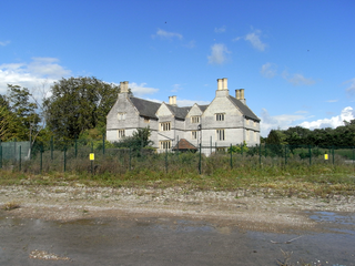
Pond in front of Manor House Farm
Location North Petherton, Somerset, England
Coordinates 51°05′18″N2°59′05″W / 51.08833°N 2.98472°W / 51.08833; -2.98472 Coordinates: 51°05′18″N2°59′05″W / 51.08833°N 2.98472°W / 51.08833; -2.98472
Built17th century
Listed Building – Grade II
Official name: Petherton Park Farmhouse and Park Manorhouse
Designated29 March 1963 [1]
Reference no.1060171
Listed Building – Grade II
Official name: Two pairs of gate piers on frontage of Petherton Park Farmhouse and Park Manorhouse
Designated29 March 1963 [2]
Reference no.1344640
Somerset UK location map.svg
Red pog.svg
Location of Petherton Park in Somerset

Petherton Park (also known as North Petherton Park or Newton Park) was a Deer park around North Petherton within the English county of Somerset.

The origins are unclear but the area was part of an earlier Royal Forest stretching from the River Parrett to the Quantock Hills. [3] According to the late 13th century Hundred Rolls, King Henry II of England (d. 1189) gave William of Wrotham lands at North Petherton. [4] [5] During the reigns of Henry II (1154-1189) and Richard I (1189-1199), the royal forest of Petherton Park, was held from the crown by Osbert and William Dacus by grand serjeanty of being the king's Forester of Petherton. [6] William de Plessis, who died in 1274 was granted Petherton Park and it was inherited by his son Richard de Barbeflote or Plessis. [7]

The park was the only part of the royal estate which had not been granted away from royal ownership by the end of the 13th century. [8] From 1391 until his death in 1400 the poet Geoffrey Chaucer was one of the foresters. [9] [10] He was succeeded by his son Thomas Chaucer.

At various points during the 13th and 14th centuries the park was the source of venison for royal feasts. [11] The park was also a source of timber, which was granted by the king often to religious houses such as the Buckland Priory and the Friary and Nunnery in Ilchester. [12] Between 1513 and 1535 Sir William Courtenay (d.1535) of Powderham, Devon was the keeper of North Petherton Park. [13]

The park was visited by John Leland in 1538 who recorded that there were around 2000 deer in the park. [14] Its extent was shown on the map of 1575 by Christopher Saxton and again in a map of 1610 by John Speed. [15]

In 1583 the park was recorded as being owned by absentee landlords and falling into decline, although it was still a source of timber for sale. In 1584 part of the park was enclosed and leased. In 1638 the keeper Sir Thomas Wroth, of the Wroth baronets who had held the park since the reign of Elizabeth I, [14] started to break up the park and by 1665 it had been divided into 11 different holdings, [16] and by 1676 there were 15. [17]
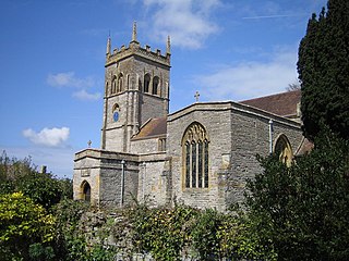
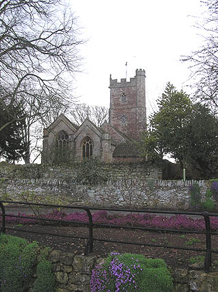
The Alfred Jewel an Anglo-Saxon artefact made of enamel and quartz enclosed in gold that was discovered in the park in 1693, and is now one of the most popular exhibits at the Ashmolean Museum in Oxford. It has been dated from the late 9th century. It was made in the reign of Alfred the Great and is inscribed "AELFRED MEC HEHT GEWYRCAN", meaning 'Alfred ordered me made'. The jewel was once attached to a rod, probably of wood, at its base. After decades of scholarly discussion, it is now "generally accepted" that the jewel's function was to be the handle for a pointer stick for following words when reading a book. It is an exceptional and unusual example of Anglo-Saxon jewellery. There is a replica of the jewel in the Church of St Mary, North Petherton.

Maunsel House at North Newton, which was within the area of the earlier park, was built in the late 14th or early 15th century. Between 1648 and 1726 it was owned by the Bacon family who turned some the land into gardens, orchards and a fish pond. [18]

The house which takes the name of Petherton Park was built in the 17th century. It is a Grade II listed building. [1] It is now known as Petherton Park Farmhouse and has been divided into two separate houses. [1] The two storey building has an eleven bay front. [1] Two gatepiers at the entry to the site are also listed. [2]

Related Research Articles

The Battle of Cynwit, also spelt Cynuit, was a battle between West Saxons and Vikings in 878 at a fort which Asser calls Cynwit. The location of the battle is uncertain. Possible sites include Cannington Hill, near Cannington, Somerset; and Countisbury Hill, near Countisbury, Devon.

A rhyne (Somerset), rhine/rhyne (Gloucestershire), or reen is a drainage ditch, or canal, used to turn areas of wetland at around sea level into useful pasture.

Church of St Mary & All Saints, Broomfield church in Broomfield, Somerset

The Church of St Mary & All Saints in Broomfield, Somerset, England was built in the 15th and 16th centuries and has been designated as a Grade I listed building.

St Marys Church, Cannington church in Sedgemoor, UK

The Church of St Mary is the parish church of Cannington, Somerset, England.

St Margarets Church, Spaxton church in Sedgemoor, UK

The Church of St Margaret in Spaxton, Somerset, England has some parts from the 12th and 13th centuries but is predominantly from the 15th century, and was restored in 1895. It has been designated as a Grade I listed building.

Church of St Mary, North Petherton church in Sedgemoor, UK

The Church of St Mary in North Petherton, Somerset, England dates from the 15th century and has been designated as a grade I listed building. It is on the Heritage at Risk Register due to the condition of the roof and north aisle parapet.

Corn Exchange, Bridgwater Grade I listed corn exchange in Sedgemoor, United Kingdom

The Corn Exchange and market house in Bridgwater, Somerset, England was built in 1834 by John Bowen and extended in 1875, by Charles Knowles. It has been designated as a Grade I listed building.

Gothelney Hall Grade I listed architectural structure in Sedgemoor, United Kingdom

Gothelney Hall, also known as Gothelney Manor Farmhouse, located in the parish of Spaxton, Somerset, England was built in the 15th century and has been designated as a Grade I listed building.

Buckland Priory human settlement in United Kingdom

Buckland Priory was established around 1167 in Lower Durston, Somerset, England.

Hundred of Andersfield

The Hundred of Andersfield is one of the 40 historical Hundreds in the ceremonial county of Somerset, England, dating from before the Norman conquest during the Anglo-Saxon era although exact dates are unknown.

Hundred of North Petherton

The Hundred of North Petherton is one of the 40 historical Hundreds in the ceremonial county of Somerset, England, dating from before the Norman conquest. Although the Hundreds have never been formally abolished, their functions ended with the establishment of county courts in 1867 and the introduction of districts by the Local Government Act 1894. The name of the hundred derives from the name of the large royal estate that covered much of the area in 1086, recorded variously as Nortpetret in the Domesday Book, Nortpedret in Liber Exoniensis and Nort Peretu in the associated tax returns. This, in turn, was derived from the area's location to the northern end of the River Parrett.

Alfred of Spain was a Norman lord recorded in the Domesday Book. He held land mainly in Somerset but also in Devon, Dorset, Wiltshire, Gloucestershire and Herefordshire. He was not from Spain but from Épaignes in Normandy. The Domesday scribes rendered his name into Latin as Alvredi De Ispania as a kind of word play and in English his name is written variously Alfred or Alvredof or de Spain, Hispania or Ispania. It has been suggested that he may have built the castle at Nether Stowey or possibly an earlier one which has disappeared at Over Stowey. Much of his land was the pre-conquest estate of a Saxon lord Alfwy although the important manor of Stowey had been held by King Harold.

Church of St Peter and St Paul, Over Stowey church in Sedgemoor, UK

Church Of St Peter And St Paul in Over Stowey, Somerset, England is the Anglican parish church for the ancient parish of Over Stowey, now part of the Quantock Villages Benefice in the Diocese of Bath and Wells.

Walford, Somerset Human settlement in England

Walford is a small village 3 miles (5 km) north east of Taunton in Somerset, England. Most of the village, including Walford Cross at the junction of the A38 and the A361, lies in the civil parish of Creech St Michael. The western part of the village, including Walford House, is in the civil parish of West Monkton. The village lies close to the A38 and the M5 motorway.

Manor of Sydenham

The Manor of Sydenham was a historic manor in Somerset, England, situated about 1/4 mile north-east of the centre of historic Bridgwater. Sydenham House, the manor house, a grade II listed building situated in the parish of Wembdon, was built in the early 16th century and refronted and rebuilt after 1613. In 1937 British Cellophane Ltd set up production and built extensive factories on 59 acres of land adjacent to the manor house. Production ceased in 2005 and between 2010 and 2015 the industrial site was razed to the ground. In 2015 the razed site is owned by EDF Energy, which in 2012 purchased the manor house with the former factory site, intended for construction of temporary accommodation for 1,000 workers on the proposed new Hinkley Point C nuclear power station 12 miles away. The Manor House is situated to the north side of the A39 Bath Road. Its owners were on the losing side in the Civil War and again in the Monmouth Rebellion.

Church of St Giles, Thurloxton

The Norman Anglican Church of St Giles in Thurloxton dates from the 14th century but is predominantly from the 15th century with 19th-century restoration including the addition of the north aisle in 1868. It has been designated by English Heritage as a Grade II* listed building.

West Bower Manor

West Bower Manor in Durleigh within the English county of Somerset was largely built in the 15th century. It is a Grade II* listed building.

Church of St Hugh, Durleigh

The Church of St Hugh at Durleigh in the English county of Somerset was built in the 11th century. It is a Grade II* listed building.

Church of St Peter, North Newton church in Sedgemoor, UK

The Anglican Church of St Peter in North Newton within the English county of Somerset has a tower believed to date from Saxon times. It is a Grade II* listed building.

Church of the Holy Trinity, Chilton Trinity church in Sedgemoor, UK

The Anglican Church of the Holy Trinity at Chilton Trinity in the English county of Somerset was established in the 13th century. It is a Grade II* listed building.

References

  1. 1 2 3 4 Historic England. "Petherton Park Farmhouse and Park Manorhouse (1060171)". National Heritage List for England . Retrieved 5 April 2015.
  2. 1 2 Historic England. "Two pairs of gate piers on frontage of Petherton Park Farmhouse and Park Manorhouse (1344640)". National Heritage List for England . Retrieved 5 April 2015.
  3. Bond 1998, p. 23.
  4. Gathercole, Clare. "North Petherton" (PDF). The Somerset Urban Archaeological Survey. Somerset County Council. Archived from the original (PDF) on 19 October 2014. Retrieved 19 October 2014.
  5. Golding "Wrotham, William of (d. 1217/18)" Oxford Dictionary of National Biography
  6. Collinson, Rev. John, History and Antiquities of the County of Somerset, Vol.3, Bath, 1791, p.55
  7. R W Dunning, C R Elrington (Editors), A P Baggs, M C Siraut (1992). "North Petherton: Manors and other estates". A History of the County of Somerset: Volume 6: Andersfield, Cannington, and North Petherton Hundreds (Bridgwater and neighbouring parishes). Institute of Historical Research. Retrieved 19 October 2014.CS1 maint: multiple names: authors list (link)
  8. R W Dunning, C R Elrington (Editors), A P Baggs, M C Siraut (1992). "North Petherton Hundred". A History of the County of Somerset: Volume 6: Andersfield, Cannington, and North Petherton Hundreds (Bridgwater and neighbouring parishes). Institute of Historical Research. Retrieved 19 October 2014.CS1 maint: multiple names: authors list (link)
  9. R W Dunning, C R Elrington (Editors), A P Baggs, M C Siraut (1992). "North Petherton". A History of the County of Somerset: Volume 6: Andersfield, Cannington, and North Petherton Hundreds (Bridgwater and neighbouring parishes). Institute of Historical Research. Retrieved 19 October 2014.CS1 maint: multiple names: authors list (link)
  10. "Local History". North Petherton. Retrieved 19 October 2014.
  11. Bond 1998, p. 24.
  12. Bond 1998, p. 28.
  13. "Bindoff, S.T. (Ed.)History of Parliament, House of Commons 1509-1558, 1982".
  14. 1 2 Greswell 1905, p. 84.
  15. Greswell 1905, p. 85.
  16. Bond 1998, p. 59.
  17. R W Dunning, C R Elrington (Editors), A P Baggs, M C Siraut (1992). "North Petherton: Economic history". A History of the County of Somerset: Volume 6: Andersfield, Cannington, and North Petherton Hundreds (Bridgwater and neighbouring parishes). Institute of Historical Research. Retrieved 19 October 2014.CS1 maint: multiple names: authors list (link)
  18. Bond 1998, p. 73.

Bibliography