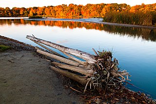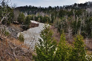
The Don River is a watercourse in southern Ontario, that empties into Lake Ontario, at Toronto Harbour. Its mouth was just east of the street grid of the town of York, Upper Canada, the municipality that evolved into Toronto, Ontario. The Don is one of the major watercourses draining Toronto that have headwaters in the Oak Ridges Moraine.

The Humber River is a river in Southern Ontario, Canada. It is in the Great Lakes Basin, is a tributary of Lake Ontario and is one of two major rivers on either side of the city of Toronto, the other being the Don River to the east. It was designated a Canadian Heritage River on September 24, 1999.

Halton Hills is a town in the Regional Municipality of Halton, located in the northwestern end of the Greater Toronto Area, Ontario, Canada with a population of 61,161 (2016).

The Oak Ridges Moraine is an ecologically important geological landform in the Mixedwood Plains of south-central Ontario, Canada. The moraine covers a geographic area of 1,900 square kilometres (730 sq mi) between Caledon and Rice Lake, near Peterborough. One of the most significant landforms in southern Ontario, the moraine gets its name from the rolling hills and river valleys extending 160 km (99 mi) from the Niagara Escarpment east to Rice Lake. It was formed 12,000 years ago by advancing and retreating glaciers. The moraine is a contested site in Ontario, since it stands in the path of major urban development.

The Rouge River is a river in Markham, Pickering, Richmond Hill and Toronto in the Greater Toronto Area of Ontario, Canada. The river flows from the Oak Ridges Moraine to Lake Ontario at the eastern border of Toronto, and is the location of Rouge Park, the only national park in Canada within a municipality. At its southern end, the Rouge River is the boundary between Toronto and southwestern Pickering in the Regional Municipality of Durham.

Pottageville is an unincorporated community located in northeastern King Township, in Ontario, Canada. It is near Schomberg. It is named for one of its early settlers, Edward Pottage.

The Scarborough Bluffs, also known as The Bluffs, is an escarpment in the Scarborough district of Toronto, Ontario, Canada. There are nine parks along the bluffs, with Bluffers Park being the only one with a beach. Forming much of the eastern portion of Toronto's waterfront, the Scarborough Bluffs stands above the shoreline of Lake Ontario. At its highest point, the escarpment rises 90 metres (300 ft) above the coastline and spans a length of 15 kilometres (9.3 mi).
Toronto and Region Conservation Authority(TRCA) is the largest of 36 conservation authorities in Ontario, Canada. It owns more than 16,000 hectares of land in the Toronto region and employs more than 400 full-time employees and coordinates more than 3,000 volunteers each year. TRCA's area of jurisdiction is watershed-based, and includes 3,467 square kilometres: 2,506 on land and 961 water-based in Lake Ontario. This area comprises nine watersheds from west to east: Etobicoke Creek, Mimico Creek, Humber River, Don River, Highland Creek, Petticoat Creek, Rouge River, Duffins Creek, Carruthers Creek.
A conservation authority is a local, community-based natural resource management agency based in Ontario, Canada. Conservation authorities represent groupings of municipalities on a watershed basis and work in partnership with other agencies to carry out natural resource management activities within their respective watersheds, on behalf of their member municipalities and the Province of Ontario.

Rouge National Urban Park is a national urban park in Ontario, Canada. The park is centred around the Rouge River and its tributaries in the Greater Toronto Area. The southern portion of the park is situated around the mouth of river, in Scarborough, and extends northwards into Markham, Pickering, Uxbridge, and Whitchurch-Stouffville.

The Greenbelt is a permanently protected area of green space, farmland, forests, wetlands, and watersheds, located in Southern Ontario, Canada. It surrounds a significant portion of the Golden Horseshoe.

The Lake Simcoe Region Conservation Authority is a conservation authority established in 1951, and is among the oldest in the Canadian province of Ontario.

The Toronto ravine system is a distinctive feature of the city's geography, consisting of a network of deep ravines which forms a large urban forest that runs through most of Toronto. The ravine system is the largest in any city in the world, with the Ravine and Natural Feature Protection Bylaw protecting approximately 110 square kilometres (42 sq mi) of public and privately-owned land. The ravine system has been presented as a central characteristic of the city, with the size of the ravine system leading Toronto to be described as "a city within a park".

Cold Creek Conservation Area, usually Cold Creek, is an ecologically diverse protected Area of Natural and Scientific Interest in south-central Ontario, Canada. The 190-hectare (470-acre) conservation area was opened on 20 June 1962 by Wilf Spooner and the Toronto and Region Conservation Authority. It is located on the western end of King Township, overlapping the Oak Ridges Moraine. The Government of Ontario Ministry of Natural Resources classifies the area as a provincially significant Area of Natural and Scientific Interest for its "provincially or regionally significant representative ecological features". The area was also a site classified for the International Biological Program. The Life Science area, known as Cold Creek Swamp, is composed of a swamp and forest.

The Mixedwood Plains Ecozone is the Canadian ecozone with the most southern extent, covering all of southwestern Ontario, and parts of central and northeastern Ontario and southern Quebec along the Saint Lawrence River. It was originally dominated by temperate deciduous forest growing mostly on limestone covered by glacial till. It is the smallest ecozone in Canada, but it includes the country's most productive industrial and commercial region, and is home to nearly half of Canada's population, including its two largest cities, Toronto, Ontario and Montreal, Quebec. Hence, little of the original forest cover remains, making protection of the remaining forests a high conservation priority. This ecozone includes two regions described by J.S. Rowe in his classic Forest Regions of Canada: the entire Deciduous Forest Region, and the southern portions of the Great Lakes-St. Lawrence Forest Region. In the province of Ontario, the Ontario Ministry of Natural Resources maps this area as Site Regions 6E and 7E.
Albion Hills Conservation Area (AHCA) is located in the Town of Caledon within the Regional Municipality of Peel. AHCA is located eight kilometers north of Bolton, off of Highway 50 at 16500 Highway 50, Palgrave, Ontario. It is owned and managed by the Toronto and Region Conservation Authority (TRCA). AHCA sees about 120,000 visitors each year, who visit the conservation area for mountain biking, camping, swimming, special events, cross-country skiing and more.

Heart Lake Conservation Area (HLCA) occupies 169 hectares in the Etobicoke Creek watershed, within the City of Brampton, Ontario. It is owned and managed by the Toronto and Region Conservation Authority (TRCA).
Deborah Martin-Downs is a Canadian aquatic biologist who specializes in fish and their environments. She has worked in ecology and conservation for over 30 years in Toronto both as a consultant and as director of the Toronto and Region Conservation Authority (TRCA). She is currently the Chief Administrative Officer Credit Valley Conservation Authority and oversees environmental conservation projects in and around Toronto.
Big Creek is a watercourse in Norfolk County, Ontario. It is approximately 60 kilometres (37 mi) long. It empties into Lake Erie, at Port Rowan, at Long Point. Its watershed covers 730 square kilometres (280 sq mi), alternately 750 square kilometres (290 sq mi).

The Toronto waterway system comprises a series of natural and man-made watercourses in the Canadian city of Toronto. The city is dominated by a large river system spanning most of the city including the Don River, Etobicoke Creek, Highland Creek, Humber River, Mimico Creek and Rouge River.


