Squires is an unincorporated community in Douglas County, Missouri, United States. Squires is located approximately 9 miles (14 km) south of Ava on Route 5 at the intersection with Route JJ. The Squires fire tower is located one-quarter mile to the southwest, at an elevation of 1,517 feet (462 m). Wasola in Ozark County is about 5 miles (8.0 km) to the southeast.
Smallett is an unincorporated community in southern Douglas County, Missouri, United States. It is located approximately nine miles south of Ava and is located on Missouri Supplemental Route A. It previously had its own post office from 1888-1967 with ZIP code 65750, but mail is now served by the post office in Ava. Some say Smallett was named for its first postmaster, James Small, while others believe the name honors another early settler.

Hilda is an unincorporated community in Taney County, Missouri, United States. It is located on U.S. Route 160 two miles east of the Kissee Mills recreation area on the Beaver Creek arm of Bull Shoals Lake and approximately fifteen miles east of Branson. The Hilda Lookout Tower in approximately one mile south on Lime Kiln Mountain. Hilda is part of the Branson Micropolitan Statistical Area.

Peyton is a ghost town in Tunica County, Mississippi, United States.
Ben Lomond is a ghost town in Issaquena County, Mississippi, United States.
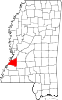
Eutaw is a ghost town in Bolivar County, Mississippi, United States. The settlement had a port on the Mississippi River called "Eutaw Landing."
Kienstra is a ghost town located in Adams County, Mississippi, United States. South of the town was Kienstra Landing, located on the Mississippi River.
Artonish is a ghost town located in Wilkinson County, Mississippi, United States. South of the town was Artonish Landing, located on a stretch of the Mississippi River known as the "Homochitto Cutoff".
Aserdaten is an unincorporated community and ghost town located within Lacey Township in Ocean County, New Jersey, United States.
Murphreesboro is a ghost town in Tallahatchie County, Mississippi, United States.
Promised Land is a ghost town in Sunflower County, Mississippi, United States.
Comeby is a ghost town in Rankin County, Mississippi, United States.
Dobson is a ghost town in Rankin County, Mississippi, United States.
Czar is an unincorporated community in southeastern Crawford County, in the U.S. state of Missouri. The community was located on the east side of Shoal Creek on Missouri Route Y, approximately four miles north of Viburnum. The Czar church and cemetery are about one-half mile northwest and the Czar Lookout Tower is on a ridge about one mile northeast on Route Y.
Rocky Mount is an unincorporated community in western Miller County, Missouri United States. The site is on Missouri Route Y approximately four miles southwest of Eldon. The Rocky Mount church is located at this location, however the post office was moved into neighboring Morgan County about two miles to the southwest in 1919. The Rocky Mount Lookout Tower and Rocky Mount Towersite State Wildlife Area lie approximately two miles to the east.
Dogwood is an unincorporated community in Mississippi County, in the U.S. state of Missouri.
Rushs Ridge is an extinct town in Mississippi County, in the U.S. state of Missouri. The GNIS classifies it as a populated place.
Cannonsburg is an unincorporated community in Jefferson County, Mississippi, United States.
Monterey is an unincorporated community in Rankin County, Mississippi, United States.
Lynwood is a ghost town in Rankin County, Mississippi, United States.