Phillips Square

Last updated
Phillips Square
French: square Phillips
Phillips Square, Montreal, Sep 06 2022.jpg
Montreal-blank.png
Red pog.svg
Type Town square
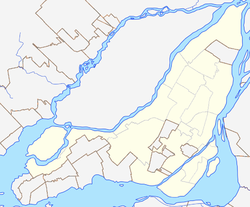
Location Downtown Montreal, Ville-Marie Montreal, Quebec, Canada
Coordinates 45°30′13″N73°34′07″W / 45.5037°N 73.5686°W / 45.5037; -73.5686
Created1872 (1872)
Operated byCity of Montreal
StatusOpen all year

Phillips Square (French : square Phillips) is a public square located in Downtown Montreal, Quebec, Canada. The Square was established in 1842 thanks to a gift from Alfred Phillips to the city of Montreal. [1]

Contents

History

In 1842, the square was first laid out in what was then a wealthy residential area on the fringe of the city of Montreal. The first merchant to open a business on Phillips Square was Alfred Joyce; “the high class caterer and confectioner” and one-time mayor of the town of Outremont who built an elegant shop on the south side of the square in 1878. In 1891, Morgan's department store established itself on the north side of the square. That site is of particular interest to visitors from the United States because Confederate President Jefferson Davis sent his family to live in Montreal during the American Civil War. A brass plaque installed on the west side of the store, today called The Bay, was dedicated to his memory. Davis came in 1867 to stay in John Lovell’s house, which then stood on the site. The plaque was removed in 2017.

The head office of Henry Birks and Sons was built soon after on the west side of the square in 1894. The fast food outlet on the corner of the east side of Phillips Square was the site of Montreal’s first art gallery, which was inaugurated by the governor general of Canada, Sir John Campbell, 9th Duke of Argyll (also known as the Marquis of Lorne) in 1879. When its collection grew, it eventually moved to the present-day Montreal Museum of Fine Arts. [2] On the south side of the square, where Alfred Joyce once had his pastry shop, is the Canada Cement Building, built in 1921. Designed by Barott and Blackader, the dignified 10-storey building was the first office tower to be built completely of reinforced concrete. Canada Cement was founded by Max Aitken, later Lord Beaverbrook, and Barott convinced him to use concrete in the building of his head office to advertise his cement-based products. The building was considered avant-garde when it opened because it was the first skyscraper in Montreal to have an underground parking garage, and there were then only a few automobiles on the road.

On August 31, 2012, a memorial to the victims of the Blue Bird Café fire, which occurred nearby in 1972, was unveiled by the city of Montreal on the south side of the square to mark the 40th anniversary of the tragedy.

In 2022, Provencher_Roy transformed part of Sainte-Catherine Street West into a pedestrian oriented hub. At the heart of the project sits Phillips Square a newly expanded public space. The plan eliminates street parking and drastically widens the sidewalks, flipping the proportion of space allocated to cars and pedestrians to turn it into a place for people. Bronze plates in the street serve as urban markers, identifying the grand turn-of-the-century department stores and commercial buildings that lend this area its storied heritage. The design also recenters Phillips Square as an integral part of the downtown core as envisioned in the 1841 Phillips Plan. A contemporary interpretation of the English Garden Square, the space is newly expanded thanks to wider sidewalks, lush plantings and open sightlines, which offer picturesque views over the built environment and surrounding landscape. The monument to Edward VII is showcased with new uplighting, surrounded by integrated urban furniture and a programmable water feature. In addition, the project increases vegetation in the Square by 46% and plants 14 times the number of current trees. [3]

Monuments

The square features a bronze monument of King Edward VII, who ruled from 1901 to 1910. He visited Montreal in 1860, while he was still the Prince of Wales, and opened the Victoria Bridge. The statue was designed by Louis-Philippe Hébert and was erected in 1914. The four allegorical figures at the base of the monument represent Peace, the Four Founding Nations, Abundance, and Liberty.


Related Research Articles

<span class="mw-page-title-main">Sidewalk</span> Pedestrian path along the side of a road

A sidewalk, pavement, footpath in Australia, India, New Zealand and Ireland, or footway, is a path along the side of a road. Usually constructed of concrete, pavers, brick, stone, or asphalt, it is designed for pedestrians. A sidewalk is normally higher than the roadway, and separated from it by a kerb. There may also be a planted strip between the sidewalk and the roadway and between the roadway and the adjacent land.

<span class="mw-page-title-main">Street</span> Public thoroughfare in a built environment

A street is a public thoroughfare in a built environment. It is a public parcel of land adjoining buildings in an urban context, on which people may freely assemble, interact, and move about. A street can be as simple as a level patch of dirt, but is more often paved with a hard, durable surface such as tarmac, concrete, cobblestone or brick. Portions may also be smoothed with asphalt, embedded with rails, or otherwise prepared to accommodate non-pedestrian traffic.

<span class="mw-page-title-main">Queen's Park (Toronto)</span> Toronto park home to the Ontario Legislature

Queen's Park is an urban park in Downtown Toronto, Ontario, Canada. Opened in 1860 by Edward, Prince of Wales, it was named in honour of Queen Victoria. The park is the site of the Ontario Legislative Building, which houses the Legislative Assembly of Ontario. The phrase "Queen's Park" is regularly used as a metonym for the Government of Ontario or the Legislative Assembly of Ontario.

<span class="mw-page-title-main">Jacques Cartier Bridge</span> Bridge near Montreal, Quebec, Canada

The Jacques Cartier Bridge is a steel truss cantilever bridge crossing the Saint Lawrence River from Montreal Island, Montreal, Quebec, to the south shore at Longueuil, Quebec, Canada. The bridge crosses Saint Helen's Island in the centre of the river, where offramps allow access to the Parc Jean-Drapeau and La Ronde amusement park.

<span class="mw-page-title-main">Exhibition Place</span> Publicly owned mixed-use development in Toronto

Exhibition Place is a publicly owned mixed-use district in Toronto, Ontario, Canada, located by the shoreline of Lake Ontario, just west of downtown. The 197-acre (80 ha) site includes exhibit, trade, and banquet centres, theatre and music buildings, monuments, parkland, sports facilities, and a number of civic, provincial, and national historic sites. The district's facilities are used year-round for exhibitions, trade shows, public and private functions, and sporting events.

<span class="mw-page-title-main">City block</span> Smallest area that is surrounded by streets

A city block, residential block, urban block, or simply block is a central element of urban planning and urban design.

<span class="mw-page-title-main">Nathan Phillips Square</span> Public square in Downtown Toronto

Nathan Phillips Square is an urban plaza in Toronto, Ontario, Canada. It forms the forecourt to Toronto City Hall, or New City Hall, at the intersection of Queen Street West and Bay Street, and is named after Nathan Phillips, mayor of Toronto from 1955 to 1962. The square was designed by the City Hall's architect Viljo Revell and landscape architect Richard Strong. It opened in 1965. The square is the site of concerts, art displays, a weekly farmers' market, the winter festival of lights, and other public events, including demonstrations. During the winter months, the reflecting pool is converted into an ice rink for ice skating. The square attracts an estimated 1.5 million visitors yearly. With an area of 4.85 hectares, it is Canada's largest city square.

<span class="mw-page-title-main">Quartier international de Montréal</span> Neighbourhood in Montreal, Quebec, Canada

The Quartier international de Montréal (QIM) or Montreal's International District is a district of the Ville-Marie borough in the city's downtown core of Montreal, Quebec, Canada. It is roughly bordered by René-Levesque Boulevard to the north, Notre-Dame Street to the south, De Bleury/Saint-Pierre Street to the east and Robert-Bourassa Boulevard to the west. The Palais des congrès building lying just east of the district is also usually comprised in it. Constructed dispersedly between 1965 and 1985 in place of older colonial housing blocks, the district underwent major urban renewal as a central business district in 2000–2003.

<span class="mw-page-title-main">Saint Catherine Street</span> Street in Montreal, Canada

Sainte-Catherine Street is the primary commercial artery of Downtown Montreal, Quebec, Canada. It crosses the central business district from west to east, beginning at the corner of Claremont Avenue and de Maisonneuve Boulevard in Westmount, and ending at the Grace Dart Extended Care Centre by Assomption metro station, where it folds back into Notre-Dame Street. It also traverses Ville-Marie, passing just east of Viau in Mercier–Hochelaga-Maisonneuve. The street is 11.2 km long, and considered the backbone of Downtown Montreal.

<span class="mw-page-title-main">Victoria Square, Montreal</span>

Victoria Square is a town square and public space in the Quartier International de Montréal area of downtown Montreal, Quebec, Canada, at the intersection of Beaver Hall Hill and McGill Street. The Square forms an integral component of the city's urban public transit system and constitutes a 'prestige address' for the international face of the city. It is bordered by Viger Street to the north, Saint Jacques Street to the south, Beaver Hall Hill to the west and Square Victoria Street along the eastern side. As with other city squares, Square Victoria is open 24 hours per day to all citizens of Montreal and provides the role of an urban breathing space, with dense foliage to the south that tapers as the square rises up Beaver Hall Hill.

<span class="mw-page-title-main">St. James United Church (Montreal)</span> Church in Montreal, Quebec

Saint James United Church is a heritage church in the city's downtown core of Montreal, Quebec, Canada. It is a Protestant church affiliated with the United Church of Canada. It is located at 463 Saint Catherine Street West between Saint Alexandre and City Councillors Streets, in the borough of Ville-Marie within Downtown Montreal. It was designated as a National Historic Site of Canada in 1996.

<span class="mw-page-title-main">Provencher Bridge</span> Bridge in Manitoba, Canada

The Provencher Bridge is a set of paired bridges—a four-lane vehicular bridge and a suspended pedestrian bridge —across the Red River in Winnipeg, Manitoba.

This is a list of landmarks of Montreal.

<span class="mw-page-title-main">Cooper Square</span> Square in Manhattan, New York

Cooper Square is a junction of streets in Lower Manhattan in New York City located at the confluence of the neighborhoods of Bowery to the south, NoHo to the west and southwest, Greenwich Village to the west and northwest, the East Village to the north and east, and the Lower East Side to the southeast.

<span class="mw-page-title-main">La Fontaine Park</span> Urban park in Montreal, Canada

La Fontaine Park is a 34 ha urban park located in the borough of Le Plateau-Mont-Royal in Montreal, Quebec, Canada. Named in honour of Louis-Hippolyte Lafontaine, The park's features include two linked ponds with a fountain and waterfalls, the Théâtre de Verdure open-air venue, the Calixa-Lavallée cultural centre, a monument to Adam Dollard des Ormeaux, playing fields and tennis courts.

Montreal is a city located in Quebec, Canada and is one of the transportation hubs for eastern Canada and most of Quebec, with well-developed air, road, rail, and maritime links to the rest of Canada, as well as the United States and the rest of the world.

<span class="mw-page-title-main">Dorchester Square</span> Square in downtown Montreal, Quebec, Canada

Dorchester Square is a large urban square in downtown Montreal. Together with Place du Canada, the area is just over 21,000 m2 (230,000 sq ft) or 2.1 ha of manicured and protected urban parkland bordered by René Lévesque Boulevard to the south, Peel Street to the west, Metcalfe Street to the east and Dorchester Square Street to the north. The square is open to the public 24 hours a day and forms a focal point for pedestrian traffic in the city. Until the creation of Place du Canada in 1967, the name "Dominion Square" had been applied to the entire area.

<span class="mw-page-title-main">Edward VII Monument (Montreal)</span>

The Edward VII Monument is a statue of King Edward VII by artist Louis-Philippe Hébert and located at Phillips Square in Montreal, Quebec, Canada.

Quad Windsor is a new downtown neighborhood in Montreal, Quebec, Canada, to be constructed in stages and planned to be finished by 2025 and 2030. Cadillac Fairview will build a total of nine new buildings in the area, five being residential towers and two office towers all located south of Saint-Antoine Street, with construction stretching over 15 years. The project involves investments totaling more than $ 2 billion.

<span class="mw-page-title-main">Provencher Roy</span> Canadian Architecture Firm

Provencher Roy + Associés Architectes Inc. or Provencher_Roy is a Canadian architectural firm founded in Montreal in 1983, by architects Claude Provencher (1949-2022) and Michel Roy.

References

  1. Marsan, Jean-Claude (1990). Montreal in Evolution: Historical Analysis of the Development of Montreal's Architecture and Urban Environment. Montreal, Quebec: McGill-Queens University Press. p. 295. ISBN   978-0-7735-0798-2.
  2. Skelly, Julia. "Art Association of Montreal". The Canadian Encyclopedia. Retrieved 10 February 2022.
  3. "Revitalization of Sainte-Catherine Street West and Phillips Square". Provencher_Roy | Architecture - Design - Urbanisme - Paysage.