
An unincorporated area is a region that is not governed by a local municipal corporation. Widespread unincorporated communities and areas are a distinguishing feature of the United States and Canada. Most other countries of the world have either no unincorporated areas at all or these are very rare; typically remote, outlying, sparsely populated or uninhabited areas.

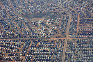
Diepsloot, Afrikaans for "deep ditch", is a densely populated township in Gauteng, South Africa. It is located in the newly formed Region A of the City of Johannesburg Metropolitan Municipality. There are high levels of crimes here including illegal electricity connections and theft.
Matatiele is a town located in the northern part of the Eastern Cape Province of South Africa. According to the South African National Census of 2011, its 12,466 residents and 4,107 households make Matatiele the largest populated town in the Matatiele Local Municipality.
Thokoza, formerly Tokoza, is a township in Ekurhuleni, Gauteng. Thokoza is at the location of the now-defunct Palmietfontein Airport. It is situated south east of Alberton, adjacent to Katlehong. Thokoza was the first black township which was established in the South. During the early 1990s Thokoza was the middle of unrest between the supporters of the Inkatha Freedom Party (IFP), rival party of the African National Congress (ANC).
Kuthuparamba is a town and a municipality in the Kannur district, state of Kerala, India. It is about 24 km south east of Kannur and 14 km east of Thalassery.

Mier was a local municipality within the ZF Mgcawu District Municipality in the Northern Cape province of South Africa. Its area includes the South African portion of one of the world's largest conservation areas, the Kgalagadi Transfrontier Park. The main settlement in the municipality is the town of Rietfontein.
Malamulele can refer to the town of Malamulele or the area of Malamulele. Both the town and area are in the Limpopo province of South Africa and predominantly occupied by Tsonga people. Malamulele town has one provincial road and one regional road; the R81 to Giyani and the R524 to Thohoyandou respectively. Malamulele is flanked by two rivers, Levubu River (Rivhubye) to the west and Letaba River to the east, meanwhile the Shingwedzi River runs from Malamulele West to Malamulele East, joining the Olifants in Mozambique on its way to the Indian Ocean. Malamulele is the seat of the Collins Chabane Local Municipality.
Bushbuckridge Local Municipality(Mapulaneng) is a third-level administrative division in the Ehlanzeni District of Mpumalanga in South Africa. Commercial farming, which consists of pine /bluegum plantations, tobacco, cotton, sub-tropical fruits and vegetables is practised in the municipality's countryside. The municipality includes the southern part of the Kruger National Park. Bushbuckridge is the largest local municipality in Mpumalanga in terms of land size.

Maluti-a-Phofung Local Municipality is an administrative area in the Thabo Mofutsanyane District of the Free State in South Africa. It encompasses substantially all of the former bantustan of QwaQwa, except for the small enclave at Botshabelo. The population is almost entirely Southern Sotho. The municipality is named after the Drakensberg mountains. The peak in QwaQwa is known as the Sentinel, which is called "Phofung" in Sesotho.

Greater Kokstad Local Municipality is an administrative area in the Harry Gwala District of KwaZulu-Natal in South Africa. Kokstad is derived from Dutch, and it means "town of Kok". It was named after Adam Kok III.

Ntabankulu Local Municipality is a local municipality in Alfred Nzo District Municipality in the Wild Coast Region of the Eastern Cape Province in South Africa.
Coronation is a populated place in the Emalahleni Local Municipality, Nkangala District Municipality in the Mpumalanga Province of South Africa.
Ikageng is a populated place in the Emalahleni Local Municipality of the Nkangala District Municipality in the Mpumalanga Province of South Africa.
Rethabile is a populated place in the Emalahleni Local Municipality of the Nkangala District Municipality in the Mpumalanga Province of South Africa.
Wolwekrans is a populated place in the Emalahleni Local Municipality of the Nkangala District Municipality in the Mpumalanga Province of South Africa.
Springbok is a populated place in the Emalahleni Local Municipality of the Nkangala District Municipality in the Mpumalanga Province of South Africa.
Reedstream Park is a populated place in the Emalahleni Local Municipality, Nkangala District Municipality in the Mpumalanga Province of South Africa.
Pambili is a populated place in the Emalahleni Local Municipality, Nkangala District Municipality in the Mpumalanga Province of South Africa.
New Largo is a populated place in the Emalahleni Local Municipality, Nkangala District Municipality in the Mpumalanga Province of South Africa.
Naauwpoort is a populated place in the Emalahleni Local Municipality, Nkangala District Municipality in the Mpumalanga Province of South Africa.