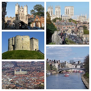
York is a cathedral city in North Yorkshire, England, with Roman origins, sited at the confluence of the rivers Ouse and Foss. The city has many historic buildings and other structures, such as a minster, castle, and city walls. It is the largest settlement and the administrative centre of the wider City of York district. It is located 27 miles (43 km) north-east of Leeds, 90 miles (140 km) south of Newcastle upon Tyne and 207 miles (333 km) north of London. York's built-up area had a recorded population of 141,685 in 2021.
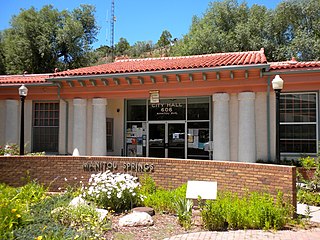
Manitou Springs is a home rule municipality located at the foot of Pikes Peak in western El Paso County, Colorado, United States. The town was founded for its natural mineral springs. The downtown area continues to be of interest to travelers, particularly in the summer, with many shops and restaurants, as well as a creekside city park. The main road through the center of town was one of the direct paths to the base of Pikes Peak. Barr Trail, which winds its way up Pikes Peak, is accessible from town. The subdivision Crystal Hills was added to the municipality in the 1960s.
The River Little Ouse, also known as the Brandon River, is a river in the east of England, a tributary of the River Great Ouse. For much of its length it defines the boundary between Norfolk and Suffolk.
St Neots is a town and civil parish in the Huntingdonshire district of Cambridgeshire, England. It is 18 miles (29 km) west of Cambridge. The areas of Eynesbury, Eaton Ford, Eaton Socon, and Wintringham form part of the town.
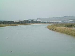
The Ouse is a 35 miles long river in the English counties of West and East Sussex. It rises near Lower Beeding in West Sussex, and flows eastwards and then southwards to reach the sea at Newhaven. It skirts Haywards Heath and passes through Lewes. It forms the main spine of an extensive network of smaller streams, of which the River Uck is the main tributary. As it nears the coast it passes through the Lewes and Laughton Levels, an area of flat, low-lying land that borders the river and another tributary, the Glynde Reach. It was a large tidal inlet at the time of the Domesday book in 1086, but over the following centuries, some attempts were made to reclaim some of the valley floor for agriculture, by building embankments, but the drainage was hampered by the buildup of a large shingle bar which formed across the mouth of the river by longshore drift.
The River Foss is in North Yorkshire, England. It is a tributary of the River Ouse. It rises in the Foss Crooks Woods near Oulston Reservoir close to the village of Yearsley and runs south through the Vale of York to the Ouse in the centre of York. The name most likely comes from the Latin word Fossa, meaning ditch. It is mentioned in the Domesday Book. The York district was settled by Norwegian and Danish people, so parts of the place names could be old Norse. Referring to the etymological dictionary "Etymologisk ordbog", ISBN 82-905-2016-6 deals with the common Danish and Norwegian languages – roots of words and the original meaning. The old Norse word Fos (waterfall) means impetuous. The River Foss was dammed, and even though the elevation to the River Ouse is small, a waterfall was formed. This may have led to the name Fos which became Foss.

Kempston is a town and civil parish in the Borough of Bedford, Bedfordshire, England, situated around 2 miles (3.2 km) south-west of Bedford town centre. It had a population of 19,330 in the 2011 census, and forms part of the wider Bedford built-up area. The River Great Ouse separates it from the Queen's Park area of Bedford.
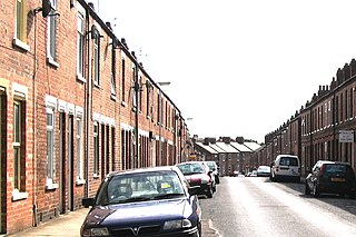
Fulford is a historic village and civil parish on the outskirts of York, in the York district, in the ceremonial county of North Yorkshire, England. Fulford is located 2 miles (3 km) to the south of the city, on the east bank of the River Ouse.

Ponds Forge International Sports Centre is a leisure complex in Sheffield, England. It has an Olympic-sized swimming pool with 2,600 seating capacity, a family and children's pools, water slides amongst other facilities.

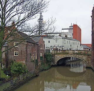
There are nine bridges across the River Ouse and eighteen smaller bridges and passages across the narrower River Foss within the city of York, England.

York has, since Roman times, been defended by walls of one form or another. To this day, substantial portions of the walls remain, and York has more miles of intact wall than any other city in England. They are known variously as York City Walls, the Bar Walls and the Roman walls. The walls are generally 13 feet (4m) high and 6 feet (1.8m) wide. They are the longest town walls in England.
Barker's Pool is a public city square and street in the centre of Sheffield, England. The focus of Barker's Pool is the Grade II* listed 90-foot-tall (27 m) war memorial that was unveiled on 28 October 1925 to commemorate the First World War. The Grade II* listed Sheffield City Hall is on the north side of the plaza facing the Grade II listed former John Lewis & Partners department store.

Brandon is a town and civil parish in the English county of Suffolk. Brandon is located in the Breckland area of Suffolk in the extreme north-west of the county, close to the adjoining county of Norfolk. It lies between the towns of Bury St Edmunds, Thetford, Mildenhall, Downham Market and the city of Ely. The town is almost entirely surrounded by Thetford Forest.
South Bank is an area of York in the county of North Yorkshire, England. It is to the south of the River Ouse. It was home to the now-closed Terry's Chocolate Works.

Holgate is a suburb of York in the ceremonial county of North Yorkshire, England. It is located about 1 mile west of Micklegate Bar in the city walls. Holgate is also the name of an electoral ward in the City of York unitary authority. The ward is currently bounded by the River Ouse from Scarborough Bridge to Ouse Acres on its northern boundary. Carr Lane and Ouse Acres on one side, and the intersection of York Road and Acomb Road on the other, make up its western boundary. The remainder of the southern boundary follows Moorgate and Holgate Beck to the East Coast Main Line railway which completes the eastern boundary as far as the River Ouse/Scarborough Bridge.

Buxton Crescent is a Grade-I-listed building in the town of Buxton, Derbyshire, England. It owes much to the Royal Crescent in Bath, but has been described by the Royal Institution of British Architects as "more richly decorated and altogether more complex". It was designed by the architect John Carr of York, and built for the 5th Duke of Devonshire between 1780 and 1789. In 2020, following a multi-year restoration and redevelopment project supported by the National Heritage Memorial Fund and Derbyshire County Council, The Crescent was reopened as a 5-star spa hotel.

Monument Valley Park is a historic, recreational park in Colorado Springs, Colorado through which Monument Creek flows. It is a National Register of Historic Places listing and is on the Colorado State Register of Historic Properties.

St Oswald's Hall is a grade II* listed former church in Fulford, in south-eastern York, in England.

The Porter Valley Parks are a series of public parks and green spaces in Sheffield, England. Lying along the valley of Porter Brook, they run radially out from the city centre, providing a direct green-space connection to the Peak District national park. Created variously between 1855 and 1938, they comprise in order from the city centre; Endcliffe Park, Bingham Park, Whiteley Woods, Forge Dam Park and Porter Clough.

St Nicholas' Church, Dunnington is a Grade II* listed parish church in Dunnington, a village in the rural south-eastern part of the City of York, in England.