Guadalupe County is a county located in the U.S. state of Texas. As of the 2020 census, its population was 172,706. The county seat is Seguin. The county was founded in 1846 and is named after the Guadalupe River.
Gonzales County is a county in the U.S. state of Texas, adjacent to Greater Austin-San Antonio. As of the 2020 census, its population was 19,653. The county is named for its county seat, the city of Gonzales. The county was created in 1836 and organized the following year. As of August 2020, under strict budgetary limitations, the County of Gonzales government-body is unique in that it claims to have no commercial paper, regarding it as "the absence of any county debt."

Caldwell County is a county located in the U.S. state of Texas. As of the 2020 census, its population was 45,883. Its county seat is Lockhart. The county was founded in 1848 and named after Mathew Caldwell, a ranger captain who fought in the Battle of Plum Creek against the Comanches and against Santa Anna's armies during the Texas Revolution. Caldwell was also a signer of the Texas Declaration of Independence.
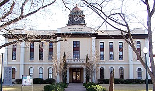
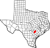
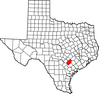
Bastrop County is located in the U.S. state of Texas. It is in Central Texas and its county seat is Bastrop.

Gage is a town in Ellis County, Oklahoma, United States. The population was 433 at the time of the 2020 census.

Gonzales is a city in the U.S. state of Texas, with a population of 7,165 at the 2020 census. It is the county seat of Gonzales County. The "Come and Take It" incident, the ride of the Immortal 32 into the Alamo, and the Runaway Scrape after the fall of the Alamo, all integral events in the War for Texas Independence from Mexico, originated in Gonzales.
Nassau Bay is a city in Harris County, Texas, United States, bordering the outermost southeastern edge of the city of Houston. It is located in the Clear Lake Area near Galveston Bay, directly adjacent to the Lyndon B. Johnson Space Center. The population was 5,347 at the 2020 census.

Taylor Lake Village is a city in Harris County, Texas, United States. The population was 3,704 at the 2020 U.S. census.

Webster is a city in the U.S. state of Texas located in Harris County, within the Houston–The Woodlands–Sugar Land metropolitan area. Its population was 12,499 at the 2020 U.S. census.

Hockley is an unincorporated community located in Harris County, Texas, United States, on Texas State Highway 6 and U.S. Route 290, approximately five miles (8.0 km) southeast of the city hall of Waller, and 36 mi (57.9 km) northwest of downtown Houston.

Glenn is an unincorporated community in Glenn County, California. It lies at an elevation of 98 feet. The town is located on the Sacramento River, at the intersection of State Route 45 and State Route 162. It is about ten miles (16 km) east of Interstate 5 and Willows on the U.S. Geological Survey 7.5-minute quadrangle, Glenn, California. The U.S. Geological Survey, National Geographic Names Database, calls its existence official with a feature ID of 1658621 and lists the NAD27 coordinates of the community as 39°31′19″N122°00′50″W. The ZIP Code, shared with Ordbend and Bayliss, is 95943. The community is inside area code 530. This area is flagged as rural by the U.S. Census Bureau.

Copano Bay is a northwestern extension of Aransas Bay, west of Rockport, Texas in Refugio and Aransas counties. It is supplied with seawater from the Gulf of Mexico via Aransas Bay, and fed freshwater from the Aransas River, Mission River and Copano Creek. As an estuary, the bay is home to a diverse ecosystem consisting of various birds including the endangered whooping crane, and numerous finfish including the redfish as well as shellfish such as oysters. It is classified as a nursery for shrimp, which prohibits production from the bay. Copano Bay is also a historic location for human usage and settlement that dates back to the 18th century, beginning with the historic port of El Copano and the 19th century settlements of St. Mary's of Aransas and Copano. The present-day towns of Bayside, Copano Village and Holiday Beach were all founded in the 20th century. Oil and natural gas are pumped from below the bay's surface, and contribute to the livelihood of the local economies. Recently, areas around the bay were affected by Hurricane Harvey which crossed over the bay as a Category 3 hurricane.
Canyon Creek is a residential neighborhood located in far northwest Austin, Texas. The neighborhood is located in ZIP Code 78726 and is bordered by Ranch to Market Road 2222 (RM 2222) on the south, Ranch to Market Road 620 (RM 620) on the west, Anderson Mill Road on the north, and a major headwater tributary of Bull Creek to the east as well as the Balcones Canyonlands National Wildlife Refuge. The major bisecting road is Boulder Lane, a loop which crosses RM 620 at the north and south entrances. The neighborhood is approximately 5 miles (8.0 km) from Lake Travis and Lake Austin.
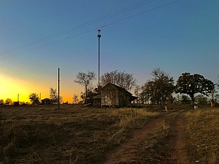
Harwood is a ghost town in Gonzales County, Texas, United States. According to the Handbook of Texas, the community had an estimated population of 112 in 2000.
Belmont, officially known as the "Belmont Site," is an unincorporated area of approximately 40 square miles in extreme western Gonzales County, Texas, United States, adjacent to Greater Austin, north of the "Belmont intersection" at the “Leesville Quad” water-testing site, electorally known as local Precinct 5. The population of Belmont-proper has been rated at 36 employees, with the greater area rated at 1,169 residents. The area is defined by the limits of the northern and western county line, bordered by the significant 1800s land grants of Eliza Dewitt, Ira Nash, Samuel Robbins and Thomas Decrew. It is served by the Belmont Volunteer Fire Department.
Bebe is an unincorporated community in Gonzales County, Texas, United States.
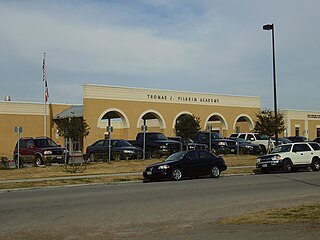
Thomas Jefferson Pilgrim started the first school in Texas. The town of Pilgrim, Texas, is named for Thomas J. Pilgrim. Thomas was born to Thomas and Dorcas Pilgrim, in East Haddam, Connecticut. Thomas attended the Hamilton Literary and Theological Institute at Colgate University. In 1828, Pilgrim heard about the settlements in Texas and left school in New York to travel to Texas in the company of approximately sixty men. The pilgrimage (npi) was led by Elias R. Wightman. Pilgrim arrived at Matagorda, Texas. Soon thereafter, Pilgrim served the Austin Colony as a Spanish interpreter. Pilgrim was also a close friend of Stephen F. Austin.

Indian River is a 59.1-mile-long (95.1 km) tributary of the Manistique River on the Upper Peninsula of Michigan in the United States. It rises out of Hovey Lake at 46°17′36″N86°42′20″W on Hiawatha National Forest land in Alger County and flows south and east through a lake district and on through Schoolcraft County. The river flows into the 8,659 acre (35 km2) Indian Lake at 46°17′36″N86°42′20″W and flows out at 45°59′30″N86°17′15″W. It then flows east and south about 2.5 miles where it merges with the Manistique River, which then flows through Manistique and into Lake Michigan at 45°56′56″N86°14′45″W.

The Lake Creek Settlement was a settlement in Stephen F. Austin's Second Colony, located in Mexican Texas, and later the Republic of Texas after it gained independence in 1836. The Lake Creek Settlement was located between the West Fork of the San Jacinto River (Texas) and the stream known as Lake Creek. It was the first Anglo-American settlement in what is today western Montgomery County, Texas.
Oak Hill is a ghost town in Bastrop County, Texas, United States. It is located four miles southwest of McDade, 12 miles southeast of Elgin, 13 miles northeast of Bastrop, and 37 miles southeast of Austin on the old Bastrop-McDade Road.