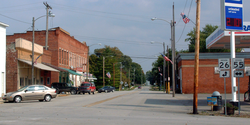
Pine Village, Indiana

Last updated

Pine Village, Indiana
Pine Village, Indiana.png
Lafayette Street at the intersection of 26 and 55
Locator map of Warren County, Indiana.svg
Red pog.svg
Pine Village, Indiana
USA Indiana location map.svg
Red pog.svg
Pine Village, Indiana
Usa edcp location map.svg
Red pog.svg
Pine Village, Indiana
Coordinates: 40°26′58″N87°15′12″W / 40.44944°N 87.25333°W / 40.44944; -87.25333
Country United States
State Indiana
County Warren
Township Adams
Founded1851
Founded byIsaac and John Metsker
Named for Big Pine Creek
Area
[1]
  Total0.12 sq mi (0.31 km2)
  Land0.12 sq mi (0.31 km2)
  Water0.00 sq mi (0.00 km2)
Elevation
[2]
689 ft (210 m)
Population
 (2020)
  Total212
  Density1,766.67/sq mi (680.07/km2)
Time zone UTC-5 (Eastern (EST))
  Summer (DST) UTC-4 (EDT)
ZIP code
47975
Area code 765
FIPS code 18-60084 [3]
GNIS feature ID2396857 [2]

Pine Village is a town in Adams Township, Warren County, in the U.S. state of Indiana. [2] The population was 217 at the 2010 census. [4]

Contents

History

The town was founded at the location of a trading post called Pine Village, which may have been named for a lone pine tree that stood on the bluff of Pine Creek, or it may have been named for the creek itself. [5] The town was laid out in 1851 by Isaac and John R. Metsker, and the plat map was made by county surveyor Perrin Kent. The Methodist Church was already there; it was built several years earlier. [6]

The post office at Pine Village has been in operation since 1854. [7]

Rail service

Rail service reached the town in the 1870s. The year 1883 witnessed the completion of a north/south Chicago and Great Southern Railway (later the Chicago and Indiana Coal Railway) line between Attica and Fair Oaks, some 50 miles (80 km) to the north. The line was later part of the Chicago and Eastern Illinois Railroad. It came to be known as the "Coal Road" for the large quantities of coal transported along it. When the C&EI floundered in the early 1920s, Charles F. Propst purchased the Coal Road and in October 1922 incorporated it as the Chicago, Attica and Southern Railroad. The CA&S was placed in receivership on August 5, 1931, and incremental abandonment occurred over subsequent years. [8] The line through Pine Village was scrapped in the fall of 1945, and the rails were pulled up using a Belgian horse and a block and tackle. [9]

Professional football

During the mid-1910s, Pine Village hosted a prominent professional football team.

Geography

Map of Pine Village Map of Pine Village, Indiana.svg
Map of Pine Village

Pine Village is located at the intersection of State Road 55 and State Road 26, near Big Pine Creek. [10] It is about 20 miles (32 km) west of Lafayette and about 14 miles (23 km) east of the Illinois border. According to the 2010 census, Pine Village has a total area of 0.12 square miles (0.31 km2), all land. [11]

The area on the east side of Pine Village near the railroad, consisting of a grain elevator and some homes, was known as Oklahoma [9] and is located at 40°26′59″N87°14′42″W / 40.44972°N 87.24500°W / 40.44972; -87.24500 (Oklahoma) .

Demographics

Historical population
CensusPop.Note
1900 279
1910 35226.2%
1920 301−14.5%
1930 3237.3%
1940 303−6.2%
1950 3112.6%
1960 309−0.6%
1970 291−5.8%
1980 257−11.7%
1990 134−47.9%
2000 25590.3%
2010 217−14.9%
2020 212−2.3%
U.S. Decennial Census [12]

As of the 2010 United States Census, there were 143 people, 60 households, and 41 families residing here. [13] The population density was 1,027.6 inhabitants per square mile (396.8/km2). There were 70 housing units at an average density of 503.0 per square mile (194.2/km2). [14] The racial makeup was 98.6% white, 0.7% black or African American, 0.0% from other races, and 0.7% from two or more races. Those of Hispanic or Latino origin made up 0.7% of the population. [13] In terms of ancestry, 32.8% were German, 13.9% were Swedish, 11.5% were Irish, 9.8% were American, and 9.8% were English. [15]

Of the 60 households, 26.7% had children under the age of 18 living with them, 55.0% were married couples living together, 8.3% had a female householder with no husband present, 31.7% were non-families, and 28.3% of all households were made up of individuals. The average household size was 2.38 and the average family size was 2.85. The median age was 46.1 years. [13]

The median income for a household was $48,750 and the median income for a family was $62,083. Males had a median income of $58,750 versus $36,250 for females. The per capita income for was $26,957. About 17.4% of families and 17.2% of the population were below the poverty line, including 0.0% of those under age 18 and 0.0% of those age 65 or over. [16]

Related Research Articles

<span class="mw-page-title-main">Marion County, Iowa</span> County in Iowa, United States

Marion County is a county in the U.S. state of Iowa. As of the 2020 census, the population was 33,414. The county seat is Knoxville. It is named for Francis Marion, a brigadier general from South Carolina in the American Revolutionary War.

<span class="mw-page-title-main">Warren County, Indiana</span> County in Indiana, United States

Warren County is a county in the U.S. state of Indiana. It lies in the western part of the state between the Illinois state line and the Wabash River. According to the 2020 census, it had a population of 8,440. Its county seat is Williamsport.

<span class="mw-page-title-main">Fountain County, Indiana</span> County in Indiana, United States

Fountain County lies in the western part of the U.S. state of Indiana on the east side of the Wabash River. The county was officially established in 1826 and was the 53rd in Indiana. The county seat is Covington.

<span class="mw-page-title-main">Pine Castle, Florida</span> Census-designated place in Florida, United States

Pine Castle is a census-designated place and unincorporated area in Orange County, Florida, United States. It is part of the Orlando–Kissimmee–Sanford, Florida Metropolitan Statistical Area.

<span class="mw-page-title-main">Boswell, Indiana</span> Town in Indiana, United States

Boswell is a town in Grant Township, Benton County, Indiana, United States. The population was 778 at the 2010 census. It is part of the Lafayette, Indiana Metropolitan Statistical Area.

<span class="mw-page-title-main">Attica, Indiana</span> City in Indiana, United States

Attica is a city in Logan Township, Fountain County, Indiana, United States.

<span class="mw-page-title-main">Covington, Indiana</span> City in Indiana, United States

Covington is a city in, and the county seat of, Fountain County, Indiana, United States. The population was 2,645 at the 2010 census.

<span class="mw-page-title-main">Warren, Indiana</span> Town in Indiana, United States

Warren is a town in Salamonie Township, Huntington County, Indiana. The population of Warren was 1,182 at the time of the 2020 census.

<span class="mw-page-title-main">La Crosse, Indiana</span> Town in Indiana, United States

La Crosse is a town in LaPorte County, Indiana, United States. The population was 551 at the 2010 census. It is included in the Michigan City, Indiana-La Porte, Indiana Metropolitan Statistical Area.

<span class="mw-page-title-main">Town of Pines, Indiana</span> Town in Indiana, United States

Town of Pines is a town in Pine Township, Porter County, in the U.S. state of Indiana. The population was 708 at the 2010 census.

<span class="mw-page-title-main">State Line City, Indiana</span> Town in Indiana, United States

State Line City is a town in Kent Township, Warren County, Indiana, United States, situated along the state's boundary with Illinois. As of the 2010 census, the town population was 143.

<span class="mw-page-title-main">West Lebanon, Indiana</span> Town in Indiana, United States

West Lebanon is a town in Pike Township, Warren County, in the U.S. state of Indiana. The population was 723 at the 2010 census.

<span class="mw-page-title-main">Williamsport, Indiana</span> Town in Indiana, United States

Williamsport is a town in Washington Township, Warren County, in the U.S. state of Indiana. The population was 1,898 at the 2010 census. It is the county seat of Warren County and is the largest of the four incorporated towns in the county. Williamsport Falls is located in downtown Williamsport.

<span class="mw-page-title-main">Cockeysville, Maryland</span> Census-designated place in Maryland, United States

Cockeysville is a census-designated place (CDP) in Baltimore County, Maryland, United States. The population was 20,776 at the 2010 census.

<span class="mw-page-title-main">Denham, Minnesota</span> City in Minnesota, United States

Denham is a city in Pine County, Minnesota, United States. The population was 37 at the 2020 census.

<span class="mw-page-title-main">Rutledge, Minnesota</span> City in Minnesota, United States

Rutledge is a city in Pine County, Minnesota, United States, at the confluence of the Kettle and Pine Rivers. The population was 229 at the 2010 census.

<span class="mw-page-title-main">Willow River, Minnesota</span> City in Minnesota, United States

Willow River is a city in Pine County, Minnesota, United States, at the confluence of the Kettle and Willow Rivers. The population was 415 at the 2010 census.

<span class="mw-page-title-main">Shippen Township, Tioga County, Pennsylvania</span> Township in Pennsylvania, United States

Shippen Township is a township in Tioga County, Pennsylvania, United States. The population was 500 at the 2020 census. Two Pennsylvania state parks, Colton Point and Leonard Harrison are in Shippen Township at the Pennsylvania Grand Canyon. The Grand Canyon Airport is also located on Pennsylvania Route 362 in Shippen Township.

<span class="mw-page-title-main">Centuria, Wisconsin</span> Village in Wisconsin, United States

Centuria is a village in Polk County, Wisconsin, United States. The population was 891 at the 2020 census.

<span class="mw-page-title-main">Arcade, New York</span> Town in New York, United States

Arcade is a town in Wyoming County, New York, United States. The population was 4220 at the 2020 census.

References

  1. "2020 U.S. Gazetteer Files". United States Census Bureau. Retrieved March 16, 2022.
  2. 1 2 3 U.S. Geological Survey Geographic Names Information System: Pine Village, Indiana
  3. "U.S. Census website". United States Census Bureau . Retrieved January 31, 2008.
  4. "Profile of General Population and Housing Characteristics: 2010". United States Census Bureau . Retrieved November 24, 2013.
  5. Baker, Ronald L.; Carmony, Marvin (1975). Indiana Place Names. Bloomington, Indiana: Indiana University Press. p. 130.
  6. A History of Warren County, Indiana. Warren County Historical Society. 1966. p. 6.
  7. "Warren County". Jim Forte Postal History. Retrieved July 10, 2016.
  8. Sulzer, Elmer G. (1998). "The Old Coal Road". Ghost Railroads of Indiana. Indiana University Press. ISBN   0-253-33483-7.
  9. 1 2 Rhode, Robert T. (2002). "A Walk Around Pine Village in the Early 1920s". A History of Warren County, Indiana. Warren County Historical Society.
  10. "US Gazetteer files: 2010, 2000, and 1990". United States Census Bureau. February 12, 2011. Retrieved April 23, 2011.
  11. "G001 - Geographic Identifiers - 2010 Census Summary File 1". United States Census Bureau. Archived from the original on February 13, 2020. Retrieved July 17, 2015.
  12. "Census of Population and Housing". Census.gov. Retrieved June 4, 2015.
  13. 1 2 3 "DP-1 Profile of General Population and Housing Characteristics: 2010 Demographic Profile Data". United States Census Bureau. Archived from the original on February 12, 2020. Retrieved July 10, 2015.
  14. "Population, Housing Units, Area, and Density: 2010". United States Census Bureau. Archived from the original on February 12, 2020. Retrieved July 10, 2015.
  15. "DP02 SELECTED SOCIAL CHARACTERISTICS IN THE UNITED STATES – 2006-2010 American Community Survey 5-Year Estimates". United States Census Bureau. Archived from the original on February 13, 2020. Retrieved July 10, 2015.
  16. "DP03 SELECTED ECONOMIC CHARACTERISTICS – 2006-2010 American Community Survey 5-Year Estimates". United States Census Bureau. Archived from the original on February 13, 2020. Retrieved July 10, 2015.