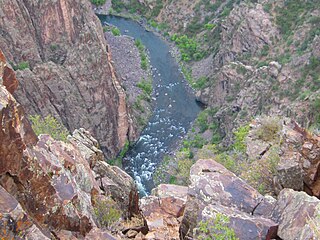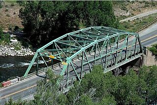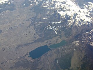
The Gunnison River is a tributary of the Colorado River, 164 miles (264 km) long, in the Southwestern state of Colorado. It is the largest tributary of the Colorado River in Colorado, with a mean flow of 2,570 cu ft/s (73 m3/s).

The Fryingpan River is a tributary of the Roaring Fork River, approximately 42 miles (68 km) long, in west central Colorado in the United States.

The Blue River is a tributary of the Colorado River, approximately 65 miles (105 km) long, in the U.S. state of Colorado.
Willow Creek is a tributary of the Colorado River, approximately 35 miles (56 km) long, in north central Colorado in the United States.

The Eagle River is a tributary of the Colorado River, approximately 60.5 miles (97.4 km) long, in west central Colorado in the United States.

The Uncompahgre River is a tributary of the Gunnison River, approximately 75 mi (121 km) long, in southwestern Colorado in the United States. Lake Como at 12,215 ft (3723m) in northern San Juan County, in the Uncompahgre National Forest in the northwestern San Juan Mountains is the headwaters of the river. It flows northwest past Ouray, Ridgway, Montrose, and Olathe and joins the Gunnison at Confluence Park in Delta.
The Piney River is a 23.7-mile-long (38.1 km) tributary of the Duck River in Middle Tennessee in the United States. Via the Duck River, the Tennessee River, and the Ohio River, it is part of the Mississippi River watershed. The headwater tributaries of the Piney River rise in Dickson County, Tennessee, near the city of Dickson. Dickson is located on the "Tennessee Valley Divide", which corresponds for some distance with the downtown's Main Street. The western part of the town, the part in the Tennessee Valley, is drained by the East Piney River, a tributary to the Piney.

Gore Creek is a tributary of the Eagle River, approximately 18.5 miles (29.8 km) long, in Eagle County in central Colorado in the United States. It drains an area of the Rocky Mountains at the south end of the Gore Range through Gore Valley. It rises on the Eagle County-Summit County border along the high crest of the Gore Range, in the White River National Forest, approximately 4 miles (6 km) north of Vail Pass, descending to the west through a narrow gorge, receiving Black Gore Creek from the south. Downstream of this confluence, it runs alongside the route of U.S. Highway 6 and Interstate 70. It flows through Vail and joins the Eagle River from the east, approximately 3 miles (5 km) west of Vail.
The Little Piney River is a 7.6-mile-long (12.2 km) tributary of the Piney River in Amherst County in the U.S. state of Virginia. Via the Piney and Tye rivers, it is part of the James River watershed.

The Eagles Nest Wilderness is a U.S. Wilderness Area located in the Gore Range near Vail, Copper Mountain, Frisco, Silverthorne, and Heeney, in Summit and Eagle Counties Colorado. Eagles Nest Wilderness falls within the jurisdiction of Dillon Ranger District and Holy Cross Ranger District, White River National Forest. The 135,114-acre (546.79 km2) wilderness with 180 miles (290 km) of trails was established in 1976. In 2010, additional lands were proposed for wilderness protection under the Hidden Gems proposal, affecting Elliot Ridge, Tenmile, and Lower Piney areas of Summit and Eagle Counties.
Big Piney Creek is a river located in Ozark National Forest in the state of Arkansas. It is a tributary of the Arkansas River and therefore part of the Mississippi River watershed. Managed by the United States Forest Service, it flows for 70.8 miles (113.9 km) through Pope, Johnson and Newton counties. The headwaters of the creek are in a rugged, remote area just east of Arkansas Route 21 south of the community of Fallsville and the mouth of the creek empties into Lake Dardanelle on the Arkansas River.
Little Dolores River is a 41.1-mile-long (66.1 km) tributary that flows into the Colorado River in Grand County, Utah from a source in Mesa County, Colorado.
The North Fork White River is a 33.0-mile-long (53.1 km) tributary of the White River. The river's source is Wall Lake in the Flat Tops Wilderness Area of Garfield County, Colorado. It joins with the South Fork White River in Rio Blanco County to form the White River.

East Fork Eagle River is an 8.6-mile-long (13.8 km) tributary of the Eagle River in Eagle County, Colorado. The river flows from a source on Chicago Ridge in the White River National Forest to a confluence with the South Fork Eagle River that forms the Eagle River.

South Fork Eagle River is a 6.9-mile-long (11.1 km) tributary of the Eagle River in Eagle County, Colorado. The river flows from a source east of Tennessee Pass in the White River National Forest to a confluence with the East Fork Eagle River that forms the Eagle River.

The New Fork River is the uppermost major tributary of the Green River in Wyoming, flowing about 70 miles (110 km) entirely within Sublette County. It drains an arid farming region of southwestern Wyoming south of the Wind River Range.
Sheephorn is an isolated, unincorporated community in Eagle County, Colorado, located at an elevation of 7,972 feet. Near the border of Eagle County and Grand County, Sheephorn is sparsely populated and is composed of several ranches, the largest being Piney Peak Ranch, previously known as the Sheephorn Ranch. Sheephorn was homesteaded in the mid-19th century by a handful of families that were cattle ranchers. Sheephorn Creek is a creek fed by snow melt that starts in the Sheephorn mountains and flows south, where it merges with the Colorado River just north of Radium, Colorado.
North Fork Piney River is a tributary of the Piney River in Eagle County, Colorado. The river flows southwest from a source on the west flank of Elliott Ridge in the White River National Forest to a confluence with the Piney River.
South Fork Piney River is a tributary of the Piney River in Eagle County, Colorado. The river flows north from a source near Red and White Mountain in the White River National Forest to a confluence with the Piney River.
First Fork South Fork Piney River is a tributary of the South Fork Piney River in Eagle County, Colorado. The river flows northeast from a source in the White River National Forest to a confluence with the South Fork Piney River.


